Geodh' a' Bhallain
Coastal Feature, Headland, Point in Argyllshire
Scotland
Geodh' a' Bhallain

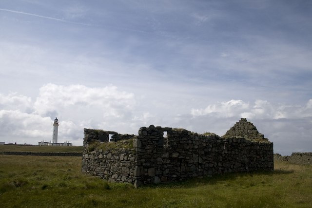
Geodh' a' Bhallain, located in Argyllshire, Scotland, is a prominent coastal feature that takes the form of a headland or point. It is situated on the western coast of the country, overlooking the Atlantic Ocean. The name "Geodh' a' Bhallain" is derived from Scottish Gaelic, with "Geodh'" meaning "cove" and "Bhallain" referring to the surrounding hazel trees.
This coastal feature is characterized by its rugged and rocky terrain, with steep cliffs and jagged edges. Geodh' a' Bhallain offers breathtaking views of the surrounding landscape, with the vast expanse of the Atlantic Ocean meeting the rugged coastline. The crashing waves and the sound of seabirds add to the dramatic atmosphere of the area.
The headland is known for its diverse wildlife, making it a popular spot for nature enthusiasts and birdwatchers. Visitors may be able to spot various seabirds, such as gannets, puffins, and cormorants, as well as seals basking on the rocks. The rich marine life also attracts occasional sightings of dolphins and porpoises.
Geodh' a' Bhallain is a place of natural beauty and tranquility, offering visitors a chance to escape the hustle and bustle of everyday life. It is an ideal location for those seeking to enjoy the rugged Scottish coastline, explore the surrounding nature, or simply take in the breathtaking views of the Atlantic Ocean.
If you have any feedback on the listing, please let us know in the comments section below.
Geodh' a' Bhallain Images
Images are sourced within 2km of 55.671626/-6.5110104 or Grid Reference NR1651. Thanks to Geograph Open Source API. All images are credited.


Geodh' a' Bhallain is located at Grid Ref: NR1651 (Lat: 55.671626, Lng: -6.5110104)
Unitary Authority: Argyll and Bute
Police Authority: Argyll and West Dunbartonshire
What 3 Words
///students.rolled.ducks. Near Portnahaven, Argyll & Bute
Nearby Locations
Related Wikis

Orsay, Inner Hebrides
Orsay (Scottish Gaelic: Orasaigh) is a small island in the Inner Hebrides of Scotland. It lies a short distance off the west coast of the island of Islay...

Eilean Mhic Coinnich
Eilean Mhic Coinnich, also known as Mackenzie Island (although recorded on the Land Register as McKenseys Island), is an uninhabited island of 17.3 hectares...

Portnahaven
Portnahaven (Scottish Gaelic: Port na h-Abhainne, meaning river port) is a village on Islay in the Inner Hebrides, Scotland. The village is within the...

Islay LIMPET
Islay LIMPET was the world's first commercial wave power device and was connected to the United Kingdom's National Grid. == History == Islay LIMPET (Land...

Rhinns complex
The Rhinns complex is a deformed Palaeoproterozoic igneous complex that is considered to form the basement to the Colonsay Group of metasedimentary rocks...

Easter Ellister
Easter Ellister (Aolastradh) is a settlement on the Rinns of Islay on Islay in the Inner Hebrides of Scotland. It lies just off the A847 road between Portnahaven...

Nerabus
Nerabus (otherwise Nereabolls) is a hamlet in the west of the isle of Islay in Scotland. The vicinity is noted for its scenic qualities and diverse birdlife...

Rinns of Islay
The Rinns of Islay (Scottish Gaelic: Na Roinn Ìleach; alternative English spelling Rhinns of Islay) is an area on the west of the island of Islay in the...
Nearby Amenities
Located within 500m of 55.671626,-6.5110104Have you been to Geodh' a' Bhallain?
Leave your review of Geodh' a' Bhallain below (or comments, questions and feedback).