Bogha na Charraig Mhòr

Coastal Feature, Headland, Point in Argyllshire

Scotland

Bogha na Charraig Mhòr

Breachacha Castle Breachacha Castle was constructed sometime in the fifteenth century and rapidly became the scene of much internecine feuding between the Coll Macleans and the Duart Macleans.
Breachacha Castle Credit: Euan Nelson

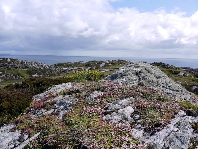
Bogha na Charraig Mhòr, located in Argyllshire, is a prominent coastal feature that serves as a headland and point in the region. This picturesque landscape is situated on the western coast of Scotland, overlooking the vast expanse of the Atlantic Ocean.

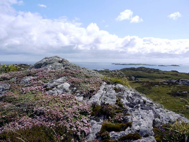
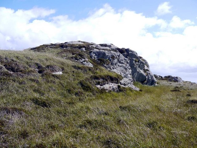
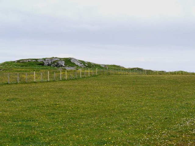
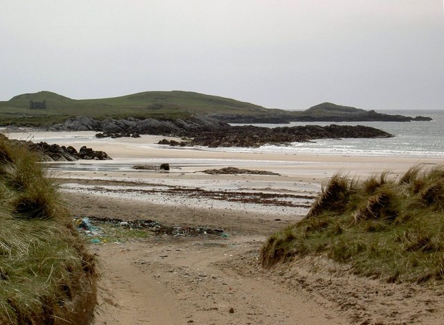
With its rugged cliffs and rocky terrain, Bogha na Charraig Mhòr offers breathtaking views of the surrounding coastline. The headland stretches out into the sea, forming a natural promontory that juts into the water. Its strategic location provides a vantage point for observing the marine life and the ever-changing tides.

The name "Bogha na Charraig Mhòr" translates to "arch of the big rock" in English, which aptly describes the distinctive geological formation found in the area. The headland is characterized by a towering rock formation that resembles an arch, created by the relentless forces of erosion over thousands of years.

This coastal feature is a popular destination for outdoor enthusiasts and nature lovers. Hikers can explore the rugged trails that wind along the headland, offering panoramic views of the surrounding landscape. Birdwatchers are also drawn to the area due to its rich avian diversity, with various species of seabirds and raptors frequently spotted.

Bogha na Charraig Mhòr is not only a natural wonder but also holds historical significance. It has been a landmark for seafarers and navigators for centuries, guiding ships along the coast and acting as a reference point for sailors.

In conclusion, Bogha na Charraig Mhòr is a captivating coastal feature in Argyllshire, offering stunning views, diverse wildlife, and a glimpse into the region's rich maritime history.

If you have any feedback on the listing, please let us know in the comments section below.

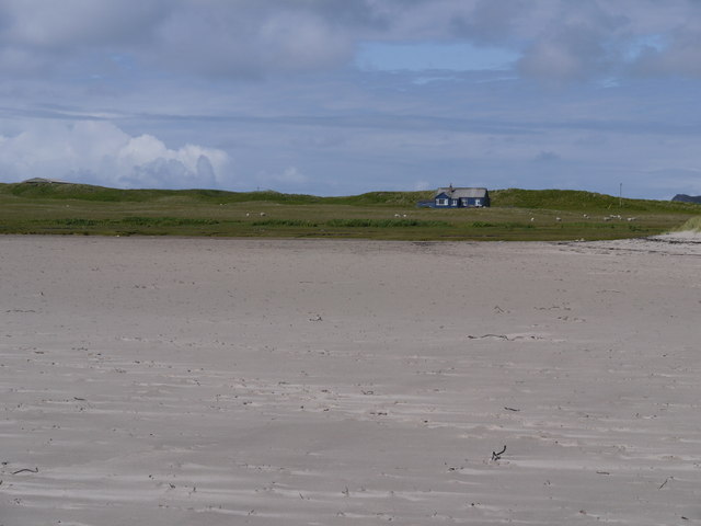
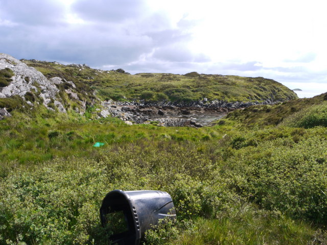
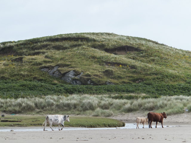
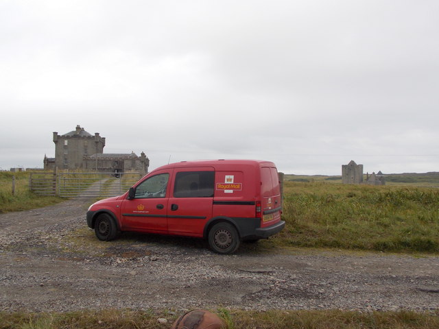
Bogha na Charraig Mhòr Images

Images are sourced within 2km of 56.57835/-6.6298897 or Grid Reference NM1552. Thanks to Geograph Open Source API. All images are credited.

Breachacha Castle Breachacha Castle was constructed sometime in the fifteenth century and rapidly became the scene of much internecine feuding between the Coll Macleans and the Duart Macleans.
Breachacha Castle
Breachacha Castle was constructed sometime in the fifteenth century and rapidly became the scene of much internecine feuding between the Coll Macleans and the Duart Macleans.
Breachacha Castle (new) This rather grand-looking mansion was built in 1750 by Hector Maclean, 13th of Coll, and in 1773 entertained Boswell and Johnson.
Breachacha Castle (new)
This rather grand-looking mansion was built in 1750 by Hector Maclean, 13th of Coll, and in 1773 entertained Boswell and Johnson.
Breachacha beach In the background are the 15th and 18th century castles at Breachacha.
Breachacha beach
In the background are the 15th and 18th century castles at Breachacha.
Looking south from Ceann Fasachd Looking due south, and the next bit of land is Islay.
Looking south from Ceann Fasachd
Looking due south, and the next bit of land is Islay.
Looking south-west from Ceann Fasachd The island of Soa and outlying skerries in the distance.
Looking south-west from Ceann Fasachd
The island of Soa and outlying skerries in the distance.
Small rock outcrop on Ceann Fasachd
Coll machair White and yellow flowers here, but elsewhere the purple of bloody cranesbill stains the banks with colour.
Coll machair
White and yellow flowers here, but elsewhere the purple of bloody cranesbill stains the banks with colour.
There's a corncrake in there somewhere! Coll's machair in full bloom, and the haunting rasp of the corncrake calling.  It's in there somewhere but this elusive bird cannot be seen in the long vegetation.  The island of Bac Mor (Dutchman's Cap) in the right distance.
There's a corncrake in there somewhere!
Coll's machair in full bloom, and the haunting rasp of the corncrake calling. It's in there somewhere but this elusive bird cannot be seen in the long vegetation. The island of Bac Mor (Dutchman's Cap) in the right distance.
Blue house on a silver beach At Loch Breachacha
Blue house on a silver beach
At Loch Breachacha
Inlet at the east side of Loch Breachacha
Traigh Chrossapol
Traigh Chrossapol
Cattle, Loch Breachacha
Old Breachacha Castle
A View Over The Sand Dunes A view over the sand dune in the general direction of Calgary Point with Crossapol Bay visible in the upper left of the photo.
A View Over The Sand Dunes
A view over the sand dune in the general direction of Calgary Point with Crossapol Bay visible in the upper left of the photo.
Isle of Coll: the old Breachacha Castle One of two adjacent properties named Breachacha Castle, this is the older one, built in the 15th century for the Macleans, the clan who owned Coll. It fell into disuse in the century following the construction of the 'new' castle next door. It was renovated back to habitable condition in the 1960s.

See <a href="https://www.geograph.org.uk/photo/4109828">NM1553 : Isle of Coll: the new Breachacha Castle</a> for a picture of the 'new' castle.
Isle of Coll: the old Breachacha Castle
One of two adjacent properties named Breachacha Castle, this is the older one, built in the 15th century for the Macleans, the clan who owned Coll. It fell into disuse in the century following the construction of the 'new' castle next door. It was renovated back to habitable condition in the 1960s. See NM1553 : Isle of Coll: the new Breachacha Castle for a picture of the 'new' castle.
Isle of Coll: the new Breachacha Castle The new 'castle' was built in 1750 alongside the old one, here on the banks of Loch Breachacha.

See <a href="https://www.geograph.org.uk/photo/4109822">NM1553 : Isle of Coll: the old Breachacha Castle</a> for a picture of the old castle.
Isle of Coll: the new Breachacha Castle
The new 'castle' was built in 1750 alongside the old one, here on the banks of Loch Breachacha. See NM1553 : Isle of Coll: the old Breachacha Castle for a picture of the old castle.
Isle of Coll: reflection of the old Breachacha Castle Looking towards <a href="https://www.geograph.org.uk/photo/4109822">NM1553 : Isle of Coll: the old Breachacha Castle</a>, which stands right on the edge of the gridsquare. It is reflected in the waters of Breachacha Bay at a low tide.
Isle of Coll: reflection of the old Breachacha Castle
Looking towards NM1553 : Isle of Coll: the old Breachacha Castle, which stands right on the edge of the gridsquare. It is reflected in the waters of Breachacha Bay at a low tide.
Isle of Coll: the postwoman delivers to the Breachacha castles Looking towards the distant tower of <a href="https://www.geograph.org.uk/photo/4109822">NM1553 : Isle of Coll: the old Breachacha Castle</a>, with <a href="https://www.geograph.org.uk/photo/4109828">NM1553 : Isle of Coll: the new Breachacha Castle</a> on the left. The island's postwoman has to stop here and deliver to both properties on foot.
Isle of Coll: the postwoman delivers to the Breachacha castles
Looking towards the distant tower of NM1553 : Isle of Coll: the old Breachacha Castle, with NM1553 : Isle of Coll: the new Breachacha Castle on the left. The island's postwoman has to stop here and deliver to both properties on foot.
Show me another place!

Bogha na Charraig Mhòr is located at Grid Ref: NM1552 (Lat: 56.57835, Lng: -6.6298897)

Unitary Authority: Argyll and Bute

Police Authority: Argyll and West Dunbartonshire

What 3 Words

///neatly.regretted.housework. Near Arinagour, Argyll & Bute

Related Wikis

Breachacha crannog

The Breachacha crannog is a crannog located near Loch Breachacha, on the Inner Hebridean island of Coll. The crannog is recognised in the United Kingdom...
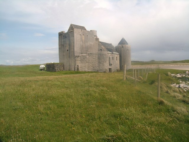
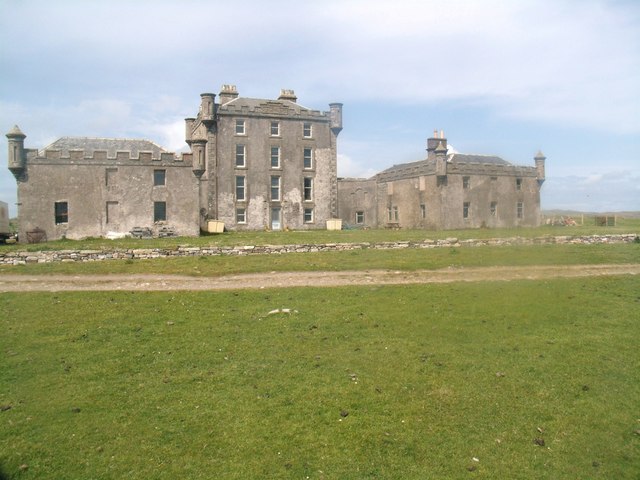
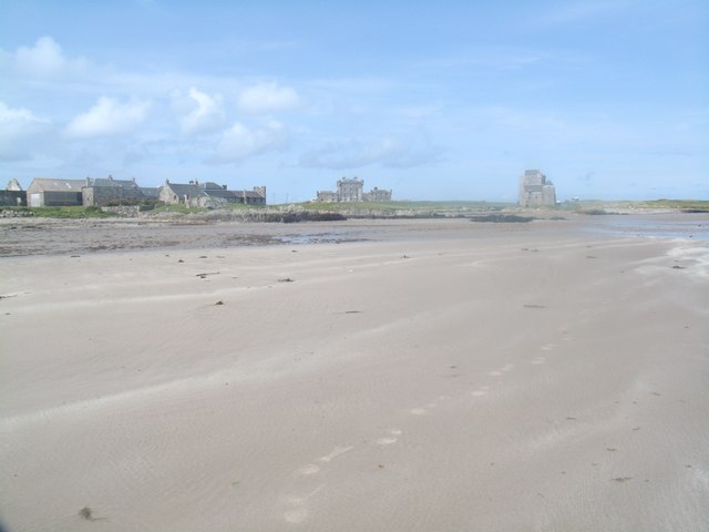
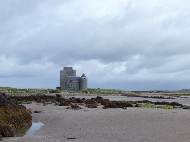
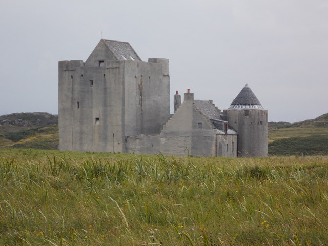
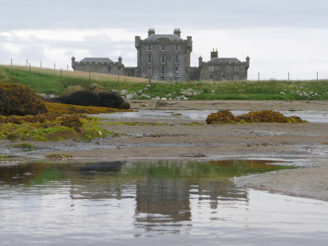
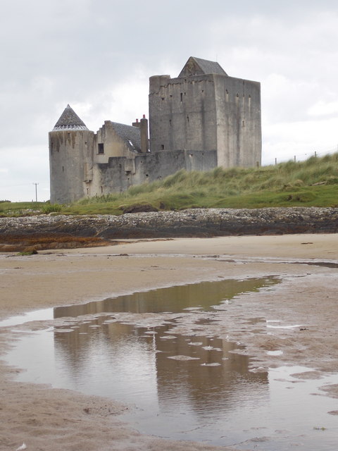
Breachacha Castle

Breachacha Castle (also spelled Breacachadh) is either of two structures on the shore of Loch Breachacha, on the Inner Hebridean island of Coll, Scotland...

Coll Airport

Coll Island Airport (IATA: COL, ICAO: EGEL) (Scottish Gaelic: Port-adhair Cholla) is located 5 NM (9.3 km; 5.8 mi) west southwest of Arinagour on the island...

Dùn an Achaidh

Dùn an Achaidh, sometimes Anglicised as Dun Acha, is a dun located near the village of Acha on the Inner Hebridean island of Coll. It is considered the...

Nearby Amenities

Located within 500m of 56.57835,-6.6298897
Natural: rock
Source: OS7
Tidal: yes
Lat/Long: 56.5799881/-6.6257164
Natural: rock
Source: OS7
Tidal: yes
Lat/Long: 56.5794999/-6.6247336
Ard Nis
Natural: cape
Lat/Long: 56.5779006/-6.6320995
The data included in this document is from www.openstreetmap.org. The data is made available under ODbL.

Have you been to Bogha na Charraig Mhòr?

Leave your review of Bogha na Charraig Mhòr below (or comments, questions and feedback).