Creag Raibistin

Coastal Feature, Headland, Point in Inverness-shire

Scotland

Creag Raibistin

West Loch Tarbert from the pier
West Loch Tarbert from the pier Credit: Alan Reid

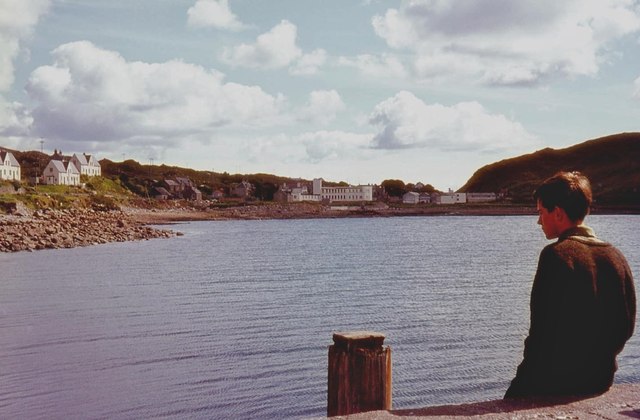
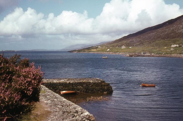
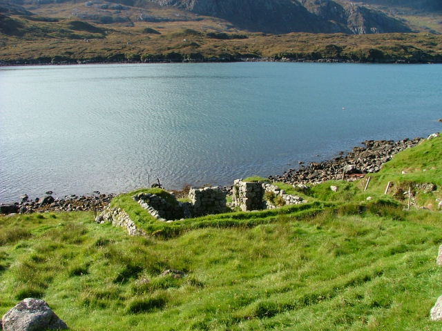
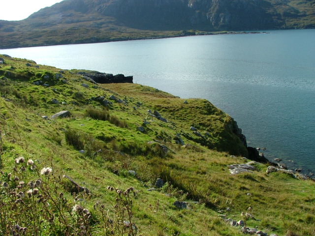
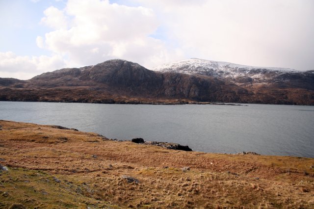
Creag Raibistin is a prominent coastal feature situated in the county of Inverness-shire, Scotland. It takes the form of a headland, jutting out into the North Atlantic Ocean, and is known for its stunning natural beauty and rugged terrain.

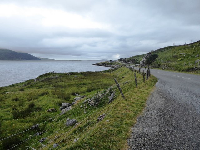
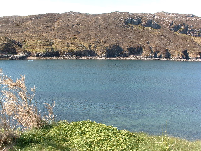
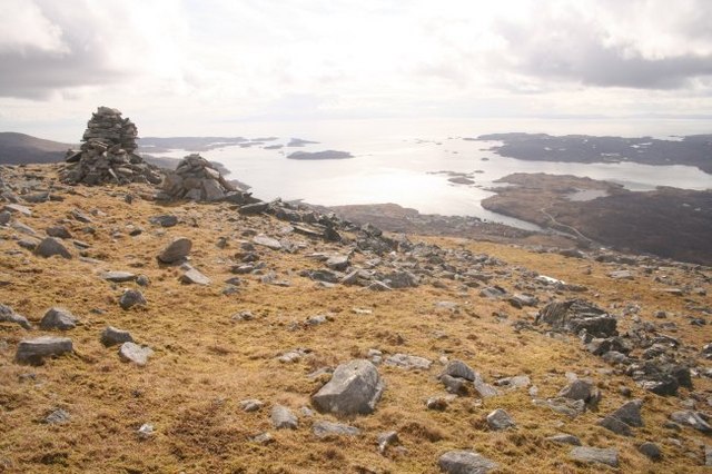
Located in the western part of Inverness-shire, Creag Raibistin offers breathtaking panoramic views of the surrounding landscape. The headland is characterized by its towering cliffs, which reach heights of up to 100 meters, providing a dramatic backdrop against the crashing waves below. The cliffs are composed of ancient rock formations, displaying layers of sedimentary rock that have been shaped by millions of years of geological activity.

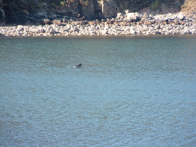
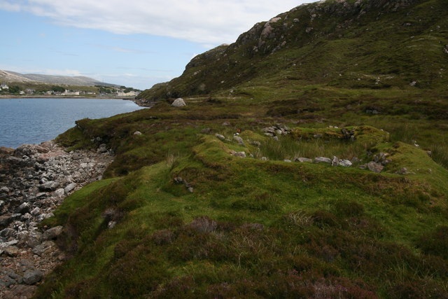
The area surrounding Creag Raibistin is rich in biodiversity, with a variety of plant and animal species calling it home. The headland provides nesting sites for seabirds such as puffins, guillemots, and kittiwakes, making it a haven for birdwatchers and nature enthusiasts.

Access to Creag Raibistin is available via a well-maintained footpath that winds its way from a nearby parking area. The path offers visitors an opportunity to explore the headland and appreciate its natural wonders up close. However, caution is advised when approaching the cliff edges, as they can be steep and exposed.

Creag Raibistin is a popular destination for outdoor activities such as hiking, photography, and wildlife spotting. Its rugged beauty and unspoiled surroundings make it a must-visit location for those seeking a true Scottish coastal experience.

If you have any feedback on the listing, please let us know in the comments section below.

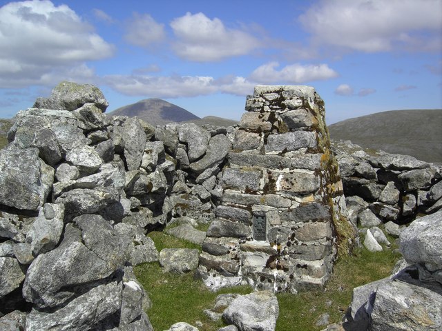
Creag Raibistin Images

Images are sourced within 2km of 57.900301/-6.8219566 or Grid Reference NB1400. Thanks to Geograph Open Source API. All images are credited.

West Loch Tarbert from the pier
West Loch Tarbert piers
Spinning wool for tweed in Harris
Tarbert Fire Station
The A859 and the shore of Loch a' Siar
The Lovely Janice They don't make them like that any more! Bus parked in the car park of the Harris Hotel
The Lovely Janice
They don't make them like that any more! Bus parked in the car park of the Harris Hotel
View of West Bay at Tarbert View from the pier on the north side of the bay towards the pier on the south side, the interesting bit of the photo is the dorsal fin a bit right and up from the centre.
View of West Bay at Tarbert
View from the pier on the north side of the bay towards the pier on the south side, the interesting bit of the photo is the dorsal fin a bit right and up from the centre.
Tarbert bay Whale presumably a Minke whale, not huge but the biggest I've seen
Tarbert bay Whale
presumably a Minke whale, not huge but the biggest I've seen
MacAskill's former store Tarbert For many years these premises were run by a Mr MacAskill as a general store. He continued to work in the store until his nineties.
MacAskill's former store Tarbert
For many years these premises were run by a Mr MacAskill as a general store. He continued to work in the store until his nineties.
Ruined Crofthouse at Leacainn Overlooking Loch A Siar.
Ruined Crofthouse at Leacainn
Overlooking Loch A Siar.
Shoreline on Loch A Siar Looking south.
Shoreline on Loch A Siar
Looking south.
Cairns on Giolabhal Glas From near the summit of Giolabhal Glas looking down to Tarbert and the islands and skerries in East Loch Tarbert.
Cairns on Giolabhal Glas
From near the summit of Giolabhal Glas looking down to Tarbert and the islands and skerries in East Loch Tarbert.
Hillside below Giolabhal Glas looking towards East Loch Tarbert Half way up the rocky slabs to the summit of Giolabhal Glas - the hill behind Tarbert.
Hillside below Giolabhal Glas looking towards East Loch Tarbert
Half way up the rocky slabs to the summit of Giolabhal Glas - the hill behind Tarbert.
West Tarbert Pier West Tarbert Pier with a small fishing boat.
West Tarbert Pier
West Tarbert Pier with a small fishing boat.
Gillaval Glas trig The trig point on Gillaval Glas.
Gillaval Glas trig
The trig point on Gillaval Glas.
Steicleit with the cliffs of Uamascleit behind Apparently quite a thriving community lived there once and even in recent years, Steicleit was the place where the folk from Tarbert went to cut their peats.
Steicleit with the cliffs of Uamascleit behind
Apparently quite a thriving community lived there once and even in recent years, Steicleit was the place where the folk from Tarbert went to cut their peats.
Remains of blackhouse The old drystone walls of a blackhouse can be seen on the south shore of West Loch Tarbert. The village of Tarbert can be seen in the background.
Remains of blackhouse
The old drystone walls of a blackhouse can be seen on the south shore of West Loch Tarbert. The village of Tarbert can be seen in the background.
HM Coastguard station, Tarbert HM Coastguard station above Tarbert, with the Tarbert TV relay (tv transmitter) in the background.
HM Coastguard station, Tarbert
HM Coastguard station above Tarbert, with the Tarbert TV relay (tv transmitter) in the background.
Show me another place!

Creag Raibistin is located at Grid Ref: NB1400 (Lat: 57.900301, Lng: -6.8219566)

Unitary Authority: Na h-Eileanan an Iar

Police Authority: Highlands and Islands

What 3 Words

///pavilions.scenes.sample. Near Tarbert, Na h-Eileanan Siar

Related Wikis

Tarbert, Harris

Tarbert (Scottish Gaelic: An Tairbeart [ən̪ˠ ˈt̪ɛrʲɛbərˠʃt̪]) is the main community on Harris in the Western Isles of Scotland. The name means "isthmus...

Harris distillery

Harris distillery is a Scotch whisky and Gin distillery in Tarbert on the Isle of Harris, Scotland. The distillery was the first legal distillery ever...

Harris, Outer Hebrides

Harris (Scottish Gaelic: Na Hearadh, pronounced [nə ˈhɛɾəɣ] ) is the southern and more mountainous part of Lewis and Harris, the largest island in the...

Ardhasaig

Ardhasaig (Scottish Gaelic: Àird Àsaig) is a settlement on the western coast of north Harris, in the Outer Hebrides, Scotland. Ardhasaig is also within...

Nearby Amenities

Located within 500m of 57.900301,-6.8219566
Bus Stop
Tarbert (Harris)
Bus: yes
Naptan AtcoCode: 6010731851
Naptan Bearing: E
Naptan CommonName: Tarbert (Harris)
Naptan Indicator: School
Naptan Landmark: School
Naptan NaptanCode: 94723683
Naptan Street: School
Naptan Verified: no
Public Transport: platform
Source: naptan_import
Lat/Long: 57.9014349/-6.8145415
Cnoc na Cloiche
Natural: peak
Source: OS7
Lat/Long: 57.8987185/-6.8246323
Turning Circle
Lat/Long: 57.9036022/-6.8163925
Turning Circle
Lat/Long: 57.9045457/-6.8205922
Black Lab Photos
Shop: art
Lat/Long: 57.9040105/-6.8208402
Recycling
Recycling Type: container
Lat/Long: 57.9026475/-6.8163583
Bench
Backrest: yes
Lat/Long: 57.9022552/-6.8155333
Material: wood
Power: pole
Lat/Long: 57.9029514/-6.816025
Material: wood
Power: pole
Lat/Long: 57.9031061/-6.8165843
Material: wood
Power: pole
Lat/Long: 57.9027355/-6.8152472
Material: wood
Power: pole
Lat/Long: 57.9025595/-6.8146692
Material: wood
Power: pole
Lat/Long: 57.9033391/-6.8173755
Barrier: cattle_grid
Lat/Long: 57.9033124/-6.8177926
Material: wood
Power: pole
Lat/Long: 57.9036042/-6.81827
Material: wood
Power: pole
Lat/Long: 57.9039027/-6.8191069
Material: wood
Power: pole
Lat/Long: 57.9038892/-6.8179978
Material: wood
Power: pole
Lat/Long: 57.9034631/-6.816202
Material: wood
Power: pole
Lat/Long: 57.9042255/-6.8179683
Material: wood
Power: pole
Lat/Long: 57.9044871/-6.8189728
Material: wood
Power: pole
Lat/Long: 57.9042063/-6.8199357
Material: wood
Power: pole
Lat/Long: 57.9045512/-6.8204024
Street Lamp
Lamp Type: electric
Lat/Long: 57.9007145/-6.8136824
Street Lamp
Lamp Type: electric
Lat/Long: 57.9011081/-6.8140898
Street Lamp
Lamp Type: electric
Lat/Long: 57.901192/-6.8138304
Street Lamp
Lamp Type: electric
Lat/Long: 57.9012732/-6.8142009
Street Lamp
Lamp Type: electric
Lat/Long: 57.90147/-6.8143649
Street Lamp
Lamp Type: electric
Lat/Long: 57.9012528/-6.814443
Street Lamp
Lamp Type: electric
Lat/Long: 57.9015494/-6.8145779
Turning Circle
Lat/Long: 57.9037383/-6.8207961
Street Lamp
Lamp Type: electric
Lat/Long: 57.9044783/-6.8216987
Street Lamp
Lamp Type: electric
Lat/Long: 57.9039835/-6.8205512
Power: pole
Lat/Long: 57.9035184/-6.8203297
Power: pole
Lat/Long: 57.9033953/-6.8195829
Power: pole
Lat/Long: 57.9032701/-6.8188425
Power: pole
Lat/Long: 57.9031312/-6.8180478
Taobh Siar
Place: hamlet
Lat/Long: 57.9037913/-6.8196866
The data included in this document is from www.openstreetmap.org. The data is made available under ODbL.

Have you been to Creag Raibistin?

Leave your review of Creag Raibistin below (or comments, questions and feedback).