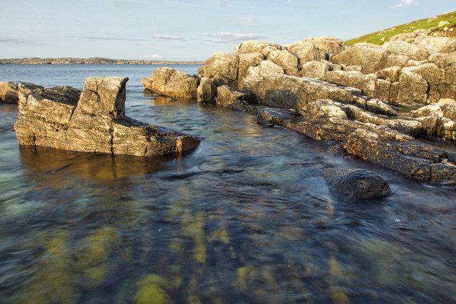
Rubha na Fainge

Coastal Feature, Headland, Point in Ross-shire

Scotland

Rubha na Fainge
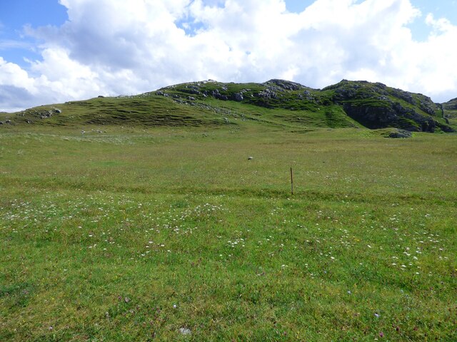
Lazy Beds at Tràigh na Beirigh Ridges formed by hand digging of fields.  These one are unusual in that some of the ridges are lined with small stones.
Lazy Beds at Tràigh na Beirigh Credit: Sandy Gerrard

Rubha na Fainge is a scenic coastal feature located in Ross-shire, a county in the Highland region of Scotland. Situated on the western coast, this prominent headland, also known as a point, offers breathtaking views of the surrounding natural beauty.

The headland stands tall, jutting out into the North Atlantic Ocean, providing a vantage point for visitors to admire the rugged coastline and the expansive sea. Its elevated position offers unobstructed views of the distant horizon and the open waters, making it a popular spot for nature enthusiasts and photographers.

Rubha na Fainge is characterized by its rocky terrain and steep cliffs, which have been shaped over centuries by the relentless crashing of waves. The exposed rocks give the headland a dramatic appearance, adding to its allure. Visitors can explore the area's diverse wildlife, including various seabirds that nest along the cliffs, such as puffins and gannets.

Access to Rubha na Fainge is relatively easy, with a well-maintained footpath that leads to the headland. The path meanders through heather-covered moorland, offering visitors a chance to immerse themselves in the region's natural beauty.

Aside from its aesthetic appeal, Rubha na Fainge also holds historical significance. The area features ancient ruins and standing stones, providing a glimpse into the rich cultural heritage of the region.

Overall, Rubha na Fainge is a captivating coastal feature that combines stunning vistas, diverse wildlife, and a touch of history. It stands as a testament to the raw beauty of Scotland's coastline and is a must-visit destination for anyone seeking a tranquil and picturesque experience.

If you have any feedback on the listing, please let us know in the comments section below.

Rubha na Fainge Images

Images are sourced within 2km of 58.203669/-6.9164531 or Grid Reference NB1134. Thanks to Geograph Open Source API. All images are credited.

Lazy Beds at Tràigh na Beirigh Ridges formed by hand digging of fields.  These one are unusual in that some of the ridges are lined with small stones.
Lazy Beds at Tràigh na Beirigh
Ridges formed by hand digging of fields. These one are unusual in that some of the ridges are lined with small stones.
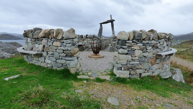
An Sùileachan Monument A monument to the Lewis land clearances <span class="nowrap"><a title="https://bhaltostrust.co.uk/suileachan-project/" rel="nofollow ugc noopener" href="https://bhaltostrust.co.uk/suileachan-project/">Link</a><img style="margin-left:2px;" alt="External link" title="External link - shift click to open in new window" src="https://s1.geograph.org.uk/img/external.png" width="10" height="10"/></span>
An Sùileachan Monument
A monument to the Lewis land clearances LinkExternal link
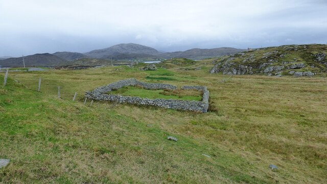
Sheepfold at Riof
Sheepfold at Riof
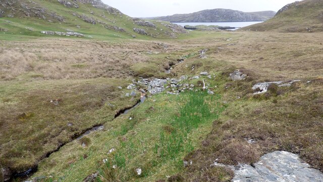
Norse Mill on burn leading from Loch Lionais The mill is very ruinous and survives as a spread of rubble overlying the lower courses of the building.  The leat serving the mill is represented by the bright green stripe.
Norse Mill on burn leading from Loch Lionais
The mill is very ruinous and survives as a spread of rubble overlying the lower courses of the building. The leat serving the mill is represented by the bright green stripe.
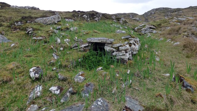
Norse Mill on burn leading from Loch Lionais The lower mill is rather better preserved with the tail race opening still intact.
Norse Mill on burn leading from Loch Lionais
The lower mill is rather better preserved with the tail race opening still intact.
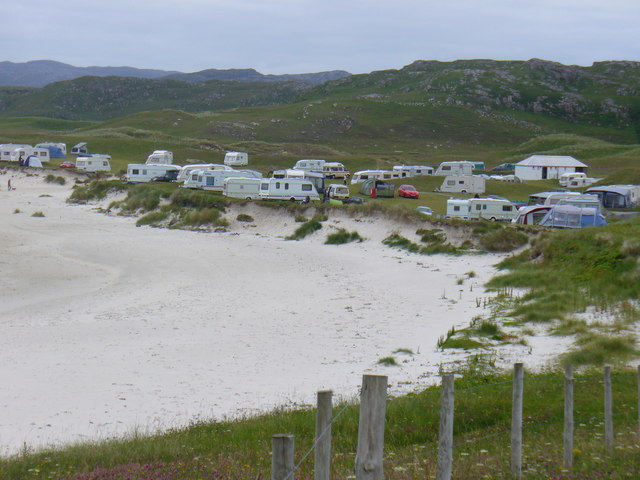
Berie Sands Caravan Park Busy site at Traigh na Beirigh with many caravans parked on the machair above the extensive sands.
Berie Sands Caravan Park
Busy site at Traigh na Beirigh with many caravans parked on the machair above the extensive sands.
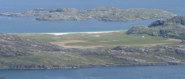
A' Bheirigh from Suaineabhal
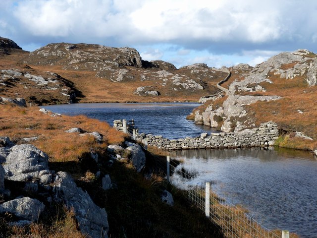
Lochan at Cragavig An old boundary wall snakes across the moorland
Lochan at Cragavig
An old boundary wall snakes across the moorland
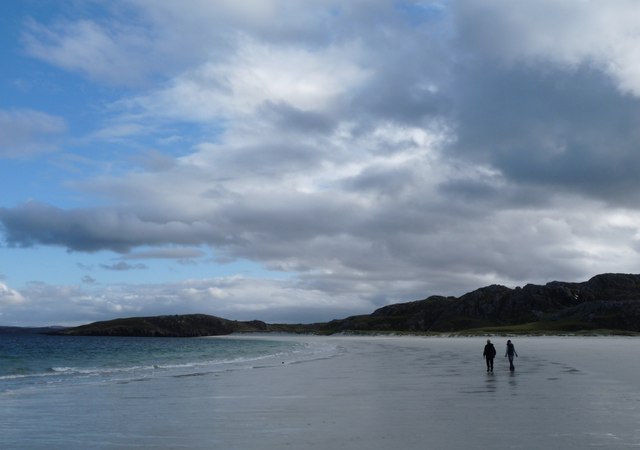
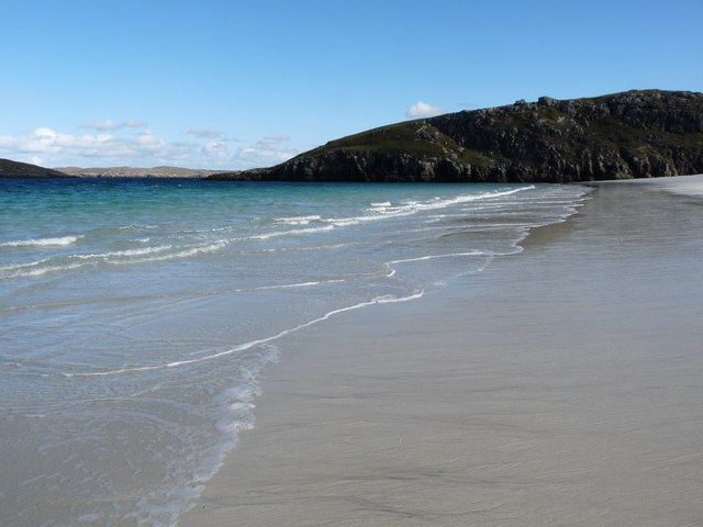
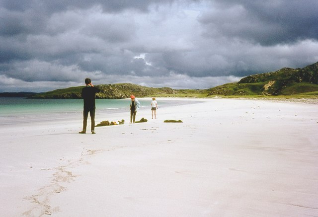
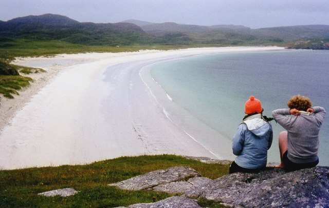
Tràigh na Beirigh A perfect crescent beach
Tràigh na Beirigh
A perfect crescent beach
A rocky buttress contains Tràigh na Beirigh
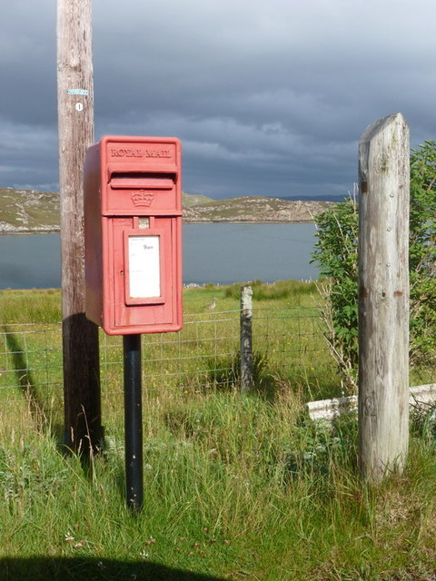
Cerishader: postbox № HS2 158 A small postbox on the B8011, with its back to Loch Ròg. It is emptied at 9 o'clock each morning, except Sunday.
Cerishader: postbox № HS2 158
A small postbox on the B8011, with its back to Loch Ròg. It is emptied at 9 o'clock each morning, except Sunday.
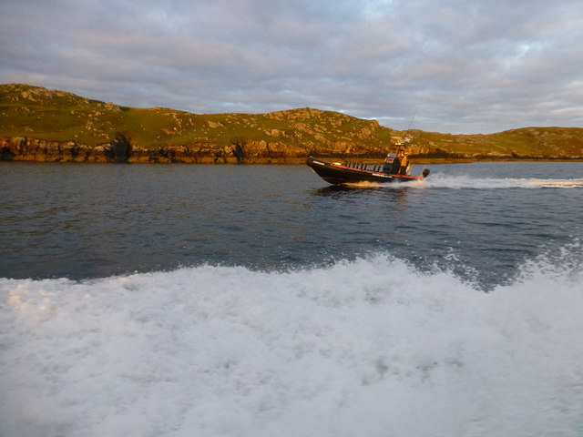
Morning RIB Commute Seatrek worker on morning commute to work at Miabhaig on a RIB. Photo taken from the MV Lochlann.
Morning RIB Commute
Seatrek worker on morning commute to work at Miabhaig on a RIB. Photo taken from the MV Lochlann.
Traigh na Berie
Traigh na Berie
Tràigh na Beirigh from the east
A' Bheirigh
A' Bheirigh
Tràigh Teinish
Tràigh Teinish
Show me another place!

Rubha na Fainge is located at Grid Ref: NB1134 (Lat: 58.203669, Lng: -6.9164531)

Unitary Authority: Na h-Eileanan an Iar

Police Authority: Highlands and Islands

What 3 Words

///overcomes.dressing.defeat. Near Carloway, Na h-Eileanan Siar

Related Wikis

Loch na Berie

Loch Na Berie is a broch in the Outer Hebrides of Scotland, located approximately 400 yards from the shore, and is thought to have been located on an island...

Loch Ròg

Loch Ròg or Loch Roag is a large sea loch on the west coast of Lewis, Outer Hebrides. It is broadly divided into East Loch Roag and West Loch Roag with...

Fuaigh Beag

Fuaigh Beag or Vuia Be(a)g is an island in the Outer Hebrides. It is off the west coast of Lewis near Great Bernera in Loch Roag. Its name means "little...

Flodaigh, Lewis

Flodaigh is a small island in Loch Roag on the west coast of Lewis in the Outer Hebrides of Scotland. It is about 33 hectares (82 acres) in extent and...

Nearby Amenities

Located within 500m of 58.203669,-6.9164531
Passing Place
Lat/Long: 58.205463/-6.9235721
Riof
Name En: Reef
Name Gd: Riof
Place: village
Lat/Long: 58.2047427/-6.9245971
Bus Stop
Reef
Naptan AtcoCode: 6010731786
Naptan Bearing: S
Naptan CommonName: Reef
Naptan Indicator: Reef
Naptan NaptanCode: 94723925
Naptan Street: Reef
Naptan Verified: no
Source: naptan_import
Lat/Long: 58.2044652/-6.9242118
Post Box
Collection Times: Mo-Fr 10:00; Sa 10:00
Old Ref: LH159
Operator: Royal Mail
Post Box Type: lamp
Ref: HS2 159
Royal Cypher: scottish_crown
Source: survey
Lat/Long: 58.2044145/-6.9243582
Barrier: cattle_grid
Lat/Long: 58.2049553/-6.9155746
Passing Place
Lat/Long: 58.2055396/-6.9176238
Turning Circle
Lat/Long: 58.2047532/-6.9148933
Power: pole
Lat/Long: 58.2047506/-6.9242338
Power: pole
Lat/Long: 58.2049218/-6.9229044
Power: pole
Lat/Long: 58.2050408/-6.9220083
Power: pole
Lat/Long: 58.2052536/-6.9211913
Power: pole
Lat/Long: 58.2054855/-6.9203426
Power: pole
Lat/Long: 58.2057281/-6.9190087
Power: pole
Lat/Long: 58.2055925/-6.9182097
Power: pole
Lat/Long: 58.2054522/-6.9174017
Power: pole
Lat/Long: 58.2053071/-6.9165733
Power: pole
Lat/Long: 58.2051775/-6.9158059
Power: pole
Lat/Long: 58.2059101/-6.9200673
Power: pole
Lat/Long: 58.2047078/-6.9213199
Power: pole
Lat/Long: 58.2046091/-6.9224078
Power: pole
Lat/Long: 58.2044354/-6.9243038
Barrier: cattle_grid
Lat/Long: 58.2045506/-6.9244502
The data included in this document is from www.openstreetmap.org. The data is made available under ODbL.

Have you been to Rubha na Fainge?

Leave your review of Rubha na Fainge below (or comments, questions and feedback).