Tartaonig

Coastal Feature, Headland, Point in Inverness-shire

Scotland

Tartaonig

Abhainn Thabhsaigh and Ruidear Having paddled about 6km up Loch Reasort (from where it got too shallow for the MV Cuma) in fibreglass sea kayaks, any significant whitewater descent in a river this rocky would have been foolish (even by my standards - I did run just the last 50 metres) but I could not resist wandering up to get a look at what a descent might be like with even more water. Looks fun, but hardly worth the walk in to this remote spot. Somewhere back there lost in the cloud is Strone Ulladale - one of the remotest serious rock climbs in the UK. Any walk in with a plastic river boat would be an equally long undertaking, and the exit from where the river ends even longer on foot, or getting on for ten miles on the sea to Huisnis. Quite possibly a first descent looking for a taker?
Abhainn Thabhsaigh and Ruidear Credit: Andy Waddington

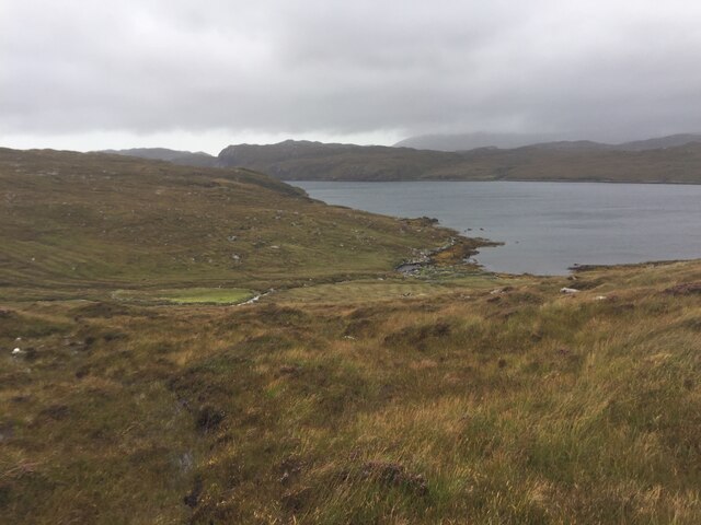
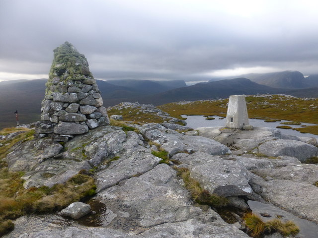
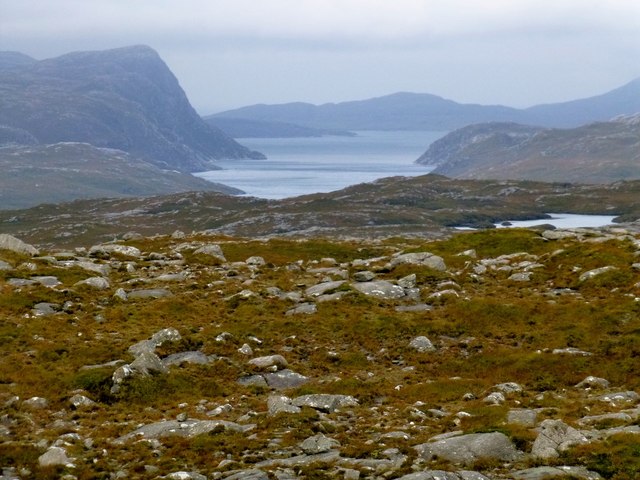
Tartaonig is a coastal feature located in Inverness-shire, Scotland. It is specifically classified as a headland or point, jutting out into the North Atlantic Ocean. Situated on the western coast of Scotland, Tartaonig offers breathtaking views of the surrounding landscape and is a popular destination for tourists and nature enthusiasts.

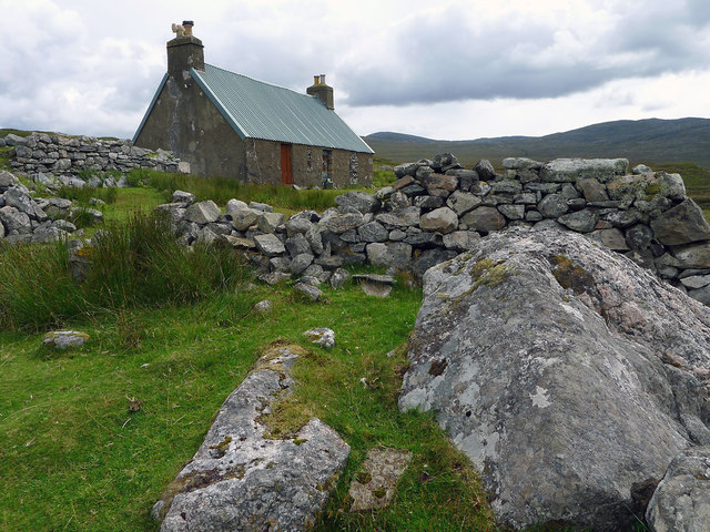
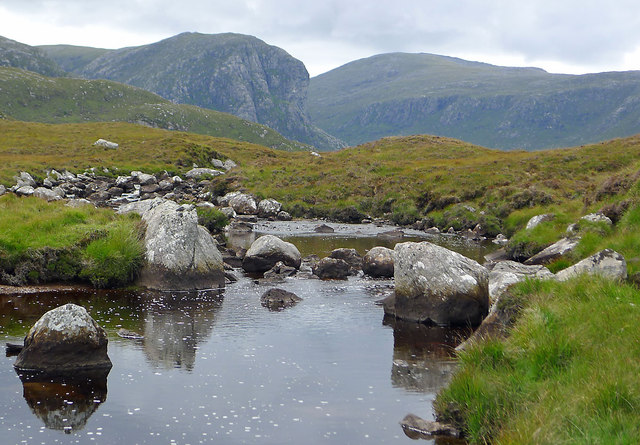
The headland is characterized by its rocky cliffs, which provide a dramatic backdrop against the crashing waves of the ocean. The rugged terrain is adorned with lush greenery, including various types of grasses and shrubs, adding to the natural beauty of the area. Tartaonig is also known for its diverse wildlife, including seabirds that nest along the cliffs and can be observed in their natural habitat.

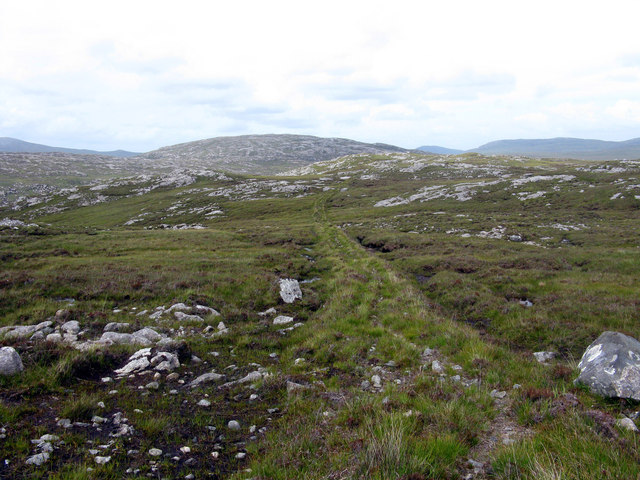
Access to Tartaonig is relatively easy, with a well-maintained footpath leading visitors to the headland. The path offers stunning panoramic views of the ocean and the surrounding coastline, making it a popular spot for hikers and photographers.

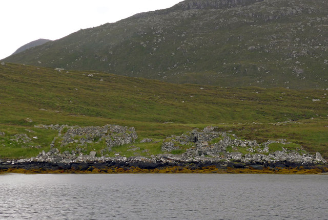
In addition to its natural beauty, Tartaonig also holds historical significance. The headland is believed to have been inhabited by ancient communities, and remnants of their presence can still be found in the form of ancient ruins and archaeological sites.

Overall, Tartaonig is a remarkable coastal feature in Inverness-shire, Scotland. Its stunning cliffs, diverse wildlife, and historical significance make it a must-visit destination for those seeking a unique and immersive coastal experience.

If you have any feedback on the listing, please let us know in the comments section below.

Tartaonig Images

Images are sourced within 2km of 58.049013/-6.9382933 or Grid Reference NB0817. Thanks to Geograph Open Source API. All images are credited.

Abhainn Thabhsaigh and Ruidear Having paddled about 6km up Loch Reasort (from where it got too shallow for the MV Cuma) in fibreglass sea kayaks, any significant whitewater descent in a river this rocky would have been foolish (even by my standards - I did run just the last 50 metres) but I could not resist wandering up to get a look at what a descent might be like with even more water. Looks fun, but hardly worth the walk in to this remote spot. Somewhere back there lost in the cloud is Strone Ulladale - one of the remotest serious rock climbs in the UK. Any walk in with a plastic river boat would be an equally long undertaking, and the exit from where the river ends even longer on foot, or getting on for ten miles on the sea to Huisnis. Quite possibly a first descent looking for a taker?
Abhainn Thabhsaigh and Ruidear
Having paddled about 6km up Loch Reasort (from where it got too shallow for the MV Cuma) in fibreglass sea kayaks, any significant whitewater descent in a river this rocky would have been foolish (even by my standards - I did run just the last 50 metres) but I could not resist wandering up to get a look at what a descent might be like with even more water. Looks fun, but hardly worth the walk in to this remote spot. Somewhere back there lost in the cloud is Strone Ulladale - one of the remotest serious rock climbs in the UK. Any walk in with a plastic river boat would be an equally long undertaking, and the exit from where the river ends even longer on foot, or getting on for ten miles on the sea to Huisnis. Quite possibly a first descent looking for a taker?
Abhainn Thabhsaigh runs down to Ceann Loch Reasort Loch Reasort is long and shallow, so its head can only be reached in shallow draught boats. This seems to include the occasional R.I.B. as well as sea kayaks, which is how we got here. Over our lunch stop, we walked up the stream a bit to prospect for a whitewater descent - too rocky to play on any but the very last bit in fibreglass boats, and hardly an enticing prospect given the remoteness and difficulty of getting in and out of the area with plastic river boats in the sort of weather (much wetter than seen here) needed for such an undertaking.
Abhainn Thabhsaigh runs down to Ceann Loch Reasort
Loch Reasort is long and shallow, so its head can only be reached in shallow draught boats. This seems to include the occasional R.I.B. as well as sea kayaks, which is how we got here. Over our lunch stop, we walked up the stream a bit to prospect for a whitewater descent - too rocky to play on any but the very last bit in fibreglass boats, and hardly an enticing prospect given the remoteness and difficulty of getting in and out of the area with plastic river boats in the sort of weather (much wetter than seen here) needed for such an undertaking.
Oxbow on the Abhainn Thabhsaigh The river meanders through the peat moorland on its way to the sea at Ceann Loch Resort.
Oxbow on the Abhainn Thabhsaigh
The river meanders through the peat moorland on its way to the sea at Ceann Loch Resort.
Kinlochresort -2011 A return visit after 47 years.  In 1964 <a href="https://www.geograph.org.uk/photo/323992">NB1017 : Kinlochresort - 1964</a> both the foreground house Kinresort Cottage and the cottage across the two rivers in Harris were occupied.  Today Kinresort Cottage is boarded up and a salmon bailiff uses the well-preserved house opposite.  A close comparison of the two images shows many changes to the buildings at Kinlochresort.
Kinlochresort -2011
A return visit after 47 years. In 1964 NB1017 : Kinlochresort - 1964 both the foreground house Kinresort Cottage and the cottage across the two rivers in Harris were occupied. Today Kinresort Cottage is boarded up and a salmon bailiff uses the well-preserved house opposite. A close comparison of the two images shows many changes to the buildings at Kinlochresort.
Kinresort Cottage I stayed here in 1964 <a href="https://www.geograph.org.uk/photo/323995">NB1017 : Kinresort Cottage - 1964</a>.  The slate roof has gone as have the windows and front door.  The adjacent barn has lost its corrugated roof and the walls are now lower.  The chimney pots are unchanged and surprisingly the staining on the end wall has hardly changed in the intervening 47 years.

A history of this house and the community that lived along the shore of Loch Resort is available in a pamphlet costing £2 from The Islands Book Trust.
Kinresort Cottage
I stayed here in 1964 NB1017 : Kinresort Cottage - 1964. The slate roof has gone as have the windows and front door. The adjacent barn has lost its corrugated roof and the walls are now lower. The chimney pots are unchanged and surprisingly the staining on the end wall has hardly changed in the intervening 47 years. A history of this house and the community that lived along the shore of Loch Resort is available in a pamphlet costing £2 from The Islands Book Trust.
Departing Kinlochresort by Seatrek RIB Just 30 minutes fast driving by modern inflatable craft from Huisinis - and a world apart - and with squalls of rain, rather exciting!
Departing Kinlochresort by Seatrek RIB
Just 30 minutes fast driving by modern inflatable craft from Huisinis - and a world apart - and with squalls of rain, rather exciting!
The Gamekeeper's (Salmon Bailiff's) house at Luachair Whilst we were there a person one took for a ghillie emerged from the house and with dog at heel and rod in arm took silently to the hills in the direction of Loch Bhoisimid.
The Gamekeeper's (Salmon Bailiff's) house at Luachair
Whilst we were there a person one took for a ghillie emerged from the house and with dog at heel and rod in arm took silently to the hills in the direction of Loch Bhoisimid.
The head of Loch Resort A walk along the water line from a temporary harbour for the Seatrek RIB brought one closer to the settlement at Kinlochresort.  The cottage over the water in Lewis was all boarded up whilst the cottage owned by the North Harris Trust on the south side of the water was occupied at the time of our visit.
The head of Loch Resort
A walk along the water line from a temporary harbour for the Seatrek RIB brought one closer to the settlement at Kinlochresort. The cottage over the water in Lewis was all boarded up whilst the cottage owned by the North Harris Trust on the south side of the water was occupied at the time of our visit.
The old Gamekeepers house at Luachair Such a surprise to find so well a renovated house at Kinlochresort.  Congratulations to the North Harris Trust.
The old Gamekeepers house at Luachair
Such a surprise to find so well a renovated house at Kinlochresort. Congratulations to the North Harris Trust.
A View Across The Shallow End of Loch Resort A view across the shallow end of Loch Resort to include the Gamekeepers Cottage at Luachair with the higher hills behind.  We then began looking for a suitable landing spot for the RIB tender to land so that we could climb Benisval.
A View Across The Shallow End of Loch Resort
A view across the shallow end of Loch Resort to include the Gamekeepers Cottage at Luachair with the higher hills behind. We then began looking for a suitable landing spot for the RIB tender to land so that we could climb Benisval.
Old Shielings at Dirascal Abandoned shielings at Dirascal between Cravadale and Loch Reasort (water in background).
Old Shielings at Dirascal
Abandoned shielings at Dirascal between Cravadale and Loch Reasort (water in background).
In Glen Ulladale The Abhainn Thabhsaigh drains Glen Ulladale and the view upstream is dominated by the overhanging face of Sron Ulladale.
In Glen Ulladale
The Abhainn Thabhsaigh drains Glen Ulladale and the view upstream is dominated by the overhanging face of Sron Ulladale.
The derelict houses at Dirascal This would have been a very harsh environment to make a living.
The derelict houses at Dirascal
This would have been a very harsh environment to make a living.
Benisval Cairn and Trig Point Benisval is a remote on the Isle of Lewis to the north of Loch Resort.  It is a HuMP with a prominence of 108 metres and a height of 189 metres.  We used a RIB to motor down Loch Resort from Huisinis.
Benisval Cairn and Trig Point
Benisval is a remote on the Isle of Lewis to the north of Loch Resort. It is a HuMP with a prominence of 108 metres and a height of 189 metres. We used a RIB to motor down Loch Resort from Huisinis.
Captain Alan Holmes Has Landed Captain Alan Holmes has landed after a RIB trip up Loch Resort and is ready to climb Benisival.  The RIB was driven by Neil James Macaulay from Islands of Adventure, Great Bernera.
Captain Alan Holmes Has Landed
Captain Alan Holmes has landed after a RIB trip up Loch Resort and is ready to climb Benisival. The RIB was driven by Neil James Macaulay from Islands of Adventure, Great Bernera.
View Towards Taran Mòr A photo from below the trig point towards a distant Taran Mòr, the entrance to Loch Resort and beyond.
View Towards Taran Mòr
A photo from below the trig point towards a distant Taran Mòr, the entrance to Loch Resort and beyond.
A View Towards Teinnasval A view from Benisval towards three hills climbed earlier on the trip. Left to right, Tamanaisval, 467 metres, a HuMP and a P108 hill; Teinnasval, 497 metres, a HuMP and a P131 hill and Tahaval, 515 metres, a Marilyn and a P252 hill.
A View Towards Teinnasval
A view from Benisval towards three hills climbed earlier on the trip. Left to right, Tamanaisval, 467 metres, a HuMP and a P108 hill; Teinnasval, 497 metres, a HuMP and a P131 hill and Tahaval, 515 metres, a Marilyn and a P252 hill.
The path from Direascal to Kinlochresort The path from Direascal to Kinlochresort was an ambitious undertaking that had not been completed when they had to abandon Direascal in 1900. When they started building the path, workers from Luachair and Direascal met at the halfway point, and each group started building a path back to their respective villages. By the time they left in 1900, the Direascal men had made good progress; the path ended on the hillside, 200 yards east of the village. But work stopped on the other section a half mile from Luachair.
The path from Direascal to Kinlochresort
The path from Direascal to Kinlochresort was an ambitious undertaking that had not been completed when they had to abandon Direascal in 1900. When they started building the path, workers from Luachair and Direascal met at the halfway point, and each group started building a path back to their respective villages. By the time they left in 1900, the Direascal men had made good progress; the path ended on the hillside, 200 yards east of the village. But work stopped on the other section a half mile from Luachair.
Show me another place!

Tartaonig is located at Grid Ref: NB0817 (Lat: 58.049013, Lng: -6.9382933)

Unitary Authority: Na h-Eileanan an Iar

Police Authority: Highlands and Islands

What 3 Words

///campers.disprove.aimlessly. Near Tarbert, Na h-Eileanan Siar

Nearby Locations

Tartaonig Loch Creagach

Related Wikis

Uladail

Uladail is a location near Amhuinnsuidhe, on Harris in the Outer Hebrides, Scotland. Sron Ulladail is a sheer cliff which at 370 metres (1,210 ft) is one...

Tiorga Mor

Tiorga Mor (679 m) is a mountain in Harris, in the Outer Hebrides of Scotland. The most westerly peak of the high mountains of Harris, it is a very rugged...

Oireabhal

Oireabhal (662 m) is a mountain in Harris, in the Outer Hebrides of Scotland. The peak is the highest point on a complex ridge that runs from north to...

Chliostair Hydro-Electric Scheme

Chliostair Hydro-Electric Scheme is a small scheme promoted by the North of Scotland Hydro-Electric Board on Harris, Outer Hebrides. It consists of a single...

Nearby Amenities

Located within 500m of 58.049013,-6.9382933
Created By: dmgroom_coastlines
Lat/Long: 58.04773/-6.94518
Created By: dmgroom_coastlines
Lat/Long: 58.04784/-6.94372
Created By: dmgroom_coastlines
Lat/Long: 58.04917/-6.93882
Created By: dmgroom_coastlines
Lat/Long: 58.04916/-6.93833
Created By: dmgroom_coastlines
Lat/Long: 58.04961/-6.93493
The data included in this document is from www.openstreetmap.org. The data is made available under ODbL.

Have you been to Tartaonig?

Leave your review of Tartaonig below (or comments, questions and feedback).