Àird Niosaboist

Coastal Feature, Headland, Point in Inverness-shire

Scotland

Àird Niosaboist

View to Luskentyre From a viewpoint on the A859.
View to Luskentyre Credit: Richard Dorrell

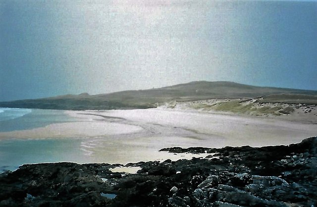
Àird Niosaboist is a prominent coastal feature located in Inverness-shire, Scotland. It is a headland that juts out into the sea, forming a distinctive point along the coastline. The name "Àird Niosaboist" is of Gaelic origin, meaning "headland of Niosaboist."

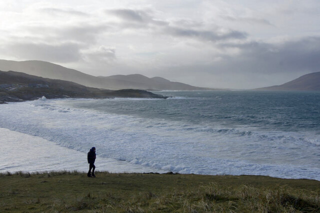
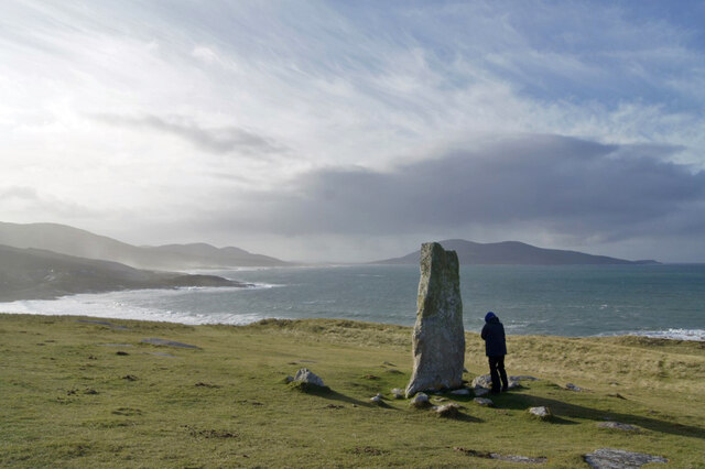
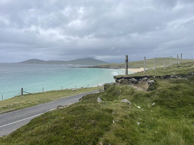
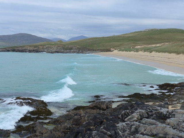
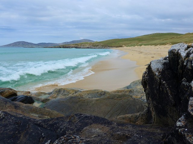
This headland offers breathtaking panoramic views of the surrounding area, with its rugged cliffs and pristine waters. It is situated on the western coast of Scotland, overlooking the North Atlantic Ocean. The headland is characterized by steep cliffs that drop dramatically into the sea, creating a striking and picturesque landscape.

The geology of Àird Niosaboist is predominantly composed of ancient rock formations, including sandstone and granite. The erosion caused by the relentless pounding of the waves has sculpted the cliffs into unique formations, adding to the area's natural beauty.

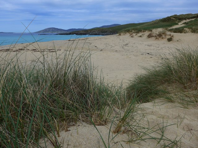
The headland is also known for its diverse marine life. Seabirds, such as gannets and puffins, can often be seen nesting on the cliffs, while seals and dolphins are occasionally spotted swimming in the nearby waters. The surrounding area is home to a variety of plant species, including heather and sea thrift, which thrive in the coastal environment.

Àird Niosaboist is a popular destination for outdoor enthusiasts and nature lovers. Hiking trails offer visitors the opportunity to explore the headland and enjoy the stunning views. The area is also a favorite spot for photographers, who are drawn to the dramatic scenery and abundant wildlife.

Overall, Àird Niosaboist is a captivating coastal feature that showcases the rugged beauty of the Scottish coastline. Its stunning cliffs, panoramic views, and diverse wildlife make it a must-visit destination for those seeking an unforgettable coastal experience.

If you have any feedback on the listing, please let us know in the comments section below.

Àird Niosaboist Images

Images are sourced within 2km of 57.869821/-6.9862616 or Grid Reference NG0497. Thanks to Geograph Open Source API. All images are credited.

View to Luskentyre From a viewpoint on the A859.
View to Luskentyre
From a viewpoint on the A859.
Above Tràigh Iar Looking towards Rubha Romagraich and beyond.
Above Tràigh Iar
Looking towards Rubha Romagraich and beyond.
Clach Mhic Leòid Looking south west past the MacLeod standing stone, with Rubha Romagraich to the left, and Ceapabhal behind the stone.
Clach Mhic Leòid
Looking south west past the MacLeod standing stone, with Rubha Romagraich to the left, and Ceapabhal behind the stone.
Toward North Harris Looking north from close to the standing stone, Clach Mhic Leòid.
Toward North Harris
Looking north from close to the standing stone, Clach Mhic Leòid.
Traigh Sheileboist in 1981
Bungalow and field near Tràigh Nisaboist
Spring on the beach at Tràigh Nisaboist A micro-sized hydrological model.
Spring on the beach at Tràigh Nisaboist
A micro-sized hydrological model.
Scenic parking spot
Scenic parking spot
Refusing to get out of shot River the Beagle.
Refusing to get out of shot
River the Beagle.
Roadside views of Harris
Holiday homes and a cafe Geocaching is a type of global treasure hunt of people looking for caches, or hidden stashes of objects. Geocaching may also be described as a series of hide-and-seek games, where hiders provide online clues for seekers. Seekers use global positioning system (GPS) devices to find hidden caches
Holiday homes and a cafe
Geocaching is a type of global treasure hunt of people looking for caches, or hidden stashes of objects. Geocaching may also be described as a series of hide-and-seek games, where hiders provide online clues for seekers. Seekers use global positioning system (GPS) devices to find hidden caches
Traigh Iar
Traigh Iar
Traigh Iar Translates as west beach/shore.  In the distance, on the hilltop, stands the massive prehistoric standing stone - Clach Mhic Leoid or Macleod's stone.
Traigh Iar
Translates as west beach/shore. In the distance, on the hilltop, stands the massive prehistoric standing stone - Clach Mhic Leoid or Macleod's stone.
The back of Traigh Iar Traigh Iar - West Shore/Beach.
The back of Traigh Iar
Traigh Iar - West Shore/Beach.
Rocks and sand at Traigh Iar
Traigh Sheileboist On a perfect day of azure seas and silver sands, Hebridean beaches are unsurpassed!  Traigh Losgaintir (Luskentyre) in the distance.

The blues are true - no Photoshopping here!
Traigh Sheileboist
On a perfect day of azure seas and silver sands, Hebridean beaches are unsurpassed! Traigh Losgaintir (Luskentyre) in the distance. The blues are true - no Photoshopping here!
Primroses above Traigh Sheileboist On a perfect day of azure seas and silver sands, Hebridean beaches are unsurpassed!  Traigh Losgaintir (Luskentyre) in the distance.

The blues are true - no Photoshopping here!
Primroses above Traigh Sheileboist
On a perfect day of azure seas and silver sands, Hebridean beaches are unsurpassed! Traigh Losgaintir (Luskentyre) in the distance. The blues are true - no Photoshopping here!
Traigh Sheileboist On a perfect day of azure seas and silver sands, Hebridean beaches are unsurpassed!  This one is busy - I can count six people on it!  Traigh Losgaintir (Luskentyre) in the distance.

The blues are true - no Photoshopping here!
Traigh Sheileboist
On a perfect day of azure seas and silver sands, Hebridean beaches are unsurpassed! This one is busy - I can count six people on it! Traigh Losgaintir (Luskentyre) in the distance. The blues are true - no Photoshopping here!
Show me another place!

Àird Niosaboist is located at Grid Ref: NG0497 (Lat: 57.869821, Lng: -6.9862616)

Unitary Authority: Na h-Eileanan an Iar

Police Authority: Highlands and Islands

What 3 Words

///boast.cement.fulfilled. Near Tarbert, Na h-Eileanan Siar

Related Wikis

Luskentyre

Luskentyre (Scottish Gaelic: Losgaintir) is a sparse settlement on the west coast of Harris, in the Outer Hebrides, Scotland. Luskentyre is situated within...

Borve, Harris

Borve (Scottish Gaelic: Na Buirgh) is a village in Harris in the Outer Hebrides, Scotland. Borve is also within the parish of Harris, and is on the A859...

Taransay

Taransay (Scottish Gaelic: Tarasaigh, pronounced [ˈt̪ʰaɾas̪aj]) is an island in the Outer Hebrides of Scotland. It was the host of the British television...

West Loch Tarbert

West Loch Tarbert (Scottish Gaelic: Loch A Siar) is a sea loch that separates the northern and southern parts of Harris in the Outer Hebrides of Scotland...

Nearby Amenities

Located within 500m of 57.869821,-6.9862616
Created By: dmgroom_coastlines
Lat/Long: 57.86836/-6.99338
Created By: dmgroom_coastlines
Lat/Long: 57.86945/-6.989
Àird Niosaboist
Natural: cape
Lat/Long: 57.8692447/-6.9856828
The data included in this document is from www.openstreetmap.org. The data is made available under ODbL.

Have you been to Àird Niosaboist?

Leave your review of Àird Niosaboist below (or comments, questions and feedback).