Lag Rainich

Coastal Feature, Headland, Point in Ross-shire

Scotland

Lag Rainich

Wild camp at the head of Tamana Siar
Wild camp at the head of Tamana Siar Credit: Peter Edwards

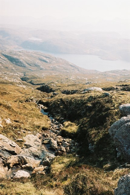
Lag Rainich is a prominent coastal feature located in Ross-shire, Scotland. It is a headland or point that juts out into the sea, offering stunning views of the surrounding coastline. The name Lag Rainich is derived from Scottish Gaelic and translates to "rocky hollow." This name is fitting, as the headland is characterized by its rugged and rocky terrain.

Situated along the northwestern coast of Scotland, Lag Rainich is known for its dramatic cliffs and steep slopes. These cliffs are formed from layers of sedimentary rock, which have been shaped by the relentless forces of erosion over millions of years. As a result, the headland boasts striking geological formations and provides a valuable site for geological studies.

The area surrounding Lag Rainich is rich in biodiversity, with a variety of plant and animal species thriving in this coastal habitat. Seabird colonies, including puffins and gannets, can often be seen nesting along the cliffs. The headland also serves as a vital feeding ground for marine mammals such as seals and dolphins.

Lag Rainich is a popular destination for outdoor enthusiasts and nature lovers. Its picturesque landscapes and panoramic views make it an ideal spot for hiking, birdwatching, and photography. The headland is easily accessible by foot, with well-maintained trails leading visitors to the edge of the cliffs.

Overall, Lag Rainich in Ross-shire is a remarkable coastal feature that showcases the rugged beauty of the Scottish coastline. Whether it's the geology, wildlife, or breathtaking vistas, this headland offers a memorable experience for anyone venturing to its shores.

If you have any feedback on the listing, please let us know in the comments section below.

Lag Rainich Images

Images are sourced within 2km of 58.06319/-7.04822 or Grid Reference NB0219. Thanks to Geograph Open Source API. All images are credited.

Wild camp at the head of Tamana Siar
Mullach na h-Airde Bige Second HuMP around the northern edge of Loch Resort on an Alan Holmes RIB trip. What a brilliant day.
Name: Mullach na h-Airde Bige
Hill number: 4947
Height: 182m / 597ft
Area: 24A: Lewis and Nearby Islands
Class: Hu,1
Grid ref: NB026188 (est)
Drop: 128m
Col: 54m  NB044194
Mullach na h-Airde Bige
Second HuMP around the northern edge of Loch Resort on an Alan Holmes RIB trip. What a brilliant day. Name: Mullach na h-Airde Bige Hill number: 4947 Height: 182m / 597ft Area: 24A: Lewis and Nearby Islands Class: Hu,1 Grid ref: NB026188 (est) Drop: 128m Col: 54m NB044194
Steep Climb From Landing Point For Mullach na h-Airde Bige Our boatman Neil was a little worried by the steep climb up from our landing point. It proved to be no problem for Douglas Law, Alan Holmes, George Morl, Michael Earnshaw, Jim Bloomer, Martin Richardson, Mark Smith, Richard Tibbetts and Colin Crawford who were soon on top of the HuMP, Mullach na h-Airde Bige.
Steep Climb From Landing Point For Mullach na h-Airde Bige
Our boatman Neil was a little worried by the steep climb up from our landing point. It proved to be no problem for Douglas Law, Alan Holmes, George Morl, Michael Earnshaw, Jim Bloomer, Martin Richardson, Mark Smith, Richard Tibbetts and Colin Crawford who were soon on top of the HuMP, Mullach na h-Airde Bige.
Eoranish More Bagged on a RIB trip with 8 others to the HuMPs north of Loch Resort. Looking west towards Mullach na h-Airde Bige.
Name: Eoranish More
Hill number: 104363
Height: 158m / 518ft
Area: 24A: Lewis and Nearby Islands
Class: 1
Grid ref: NB032188 (est)
Drop: 79m
Col: 79m
Eoranish More
Bagged on a RIB trip with 8 others to the HuMPs north of Loch Resort. Looking west towards Mullach na h-Airde Bige. Name: Eoranish More Hill number: 104363 Height: 158m / 518ft Area: 24A: Lewis and Nearby Islands Class: 1 Grid ref: NB032188 (est) Drop: 79m Col: 79m
View Across Loch Gruineabhat View across Loch Gruineabhat and beyond to the subHuMP Aineabhal which is the next hill on our bagging list today.
View Across Loch Gruineabhat
View across Loch Gruineabhat and beyond to the subHuMP Aineabhal which is the next hill on our bagging list today.
Crossing Damp Moorland Crossing damp moorland after descending from Eoranish More and heading towards Aineabhal.
Crossing Damp Moorland
Crossing damp moorland after descending from Eoranish More and heading towards Aineabhal.
Meall nan Sidhean [Meall nan Sithean] Last of four HuMPs around the north of Loch Resort on an Alan Holmes RIB trip. What a brilliant day. The summit is one of 3 tops in a line with the middle rocky top being lower than the tops on either side.
Name: Meall nan Sidhean [Meall nan Sithean]
Hill number: 4948
Height: 177m / 581ft
Area: 24A: Lewis and Nearby Islands
Class: Hu,1
Grid ref: NB024175 (est)
Drop: 122m
Col: 55m  NB039176
Meall nan Sidhean [Meall nan Sithean]
Last of four HuMPs around the north of Loch Resort on an Alan Holmes RIB trip. What a brilliant day. The summit is one of 3 tops in a line with the middle rocky top being lower than the tops on either side. Name: Meall nan Sidhean [Meall nan Sithean] Hill number: 4948 Height: 177m / 581ft Area: 24A: Lewis and Nearby Islands Class: Hu,1 Grid ref: NB024175 (est) Drop: 122m Col: 55m NB039176
Rubha Geodha nan Sgarbh The entrance to Loch Tealasvay is well concealed close to the right of the picture.
Rubha Geodha nan Sgarbh
The entrance to Loch Tealasvay is well concealed close to the right of the picture.
A deep cleft
A deep cleft
House and Outbuildings at Tamnabhaigh
Loch Tamnabhaigh Aird Bheag to left of image and Tamana Sear to right
Loch Tamnabhaigh
Aird Bheag to left of image and Tamana Sear to right
Burn flowing into Gleann Sgaladail
The head of Gleann Sgaladail The lower picture shows ruined shielings with a burn running through.
The head of Gleann Sgaladail
The lower picture shows ruined shielings with a burn running through.
Ruined shielings in Gleann Sgaladail
Gleann Sgaladail burn meets Loch Tamnabhaigh
Moorland above Loch Tamnabhaigh
Mocleitean from Aird Bheag with Eilean Mhealasta in the background
Bridge over Abhainn Tamnabhaig
Show me another place!

Lag Rainich is located at Grid Ref: NB0219 (Lat: 58.06319, Lng: -7.04822)

Unitary Authority: Na h-Eileanan an Iar

Police Authority: Highlands and Islands

What 3 Words

///aimed.tilting.crown. Near Tarbert, Na h-Eileanan Siar

Related Wikis

Eilean Mhealasta

Eilean Mhealasta (Mealista Island) is an uninhabited island off the west coast of Lewis in the Outer Hebrides of Scotland. It takes its name from Mealista...

Mealista

Mealista (Scottish Gaelic: Mealasta) was a township in the west of the Isle of Lewis. It is currently largely uninhabited due to the Highland Clearances...

Game pieces of the Lewis chessmen hoard

Game pieces of the Lewis chessmen hoard include the ninety-three game pieces of the Lewis chessmen hoard found on the Isle of Lewis in the Outer Hebrides...

Scarp, Scotland

Scarp (Scottish Gaelic: An Sgarp) is an uninhabited island in the Outer Hebrides of Scotland, west of Hushinish on Harris. Once inhabited, the island was...

Brenish

Brenish (Scottish Gaelic: Brèinis) is a small village situated on the west coast of the Isle of Lewis, which is part of the Outer Hebrides of Scotland...

Hushinish

Huisinish or Hushinish (Scottish Gaelic Hùisinis) is a remote place on the west coast of Harris in the Outer Hebrides of Scotland. It lies at the end of...

Uladail

Uladail is a location near Amhuinnsuidhe, on Harris in the Outer Hebrides, Scotland. Sron Ulladail is a sheer cliff which at 370 metres (1,210 ft) is one...

Tiorga Mor

Tiorga Mor (679 m) is a mountain in Harris, in the Outer Hebrides of Scotland. The most westerly peak of the high mountains of Harris, it is a very rugged...

Nearby Amenities

Located within 500m of 58.06319,-7.04822
Created By: dmgroom_coastlines
Lat/Long: 58.064/-7.0515
Created By: dmgroom_coastlines
Lat/Long: 58.06539/-7.04225
The data included in this document is from www.openstreetmap.org. The data is made available under ODbL.

Have you been to Lag Rainich?

Leave your review of Lag Rainich below (or comments, questions and feedback).