Rubha Bhogha-sgeir

Coastal Feature, Headland, Point in Inverness-shire

Scotland

Rubha Bhogha-sgeir

Horsanais Point Quite a prominent headland in West Loch Tarbert. Ben Luskentyre centre and Isle Taransay to right of frame.
Horsanais Point Credit: JJM

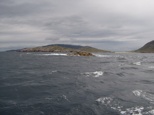
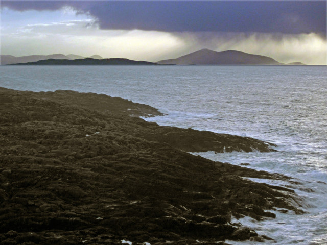
Rubha Bhogha-sgeir is a prominent coastal feature located in Inverness-shire, Scotland. This headland, also referred to as a point, is known for its rugged beauty and breathtaking views of the surrounding landscape. It is situated on the western coast of Scotland, overlooking the North Atlantic Ocean.

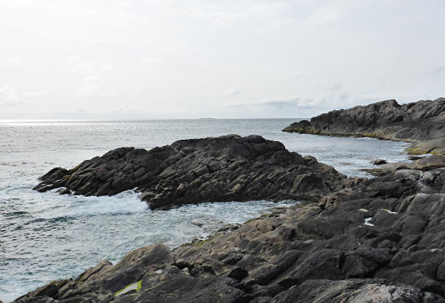
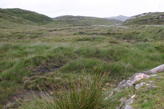
Rubha Bhogha-sgeir is characterized by its rocky cliffs, which rise steeply from the sea. The headland stretches out into the ocean, forming a natural barrier against the crashing waves. This topography provides a dramatic backdrop to the coastal scenery and offers a sense of tranquility for visitors.

The area surrounding Rubha Bhogha-sgeir is rich in wildlife and is particularly notable for its diverse bird population. The headland serves as an important nesting site for seabirds, such as gannets, guillemots, and puffins. Birdwatchers flock to this location to observe these fascinating creatures in their natural habitat.

In addition to its natural beauty, Rubha Bhogha-sgeir holds historical significance. The ruins of an ancient fort can be found on the headland, providing a glimpse into the region's past. This fort, believed to have been used during the Iron Age, is a testament to the area's long-standing human presence.

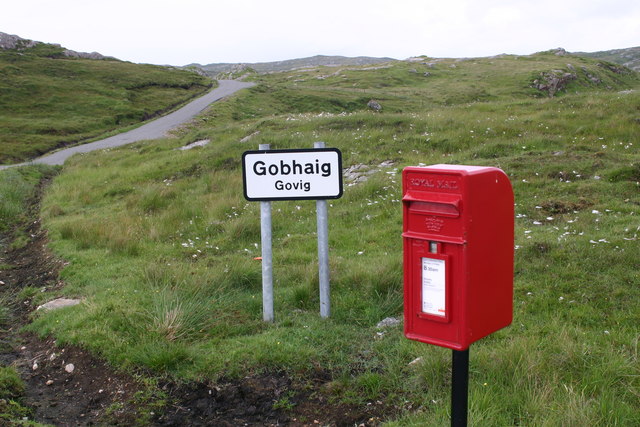
Access to Rubha Bhogha-sgeir is relatively straightforward, with a well-maintained footpath leading visitors to the headland. The path offers various viewpoints along the way, allowing visitors to appreciate the stunning vistas and immerse themselves in the natural surroundings.

Overall, Rubha Bhogha-sgeir is a captivating coastal feature in Inverness-shire, offering a combination of rugged cliffs, diverse wildlife, and historical significance. It is a must-visit destination for nature enthusiasts and history buffs alike.

If you have any feedback on the listing, please let us know in the comments section below.

Rubha Bhogha-sgeir Images

Images are sourced within 2km of 57.964962/-7.0702616 or Grid Reference NB0008. Thanks to Geograph Open Source API. All images are credited.

Horsanais Point Quite a prominent headland in West Loch Tarbert. Ben Luskentyre centre and Isle Taransay to right of frame.
Horsanais Point
Quite a prominent headland in West Loch Tarbert. Ben Luskentyre centre and Isle Taransay to right of frame.
Gloraig Huisinis Some might say the 'dreaded Huisinis Gloraigs' Strong tides prevail here and it does not take much strength of westerly wind to raise a nasty sea. The white sands of Huisinis Beach are prominent to the right of the frame and the Island of Scarp skyline can be seen in distance.
Gloraig Huisinis
Some might say the 'dreaded Huisinis Gloraigs' Strong tides prevail here and it does not take much strength of westerly wind to raise a nasty sea. The white sands of Huisinis Beach are prominent to the right of the frame and the Island of Scarp skyline can be seen in distance.
Looking south across Baralob to Toe Head The dark rocks around Baralob are run through by trenches of redder rocks
Looking south across Baralob to Toe Head
The dark rocks around Baralob are run through by trenches of redder rocks
Horsanish coastline
Horsanish coastline
Communications mast near Gobhaig
Water pipe access covers by the outflow of an unnamed loch on Àirde Beaga
Communications mast near Gobhaig
Water pipe access covers at covered reservoir north-west of Gobhaig
Tidal pool at Conachro Look west across the tidal pool at Conachro
Tidal pool at Conachro
Look west across the tidal pool at Conachro
Rubha Bhogha-sgeir Horsanish coastline.
Rubha Bhogha-sgeir
Horsanish coastline.
Whit you lookin it? Says the cow whose mate had blocked the road and only decided to let us past after I gave him a hard stare.  This one was really just scratching an itchy spot on his back and not trying to pick a fight at all.
Whit you lookin it?
Says the cow whose mate had blocked the road and only decided to let us past after I gave him a hard stare. This one was really just scratching an itchy spot on his back and not trying to pick a fight at all.
Is it real? What an amazing pastime is Geographing!  How else would you be able to spot and photograph a shot like this, unless you were heading to grab a Geograph in remote myriad NA?  This is of course a passing place - but the cow has completely misread the sign.
Is it real?
What an amazing pastime is Geographing! How else would you be able to spot and photograph a shot like this, unless you were heading to grab a Geograph in remote myriad NA? This is of course a passing place - but the cow has completely misread the sign.
A bad hair day by the loch side
On the B887 road to Huisinis
Old peat cuttings
Old peat cuttings
Burn on the road to Huisinis Looking up a small burn coming off the southern slope of Sròn a' Ghoirtein.
Burn on the road to Huisinis
Looking up a small burn coming off the southern slope of Sròn a' Ghoirtein.
Loch na Beiste By the Huisinis road.
Loch na Beiste
By the Huisinis road.
Road to Govig
Road to Govig
Show me another place!

Rubha Bhogha-sgeir is located at Grid Ref: NB0008 (Lat: 57.964962, Lng: -7.0702616)

Unitary Authority: Na h-Eileanan an Iar

Police Authority: Highlands and Islands

What 3 Words

///breezes.engaging.genius. Near Tarbert, Na h-Eileanan Siar

Related Wikis

Hushinish

Huisinish or Hushinish (Scottish Gaelic Hùisinis) is a remote place on the west coast of Harris in the Outer Hebrides of Scotland. It lies at the end of...

Amhuinnsuidhe

Amhuinnsuidhe (Scottish Gaelic: Abhainn Suidhe) is a settlement on Harris, in the Outer Hebrides, Scotland. The settlement is also within the parish of...

Amhuinnsuidhe Castle

Amhuinnsuidhe Castle is a large 19th-century private country house on Harris, one of the Western Isles of Scotland. It was designated as a Category A listed...

Chliostair Hydro-Electric Scheme

Chliostair Hydro-Electric Scheme is a small scheme promoted by the North of Scotland Hydro-Electric Board on Harris, Outer Hebrides. It consists of a single...

Nearby Amenities

Located within 500m of 57.964962,-7.0702616
Rubha Bhogha-sgeir
Natural: cape
Lat/Long: 57.9653365/-7.0665098
The data included in this document is from www.openstreetmap.org. The data is made available under ODbL.

Have you been to Rubha Bhogha-sgeir?

Leave your review of Rubha Bhogha-sgeir below (or comments, questions and feedback).