Liath-Chleit

Coastal Feature, Headland, Point in Ross-shire

Scotland

Liath-Chleit

Slipway and winch at Camas Mol Linnis The slipway is very steep and the winch must have made all the difference.
Slipway and winch at Camas Mol Linnis Credit: Sandy Gerrard

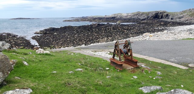
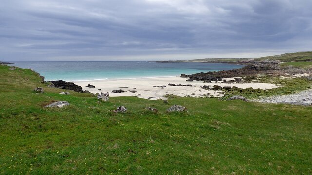
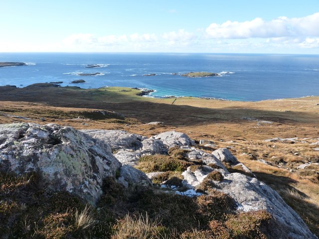
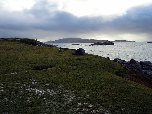
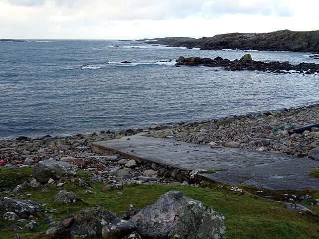
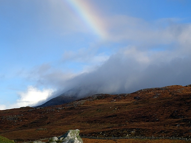
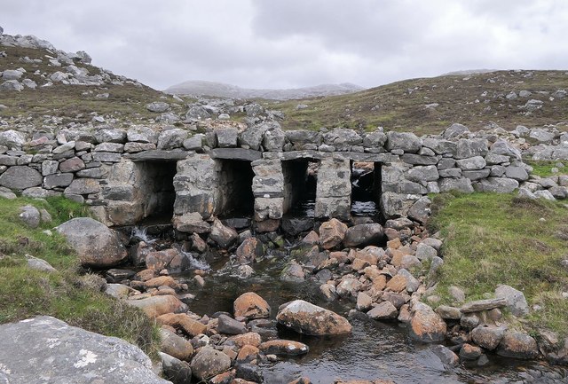
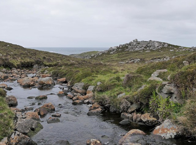
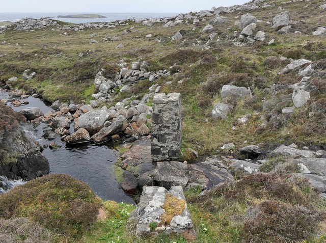
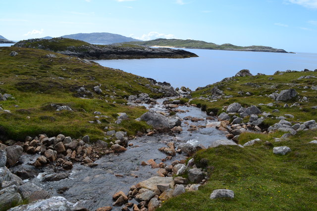
Liath-Chleit, located in Ross-shire, Scotland, is a prominent coastal feature known for its breathtaking headland and point. Situated on the rugged coastline of the Scottish Highlands, it offers stunning panoramic views of the surrounding sea and landscape.

The name "Liath-Chleit" translates to "grey rock" in Gaelic, which perfectly describes the rocky cliffs that make up this headland. Rising majestically from the sea, it is formed by layers of ancient sedimentary rock, which have been shaped and sculpted by the elements over centuries.

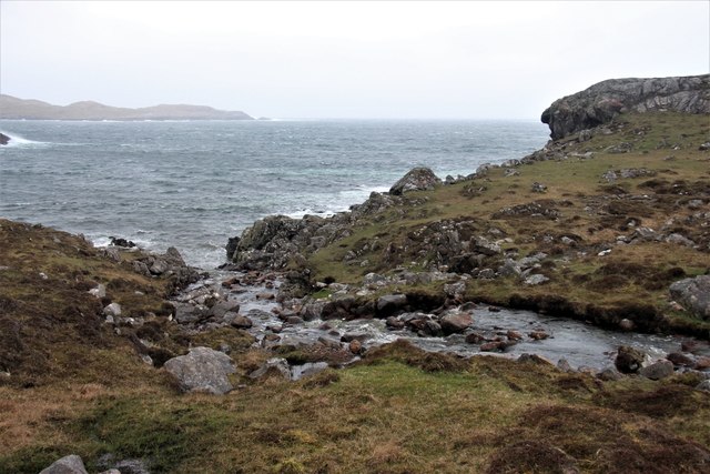
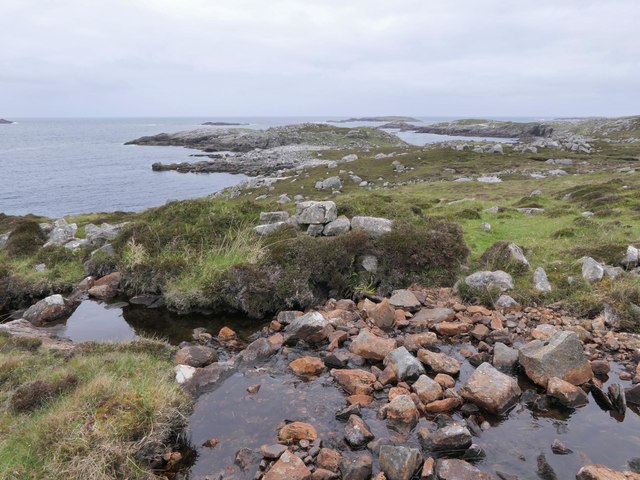
This coastal feature is a haven for nature enthusiasts and wildlife lovers. The headland provides a perfect vantage point for birdwatching, as sea birds such as gannets, puffins, and fulmars can be spotted nesting and gliding along the cliffs. Dolphins and seals are also frequently sighted in the waters surrounding Liath-Chleit, adding to its allure.

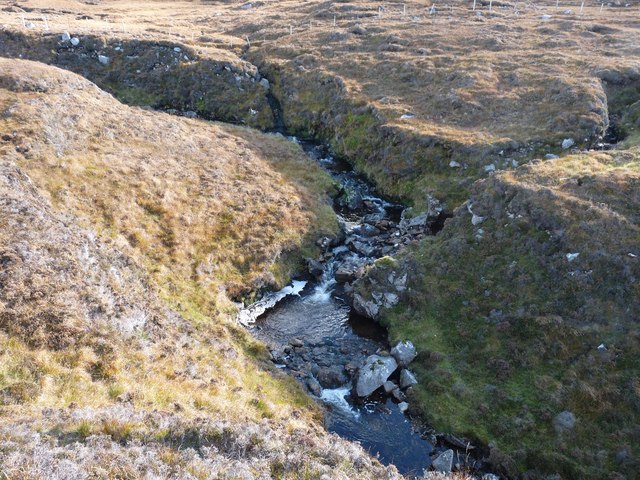
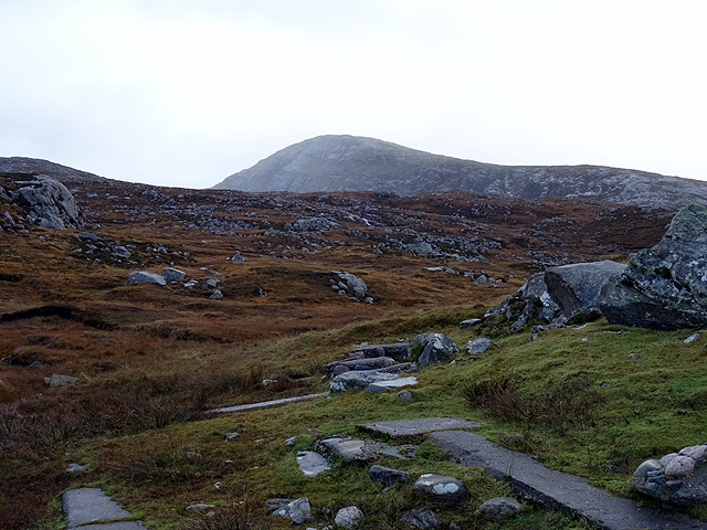
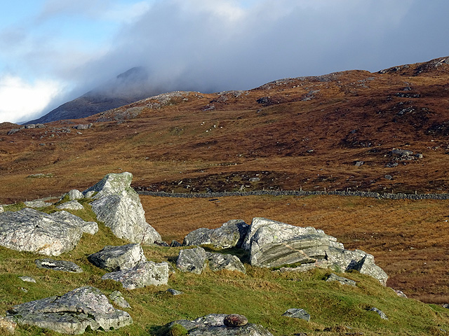
Exploring the area around Liath-Chleit is an adventure in itself. The headland offers a network of walking trails that wind through heather-covered moorland and along the cliff edge. These paths provide an opportunity to appreciate the stunning views, breathe in the invigorating sea air, and immerse oneself in the rugged beauty of the Scottish coastline.

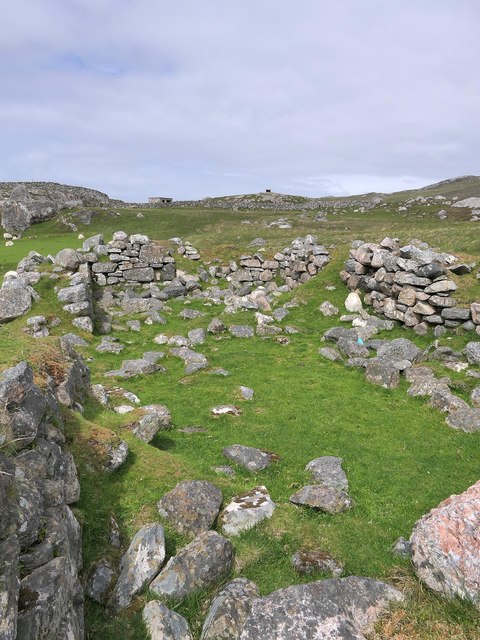
For those interested in history, Liath-Chleit holds significance as well. The headland is home to several ancient archaeological sites, including Iron Age forts, burial cairns, and standing stones. These remnants of past civilizations offer a glimpse into the rich cultural heritage of the region.

Overall, Liath-Chleit is a captivating coastal feature, combining natural beauty, abundant wildlife, and a touch of history. Its dramatic cliffs, panoramic views, and diverse ecosystem make it a must-visit destination for nature lovers and adventure seekers alike.

If you have any feedback on the listing, please let us know in the comments section below.

Liath-Chleit Images

Images are sourced within 2km of 58.092963/-7.096646 or Grid Reference NA9922. Thanks to Geograph Open Source API. All images are credited.

Slipway and winch at Camas Mol Linnis The slipway is very steep and the winch must have made all the difference.
Slipway and winch at Camas Mol Linnis
The slipway is very steep and the winch must have made all the difference.
Mol Foirs Geòdha A small beach by Western Isles standards.
Mol Foirs Geòdha
A small beach by Western Isles standards.
Moorland opposite Eilean Mhealasta
Abhainn Ruadh Tumbling from the western slopes of the Lewis mountains towards the Atlantic
Abhainn Ruadh
Tumbling from the western slopes of the Lewis mountains towards the Atlantic
Looking west from Taireabhal This hill is near the end of civilisation in Lewis.
Looking west from Taireabhal
This hill is near the end of civilisation in Lewis.
Looking south from Mealasta The larger island in the middle distance is Eileen Mhealasta. Beyond that is Scarp.
Looking south from Mealasta
The larger island in the middle distance is Eileen Mhealasta. Beyond that is Scarp.
The end of the road from Uig The road on the west side of Lewis ends at this remote jetty with a view out over Camas Mol Linnis. The map carries a name Totarol nearby but I'm unable to establish to what that refers.
The end of the road from Uig
The road on the west side of Lewis ends at this remote jetty with a view out over Camas Mol Linnis. The map carries a name Totarol nearby but I'm unable to establish to what that refers.
At the end of the road south of Mealasta Remains of concrete structures suggest busier times here in the past at this very remote location. The distant peak appears to be Naideabhal a Staigh <a href="https://www.geograph.org.uk/gridref/NB012235">NB012235</a>.
At the end of the road south of Mealasta
Remains of concrete structures suggest busier times here in the past at this very remote location. The distant peak appears to be Naideabhal a Staigh NB012235.
Outcropping rock at Mealasta Looking towards Cracabhal.
Outcropping rock at Mealasta
Looking towards Cracabhal.
Truncated rainbow above  Cracabhal Viewed from Mealasta.
Truncated rainbow above Cracabhal
Viewed from Mealasta.
Allt Hatasaidh reaching the Atlantic
Flotsam washed up at Mealasta, Isle of Lewis The island is Grèineam.


Other Geograph contributors have told me that the item is probably a fender, possibly one which would be used between a submarine and a harbour wall.

The distance the item is from the shore illustrates the ferocity of the storms experienced by the west coast of Lewis.
Flotsam washed up at Mealasta, Isle of Lewis
The island is Grèineam. Other Geograph contributors have told me that the item is probably a fender, possibly one which would be used between a submarine and a harbour wall. The distance the item is from the shore illustrates the ferocity of the storms experienced by the west coast of Lewis.
Site of horizontal mill on the Abhainn Ruadh, Isle of Lewis The pile of stone blocks in the centre of the photo on the other side of the stream are remains of the mill.  It is shown as a ruin on the 1st Edition OS map surveyed in 1852-53.
Site of horizontal mill on the Abhainn Ruadh, Isle of Lewis
The pile of stone blocks in the centre of the photo on the other side of the stream are remains of the mill. It is shown as a ruin on the 1st Edition OS map surveyed in 1852-53.
Clapper bridge near Camus Mol Linnis, Isle of Lewis The two hills in the centre of the horizon are Laibheal a Tuath and Lasibheal a Deas.

The bridge carries the road to Camus Mol Linnis over the Abhainn Hotaroil.
Clapper bridge near Camus Mol Linnis, Isle of Lewis
The two hills in the centre of the horizon are Laibheal a Tuath and Lasibheal a Deas. The bridge carries the road to Camus Mol Linnis over the Abhainn Hotaroil.
Site of a horizontal mill on the Abhainn Hotaroil, Isle of Lewis What remains of the mill is on the right and there is a millstone half in the water on the left.
Site of a horizontal mill on the Abhainn Hotaroil, Isle of Lewis
What remains of the mill is on the right and there is a millstone half in the water on the left.
Former pipeline crossing the Abhainn Hotaroil, Isle of Lewis The pillar in the burn has 1942 inscribed on it which, along with the general direction of the pipeline, makes me think that this might have been the water supply for <a href="https://www.geograph.org.uk/photo/13700">NA9924 : Brenish WWII Chain Home radar station</a>, the construction of which was completed in 1942. 

The remains of a horizontal mill can be seen beyond the top left of the pillar.
Former pipeline crossing the Abhainn Hotaroil, Isle of Lewis
The pillar in the burn has 1942 inscribed on it which, along with the general direction of the pipeline, makes me think that this might have been the water supply for NA9924 : Brenish WWII Chain Home radar station, the construction of which was completed in 1942. The remains of a horizontal mill can be seen beyond the top left of the pillar.
Taigh nan Cailleachan Dubha, Isle of Lewis Taigh nan Cailleachan Dubha means the House of the Old Black Women.  In the OS Name Book of 1848-52 it was stated that this building had been part of a nunnery occupied by the order of the Black Nuns.  However other sources say that this is "highly unlikely" and this blackhouse is part of a typical pre-crofting settlement.  See <span class="nowrap"><a title="https://canmore.org.uk/site/3983" rel="nofollow ugc noopener" href="https://canmore.org.uk/site/3983">Link</a><img style="margin-left:2px;" alt="External link" title="External link - shift click to open in new window" src="https://s1.geograph.org.uk/img/external.png" width="10" height="10"/></span> for further information.
Taigh nan Cailleachan Dubha, Isle of Lewis
Taigh nan Cailleachan Dubha means the House of the Old Black Women. In the OS Name Book of 1848-52 it was stated that this building had been part of a nunnery occupied by the order of the Black Nuns. However other sources say that this is "highly unlikely" and this blackhouse is part of a typical pre-crofting settlement. See LinkExternal link for further information.
Stream flowing into Camas Mol Linnis
Show me another place!

Liath-Chleit is located at Grid Ref: NA9922 (Lat: 58.092963, Lng: -7.096646)

Unitary Authority: Na h-Eileanan an Iar

Police Authority: Highlands and Islands

What 3 Words

///garlic.custodian.insert. Near Tarbert, Na h-Eileanan Siar

Related Wikis

Mealista

Mealista (Scottish Gaelic: Mealasta) was a township in the west of the Isle of Lewis. It is currently largely uninhabited due to the Highland Clearances...

Game pieces of the Lewis chessmen hoard

The game pieces of the Lewis chessmen hoard consist of ninety-three game pieces of the Lewis chessmen found on the Isle of Lewis in the Outer Hebrides...

Eilean Mhealasta

Eilean Mhealasta (Mealista Island) is an uninhabited island off the west coast of Lewis in the Outer Hebrides of Scotland. It takes its name from Mealista...

Brenish

Brenish (Scottish Gaelic: Brèinis) is a small village situated on the west coast of the Isle of Lewis, which is part of the Outer Hebrides of Scotland...

Have you been to Liath-Chleit?

Leave your review of Liath-Chleit below (or comments, questions and feedback).