Cleit Ghriamanais

Coastal Feature, Headland, Point in Ross-shire

Scotland

Cleit Ghriamanais

Wild camp at the head of Tamana Siar
Wild camp at the head of Tamana Siar Credit: Peter Edwards

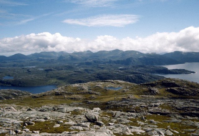
Cleit Ghriamanais is a prominent coastal feature situated in Ross-shire, a county in the Highlands region of Scotland. It is specifically located on the western coast of the mainland, near the village of Achiltibuie. Cleit Ghriamanais is a headland, also known as a point, that juts out into the North Atlantic Ocean.

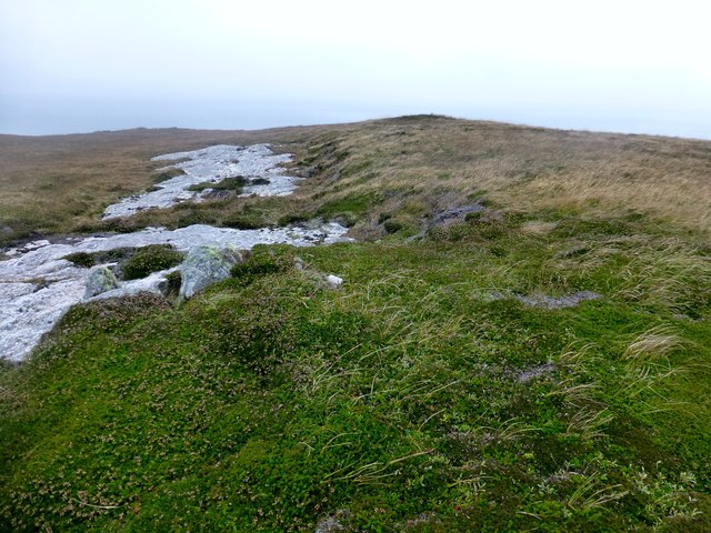
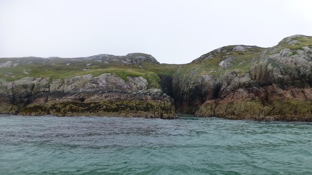
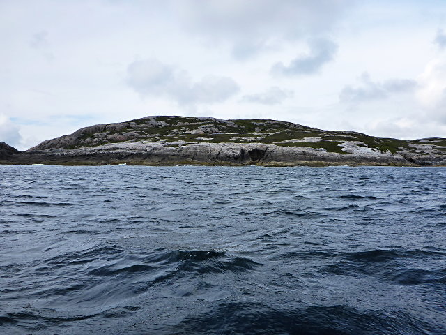
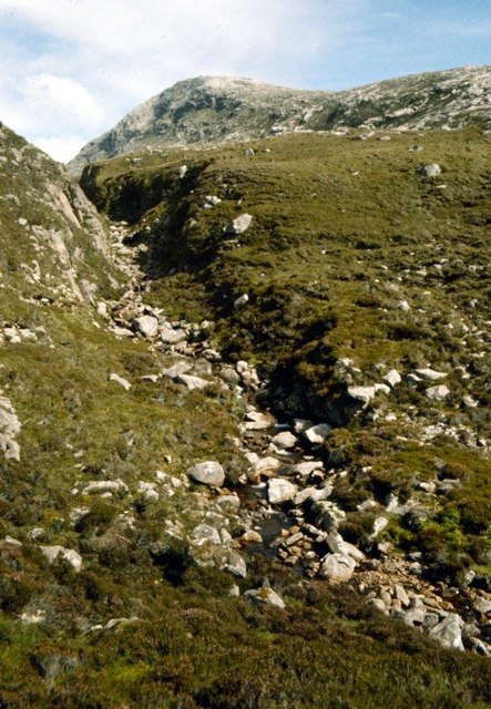
This coastal feature is characterized by its rugged and rocky terrain, with steep cliffs towering over the surrounding waters. The headland offers breathtaking panoramic views of the ocean and the surrounding coastal landscape, making it a popular destination for nature enthusiasts and photographers.

Cleit Ghriamanais is known for its diverse wildlife, including various seabirds such as puffins, gannets, and cormorants. The surrounding waters are also home to a variety of marine life, with seals often spotted basking on the rocks.

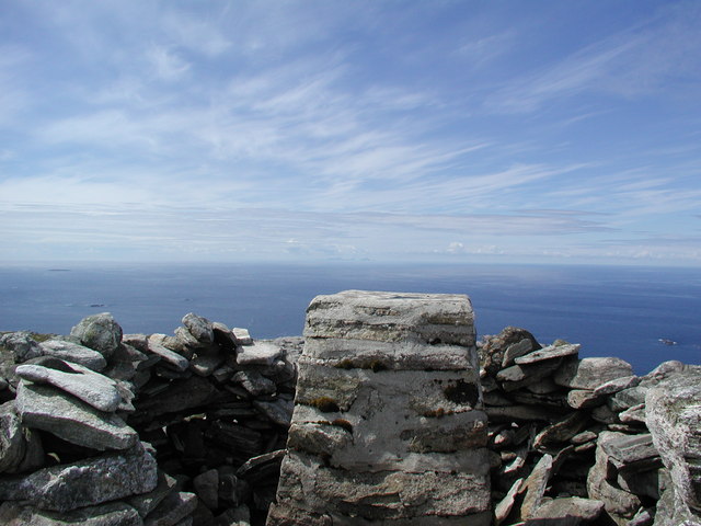
The headland is easily accessible via a coastal path that runs along the cliffs, offering visitors the opportunity to explore the area on foot. The path provides access to several viewpoints, allowing visitors to fully appreciate the stunning natural beauty of Cleit Ghriamanais.

In addition to its natural attractions, Cleit Ghriamanais also holds historical significance. The remains of an ancient fort can be found on the headland, dating back to the Iron Age. These archaeological remnants provide a glimpse into the area's rich cultural heritage.

Overall, Cleit Ghriamanais is a captivating coastal feature that showcases the raw beauty of Scotland's western coastline. Its dramatic cliffs, diverse wildlife, and historical significance make it a must-visit destination for those seeking an authentic and awe-inspiring Scottish coastal experience.

If you have any feedback on the listing, please let us know in the comments section below.

Cleit Ghriamanais Images

Images are sourced within 2km of 58.075351/-7.0960822 or Grid Reference NA9920. Thanks to Geograph Open Source API. All images are credited.

Wild camp at the head of Tamana Siar
Moorland opposite Eilean Mhealasta
Druim na Sgatha Bagging the high point of Eilean Mealasta by RIB with eight other island baggers.
Name: Druim na Sgatha
Hill number: 104561
Height: 77m / 253ft
Area: 24A: Lewis and Nearby Islands
Class: 0
Grid ref: NA977212 (est)
Drop: 77m
Col: Sea
Druim na Sgatha
Bagging the high point of Eilean Mealasta by RIB with eight other island baggers. Name: Druim na Sgatha Hill number: 104561 Height: 77m / 253ft Area: 24A: Lewis and Nearby Islands Class: 0 Grid ref: NA977212 (est) Drop: 77m Col: Sea
Eastern Coast Of Eilean Mealasta A rocky inlet on the eastern side of the island of Eilean Mealasta to the west of Lewis.
Eastern Coast Of Eilean Mealasta
A rocky inlet on the eastern side of the island of Eilean Mealasta to the west of Lewis.
Sgeir Ghlas na Roinne This is the southernmost tip of Mealasta Island
Sgeir Ghlas na Roinne
This is the southernmost tip of Mealasta Island
Rubha Leacach Southwest corner of Mealasta Island
Rubha Leacach
Southwest corner of Mealasta Island
Rubha Loisgte An abruptly truncated spur of rock meets the sea.
Rubha Loisgte
An abruptly truncated spur of rock meets the sea.
Summit of Gromabhal On horizon 92km away is St Kilda
Summit of Gromabhal
On horizon 92km away is St Kilda
View over the summit plateau of Griomabhal From the worn-down gneiss platform of Griomaval (which was how it was spelt on the OS map when we climbed it in 1974), the hills of South Harris are laid out in all their splendour (when you can see them).
View over the summit plateau of Griomabhal
From the worn-down gneiss platform of Griomaval (which was how it was spelt on the OS map when we climbed it in 1974), the hills of South Harris are laid out in all their splendour (when you can see them).
Stream gully in the Hebrides The rough moorland alongside the stream that flows down from Dubh Loch in Glen Tealasdale, on the way to Griomabhal, which can be seen in the distance. It is not easy countryside to walk over.
Stream gully in the Hebrides
The rough moorland alongside the stream that flows down from Dubh Loch in Glen Tealasdale, on the way to Griomabhal, which can be seen in the distance. It is not easy countryside to walk over.
View to Scarp from the Island of Liongam
View of the Lewis mainland to Mealasta Island from the Island of Liongam
View from the Island of Liongam to the North Harris Hills
Looking South over the lochan to Scarp and beyond from the Island of Liongam
Looking East to the Lewis mainland from the Island of Liongam
The Rocky South East Shore of the Island of Liongam with a view of the North Harris Hills
A Craggy Cove on the East Coast of the Island of Liongam
A View looking South over the Island of Liongam to Scarp, the North Harris Hills and Taransay beyond
Show me another place!

Cleit Ghriamanais is located at Grid Ref: NA9920 (Lat: 58.075351, Lng: -7.0960822)

Unitary Authority: Na h-Eileanan an Iar

Police Authority: Highlands and Islands

What 3 Words

///wiser.booster.feuds. Near Tarbert, Na h-Eileanan Siar

Related Wikis

Eilean Mhealasta

Eilean Mhealasta (Mealista Island) is an uninhabited island off the west coast of Lewis in the Outer Hebrides of Scotland. It takes its name from Mealista...

Mealista

Mealista (Scottish Gaelic: Mealasta) was a township in the west of the Isle of Lewis. It is currently largely uninhabited due to the Highland Clearances...

Game pieces of the Lewis chessmen hoard

The game pieces of the Lewis chessmen hoard consist of ninety-three game pieces of the Lewis chessmen found on the Isle of Lewis in the Outer Hebrides...

Brenish

Brenish (Scottish Gaelic: Brèinis) is a small village situated on the west coast of the Isle of Lewis, which is part of the Outer Hebrides of Scotland...

Have you been to Cleit Ghriamanais?

Leave your review of Cleit Ghriamanais below (or comments, questions and feedback).