Troll-eilean
Coastal Feature, Headland, Point in Inverness-shire
Scotland
Troll-eilean
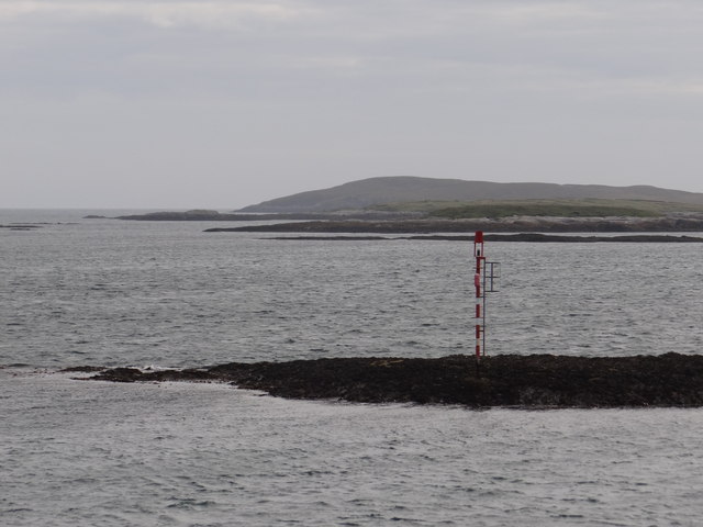
Troll-eilean, located in Inverness-shire, Scotland, is a captivating coastal feature that stands out as a prominent headland and point. This picturesque location offers breathtaking views of the surrounding landscape and the vast Atlantic Ocean. The name "Troll-eilean" stems from Scottish folklore, with "Troll" referring to mythical creatures and "eilean" meaning island in Gaelic. Although not an actual island, the name pays homage to the enchanting atmosphere that surrounds the area.
Situated on the western coast of Scotland, Troll-eilean boasts rugged cliffs that plunge dramatically into the sea below. Its towering presence and distinctive features make it an ideal spot for nature enthusiasts and photographers alike. The headland offers a unique vantage point to observe the diverse marine life, including seals, dolphins, and various seabird species that frequent the area.
The coastal feature is also known for its rich history and cultural significance. Archaeological evidence suggests that Troll-eilean has been inhabited since prehistoric times, with remnants of ancient settlements and burial mounds found nearby. The headland's strategic location made it an important site during various conflicts throughout history, including Viking invasions and clan wars.
Today, Troll-eilean attracts visitors from around the world who come to explore its rugged beauty and immerse themselves in its history. Hiking trails and viewpoints allow visitors to fully appreciate the stunning coastal landscape and experience the sense of wonder that Troll-eilean evokes. Whether it be for its natural beauty, mythical allure, or historical significance, Troll-eilean is undoubtedly a captivating coastal feature that leaves a lasting impression on all who visit.
If you have any feedback on the listing, please let us know in the comments section below.
Troll-eilean Images
Images are sourced within 2km of 57.675605/-7.0660596 or Grid Reference NF9876. Thanks to Geograph Open Source API. All images are credited.
Troll-eilean is located at Grid Ref: NF9876 (Lat: 57.675605, Lng: -7.0660596)
Unitary Authority: Na h-Eileanan an Iar
Police Authority: Highlands and Islands
What 3 Words
///universes.dunes.toolbar. Near Lochmaddy, Na h-Eileanan Siar
Nearby Locations
Related Wikis

South Lewis, Harris and North Uist National Scenic Area
South Lewis, Harris and North Uist is a large national scenic area (NSA) in the Western Isles of Scotland. It is one of 40 such areas in Scotland, which...

Tahay
Tahay (Scottish Gaelic: Taghaigh) is an island in the Outer Hebrides of Scotland. The name originates from the Old Norse tagg-øy meaning island with a...
Hermetray
Hermetray (Scottish Gaelic: Theàrnatraigh) is an uninhabited island off North Uist, in the Outer Hebrides of Scotland. == Geography and geology == Hermetray...

Sursaigh
Sursaigh (Scottish Gaelic: Sursaigh) is an island off North Uist in the Sound of Harris, Scotland. It lies 8 kilometres (5.0 mi) northeast of the village...
Have you been to Troll-eilean?
Leave your review of Troll-eilean below (or comments, questions and feedback).