An Dubh-sgeir

Coastal Feature, Headland, Point in Argyllshire

Scotland

An Dubh-sgeir

Old CEL Roller at West Hynish
Old CEL Roller at West Hynish Credit: Mike Shields

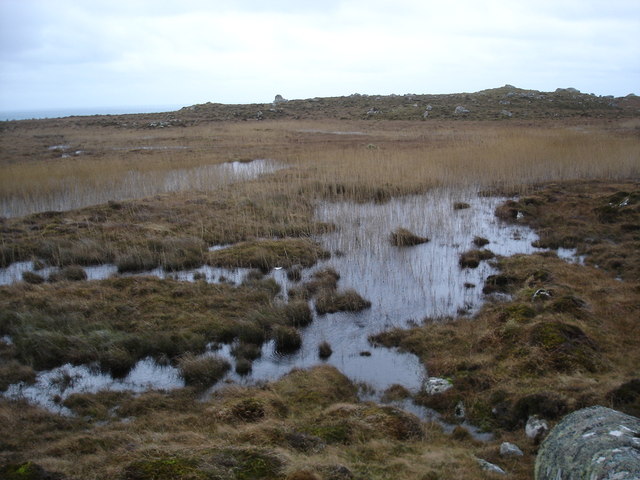
An Dubh-sgeir is a prominent coastal feature located in Argyllshire, Scotland. It is a headland or point that juts out into the sea, offering stunning views of the surrounding landscape. The name "An Dubh-sgeir" translates to "the black rock" in Gaelic, which accurately describes the appearance of the headland.

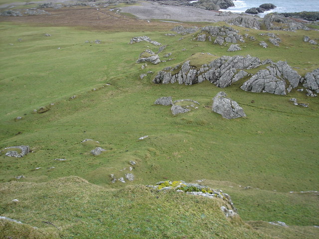
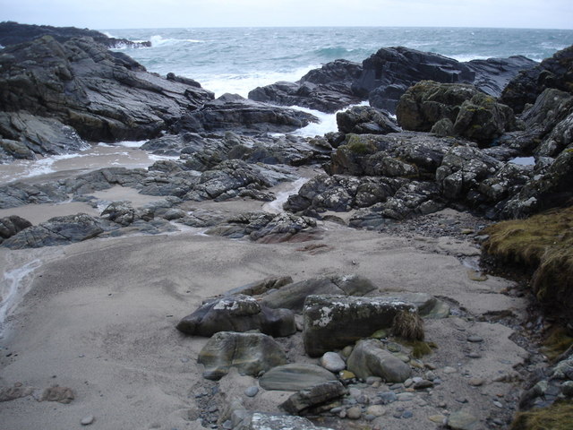
Situated on the western coast of Scotland, An Dubh-sgeir is known for its rugged and dramatic cliffs that extend out into the Atlantic Ocean. The headland is made up of dark, jagged rocks that have been shaped over thousands of years by the powerful waves crashing against them.

The area surrounding An Dubh-sgeir is rich in biodiversity, with a variety of marine life and seabirds making it their home. The headland serves as an important breeding ground for several bird species, such as gannets, puffins, and kittiwakes. It is also a popular spot for birdwatchers and nature enthusiasts who flock to witness the diverse bird population.

In addition to its natural beauty, An Dubh-sgeir holds historical significance. It is believed to have been a navigational landmark for sailors and fishermen in ancient times. The headland's strategic location and distinctive appearance made it a useful reference point for those venturing along the coast.

Today, An Dubh-sgeir continues to attract visitors who are captivated by its breathtaking scenery and abundant wildlife. Whether it's exploring the rocky cliffs, observing the birds, or simply enjoying the panoramic views, this coastal feature offers a truly unique experience for all who visit.

If you have any feedback on the listing, please let us know in the comments section below.

An Dubh-sgeir Images

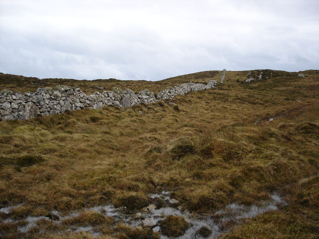
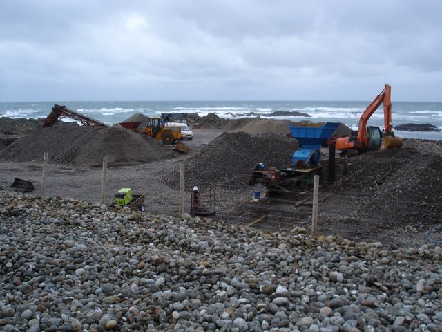
Images are sourced within 2km of 56.447296/-6.9395689 or Grid Reference NL9539. Thanks to Geograph Open Source API. All images are credited.

Old CEL Roller at West Hynish
Coast near West Hynish Nice deep layer of rather pungent seaweed washed ashore here.
Coast near West Hynish
Nice deep layer of rather pungent seaweed washed ashore here.
Dry stone dyke on Beinn Hynish A very popular location for wall is along the ridge line of hills, and in terms of Tiree this is a big as it gets.
Dry stone dyke on Beinn Hynish
A very popular location for wall is along the ridge line of hills, and in terms of Tiree this is a big as it gets.
Near the fort When I was here I was convinced that this was the location of the fort on the map.  The high ground on either sided and the parallel ridges remains of ditch systems.      Although it could be that the hill I'm standing on was the site.
Near the fort
When I was here I was convinced that this was the location of the fort on the map. The high ground on either sided and the parallel ridges remains of ditch systems. Although it could be that the hill I'm standing on was the site.
Port Snoig This is typical of this section of coastline.  Small sandy beaches and lots of rocks.
Port Snoig
This is typical of this section of coastline. Small sandy beaches and lots of rocks.
Pebble Quarry The pebbles are crushed and used as aggregate.
Pebble Quarry
The pebbles are crushed and used as aggregate.
Eilean Mòr Although give the name "big island" it is a bit of a misnomer, a skerry would be a better classification.
Eilean Mòr
Although give the name "big island" it is a bit of a misnomer, a skerry would be a better classification.
Linne Thorramhuill A very heavily reeded lochan, or maybe just very wet bog.  The whole area is rather damp as it seems to be the source of several rivers.
Linne Thorramhuill
A very heavily reeded lochan, or maybe just very wet bog. The whole area is rather damp as it seems to be the source of several rivers.
Road to the radar The access road to the NAT radar on the summit of Carnan Mòr.
Road to the radar
The access road to the NAT radar on the summit of Carnan Mòr.
Natural arch near An Snoig
There's never a gate when you really need one
Little gulley leading to a pebble beach
Moorland below Beinn Hynish
View across the moorland to Beinn Hynish A few rocky outcrops in this area.
View across the moorland to Beinn Hynish
A few rocky outcrops in this area.
NATS road Not as in the political Scot Nats, but rather the National Air Traffic Services and their road to the radar station.
NATS road
Not as in the political Scot Nats, but rather the National Air Traffic Services and their road to the radar station.
Sheds below the radar station
Giant Hogweed bud This enormous bud was growing in rocks by the Hynish shore.  I'm no expert so could not identify it.  BUT - I am now informed (May 2010) by a fellow geographer that this "shows Giant Hogweed (Heracleum mantegazzianum) a very unpleasant invasive species which can cause serious skin burns."
Giant Hogweed bud
This enormous bud was growing in rocks by the Hynish shore. I'm no expert so could not identify it. BUT - I am now informed (May 2010) by a fellow geographer that this "shows Giant Hogweed (Heracleum mantegazzianum) a very unpleasant invasive species which can cause serious skin burns."
Coastal colour below Ben Hynish Thrift and lichen on the rocks in the foreground contrast with the deep blue of the sea on a typically breezy Tiree day.  Looking south, the next land is the Irish coast.
Coastal colour below Ben Hynish
Thrift and lichen on the rocks in the foreground contrast with the deep blue of the sea on a typically breezy Tiree day. Looking south, the next land is the Irish coast.
Show me another place!

An Dubh-sgeir is located at Grid Ref: NL9539 (Lat: 56.447296, Lng: -6.9395689)

Unitary Authority: Argyll and Bute

Police Authority: Argyll and West Dunbartonshire

What 3 Words

///clincher.engages.vanish. Near Scarinish, Argyll & Bute

Related Wikis

Mannal

Mannal is a coastal hamlet on the west side of Hynish Bay, on the island of Tiree, Scotland. The township of Mannal lies on the southwest corner of Tiree...

Tiree Music Festival

Tiree Music Festival is a Scottish folk music festival held annually on the Island of Tiree in the Inner Hebrides. The festival was founded in 2010 by...

Tiree Airport

Tiree Airport (Scottish Gaelic: Port-adhair Thiriodh) (IATA: TRE, ICAO: EGPU) is located 2.5 nautical miles (4.6 km; 2.9 mi) north northeast of Balemartine...

Nearby Amenities

Located within 500m of 56.447296,-6.9395689
Power: pole
Lat/Long: 56.4471882/-6.9331557
Power: pole
Lat/Long: 56.4479883/-6.9333542
Power: pole
Lat/Long: 56.4492277/-6.9336646
Power: pole
Lat/Long: 56.449635/-6.9337554
Power: pole
Lat/Long: 56.4496665/-6.9344058
Power: pole
Lat/Long: 56.4502547/-6.9344607
Lòn na Dubh-sgeir
Natural: bay
Lat/Long: 56.4462219/-6.9369128
Am Port Mòr
Natural: bay
Lat/Long: 56.4514552/-6.9393427
Poll nan Cudainean
Natural: bay
Lat/Long: 56.4493028/-6.939407
Port Riseag
Natural: bay
Lat/Long: 56.4460236/-6.9337315
An Garbh-phort Mòr
Natural: bay
Lat/Long: 56.4501804/-6.938649
Sloc a' Chàise
Place: locality
Lat/Long: 56.4507437/-6.9394912
Man Made: cairn
Seamark Type: landmark
Lat/Long: 56.4499958/-6.9353378
Na Glacan
Place: locality
Lat/Long: 56.4494889/-6.9367218
Port a' Mhine
Natural: bay
Lat/Long: 56.4476773/-6.9355148
The data included in this document is from www.openstreetmap.org. The data is made available under ODbL.

Have you been to An Dubh-sgeir?

Leave your review of An Dubh-sgeir below (or comments, questions and feedback).