Airigh Fhearchair

Coastal Feature, Headland, Point in Argyllshire

Scotland

Airigh Fhearchair

Tràigh Thodhrasdail, Tiree Known as The Maze to wind surfers.
Tràigh Thodhrasdail, Tiree Credit: Richard Webb

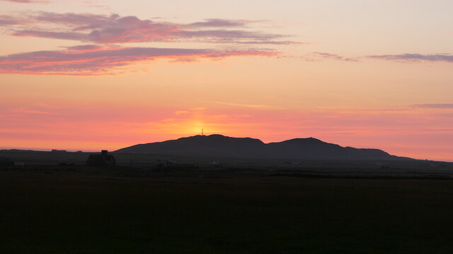
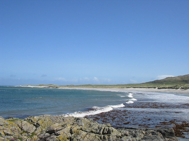
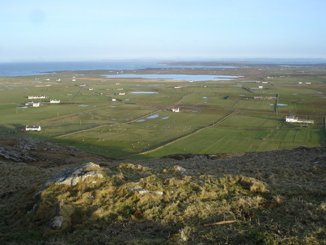
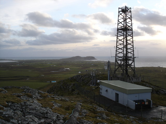
Airigh Fhearchair is a stunning coastal feature located in Argyllshire, Scotland. Situated on the western coast of the region, it is known for its rugged beauty and dramatic cliffs.

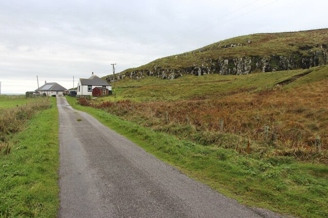
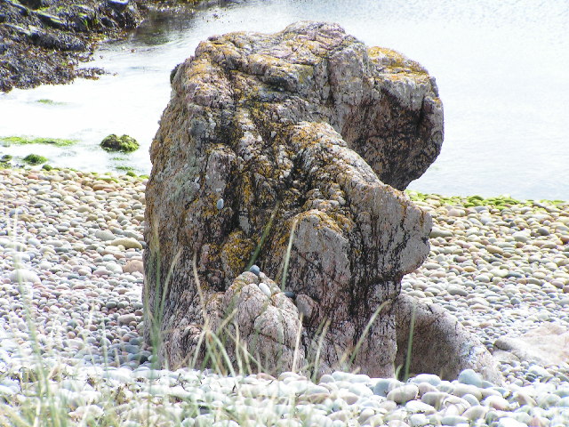
This headland, also referred to as a point, juts out into the North Atlantic Ocean, offering breathtaking panoramic views of the surrounding landscape. The point itself is characterized by tall cliffs, which provide a dramatic backdrop against the crashing waves. The rich greenery that covers the cliffs adds to the picturesque scenery, making Airigh Fhearchair a popular spot for nature enthusiasts and photographers alike.

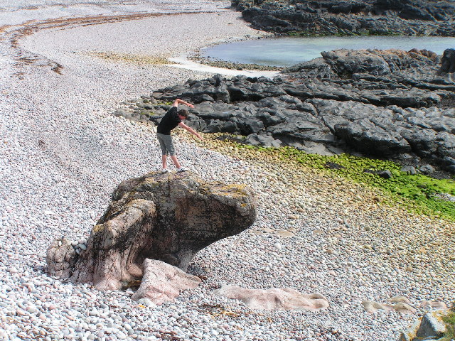
The coastal area surrounding Airigh Fhearchair is abundant in wildlife, providing a haven for various bird species, including puffins and gannets. The waters off the point are also home to a diverse range of marine life, attracting snorkelers and divers who are keen to explore the underwater world.

Access to Airigh Fhearchair is relatively challenging, as it requires a hike along a rugged path. However, this only adds to the allure of the location, as it ensures that the area remains unspoiled and untamed. The hike is rewarded with stunning views of the coastline and the opportunity to witness the raw power of the ocean.

Overall, Airigh Fhearchair is a captivating coastal feature that showcases the wild and untamed beauty of Argyllshire. Its towering cliffs, diverse wildlife, and breathtaking views make it a must-visit destination for those seeking a true Scottish coastal experience.

If you have any feedback on the listing, please let us know in the comments section below.

Airigh Fhearchair Images

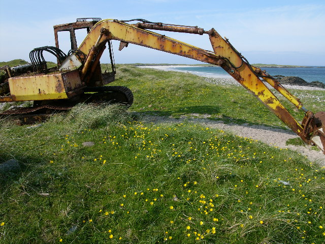
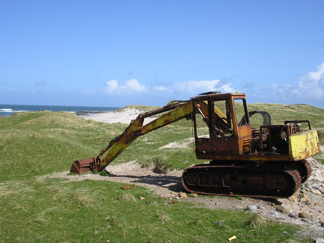
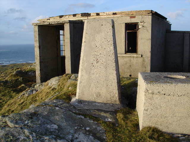
Images are sourced within 2km of 56.506495/-6.992824 or Grid Reference NL9246. Thanks to Geograph Open Source API. All images are credited.

Tràigh Thodhrasdail, Tiree Known as The Maze to wind surfers.
Tràigh Thodhrasdail, Tiree
Known as The Maze to wind surfers.
Tràigh Thodhrasdail, Tiree
Surfboard transport Quadbike and trailer carrying boards to Tràigh Thodhrasdail.
Surfboard transport
Quadbike and trailer carrying boards to Tràigh Thodhrasdail.
Sun pillar, Beinn Hough Taken after 11pm looking not far off north.
Sun pillar, Beinn Hough
Taken after 11pm looking not far off north.
Two houses below Cnoc an Fhithich
is it a dog? interesting rock structure
is it a dog?
interesting rock structure
view south
view south
Steep shingle beach some interesting rock structures
Steep shingle beach
some interesting rock structures
Hough Bay and Traigh Hough, Tiree (with late 20th. cent. artefact) And the locals complain about the impact of tourism! Presumably, this is one that got away, from The Turner Art Gallery!
Hough Bay and Traigh Hough, Tiree (with late 20th. cent. artefact)
And the locals complain about the impact of tourism! Presumably, this is one that got away, from The Turner Art Gallery!
Hough Bay
Hough Bay
Digger on the dunes
Digger on the dunes
Eilean Ghreasamuill and Traigh Throdhrasdail, Tiree The rocks of Eilean Ghreasamuill and the sands of Traigh Throdhrasdail on the west coast of Tiree
Eilean Ghreasamuill and Traigh Throdhrasdail, Tiree
The rocks of Eilean Ghreasamuill and the sands of Traigh Throdhrasdail on the west coast of Tiree
Triangulation Pillar on Beinn Hough Behind the triangularion pillar is the remains of a WWII radar station.  A series of steps to the top of the hill were made for access to the station.
Triangulation Pillar on Beinn Hough
Behind the triangularion pillar is the remains of a WWII radar station. A series of steps to the top of the hill were made for access to the station.
View over Loch Bhasapoll from Beinn Hough You can see the whole island from the excellent viewpoint.
View over Loch Bhasapoll from Beinn Hough
You can see the whole island from the excellent viewpoint.
Mast on Cnoc an Fhithich View in the distance of Ceann a' Mhara
Mast on Cnoc an Fhithich
View in the distance of Ceann a' Mhara
Dunes around Kilkenneth Chapel The dunes are a big feature of many of the squares at this end of the island.  The chapel can be seen just poking out above the dunes.
Dunes around Kilkenneth Chapel
The dunes are a big feature of many of the squares at this end of the island. The chapel can be seen just poking out above the dunes.
The view west from Cnoc an Fhithich The long thin peninsula making up the most western point of Tiree can be clearly seen.  Strange to think that there were several townships in this area west of Beinn Hough which have been inundated by sand and nothing can be seen of them now.
The view west from Cnoc an Fhithich
The long thin peninsula making up the most western point of Tiree can be clearly seen. Strange to think that there were several townships in this area west of Beinn Hough which have been inundated by sand and nothing can be seen of them now.
Traidh Thodhrasdail Bay, Tiree
Show me another place!

Airigh Fhearchair is located at Grid Ref: NL9246 (Lat: 56.506495, Lng: -6.992824)

Unitary Authority: Argyll and Bute

Police Authority: Argyll and West Dunbartonshire

What 3 Words

///bombshell.defrost.gravitate. Near Scarinish, Argyll & Bute

Nearby Locations

Airigh Fhearchair

Related Wikis

Tiree Music Festival

Tiree Music Festival is a Scottish folk music festival held annually on the Island of Tiree in the Inner Hebrides. The festival was founded in 2010 by...

Tiree Airport

Tiree Airport (Scottish Gaelic: Port-adhair Thiriodh) (IATA: TRE, ICAO: EGPU) is located 2.5 nautical miles (4.6 km; 2.9 mi) north northeast of Balemartine...

Mannal

Mannal is a coastal hamlet on the west side of Hynish Bay, on the island of Tiree, Scotland. The township of Mannal lies on the southwest corner of Tiree...

Nearby Amenities

Located within 500m of 56.506495,-6.992824
Source: PGS
Lat/Long: 56.5037783/-6.9867019
Source: PGS
Lat/Long: 56.5038236/-6.9871827
Source: PGS
Lat/Long: 56.5040079/-6.9873022
Source: PGS
Lat/Long: 56.5040241/-6.9874932
Source: PGS
Lat/Long: 56.5040917/-6.9877869
Source: PGS
Lat/Long: 56.5041708/-6.98821
Created By: dmgroom_coastlines
Source: PGS
Lat/Long: 56.50411/-6.98845
Created By: dmgroom_coastlines
Source: PGS
Lat/Long: 56.50399/-6.98869
Created By: dmgroom_coastlines
Source: PGS
Lat/Long: 56.50399/-6.98915
Created By: dmgroom_coastlines
Source: PGS
Lat/Long: 56.50413/-6.98938
Source: PGS
Lat/Long: 56.5042379/-6.9893707
Source: PGS
Lat/Long: 56.5042847/-6.9895109
Source: PGS
Lat/Long: 56.5043733/-6.9899984
Source: PGS
Lat/Long: 56.5043892/-6.9902868
Source: PGS
Lat/Long: 56.5045313/-6.9908541
Source: PGS
Lat/Long: 56.5043175/-6.9929541
Created By: dmgroom_coastlines
Source: PGS
Lat/Long: 56.50392/-6.99309
Created By: dmgroom_coastlines
Source: PGS
Lat/Long: 56.50381/-6.99333
Created By: dmgroom_coastlines
Source: PGS
Lat/Long: 56.50369/-6.99426
Created By: dmgroom_coastlines
Source: PGS
Lat/Long: 56.50318/-6.99453
Created By: dmgroom_coastlines
Source: PGS
Lat/Long: 56.50306/-6.99476
Created By: dmgroom_coastlines
Source: PGS
Lat/Long: 56.50308/-6.99568
Created By: dmgroom_coastlines
Source: PGS
Lat/Long: 56.50308/-6.99615
Created By: dmgroom_coastlines
Source: PGS
Lat/Long: 56.50296/-6.99639
Created By: dmgroom_coastlines
Source: PGS
Lat/Long: 56.50283/-6.99662
Created By: dmgroom_coastlines
Source: PGS
Lat/Long: 56.50401/-6.99818
Created By: dmgroom_coastlines
Source: PGS
Lat/Long: 56.50452/-6.99817
Created By: dmgroom_coastlines
Source: PGS
Lat/Long: 56.50478/-6.99837
Created By: dmgroom_coastlines
Source: PGS
Lat/Long: 56.5049/-6.9979
Created By: dmgroom_coastlines
Source: PGS
Lat/Long: 56.50501/-6.99651
Created By: dmgroom_coastlines
Source: PGS
Lat/Long: 56.50603/-6.99622
Created By: dmgroom_coastlines
Source: PGS
Lat/Long: 56.50654/-6.99596
Created By: dmgroom_coastlines
Source: PGS
Lat/Long: 56.50666/-6.9955
Created By: dmgroom_coastlines
Source: PGS
Lat/Long: 56.50691/-6.99502
Created By: dmgroom_coastlines
Source: PGS
Lat/Long: 56.507/-6.99316
Created By: dmgroom_coastlines
Source: PGS
Lat/Long: 56.50675/-6.99341
Created By: dmgroom_coastlines
Source: PGS
Lat/Long: 56.5065/-6.99364
Created By: dmgroom_coastlines
Source: PGS
Lat/Long: 56.50636/-6.99273
Created By: dmgroom_coastlines
Source: PGS
Lat/Long: 56.50635/-6.99227
Created By: dmgroom_coastlines
Source: PGS
Lat/Long: 56.50659/-6.99133
Created By: dmgroom_coastlines
Source: PGS
Lat/Long: 56.50683/-6.99085
Created By: dmgroom_coastlines
Source: PGS
Lat/Long: 56.50707/-6.98945
Created By: dmgroom_coastlines
Source: PGS
Lat/Long: 56.50719/-6.98898
Created By: dmgroom_coastlines
Source: PGS
Lat/Long: 56.50693/-6.98877
Created By: dmgroom_coastlines
Source: PGS
Lat/Long: 56.50616/-6.98857
Created By: dmgroom_coastlines
Source: PGS
Lat/Long: 56.50602/-6.98766
Created By: dmgroom_coastlines
Source: PGS
Lat/Long: 56.506/-6.98627
Created By: dmgroom_coastlines
Source: PGS
Lat/Long: 56.50624/-6.98578
The data included in this document is from www.openstreetmap.org. The data is made available under ODbL.

Have you been to Airigh Fhearchair?

Leave your review of Airigh Fhearchair below (or comments, questions and feedback).