Am Meall

Coastal Feature, Headland, Point in Argyllshire

Scotland

Am Meall

Tiree - Abandoned military building, Hough The almost flat machair between Tràigh Hough and the twin eminences of Beinn Hough & Beinn Mhurstat is host to a number of disused military buildings such as the one seen crouching beneath the hills here.
See also <a href="https://www.geograph.org.uk/photo/6904420">NL9446 : Tiree - Old military installations near Loch Earblaig</a>
For a closer view, see <a href="https://www.geograph.org.uk/photo/6904506">NL9446 : Tiree - Large former military building beneath Beinn Hough</a> and compare with <a href="https://www.geograph.org.uk/photo/6904511">NL9446 : Tiree - Former military building near Tràigh Hough</a>
Tiree - Abandoned military building, Hough Credit: Rob Farrow

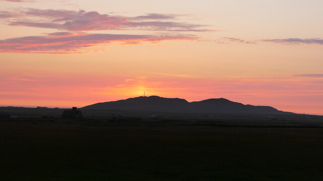
Am Meall is a prominent coastal feature located in Argyllshire, Scotland. Situated on the west coast of the country, it is specifically a headland or point that extends out into the Atlantic Ocean. The name "Am Meall" translates to "The Round Hill" in English, which aptly describes its distinctive topographical feature.

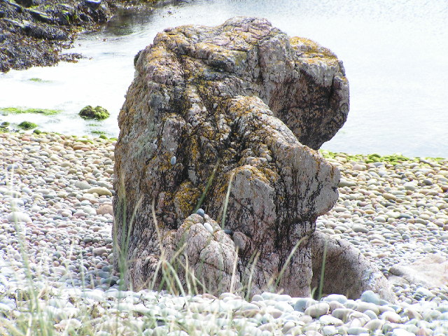
The headland is characterized by its rugged and rocky terrain, providing a stunning backdrop against the crashing waves of the ocean. With its elevated position, Am Meall offers breathtaking panoramic views of the surrounding coastline and the vast expanse of the Atlantic. On clear days, visitors can even catch a glimpse of neighboring islands such as Mull and Islay.

The headland is home to a diverse array of flora and fauna, making it an attractive spot for nature enthusiasts. It boasts a variety of seabirds, including gannets, puffins, and kittiwakes, which nest along the cliffs. The coastal waters surrounding Am Meall are also known to support a rich marine life, including seals, dolphins, and occasional sightings of whales.

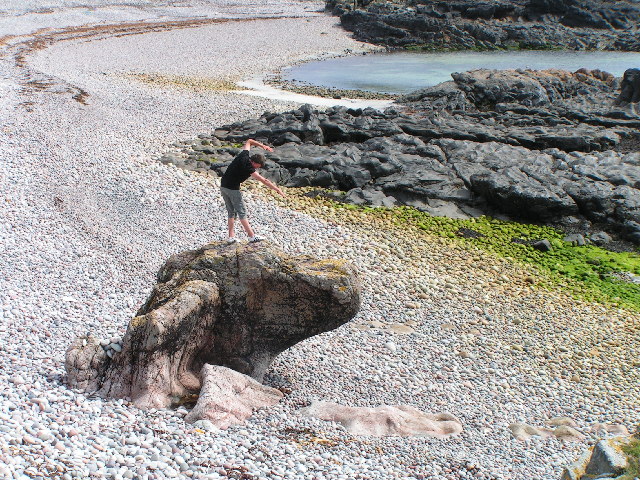
Access to Am Meall is relatively straightforward, with a well-maintained footpath leading to the headland. Visitors can explore the area on foot, enjoying the invigorating sea breeze and the sound of crashing waves. The headland is a popular destination for hikers, photographers, and nature lovers alike, seeking solace and tranquility amidst the rugged beauty of the Scottish coastline.

In summary, Am Meall in Argyllshire is a captivating headland that offers breathtaking views, diverse wildlife, and a serene coastal experience. It stands as a testament to the natural wonders that Scotland has to offer.

If you have any feedback on the listing, please let us know in the comments section below.

Am Meall Images

Images are sourced within 2km of 56.504773/-6.9946797 or Grid Reference NL9245. Thanks to Geograph Open Source API. All images are credited.

Tiree - Abandoned military building, Hough The almost flat machair between Tràigh Hough and the twin eminences of Beinn Hough & Beinn Mhurstat is host to a number of disused military buildings such as the one seen crouching beneath the hills here.
See also <a href="https://www.geograph.org.uk/photo/6904420">NL9446 : Tiree - Old military installations near Loch Earblaig</a>
For a closer view, see <a href="https://www.geograph.org.uk/photo/6904506">NL9446 : Tiree - Large former military building beneath Beinn Hough</a> and compare with <a href="https://www.geograph.org.uk/photo/6904511">NL9446 : Tiree - Former military building near Tràigh Hough</a>
Tiree - Abandoned military building, Hough
The almost flat machair between Tràigh Hough and the twin eminences of Beinn Hough & Beinn Mhurstat is host to a number of disused military buildings such as the one seen crouching beneath the hills here. See also NL9446 : Tiree - Old military installations near Loch Earblaig For a closer view, see NL9446 : Tiree - Large former military building beneath Beinn Hough and compare with NL9446 : Tiree - Former military building near Tràigh Hough
Tiree - Old military installations near Loch Earblaig Looking across the machair in the direction of (the invisible) Loch Earblaig, two disused military buildings can be seen, one at NL94354648 the other (further away) at NL94524643. The gap in the hills seen ahead is Bealach na Beinne between Beinn Hough (left, North) and Beinn Mhurstat (right, South).
See also <a href="https://www.geograph.org.uk/photo/6904347">NL9446 : Tiree - Abandoned military building, Hough</a>
For closer views, see <a href="https://www.geograph.org.uk/photo/6904506">NL9446 : Tiree - Large former military building beneath Beinn Hough</a> & <a href="https://www.geograph.org.uk/photo/6904511">NL9446 : Tiree - Former military building near Tràigh Hough</a>
Tiree - Old military installations near Loch Earblaig
Looking across the machair in the direction of (the invisible) Loch Earblaig, two disused military buildings can be seen, one at NL94354648 the other (further away) at NL94524643. The gap in the hills seen ahead is Bealach na Beinne between Beinn Hough (left, North) and Beinn Mhurstat (right, South). See also NL9446 : Tiree - Abandoned military building, Hough For closer views, see NL9446 : Tiree - Large former military building beneath Beinn Hough & NL9446 : Tiree - Former military building near Tràigh Hough
Tiree - Isolated former military building This little ex-military building, one of many on Tiree especially in this area, is perched on rising land overlooking Hough Bay.
Tiree - Isolated former military building
This little ex-military building, one of many on Tiree especially in this area, is perched on rising land overlooking Hough Bay.
Tiree - Unmade permissive track to Tràigh Hough This unfenced private track leads to  Tràigh Hough. Permission is given by the landowner for people to drive down this to park by <a href="https://www.geograph.org.uk/photo/6904450">NL9346 : Tiree - "The Old Digger"</a>
Tiree - Unmade permissive track to Tràigh Hough
This unfenced private track leads to Tràigh Hough. Permission is given by the landowner for people to drive down this to park by NL9346 : Tiree - "The Old Digger"
Tiree - "The Old Digger" Permission is given by the landowner to drive along <a href="https://www.geograph.org.uk/photo/6904447">NL9446 : Tiree - Unmade permissive track to Tràigh Hough</a> provided you park by this "Old Digger".
Tiree - "The Old Digger"
Permission is given by the landowner to drive along NL9446 : Tiree - Unmade permissive track to Tràigh Hough provided you park by this "Old Digger".
Tiree - Tràigh Hough - northern end This stony beach is at the northern end of Tràigh Hough. I obviously got too close to a tern's nest as I was dive-bombed by a particularly angry one!
Tiree - Tràigh Hough - northern end
This stony beach is at the northern end of Tràigh Hough. I obviously got too close to a tern's nest as I was dive-bombed by a particularly angry one!
Tiree - Looking down on Rubha Chràiginis Rubha Chràiginis is a straggling promontory to the south of Tràigh Hough. It is seen here from about ⅔ the way up Beinn Hough.
Tiree - Looking down on Rubha Chràiginis
Rubha Chràiginis is a straggling promontory to the south of Tràigh Hough. It is seen here from about ⅔ the way up Beinn Hough.
Tiree - Looking across Beinn Mhurstat from Beinn Hough The hill straight ahead is Beinn Mhurstat with its prominent mast on Cnoc an Fhithich. This hill at 113m (370') is just 6m/20' lower than Beinn Hough from which it was taken.
In the distance the twin tumps of Beinn Ceann a' Mhara are at the southwestern extremity of Tiree.
Tiree - Looking across Beinn Mhurstat from Beinn Hough
The hill straight ahead is Beinn Mhurstat with its prominent mast on Cnoc an Fhithich. This hill at 113m (370') is just 6m/20' lower than Beinn Hough from which it was taken. In the distance the twin tumps of Beinn Ceann a' Mhara are at the southwestern extremity of Tiree.
Tiree - Large former military building beneath Beinn Hough This large 'Brutalist style' former military building nestles at the foot of Beinn Hough.
It looks to be a larger version of its nearby neighbour here <a href="https://www.geograph.org.uk/photo/6904511">NL9446 : Tiree - Former military building near Tràigh Hough</a>
See these two buildings in context here <a href="https://www.geograph.org.uk/photo/6904347">NL9446 : Tiree - Abandoned military building, Hough</a> & <a href="https://www.geograph.org.uk/photo/6904420">NL9446 : Tiree - Old military installations near Loch Earblaig</a>
Tiree - Large former military building beneath Beinn Hough
This large 'Brutalist style' former military building nestles at the foot of Beinn Hough. It looks to be a larger version of its nearby neighbour here NL9446 : Tiree - Former military building near Tràigh Hough See these two buildings in context here NL9446 : Tiree - Abandoned military building, Hough & NL9446 : Tiree - Old military installations near Loch Earblaig
Tiree - Former military building near Tràigh Hough This disused military building is on the machair a little way inland from Tràigh Hough. It looks to be a smaller version of <a href="https://www.geograph.org.uk/photo/6904506">NL9446 : Tiree - Large former military building beneath Beinn Hough</a> which is slightly further inland.
See these two buildings in context here <a href="https://www.geograph.org.uk/photo/6904347">NL9446 : Tiree - Abandoned military building, Hough</a> & <a href="https://www.geograph.org.uk/photo/6904420">NL9446 : Tiree - Old military installations near Loch Earblaig</a>
Tiree - Former military building near Tràigh Hough
This disused military building is on the machair a little way inland from Tràigh Hough. It looks to be a smaller version of NL9446 : Tiree - Large former military building beneath Beinn Hough which is slightly further inland. See these two buildings in context here NL9446 : Tiree - Abandoned military building, Hough & NL9446 : Tiree - Old military installations near Loch Earblaig
Tràigh Thodhrasdail, Tiree Known as The Maze to wind surfers.
Tràigh Thodhrasdail, Tiree
Known as The Maze to wind surfers.
Tràigh Ghrianal The track is often used by quadbikes carrying surfboards.
Tràigh Ghrianal
The track is often used by quadbikes carrying surfboards.
Tràigh Thodhrasdail, Tiree
Surfboard transport Quadbike and trailer carrying boards to Tràigh Thodhrasdail.
Surfboard transport
Quadbike and trailer carrying boards to Tràigh Thodhrasdail.
Sun pillar, Beinn Hough Taken after 11pm looking not far off north.
Sun pillar, Beinn Hough
Taken after 11pm looking not far off north.
is it a dog? interesting rock structure
is it a dog?
interesting rock structure
view south
view south
Steep shingle beach some interesting rock structures
Steep shingle beach
some interesting rock structures
Show me another place!

Am Meall is located at Grid Ref: NL9245 (Lat: 56.504773, Lng: -6.9946797)

Unitary Authority: Argyll and Bute

Police Authority: Argyll and West Dunbartonshire

What 3 Words

///topples.tutorial.loaning. Near Scarinish, Argyll & Bute

Related Wikis

Tiree Music Festival

Tiree Music Festival is a Scottish folk music festival held annually on the Island of Tiree in the Inner Hebrides. The festival was founded in 2010 by...

Tiree Airport

Tiree Airport (Scottish Gaelic: Port-adhair Thiriodh) (IATA: TRE, ICAO: EGPU) is located 2.5 nautical miles (4.6 km; 2.9 mi) north northeast of Balemartine...

Mannal

Mannal is a coastal hamlet on the west side of Hynish Bay, on the island of Tiree, Scotland. The township of Mannal lies on the southwest corner of Tiree...

Nearby Amenities

Located within 500m of 56.504773,-6.9946797
Source: PGS
Lat/Long: 56.5038236/-6.9871827
Source: PGS
Lat/Long: 56.5040079/-6.9873022
Source: PGS
Lat/Long: 56.5040241/-6.9874932
Source: PGS
Lat/Long: 56.5040917/-6.9877869
Source: PGS
Lat/Long: 56.5041708/-6.98821
Created By: dmgroom_coastlines
Source: PGS
Lat/Long: 56.50411/-6.98845
Created By: dmgroom_coastlines
Source: PGS
Lat/Long: 56.50399/-6.98869
Created By: dmgroom_coastlines
Source: PGS
Lat/Long: 56.50399/-6.98915
Created By: dmgroom_coastlines
Source: PGS
Lat/Long: 56.50413/-6.98938
Source: PGS
Lat/Long: 56.5042379/-6.9893707
Source: PGS
Lat/Long: 56.5042847/-6.9895109
Source: PGS
Lat/Long: 56.5043733/-6.9899984
Source: PGS
Lat/Long: 56.5043892/-6.9902868
Source: PGS
Lat/Long: 56.5045313/-6.9908541
Source: PGS
Lat/Long: 56.5043175/-6.9929541
Created By: dmgroom_coastlines
Source: PGS
Lat/Long: 56.50392/-6.99309
Created By: dmgroom_coastlines
Source: PGS
Lat/Long: 56.50381/-6.99333
Created By: dmgroom_coastlines
Source: PGS
Lat/Long: 56.50369/-6.99426
Created By: dmgroom_coastlines
Source: PGS
Lat/Long: 56.50318/-6.99453
Created By: dmgroom_coastlines
Source: PGS
Lat/Long: 56.50306/-6.99476
Created By: dmgroom_coastlines
Source: PGS
Lat/Long: 56.50308/-6.99568
Created By: dmgroom_coastlines
Source: PGS
Lat/Long: 56.50308/-6.99615
Created By: dmgroom_coastlines
Source: PGS
Lat/Long: 56.50296/-6.99639
Created By: dmgroom_coastlines
Source: PGS
Lat/Long: 56.50283/-6.99662
Created By: dmgroom_coastlines
Source: PGS
Lat/Long: 56.5026/-6.99801
Created By: dmgroom_coastlines
Source: PGS
Lat/Long: 56.50249/-6.99896
Created By: dmgroom_coastlines
Source: PGS
Lat/Long: 56.50325/-6.99869
Created By: dmgroom_coastlines
Source: PGS
Lat/Long: 56.50401/-6.99818
Created By: dmgroom_coastlines
Source: PGS
Lat/Long: 56.50452/-6.99817
Created By: dmgroom_coastlines
Source: PGS
Lat/Long: 56.50478/-6.99837
Created By: dmgroom_coastlines
Source: PGS
Lat/Long: 56.5049/-6.9979
Created By: dmgroom_coastlines
Source: PGS
Lat/Long: 56.50501/-6.99651
Created By: dmgroom_coastlines
Source: PGS
Lat/Long: 56.50603/-6.99622
Created By: dmgroom_coastlines
Source: PGS
Lat/Long: 56.50654/-6.99596
Created By: dmgroom_coastlines
Source: PGS
Lat/Long: 56.50666/-6.9955
Created By: dmgroom_coastlines
Source: PGS
Lat/Long: 56.50691/-6.99502
Created By: dmgroom_coastlines
Source: PGS
Lat/Long: 56.507/-6.99316
Created By: dmgroom_coastlines
Source: PGS
Lat/Long: 56.50675/-6.99341
Created By: dmgroom_coastlines
Source: PGS
Lat/Long: 56.5065/-6.99364
Created By: dmgroom_coastlines
Source: PGS
Lat/Long: 56.50636/-6.99273
Created By: dmgroom_coastlines
Source: PGS
Lat/Long: 56.50635/-6.99227
Created By: dmgroom_coastlines
Source: PGS
Lat/Long: 56.50659/-6.99133
Created By: dmgroom_coastlines
Source: PGS
Lat/Long: 56.50683/-6.99085
Created By: dmgroom_coastlines
Source: PGS
Lat/Long: 56.50707/-6.98945
Created By: dmgroom_coastlines
Source: PGS
Lat/Long: 56.50719/-6.98898
Created By: dmgroom_coastlines
Source: PGS
Lat/Long: 56.50693/-6.98877
Created By: dmgroom_coastlines
Source: PGS
Lat/Long: 56.50616/-6.98857
Created By: dmgroom_coastlines
Source: PGS
Lat/Long: 56.50602/-6.98766
The data included in this document is from www.openstreetmap.org. The data is made available under ODbL.

Have you been to Am Meall?

Leave your review of Am Meall below (or comments, questions and feedback).