Bayhead

Settlement in Inverness-shire

Scotland

Bayhead

View towards Lingarabay Looking south.
View towards Lingarabay Credit: Richard Dorrell

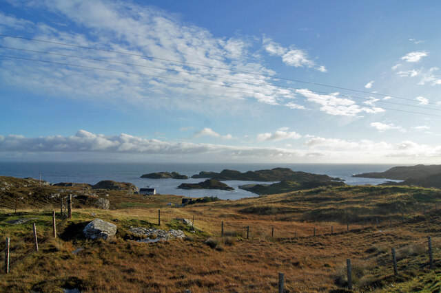
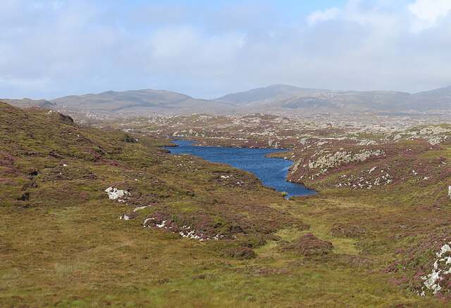
Bayhead is a small village located in the unitary authority area of Highland, within the county of Inverness-shire in Scotland. Situated on the west coast of the Scottish Highlands, Bayhead is nestled between the picturesque Loch Ewe and the rugged mountains of Torridon.

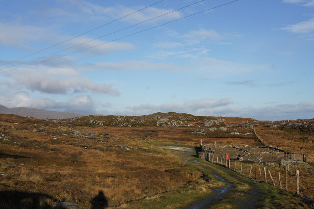
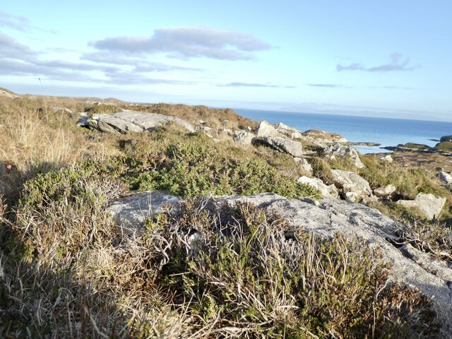
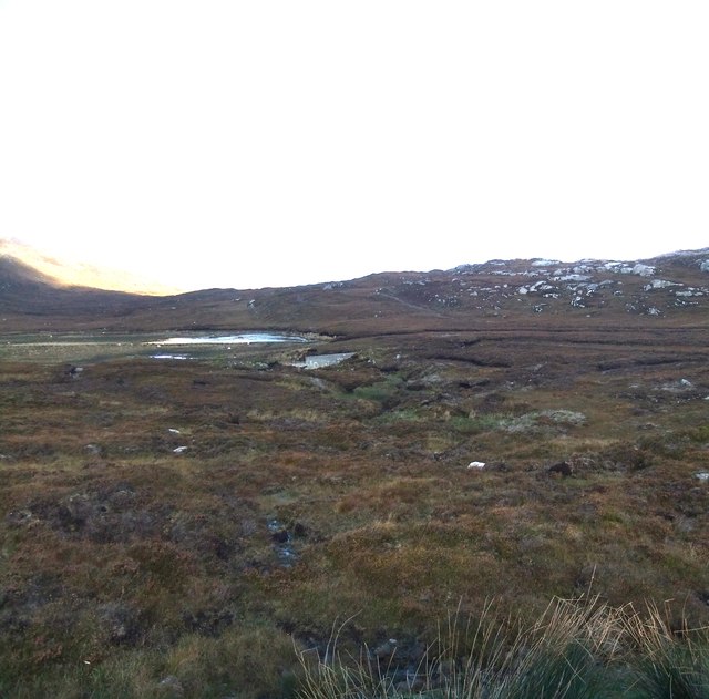
The village is known for its stunning natural beauty, with a diverse landscape that includes pristine beaches, rolling hills, and abundant wildlife. The surrounding area offers an array of outdoor activities, such as hiking, fishing, and birdwatching. Bayhead is particularly popular among nature enthusiasts and those seeking a peaceful retreat in a remote and tranquil setting.

Despite its relatively small size, Bayhead is home to a close-knit community that takes pride in its rich history and cultural heritage. The village has a few local amenities, including a small shop, a post office, and a pub, which serves as a gathering place for locals and visitors alike.

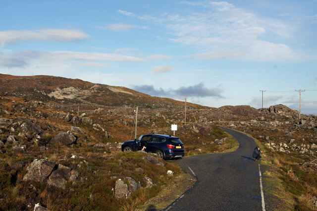
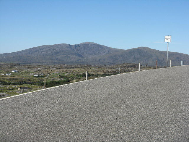
In terms of transportation, Bayhead is accessible by road via the A832 and is around 80 miles northwest of Inverness. The closest railway station is in Achnasheen, approximately 30 miles away.

Overall, Bayhead offers a unique blend of natural beauty, outdoor activities, and a strong sense of community, making it an attractive destination for those looking to immerse themselves in Scotland's stunning Highland scenery.

If you have any feedback on the listing, please let us know in the comments section below.

Bayhead Images

Images are sourced within 2km of 57.757994/-6.9447243 or Grid Reference NG0685. Thanks to Geograph Open Source API. All images are credited.

View towards Lingarabay Looking south.
View towards Lingarabay
Looking south.
Track and sheep pen, Lingarabay A few nomadic sheep manage to survive here, among the heather and bedrock on the east coast of Harris.
Track and sheep pen, Lingarabay
A few nomadic sheep manage to survive here, among the heather and bedrock on the east coast of Harris.
Road north from Roghadal Sue crouches to get some foreground in her arty photo looking out to sea, while I capture the scene for Geograph.
Road north from Roghadal
Sue crouches to get some foreground in her arty photo looking out to sea, while I capture the scene for Geograph.
Prostrate Juniper near Beinn na h-Aire Zone 2 - Juniperus communis ssp nana. Found in abundance in this area - this one on the slopes of Beinn na h-Aire, on the way up to Roineabhal from Lingreabhagh. This is a designated National Scenic Area (NSA).
Prostrate Juniper near Beinn na h-Aire
Zone 2 - Juniperus communis ssp nana. Found in abundance in this area - this one on the slopes of Beinn na h-Aire, on the way up to Roineabhal from Lingreabhagh. This is a designated National Scenic Area (NSA).
Near Lingarabay One of the great pleasures of a visit to Harris is driving the road along the east coast, with its vistas of impossibly rocky land.
Near Lingarabay
One of the great pleasures of a visit to Harris is driving the road along the east coast, with its vistas of impossibly rocky land.
The Bays Road This narrow road with passing places twists and winds along the east coast of Harris between Roghadal and Tairbeart. The scar on the hill ahead is the anorthosite quarry above Lingerbay. A proposal to develop a super-quarry here led to protracted planning wrangles until it was finally turned down in 2004. See <span class="nowrap"><a title="https://en.wikipedia.org/wiki/Lingarabay" rel="nofollow ugc noopener" href="https://en.wikipedia.org/wiki/Lingarabay">Link</a><img style="margin-left:2px;" alt="External link" title="External link - shift click to open in new window" src="https://s1.geograph.org.uk/img/external.png" width="10" height="10"/></span> for details. Anorthosite is a rock composed mainly of plagioclase feldspar with other minerals, and it appears very white. Much of the Moon is composed of anorthosite.
The Bays Road
This narrow road with passing places twists and winds along the east coast of Harris between Roghadal and Tairbeart. The scar on the hill ahead is the anorthosite quarry above Lingerbay. A proposal to develop a super-quarry here led to protracted planning wrangles until it was finally turned down in 2004. See LinkExternal link for details. Anorthosite is a rock composed mainly of plagioclase feldspar with other minerals, and it appears very white. Much of the Moon is composed of anorthosite.
Beinn na h-Aire Or rather the northern slopes of Beinn na h-Aire, much of the hill being hidden in the cloud.
Beinn na h-Aire
Or rather the northern slopes of Beinn na h-Aire, much of the hill being hidden in the cloud.
Loch an Luig One of the hundreds of small lochs among the gneiss of eastern Harris.
Loch an Luig
One of the hundreds of small lochs among the gneiss of eastern Harris.
Loch Sgùrr The road is right on the brink of this small lochan.
Loch Sgùrr
The road is right on the brink of this small lochan.
The road to Leverburgh from Rodel
Hillside, Gleann Roghadail Improved pasture and rocky rough grazing.
Hillside, Gleann Roghadail
Improved pasture and rocky rough grazing.
Gleann Roghadail Looking down the glen to Rodel/Roghadal.
Gleann Roghadail
Looking down the glen to Rodel/Roghadal.
Roineabhal from Manish With Coire Ròineabhail showing well from 7km away.
Roineabhal from Manish
With Coire Ròineabhail showing well from 7km away.
Track to Loch na Criadhach With the Little Minch in the distance.
Track to Loch na Criadhach
With the Little Minch in the distance.
Outcrop near Finsbay/Fionnsabhagh Rough heathery moorland with rocks.
Outcrop near Finsbay/Fionnsabhagh
Rough heathery moorland with rocks.
Road near Lingreabhagh
Loch a' Choire A bigger loch before the dam collapsed.
Loch a' Choire
A bigger loch before the dam collapsed.
Mast near Rodel
Mast near Rodel
Show me another place!

Bayhead is located at Grid Ref: NG0685 (Lat: 57.757994, Lng: -6.9447243)

Unitary Authority: Na h-Eileanan an Iar

Police Authority: Highlands and Islands

Also known as: Ceann Bhaigh

What 3 Words

///restriction.relations.suggested. Near Leverburgh, Na h-Eileanan Siar

Related Wikis

Harris Superquarry

The Harris Super Quarry was a super quarry at Lingerbay, Harris, Scotland proposed by Redland Aggregates in 1991. The plan was to surface mine aggregate...

Lingarabay

Lingarabay (also Lingerabay or Lingerbay; Scottish Gaelic: Lingreabhagh) is a small coastal settlement on Harris, in the Outer Hebrides of Scotland. It...

Roineabhal

Roineabhal is a hill in Harris, in the Western Isles of Scotland. The granite on the summit plateau of the mountain is anorthosite, and is similar in composition...

Borsham

Borsham (Scottish Gaelic: Boirseam) is a village in the 'Bays' area of Harris in the Outer Hebrides, Scotland. Borsham is within the parish of Harris....

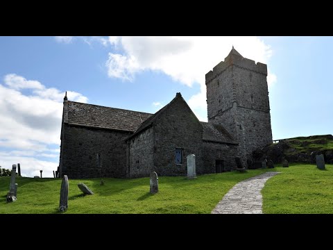
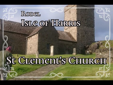
St Clement's Church, Rodel

St Clement's Church (Scottish Gaelic: Tùr Chliamhainn, meaning Clement's Tower) is a late fifteenth-century or early sixteenth-century church in Rodel...

Rodel

Rodel (Scottish Gaelic: Roghadal) is a village on the south-eastern coast of Harris, an island in the Scottish Outer Hebrides. Rodel is situated in the...

Outer Hebrides

The Outer Hebrides ( HEB-rid-eez) or Western Isles (Scottish Gaelic: na h-Eileanan Siar [nə ˈhelanən ˈʃiəɾ] , na h-Eileanan an Iar [nə ˈhelanən əɲ ˈiəɾ...

Leverburgh

Leverburgh (Scottish Gaelic: An t-Òb [ən̪ˠ ˈt̪ɔːp]) is the second largest village, after Tarbert, in Harris in the Outer Hebrides of Scotland. Leverburgh...

Related Videos

St Clement's Church On Visit To Rodel Isle Of Harris Outer Hebrides Scotland

Tour Scotland travel video, with Scottish music, of St Clement's Church and graveyard on ancestry, genealogy, history visit to ...

St Clement's Church On History Visit To Rodel Isle Of Harris Outer Hebrides Scotland

Tour Scotland short travel video clip, with Scottish music, of St Clement's Church and graveyard on ancestry, genealogy, history ...

St Clement's Church With Music On History Visit To Rodel Isle Of Harris Outer Hebrides Scotland

Tour Scotland 4K travel video, with Scottish music, of St Clement's Church and graveyard on ancestry, genealogy, history visit to ...

Nearby Amenities

Located within 500m of 57.757994,-6.9447243
Passing Place
Lat/Long: 57.7561136/-6.9490615
Passing Place
Lat/Long: 57.7572287/-6.9472451
Passing Place
Lat/Long: 57.7588066/-6.946604
Bus Stop
Lingerbay
Bus: yes
Naptan AtcoCode: 6010731722
Naptan Bearing: S
Naptan CommonName: Lingerbay
Naptan Indicator: Turn
Naptan Landmark: Turn
Naptan NaptanCode: 94723598
Naptan Street: Turn
Naptan Verified: no
Public Transport: platform
Source: naptan_import
Lat/Long: 57.7608301/-6.9421299
Post Box
Ref: HS3 126
Source: survey
Lat/Long: 57.7608709/-6.9420863
Barrier: cattle_grid
Source: survey
Lat/Long: 57.760899/-6.9403501
Lingreabhagh
Name En: Lingara Bay
Name Gd: Lingreabhagh
Natural: bay
Lat/Long: 57.7544393/-6.9396783
Passing Place
Lat/Long: 57.7549394/-6.9496875
Passing Place
Lat/Long: 57.7601822/-6.9437139
Material: wood
Power: pole
Lat/Long: 57.7573026/-6.9467144
Material: wood
Power: pole
Lat/Long: 57.7554786/-6.948665
Material: wood
Power: pole
Lat/Long: 57.7615126/-6.9401672
Material: wood
Power: pole
Lat/Long: 57.7608888/-6.9410939
Material: wood
Power: pole
Lat/Long: 57.7607736/-6.9419737
Material: wood
Power: pole
Lat/Long: 57.7606197/-6.9425021
Material: wood
Power: pole
Lat/Long: 57.7601762/-6.9422794
Material: wood
Power: pole
Lat/Long: 57.7596516/-6.9455373
Material: wood
Power: pole
Lat/Long: 57.7593019/-6.9461939
Material: wood
Power: pole
Lat/Long: 57.7582952/-6.9466264
Material: wood
Power: pole
Lat/Long: 57.7567598/-6.9472931
Material: wood
Power: pole
Lat/Long: 57.7559536/-6.9481975
Material: wood
Power: pole
Lat/Long: 57.7544388/-6.9498469
Material: wood
Power: pole
Lat/Long: 57.754932/-6.9493069
Material: wood
Power: pole
Lat/Long: 57.7599228/-6.9434623
Passing Place
Lat/Long: 57.7596832/-6.9456899
Passing Place
Lat/Long: 57.7609723/-6.9417659
Passing Place
Lat/Long: 57.7609331/-6.9396521
Material: wood
Power: pole
Lat/Long: 57.7602815/-6.9432547
Material: wood
Power: pole
Lat/Long: 57.7600599/-6.9439267
Material: wood
Power: pole
Lat/Long: 57.7605683/-6.941676
The data included in this document is from www.openstreetmap.org. The data is made available under ODbL.

Have you been to Bayhead?

Leave your review of Bayhead below (or comments, questions and feedback).