Rubha Thaltois

Coastal Feature, Headland, Point in Inverness-shire

Scotland

Rubha Thaltois

Young King Canute Young boy looking towards Pabbay from Northton beach.
Young King Canute Credit: Charles Kearton

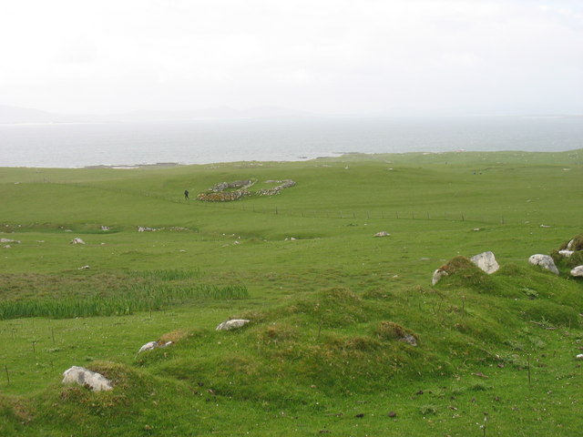
Rubha Thaltois is a prominent coastal feature located in Inverness-shire, Scotland. It is a headland jutting out into the North Atlantic Ocean, forming a distinct point along the rugged coastline. The name "Rubha Thaltois" is of Gaelic origin, meaning "headland of the holm" or "promontory of the marsh."

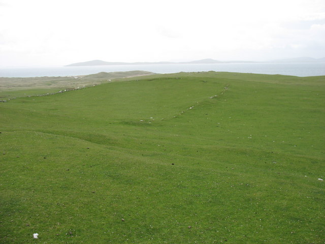
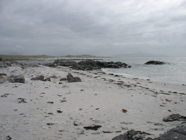
Situated approximately 20 miles north of Inverness, Rubha Thaltois offers breathtaking views of the surrounding landscape. The headland is characterized by steep cliffs, standing tall against the crashing waves below. The dramatic and wild beauty of this coastal feature makes it a popular destination for nature enthusiasts and photographers alike.

The flora and fauna found at Rubha Thaltois are diverse and unique. The headland is home to a variety of seabirds, including puffins, gannets, and guillemots, which nest on the cliffs during the breeding season. The surrounding waters are also inhabited by seals and dolphins, adding to the area's natural charm.

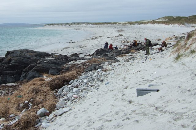
Visitors to Rubha Thaltois can enjoy a range of outdoor activities, such as hiking along the coastal paths, birdwatching, and even sea kayaking. The headland is also a fantastic spot for fishing, with opportunities to catch a variety of species, including mackerel and cod.

Overall, Rubha Thaltois is a stunning coastal feature that showcases the rugged beauty of the Scottish coastline. With its breathtaking views, diverse wildlife, and outdoor activities, it is a must-visit destination for those seeking a true Scottish coastal experience.

If you have any feedback on the listing, please let us know in the comments section below.

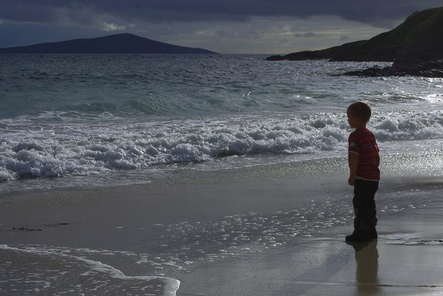
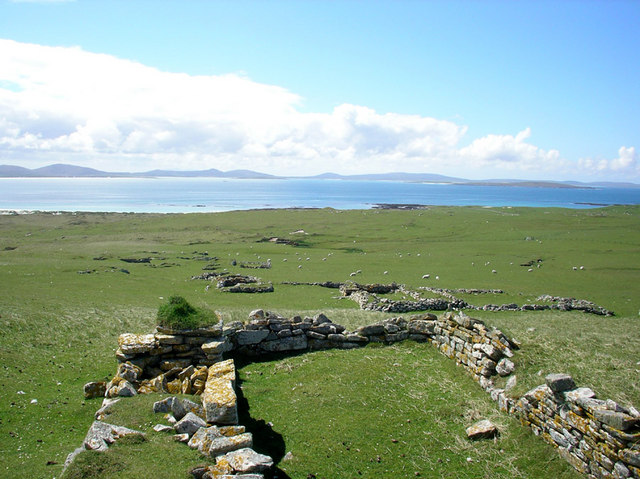
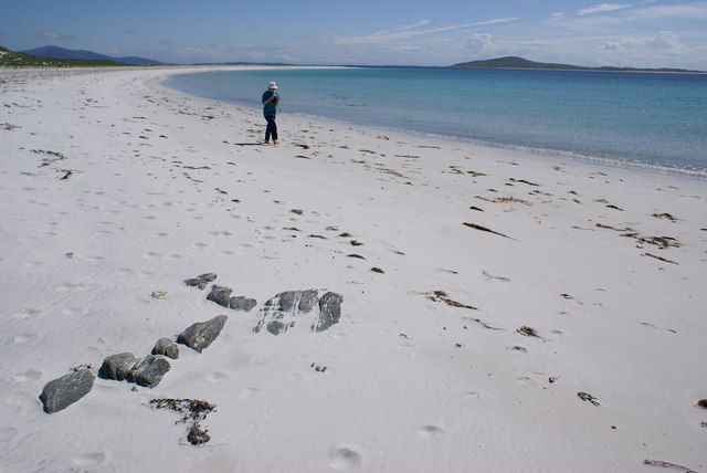
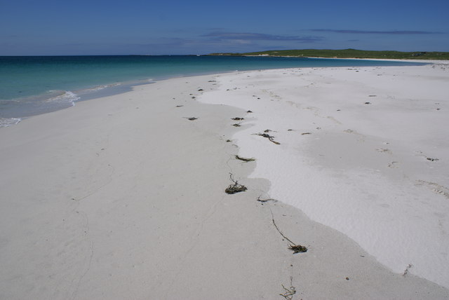
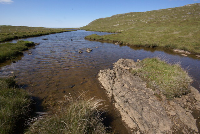
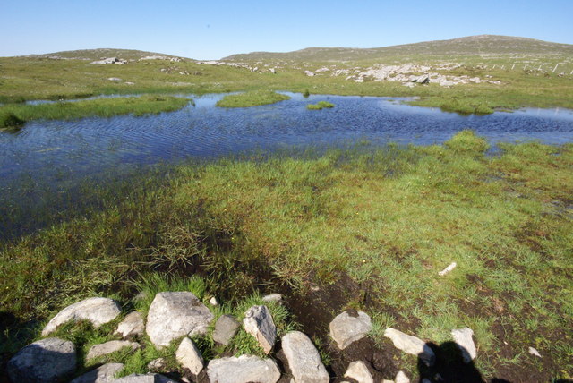
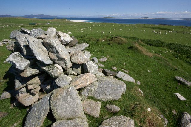
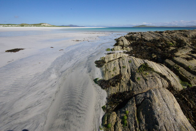
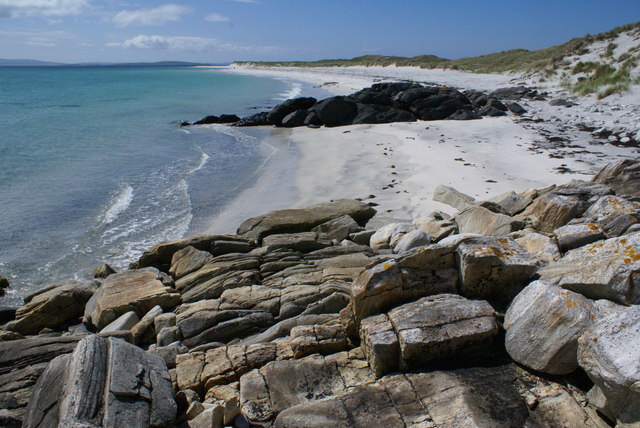
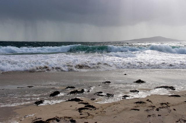
Rubha Thaltois Images

Images are sourced within 2km of 57.758566/-7.235712 or Grid Reference NF8886. Thanks to Geograph Open Source API. All images are credited.

Young King Canute Young boy looking towards Pabbay from Northton beach.
Young King Canute
Young boy looking towards Pabbay from Northton beach.
Baile Lingay The ruins of Baile Lingay on the isle of Pabbay. The village was cleared of its people in 1843.
Baile Lingay
The ruins of Baile Lingay on the isle of Pabbay. The village was cleared of its people in 1843.
Pabbay Beach Scene Beinn Shleibhe on Berneray is seen on the right skyline
Pabbay Beach Scene
Beinn Shleibhe on Berneray is seen on the right skyline
An Corran, Pabbay Pabbay's southern beaches are stunning
An Corran, Pabbay
Pabbay's southern beaches are stunning
Loch Heddal More Pabbay's largest freshwater loch
Loch Heddal More
Pabbay's largest freshwater loch
Pabbay - unnamed lochan The small hill of Meahall shows top right.
Pabbay - unnamed lochan
The small hill of Meahall shows top right.
Baile Na Ceal, Pabbay This area was the main of four small townships on Pabbay in the 17th Century.  Today visiting shepherds stay in the house above the cairn.
Baile Na Ceal, Pabbay
This area was the main of four small townships on Pabbay in the 17th Century. Today visiting shepherds stay in the house above the cairn.
Rubha Thaltois, Pabbay Haltosh Point borders the stunning beaches on Pabbay
Rubha Thaltois, Pabbay
Haltosh Point borders the stunning beaches on Pabbay
A former settlement on Pabbay Pabbay is a now uninhabited island at the west end of the Sound of Harris.
A former settlement on Pabbay
Pabbay is a now uninhabited island at the west end of the Sound of Harris.
Pabbay - an old field boundary The southern slopes of Pabbay show much evidence of habitation and agriculture in days gone by.
The island in the distance (on the left) is Berneray.
Pabbay - an old field boundary
The southern slopes of Pabbay show much evidence of habitation and agriculture in days gone by. The island in the distance (on the left) is Berneray.
Pabbay shore Near this spot is the best place to land on Pabbay. Though even that is not easy in anything other than calm conditions!
Pabbay shore
Near this spot is the best place to land on Pabbay. Though even that is not easy in anything other than calm conditions!
Island of Pabbay, Sound of Harris Waited here for ages for the boat while two of the party failed to find the right part of the beach. So I took a photo.
Island of Pabbay, Sound of Harris
Waited here for ages for the boat while two of the party failed to find the right part of the beach. So I took a photo.
Seana Chaisteal on Pabbay This mound is all that’s left of Seana Chaisteal (the old castle). It was here that Macleod of Lewis hid out “when he was fearit”.
Seana Chaisteal on Pabbay
This mound is all that’s left of Seana Chaisteal (the old castle). It was here that Macleod of Lewis hid out “when he was fearit”.
Rubh' an t-Seana-chaisteil Looking along Traigh an t-Seana-chaisteil
Rubh' an t-Seana-chaisteil
Looking along Traigh an t-Seana-chaisteil
Wild Atlantic, shower and surf The island of Pabaigh lies on the horizon.
Wild Atlantic, shower and surf
The island of Pabaigh lies on the horizon.
Show me another place!

Rubha Thaltois is located at Grid Ref: NF8886 (Lat: 57.758566, Lng: -7.235712)

Unitary Authority: Na h-Eileanan an Iar

Police Authority: Highlands and Islands

What 3 Words

///football.inflation.signed. Near Leverburgh, Na h-Eileanan Siar

Related Wikis

Pabbay, Harris

Pabbay (Scottish Gaelic: Pabaigh) is an uninhabited island in the Outer Hebrides of Scotland which lies in the Sound of Harris between Harris and North...

Shillay

Shillay (Scottish Gaelic: Siolaigh) is an uninhabited island which lies 2 km north of Pabbay in the Outer Hebrides of Scotland. The name is derived from...

Berneray (North Uist)

Berneray (Scottish Gaelic: Beàrnaraigh na Hearadh) is an island and community in the Sound of Harris, Scotland. It is one of fifteen inhabited islands...

Boreray, North Uist

Boreray (Scottish Gaelic: Boraraigh) is an island with a single croft, lying 2 kilometres (1.2 mi) north of North Uist in the Outer Hebrides of Scotland...

Nearby Amenities

Located within 500m of 57.758566,-7.235712
Source: PGS
Lat/Long: 57.7590358/-7.2368926
Source: PGS
Lat/Long: 57.7595616/-7.2368724
Source: PGS
Lat/Long: 57.7597032/-7.237833
Source: PGS
Lat/Long: 57.7597133/-7.2387936
Source: PGS
Lat/Long: 57.7594706/-7.2402598
Source: PGS
Lat/Long: 57.7594908/-7.2412306
Source: PGS
Lat/Long: 57.7597537/-7.2417058
Source: PGS
Lat/Long: 57.7597639/-7.2426665
Source: PGS
Lat/Long: 57.7596526/-7.2436473
Source: PGS
Lat/Long: 57.7602042/-7.2305937
Source: PGS
Lat/Long: 57.7600002/-7.231769
Source: PGS
Lat/Long: 57.7602732/-7.2327195
Source: PGS
Lat/Long: 57.7602833/-7.2332049
Source: PGS
Lat/Long: 57.7600249/-7.2340617
Source: PGS
Lat/Long: 57.759625/-7.2346106
Source: PGS
Lat/Long: 57.7591555/-7.2347101
Source: PGS
Lat/Long: 57.7589864/-7.235594
Source: PGS
Lat/Long: 57.7591571/-7.2364072
The data included in this document is from www.openstreetmap.org. The data is made available under ODbL.

Have you been to Rubha Thaltois?

Leave your review of Rubha Thaltois below (or comments, questions and feedback).