Carnew Rock

Coastal Feature, Headland, Point in Cornwall

England

Carnew Rock

Field with prehistoric cairn and field system To the east of Barnaby Lane, which runs just over the wall on the right.

Scheduled Monument List Entry Number:1015002  <span class="nowrap"><a title="https://historicengland.org.uk/listing/the-list/list-entry/1015002?section=official-list-entry" rel="nofollow ugc noopener" href="https://historicengland.org.uk/listing/the-list/list-entry/1015002?section=official-list-entry">Link</a><img style="margin-left:2px;" alt="External link" title="External link - shift click to open in new window" src="https://s1.geograph.org.uk/img/external.png" width="10" height="10"/></span>
Field with prehistoric cairn and field system Credit: David Lally

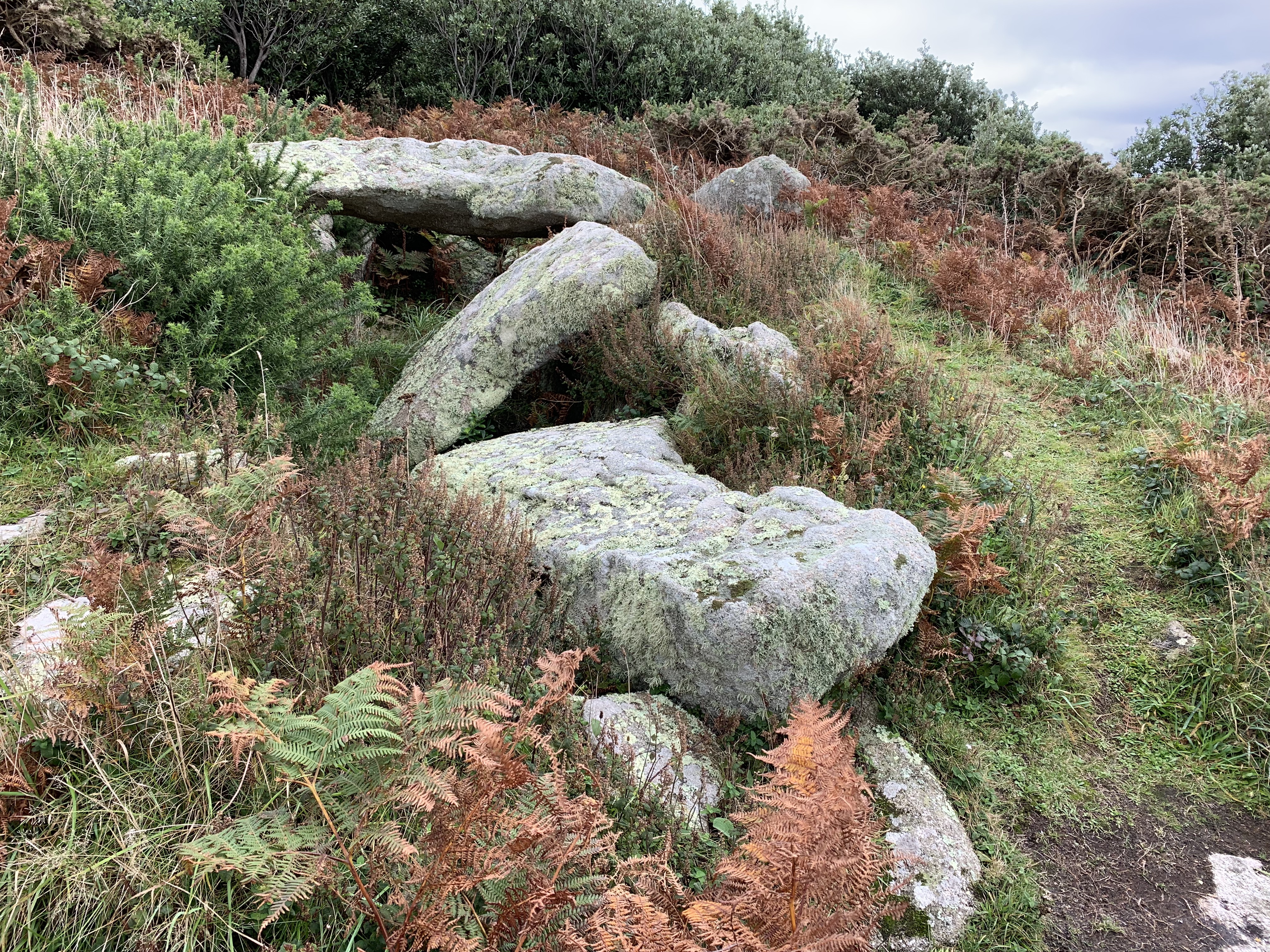
Carnew Rock is a prominent coastal feature located in Cornwall, England. Situated on the north coast of the county, it is classified as a headland or a point, jutting out into the Atlantic Ocean. The rock is positioned between the popular towns of Newquay and Perranporth, making it easily accessible for visitors.

Rising approximately 80 meters above sea level, Carnew Rock offers breathtaking panoramic views of the surrounding coastline and the vast ocean beyond. Its rugged cliffs are a striking feature, formed from ancient slate and granite rocks. These cliffs provide a nesting site for various seabirds, including gulls, cormorants, and fulmars. The rock's exposed position also makes it a popular spot for birdwatchers, who can observe the diverse marine birdlife.

Carnew Rock is a haven for outdoor enthusiasts, offering an array of activities. The surrounding area boasts several walking trails, allowing visitors to explore the dramatic cliffs and take in the stunning scenery. The rock is also a renowned destination for rock climbers, who are drawn to its challenging vertical faces and exhilarating climbs.

In addition to its natural beauty, Carnew Rock has historical significance. It is believed to have been a lookout point during World War II, with remnants of structures still visible. These remnants serve as a reminder of the area's role in defending the coastline against potential invasions.

Overall, Carnew Rock is a captivating coastal feature that combines natural beauty, outdoor activities, and historical significance. Its commanding presence, breathtaking views, and diverse wildlife make it a must-visit destination for nature lovers and adventure seekers alike.

If you have any feedback on the listing, please let us know in the comments section below.

Carnew Rock Images

Images are sourced within 2km of 49.889887/-6.3548412 or Grid Reference SV8707. Thanks to Geograph Open Source API. All images are credited.

Field with prehistoric cairn and field system To the east of Barnaby Lane, which runs just over the wall on the right.

Scheduled Monument List Entry Number:1015002  <span class="nowrap"><a title="https://historicengland.org.uk/listing/the-list/list-entry/1015002?section=official-list-entry" rel="nofollow ugc noopener" href="https://historicengland.org.uk/listing/the-list/list-entry/1015002?section=official-list-entry">Link</a><img style="margin-left:2px;" alt="External link" title="External link - shift click to open in new window" src="https://s1.geograph.org.uk/img/external.png" width="10" height="10"/></span>
Field with prehistoric cairn and field system
To the east of Barnaby Lane, which runs just over the wall on the right. Scheduled Monument List Entry Number:1015002 LinkExternal link
Table laid-out for the St Agnes Coronation Street Party The “street” in this case is Old Lane.  No traffic order is required to close the road here! The Island Hall on the left had tables groaning under the weight of many cakes and other treats.
Table laid-out for the St Agnes Coronation Street Party
The “street” in this case is Old Lane. No traffic order is required to close the road here! The Island Hall on the left had tables groaning under the weight of many cakes and other treats.
Remains of a 19th century gig-shed On the north east edge of Per Askin. 

Of all the islands St Agnes as it is the most south westerly was in the best-placed to spot incoming vessels and launch a pilot-gig . Per Askin at the south west of the island would further increase the chance of getting a pilot aboard first. St Agnes pilots (typically named Hicks)  would then guide the ships as far as Bristol or the south coast ports. A major source of income for the Island throughout the 19th century.

A Scheduled Monument List Entry Number:1009280 <span class="nowrap"><a title="https://historicengland.org.uk/listing/the-list/list-entry/1009280?section=official-list-entry" rel="nofollow ugc noopener" href="https://historicengland.org.uk/listing/the-list/list-entry/1009280?section=official-list-entry">Link</a><img style="margin-left:2px;" alt="External link" title="External link - shift click to open in new window" src="https://s1.geograph.org.uk/img/external.png" width="10" height="10"/></span>
Remains of a 19th century gig-shed
On the north east edge of Per Askin. Of all the islands St Agnes as it is the most south westerly was in the best-placed to spot incoming vessels and launch a pilot-gig . Per Askin at the south west of the island would further increase the chance of getting a pilot aboard first. St Agnes pilots (typically named Hicks) would then guide the ships as far as Bristol or the south coast ports. A major source of income for the Island throughout the 19th century. A Scheduled Monument List Entry Number:1009280 LinkExternal link
A stile to Browarth A tad more conventional than 15 years ago <a href="https://www.geograph.org.uk/photo/827432">SV8708 : Crate Based Stile</a>.
A stile to Browarth
A tad more conventional than 15 years ago SV8708 : Crate Based Stile.
Two post-medieval quays These quays are believed to have been built to land coal for the St Agnes lighthouse.

For more details see the details on their Historic England listing:
List Entry Number:1016512. <span class="nowrap"><a title="https://historicengland.org.uk/listing/the-list/list-entry/1016512?section=official-list-entry" rel="nofollow ugc noopener" href="https://historicengland.org.uk/listing/the-list/list-entry/1016512?section=official-list-entry">Link</a><img style="margin-left:2px;" alt="External link" title="External link - shift click to open in new window" src="https://s1.geograph.org.uk/img/external.png" width="10" height="10"/></span>

The named quay “Uncle Tom’s Quay” is the more eroded of the two but can still be discerned to the right of the picture surmounted by a herring gull.
Two post-medieval quays
These quays are believed to have been built to land coal for the St Agnes lighthouse. For more details see the details on their Historic England listing: List Entry Number:1016512. LinkExternal link The named quay “Uncle Tom’s Quay” is the more eroded of the two but can still be discerned to the right of the picture surmounted by a herring gull.
A fork in the path Compare with <a href="https://www.geograph.org.uk/photo/821812">SV8908 : A Fork in the Path</a> taken by me one day short of fifteen years ago.
A fork in the path
Compare with SV8908 : A Fork in the Path taken by me one day short of fifteen years ago.
The Bar from Gugh A picture postcard scene, but a must to take on a walk around Hoe point today
The Bar from Gugh
A picture postcard scene, but a must to take on a walk around Hoe point today
Sunrise over Gugh
Sunrise over Gugh
Sunrise over Penninis Glad I decided to walk this way this morning.
Sunrise over Penninis
Glad I decided to walk this way this morning.
Crooked Rock One of the named granite outcrops on Wingletang.
Crooked Rock
One of the named granite outcrops on Wingletang.
Refloating Elvera This small launch is probably about 90 years old now.

It's spent the winter in a nearby field undergoing "months of work" according to its owner (on the right of the picture standing on the slipway.)

I expressed surprise that they had towed it down at such a low tide "You are going to let the tide float her?" "Yes, she's full of leaks".
Refloating Elvera
This small launch is probably about 90 years old now. It's spent the winter in a nearby field undergoing "months of work" according to its owner (on the right of the picture standing on the slipway.) I expressed surprise that they had towed it down at such a low tide "You are going to let the tide float her?" "Yes, she's full of leaks".
The St Agnes Lighthouse and attached house From Old lane.

The lighthouse is both a Grade II* listed building List Entry Number:1328835 <span class="nowrap"><a title="https://historicengland.org.uk/listing/the-list/list-entry/1328835" rel="nofollow ugc noopener" href="https://historicengland.org.uk/listing/the-list/list-entry/1328835">Link</a><img style="margin-left:2px;" alt="External link" title="External link - shift click to open in new window" src="https://s1.geograph.org.uk/img/external.png" width="10" height="10"/></span>

and a Scheduled Monument List Entry Number:1014999 <span class="nowrap"><a title="https://historicengland.org.uk/listing/the-list/list-entry/1014999?section=official-list-entry" rel="nofollow ugc noopener" href="https://historicengland.org.uk/listing/the-list/list-entry/1014999?section=official-list-entry">Link</a><img style="margin-left:2px;" alt="External link" title="External link - shift click to open in new window" src="https://s1.geograph.org.uk/img/external.png" width="10" height="10"/></span>

The house is Grade II List Entry Number:1218288 <span class="nowrap"><a title="https://historicengland.org.uk/listing/the-list/list-entry/1218288" rel="nofollow ugc noopener" href="https://historicengland.org.uk/listing/the-list/list-entry/1218288">Link</a><img style="margin-left:2px;" alt="External link" title="External link - shift click to open in new window" src="https://s1.geograph.org.uk/img/external.png" width="10" height="10"/></span>
The St Agnes Lighthouse and attached house
From Old lane. The lighthouse is both a Grade II* listed building List Entry Number:1328835 LinkExternal link and a Scheduled Monument List Entry Number:1014999 LinkExternal link The house is Grade II List Entry Number:1218288 LinkExternal link
Aboard The Sapphire It was great to have this fine Association (<span class="nowrap"><a title="https://www.scillyboating.co.uk" rel="nofollow ugc noopener" href="https://www.scillyboating.co.uk">Link</a><img style="margin-left:2px;" alt="External link" title="External link - shift click to open in new window" src="https://s1.geograph.org.uk/img/external.png" width="10" height="10"/></span> ) open boat to ourselves.  It had just dropped off a full load of day-trippers from St Mary's on the St Agnes quay.  We "hitched" a ride back to St Mary's as the Spirit of St Agnes was out of service due to engine trouble.
Aboard The Sapphire
It was great to have this fine Association (LinkExternal link ) open boat to ourselves. It had just dropped off a full load of day-trippers from St Mary's on the St Agnes quay. We "hitched" a ride back to St Mary's as the Spirit of St Agnes was out of service due to engine trouble.
Refloating Elvera Taken a few minutes before <a href="https://www.geograph.org.uk/photo/7486422">SV8708 : Refloating Elvera</a>. This shows a family group bringing an heirloom back into use.

60 years ago this little launch would take my family (weather permitting) to Catholic Mass on St Mary's when holidaying on St Agnes . It would be sailed by the father of the man on driving the tractor and grandfather of the two men at the stern of the boat.
Refloating Elvera
Taken a few minutes before SV8708 : Refloating Elvera. This shows a family group bringing an heirloom back into use. 60 years ago this little launch would take my family (weather permitting) to Catholic Mass on St Mary's when holidaying on St Agnes . It would be sailed by the father of the man on driving the tractor and grandfather of the two men at the stern of the boat.
Refloating Elvera Taken a minute or two after <a href="https://www.geograph.org.uk/photo/7491445">SV8708 : Refloating Elvera</a>. See that for a bit of history.
Refloating Elvera
Taken a minute or two after SV8708 : Refloating Elvera. See that for a bit of history.
Dropnose just before sunrise
Old Lane A small group of isolated cottages between the lighthouse and Periglis do not merit even a Scillonian recognition as a "Town".
Old Lane
A small group of isolated cottages between the lighthouse and Periglis do not merit even a Scillonian recognition as a "Town".
Tresco will be busy today Three cruise ships in The Road today.  No doubt the most popular shore trip will be to Tesco's famous sub-tropical gardens.  As long as they keep away from St Agnes, that will be fine.

The boat heading into Perconger is the St Agnes boating's sea taxi craft "Enterprise".
Tresco will be busy today
Three cruise ships in The Road today. No doubt the most popular shore trip will be to Tesco's famous sub-tropical gardens. As long as they keep away from St Agnes, that will be fine. The boat heading into Perconger is the St Agnes boating's sea taxi craft "Enterprise".
Show me another place!

Carnew Rock is located at Grid Ref: SV8707 (Lat: 49.889887, Lng: -6.3548412)

Division: Isles of Scilly

Unitary Authority: Isles of Scilly

Police Authority: Devon and Cornwall

What 3 Words

///fault.brownish.brain. Near St Agnes, Isles of Scilly

Related Wikis

St Agnes Lifeboat Station, Isles of Scilly

St Agnes' Lifeboat Station was situated in St Agnes, Isles of Scilly and provided a service for the Royal National Lifeboat Institution from 1891 to 1920...

Burnt Island, Isles of Scilly

Burnt Island is a small, uninhabited island in the Isles of Scilly, Cornwall, United Kingdom. It is covered in thrift and long grasses. and is linked to...

Bible Christian Chapel, St Agnes, Isles of Scilly

The Bible Christian Chapel, St Agnes was a Bible Christian chapel in St Agnes, Isles of Scilly. == History == Bible Christians arrived in St Agnes in the...

Middle Town, St Agnes

Middle Town (Cornish: Tregres) is a small settlement on the island of St Agnes. It includes the island's primary school, post office and general store...

St Agnes, Isles of Scilly

St Agnes (Cornish: Agenys) is the southernmost populated island of the Isles of Scilly. Thus the island's Troy Town Farm is the southernmost settlement...

Wingletang Down (St Agnes)

Wingletang Down is a Site of Special Scientific Interest (SSSI) on the southern side of the island of St Agnes in the Isles of Scilly, England, UK, which...

Annet, Isles of Scilly

Annet (Cornish: Anet, lit. 'kittiwake') is the second largest of the fifty or so uninhabited Isles of Scilly, 1 kilometre (0.62 mi) west of St Agnes with...

Obadiah's Barrow

Obadiah's Barrow or Obadiah's Grave is a Neolithic entrance grave located on the island of Gugh in the Isles of Scilly. The grave sits on a steep slope...

Nearby Amenities

Located within 500m of 49.889887,-6.3548412
Source: PGS
Lat/Long: 49.887766/-6.3494232
Source: PGS
Lat/Long: 49.8931161/-6.3512786
Troy Town
Place: locality
Lat/Long: 49.8909518/-6.3509384
Fast Food
Troytown Farm Ice Cream
Addr Country: GB
Addr Hamlet: St Agnes
Addr Housename: Troytown Farm
Addr Postcode: TR22 0PL
Addr State: Isles Of Scilly
Addr Suburb: Troy Town
Cuisine: ice_cream
Fhrs Id: 770051
Lat/Long: 49.8909912/-6.3511408
Generator Method: photovoltaic
Generator Output Electricity: yes
Generator Source: solar
Generator Type: solar_photovoltaic_panel
Location: roof
Power: generator
Lat/Long: 49.8909337/-6.3503521
Generator Method: photovoltaic
Generator Output Electricity: yes
Generator Source: solar
Generator Type: solar_photovoltaic_panel
Location: roof
Power: generator
Lat/Long: 49.8908091/-6.3507817
Generator Method: photovoltaic
Generator Output Electricity: yes
Generator Source: solar
Generator Type: solar_photovoltaic_panel
Location: roof
Power: generator
Lat/Long: 49.8913997/-6.3515487
Troytown Maze
Historic: archaeological_site
Lat/Long: 49.8891714/-6.3523668
The Nag's Head
Natural: rock
Lat/Long: 49.8899472/-6.3482662
Generator Method: photovoltaic
Generator Output Electricity: yes
Generator Source: solar
Generator Type: solar_photovoltaic_panel
Location: roof
Power: generator
Lat/Long: 49.8909797/-6.3513956
Bergecooth
Natural: bay
Lat/Long: 49.8926837/-6.3519142
The data included in this document is from www.openstreetmap.org. The data is made available under ODbL.

Have you been to Carnew Rock?

Leave your review of Carnew Rock below (or comments, questions and feedback).