Aird a' Mhaide

Coastal Feature, Headland, Point in Inverness-shire

Scotland

Aird a' Mhaide

End of the road at Àird Mhòr
End of the road at Àird Mhòr Credit: Hugh Venables

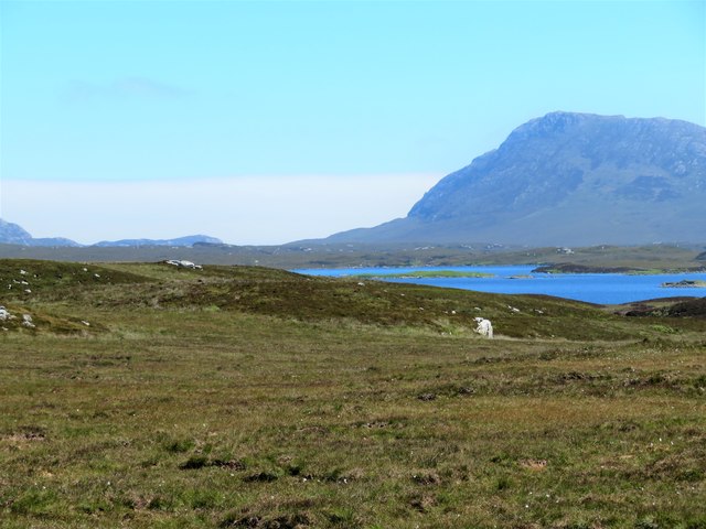
Aird a' Mhaide is a prominent coastal feature located in Inverness-shire, Scotland. Situated on the western coast of the Scottish Highlands, it is known for its stunning natural beauty and rugged landscape. Aird a' Mhaide is classified as a headland or point, jutting out into the North Atlantic Ocean.

The headland is characterized by its steep cliffs, which provide breathtaking views of the surrounding area. From the top, visitors can witness the powerful waves crashing against the rocks below, creating a dramatic and awe-inspiring sight. The headland is also home to a diverse range of marine and bird species, making it a popular spot for nature enthusiasts and birdwatchers.

The name "Aird a' Mhaide" translates to "Point of the Timber" in English. This name is believed to have originated from the historical practice of timber floating in the nearby River Beauly, where logs were transported to be used in the construction of ships. The headland's strategic location has also played a role in its historical significance, with evidence of ancient settlements and fortifications dating back to prehistoric times.

Today, Aird a' Mhaide continues to attract visitors from all over the world who come to admire its natural beauty and explore the surrounding area. The headland offers various walking trails, allowing visitors to experience the stunning coastal scenery up close. Additionally, the nearby town of Inverness provides ample accommodation options and amenities for those wishing to stay and explore the area further.

If you have any feedback on the listing, please let us know in the comments section below.

Aird a' Mhaide Images

Images are sourced within 2km of 57.51313/-7.2720426 or Grid Reference NF8459. Thanks to Geograph Open Source API. All images are credited.
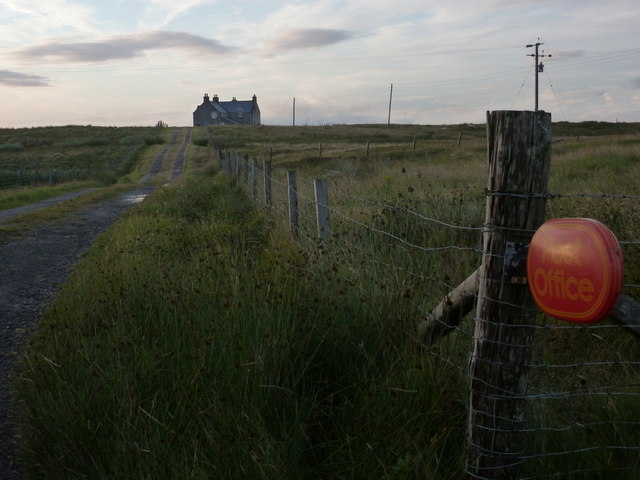
End of the road at Àird Mhòr
Ocean on the west side of the causeway to North Uist
NCN780 on Grimsay Looking east, Loch an Fhaing on the left and Eaval, North Uist, in the distance.
NCN780 on Grimsay
Looking east, Loch an Fhaing on the left and Eaval, North Uist, in the distance.
Signpost on Grimsay The house beyond the end of Loch an Fhaing is marked as a Post Office on the map, but the may not be up to date information.
Signpost on Grimsay
The house beyond the end of Loch an Fhaing is marked as a Post Office on the map, but the may not be up to date information.
Bus stop and post box on Grimsay At the road-end of a loop that leaves the main road [A865].
Bus stop and post box on Grimsay
At the road-end of a loop that leaves the main road [A865].
House on Grimsay Looking across Bog Cotton from the A865.
House on Grimsay
Looking across Bog Cotton from the A865.
Gairbh-eilean
Gairbh-eilean
Barp Hacklett Cairn One cannot be absolutely sure if this is the cairn as the OS map doesn't give a detailed site, but as it is the only pile of stones on a green protuberance on an otherwise rather squelchy moor, then one would suggest that this is it.
Barp Hacklett Cairn
One cannot be absolutely sure if this is the cairn as the OS map doesn't give a detailed site, but as it is the only pile of stones on a green protuberance on an otherwise rather squelchy moor, then one would suggest that this is it.
Moorcroft Campsite at low tide
Eilean an t-Seagail Seating located at a parking spot just off the A865 near Baile Glas on Benbecula.
Eilean an t-Seagail
Seating located at a parking spot just off the A865 near Baile Glas on Benbecula.
East from Creag nan Speireag Some 200m from the Hebridean Way path which probably cuts the corner of this square and provides some very 'soft' walking over damp moors. This diversion to a low rise gives a view eastwards towards the oddly shaped Loch Carabhat and distant Eabhal.
East from Creag nan Speireag
Some 200m from the Hebridean Way path which probably cuts the corner of this square and provides some very 'soft' walking over damp moors. This diversion to a low rise gives a view eastwards towards the oddly shaped Loch Carabhat and distant Eabhal.
View towards Loch nan Garbh Chlachan Peat and heather moorland stretch away towards the shores of Loch nan Garbh Chlachan where a line of stepping stones are visible, beyond which in an adjoining square is Dun Ban on an islet. Magnifying the image brings up what looks like some remains of walls at the dun. In the distance is the familiar outline of Eabhal.
View towards Loch nan Garbh Chlachan
Peat and heather moorland stretch away towards the shores of Loch nan Garbh Chlachan where a line of stepping stones are visible, beyond which in an adjoining square is Dun Ban on an islet. Magnifying the image brings up what looks like some remains of walls at the dun. In the distance is the familiar outline of Eabhal.
Caravat Barp chambered cairn and shieling Large Neolithic long cairn and later historic shieling or shelter (Scale 1m). <span class="nowrap"><a title="https://canmore.org.uk/site/10254/north-uist-carinish-caravat-barp" rel="nofollow ugc noopener" href="https://canmore.org.uk/site/10254/north-uist-carinish-caravat-barp">Link</a><img style="margin-left:2px;" alt="External link" title="External link - shift click to open in new window" src="https://s1.geograph.org.uk/img/external.png" width="10" height="10"/></span>
Caravat Barp chambered cairn and shieling
Large Neolithic long cairn and later historic shieling or shelter (Scale 1m). LinkExternal link
Carinish stone circle Sadly the road cuts through this stone circle. <span class="nowrap"><a title="https://canmore.org.uk/site/10249/north-uist-carinish" rel="nofollow ugc noopener" href="https://canmore.org.uk/site/10249/north-uist-carinish">Link</a><img style="margin-left:2px;" alt="External link" title="External link - shift click to open in new window" src="https://s1.geograph.org.uk/img/external.png" width="10" height="10"/></span>
Carinish stone circle
Sadly the road cuts through this stone circle. LinkExternal link
Thatch at Cladach Chairinis
Baile Glas, Grimsay Hamlet on the causewayed road between Benbecula and North Uist.
<span class="nowrap"><a title="http://www.isle-of-benbecula.co.uk/" rel="nofollow ugc noopener" href="http://www.isle-of-benbecula.co.uk/">Link</a><img style="margin-left:2px;" alt="External link" title="External link - shift click to open in new window" src="https://s1.geograph.org.uk/img/external.png" width="10" height="10"/></span>
Baile Glas, Grimsay
Hamlet on the causewayed road between Benbecula and North Uist. LinkExternal link
Sand Flats at Grimsay Tidal flats between Grimsay (foreground) and North Uist (background). Eaval / Eabhal is the distinctive mountain.
Sand Flats at Grimsay
Tidal flats between Grimsay (foreground) and North Uist (background). Eaval / Eabhal is the distinctive mountain.
Grimsay: the post office The island has had a post office since 2 May 1880 and its current location is in a room of the subpostmistress's house, visible here at the end of her long track driveway. The familiar oval sign stands at the end of the drive.

The post office is open for business from 9am, until 12 noon on Mondays and Tuesdays and for an hour longer on Wednesdays.
Grimsay: the post office
The island has had a post office since 2 May 1880 and its current location is in a room of the subpostmistress's house, visible here at the end of her long track driveway. The familiar oval sign stands at the end of the drive. The post office is open for business from 9am, until 12 noon on Mondays and Tuesdays and for an hour longer on Wednesdays.
Show me another place!

Aird a' Mhaide is located at Grid Ref: NF8459 (Lat: 57.51313, Lng: -7.2720426)

Unitary Authority: Na h-Eileanan an Iar

Police Authority: Highlands and Islands

What 3 Words

///tunnel.analogy.masterful. Near Balivanich, Na h-Eileanan Siar

Related Wikis

Baile Glas

Baile Glas or Ballaglasa (Scottish Gaelic: Am Baile Glas) is a settlement on Grimsay in the Outer Hebrides, Scotland. Ballaglasa is within the parish of...

Fraoch-Eilean

Fraoch-eilean is a small island with an uncertain population north of Benbecula in the Outer Hebrides of Scotland. It is about 55 hectares (140 acres...

Carinish

Carinish (Scottish Gaelic: Càirinis), is a hamlet on North Uist, in the Outer Hebrides, Scotland. It is in the south of the island, about two miles (three...

Bail' Iochdrach

Bail' Iochdrach or Baliochrach (Scottish Gaelic: Am Baile Ìochdrach) is a village on Benbecula in the Outer Hebrides, Scotland. Baliochrach is within the...

Nearby Amenities

Located within 500m of 57.51313,-7.2720426
Passing Place
Lat/Long: 57.5161463/-7.2662416
Power: pole
Lat/Long: 57.5160087/-7.2769672
Power: pole
Lat/Long: 57.5154642/-7.2758862
Power: pole
Lat/Long: 57.5148865/-7.2746712
Power: pole
Lat/Long: 57.5144414/-7.2737619
Power: pole
Lat/Long: 57.513989/-7.2728929
Power: pole
Lat/Long: 57.5140899/-7.2712219
Power: pole
Lat/Long: 57.5142541/-7.2689876
Power: pole
Lat/Long: 57.5143477/-7.2675446
Power: pole
Lat/Long: 57.5144486/-7.2661498
Power: pole
Lat/Long: 57.5154195/-7.2651091
Power: pole
Lat/Long: 57.5150464/-7.2752184
Power: pole
Lat/Long: 57.5155722/-7.2765005
Power: pole
Lat/Long: 57.5160836/-7.2775143
Power: pole
Lat/Long: 57.5138237/-7.2740064
Power: pole
Lat/Long: 57.5144351/-7.2748903
Power: pole
Lat/Long: 57.5162109/-7.2660484
Power: pole
Lat/Long: 57.5150977/-7.2659947
Power: pole
Lat/Long: 57.5145192/-7.2650337
Power: pole
Lat/Long: 57.5148269/-7.2673734
Barrier: cattle_grid
Lat/Long: 57.5134554/-7.2638837
Passing Place
Lat/Long: 57.5134327/-7.2646471
The data included in this document is from www.openstreetmap.org. The data is made available under ODbL.

Have you been to Aird a' Mhaide?

Leave your review of Aird a' Mhaide below (or comments, questions and feedback).