Rubha Mòr

Coastal Feature, Headland, Point in Inverness-shire

Scotland

Rubha Mòr

The rocks of Rubha Arnal A walk to the promontory where rocks take the place of sand.
The rocks of Rubha Arnal Credit: Julian Paren

Rubha Mòr is a stunning coastal feature located in Inverness-shire, Scotland. It is a prominent headland that juts out into the North Atlantic Ocean, offering breathtaking panoramic views of the surrounding landscape. The name "Rubha Mòr" translates to "big point" in Gaelic, which accurately describes its prominent position.

This rocky headland is characterized by its rugged cliffs and jagged edges, which have been shaped by the relentless force of the ocean waves over centuries. The cliffs stand tall, reaching heights of up to 100 meters, providing an awe-inspiring backdrop against the ever-changing sea. At the tip of Rubha Mòr, a small, grassy plateau offers a vantage point for visitors to take in the dramatic scenery and observe the diverse wildlife that inhabits the area.

The headland is home to a wide variety of flora and fauna, including seabirds, nesting puffins, and seals that can often be spotted basking on the rocks. The surrounding waters are also rich in marine life, with dolphins and whales occasionally making appearances.

Access to Rubha Mòr is relatively easy, with a well-maintained footpath leading visitors along the coastline. The headland is a popular spot for hikers and nature enthusiasts, offering a peaceful retreat away from the bustling cities.

Overall, Rubha Mòr is a magnificent coastal feature that showcases the raw beauty of the Scottish coast. Its dramatic cliffs, diverse wildlife, and stunning views make it a must-visit destination for anyone seeking a true taste of Scotland's natural wonders.

If you have any feedback on the listing, please let us know in the comments section below.

Rubha Mòr Images

Images are sourced within 2km of 57.568753/-7.4819538 or Grid Reference NF7266. Thanks to Geograph Open Source API. All images are credited.
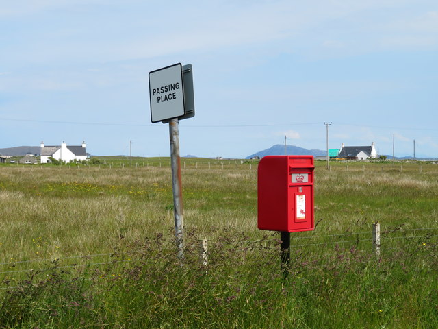
The rocks of Rubha Arnal A walk to the promontory where rocks take the place of sand.
The rocks of Rubha Arnal
A walk to the promontory where rocks take the place of sand.
North-east from Rubha Arnal A sweep of sand and backed by dunes - very characteristic of much of the Atlantic coast of the Uists.
North-east from Rubha Arnal
A sweep of sand and backed by dunes - very characteristic of much of the Atlantic coast of the Uists.
Evening at Lagan Arnal The Atlantic rollers run into the beach.
Evening at Lagan Arnal
The Atlantic rollers run into the beach.
Track to Balemore from Lagan Arnal A track that leads to the sea.
Track to Balemore from Lagan Arnal
A track that leads to the sea.
Paiblesgearraidh post box Since Chris Downer was here, the post box appears to have been replaced with a shiny new one.
Paiblesgearraidh post box
Since Chris Downer was here, the post box appears to have been replaced with a shiny new one.
Paibeil phone box Still standing against the Hebridean gales, but at a slightly drunken angle. [leaning into the prevailing wind]
Paibeil phone box
Still standing against the Hebridean gales, but at a slightly drunken angle. [leaning into the prevailing wind]
The long beach at Lagan Arnal Turn a corner at Rubh' Arnal and there is yet another fine stretch of shell sand beach.
The long beach at Lagan Arnal
Turn a corner at Rubh' Arnal and there is yet another fine stretch of shell sand beach.
Shoreline at Ruadh Bhruthach One probably wouldn't fancy a paddle on this side of the headland thanks to weed and rocks, but turn a corner to Lagan Arnal and there is a fine weed free beach.
Shoreline at Ruadh Bhruthach
One probably wouldn't fancy a paddle on this side of the headland thanks to weed and rocks, but turn a corner to Lagan Arnal and there is a fine weed free beach.
Rocky shoreline at Rubh' Arnal There's a large area of jumbled rocks and reefs at this point of land, more than appears on the 1:25000 map. The view is SE towards Ruebhal on Benbecula.
Rocky shoreline at Rubh' Arnal
There's a large area of jumbled rocks and reefs at this point of land, more than appears on the 1:25000 map. The view is SE towards Ruebhal on Benbecula.
Looking south from Rubha Arnal The rocky shoreline at Rubha Arnal with a view towards the big hills of South Uist. I note that the OS use two different spellings for this point, both Rubha and Rubh' apparently being acceptable.
Looking south from Rubha Arnal
The rocky shoreline at Rubha Arnal with a view towards the big hills of South Uist. I note that the OS use two different spellings for this point, both Rubha and Rubh' apparently being acceptable.
Shoreline rocks near the mouth of Loch Phaibeil
Paiblesgarry: postbox № HS6 33 A small postbox serving a straggling community, emptied at 8:30 on weekday mornings and a quarter of an hour later on Saturdays.
Paiblesgarry: postbox № HS6 33
A small postbox serving a straggling community, emptied at 8:30 on weekday mornings and a quarter of an hour later on Saturdays.
Paible: red telephone box A traditional red phone box, looking a little short of tender loving care.
Paible: red telephone box
A traditional red phone box, looking a little short of tender loving care.
Baile Mor, North Uist A view of a derelict building and the very spartan landscape on this beautiful island.
Baile Mor, North Uist
A view of a derelict building and the very spartan landscape on this beautiful island.
Lagan Mageir Perfect beach of white sand.
Lagan Mageir
Perfect beach of white sand.
Track across the machair. Green track heading towards the dunes from Paibeil.
Track across the machair.
Green track heading towards the dunes from Paibeil.
The beach at Rubh' Arnal The smell of rotting seaweed added to the general ambience, not that the dog seemed to mind.
The beach at Rubh' Arnal
The smell of rotting seaweed added to the general ambience, not that the dog seemed to mind.
Dunes to farmland The land south of Baile Mor is the home of a fair few cattle, and fenced off by a series sand dunes.
Dunes to farmland
The land south of Baile Mor is the home of a fair few cattle, and fenced off by a series sand dunes.
Show me another place!

Rubha Mòr is located at Grid Ref: NF7266 (Lat: 57.568753, Lng: -7.4819538)

Unitary Authority: Na h-Eileanan an Iar

Police Authority: Highlands and Islands

What 3 Words

///kitten.messaging.tributes. Near Balivanich, Na h-Eileanan Siar

Related Wikis

Kirkibost

Kirkibost (Scottish Gaelic: Eilean Chirceaboist) is a low-lying island west of North Uist in the Outer Hebrides of Scotland. == Geography == Kirkibost...

Ardheisker

Ardheisker (Scottish Gaelic: Àird Heillsgeir) is a settlement on North Uist, in the Outer Hebrides, Scotland. Ardheisker is within the parish of North...

Balranald Nature Reserve

The Balranald Nature Reserve is an RSPB reserve on the north west coast of North Uist, Outer Hebrides, Scotland. The reserve is open all year round and...

Aird an Rùnair

Aird an Rùnair is the most westerly point of the island of North Uist in the Western Isles of Scotland. The headland is approximately 4 kilometres (2.5...

Nearby Amenities

Located within 500m of 57.568753,-7.4819538
The data included in this document is from www.openstreetmap.org. The data is made available under ODbL.

Have you been to Rubha Mòr?

Leave your review of Rubha Mòr below (or comments, questions and feedback).