Geodha an t Similier

Coastal Feature, Headland, Point in Inverness-shire

Scotland

Geodha an t Similier

Traigh-stir at sunset
Traigh-stir at sunset Credit: Sandy Gerrard

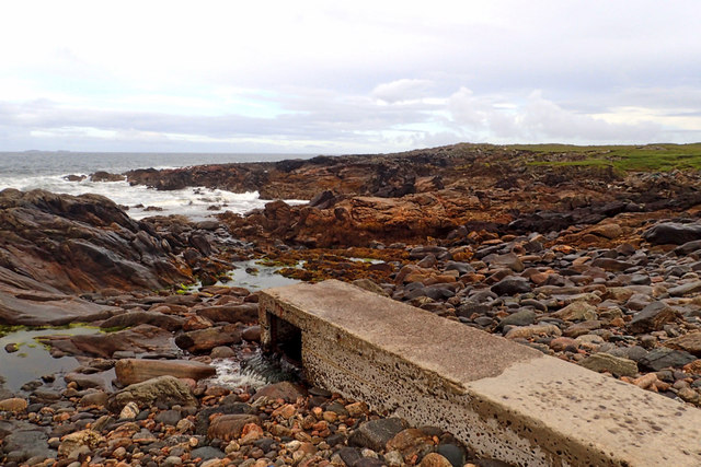
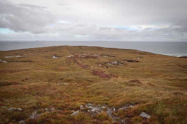
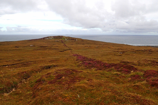
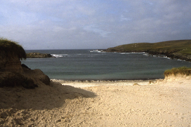
Geodha an t-Similier is a striking coastal feature located in Inverness-shire, Scotland. This unique geologic formation is classified as a headland or point due to its prominent presence jutting out into the surrounding sea. It is situated on the western coast of Inverness-shire, near the village of Plockton.

The name Geodha an t-Similier is derived from the Gaelic language, with "geodha" meaning "cove" or "inlet" and "t-Similier" referring to the specific location. The headland is characterized by its rugged cliffs, which rise dramatically from the sea, providing a picturesque and dramatic view of the surrounding landscape.

Geodha an t-Similier is known for its natural beauty and is a popular destination for tourists and nature enthusiasts. The cliffs offer a habitat for a variety of seabirds, including puffins, guillemots, and fulmars. The area surrounding the headland is also home to a diverse range of marine life, such as seals, dolphins, and occasionally whales.

Visitors to Geodha an t-Similier can explore the area on foot, following a network of coastal paths that provide stunning views of the sea and the surrounding countryside. The headland also offers opportunities for rock climbing and birdwatching.

Overall, Geodha an t-Similier is a captivating coastal feature in Inverness-shire, showcasing the natural beauty of Scotland's western coast. Its rugged cliffs, diverse wildlife, and breathtaking views make it a must-visit destination for those seeking to immerse themselves in the stunning natural landscapes of the region.

If you have any feedback on the listing, please let us know in the comments section below.

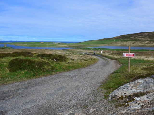
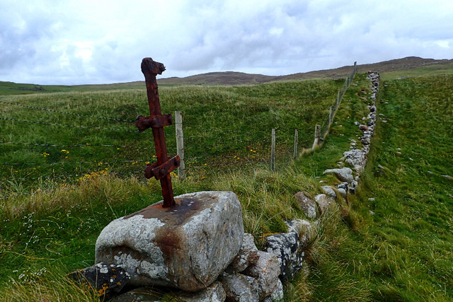
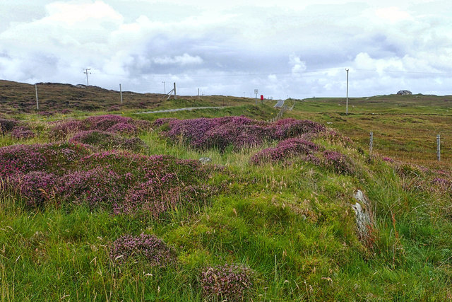
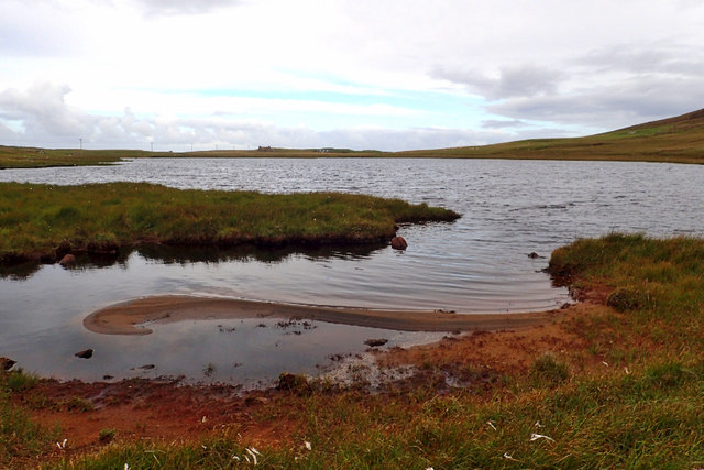
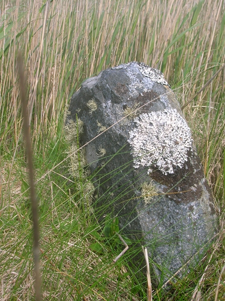
Geodha an t Similier Images

Images are sourced within 2km of 57.642922/-7.4947743 or Grid Reference NF7274. Thanks to Geograph Open Source API. All images are credited.

Traigh-stir at sunset
Track to Loch Scolpaig Loch Scolpaig has an island tower, just visible extreme left.  According to Wikipedia "It was built in about 1830 by Dr Alexander MacLeod, who was the factor of the North Uist estate. It was erected to provide employment for the purpose of famine relief."
Track to Loch Scolpaig
Loch Scolpaig has an island tower, just visible extreme left. According to Wikipedia "It was built in about 1830 by Dr Alexander MacLeod, who was the factor of the North Uist estate. It was erected to provide employment for the purpose of famine relief."
Rocks at Raicinis
Rocks at Raicinis
Ruined enclosure, Bharlais
Wall end, Baile Mhàrtainn
Loch Sgileabhat
Loch Sgileabhat
Outflow from Loch Scolpaig
Remains of boundary, leading to Sloc Rubha
Heather at entrance to Scolpaig
Loch Scolpaig
Loch Scolpaig
Old boundary, Ben Scolpaig
Old Milestone by the A865, Baleloch, above Loch Hosta, North Uist Parish By the A865, in parish of North Uist (North Uist District), near Loch Hosta, opposite field gate, South West of postbox outside white house.

Surveyed

Milestone Society National ID: WI_NUCW08.
Old Milestone by the A865, Baleloch, above Loch Hosta, North Uist Parish
By the A865, in parish of North Uist (North Uist District), near Loch Hosta, opposite field gate, South West of postbox outside white house. Surveyed Milestone Society National ID: WI_NUCW08.
Old Milestone by the A865, Druim nan Dearcag, North Uist parish Granite slab by the A865, in parish of North Uist (North Uist District), Druim nan Dearcag, in reeds on verge, on long straight near fence at right angles to road.

Inscription not recorded.

Surveyed

Milestone Society National ID: WI_NUCW10
Old Milestone by the A865, Druim nan Dearcag, North Uist parish
Granite slab by the A865, in parish of North Uist (North Uist District), Druim nan Dearcag, in reeds on verge, on long straight near fence at right angles to road. Inscription not recorded. Surveyed Milestone Society National ID: WI_NUCW10
Old Milestone by the A865, north of Balmartin, North Uist Granite slab by the A865, in parish of North Uist (North Uist District), North of Balmartin between Cross and house on hillside, on straight near metal gate.

Inscription not recorded.

Surveyed

Milestone Society National ID: WI_NUCW09
Old Milestone by the A865, north of Balmartin, North Uist
Granite slab by the A865, in parish of North Uist (North Uist District), North of Balmartin between Cross and house on hillside, on straight near metal gate. Inscription not recorded. Surveyed Milestone Society National ID: WI_NUCW09
Traigh-stir Another of the fine white sand beaches along the western side of North Uist. A small burn trickles out across the sand from Loch Hosta.
Traigh-stir
Another of the fine white sand beaches along the western side of North Uist. A small burn trickles out across the sand from Loch Hosta.
Patterned rocks, Traigh-stir In an area dominated by gneiss, the dark strips here would appear to be lines of volcanic dykes.
Patterned rocks, Traigh-stir
In an area dominated by gneiss, the dark strips here would appear to be lines of volcanic dykes.
Along the A865 This largely single track 'A' road takes a scenic course around the island from the south west side to the north east. Much of the land to either side in this view comprises machair which is largely windblown sand.
Along the A865
This largely single track 'A' road takes a scenic course around the island from the south west side to the north east. Much of the land to either side in this view comprises machair which is largely windblown sand.
Bagh Sgolpaig
Bagh Sgolpaig
Show me another place!

Geodha an t Similier is located at Grid Ref: NF7274 (Lat: 57.642922, Lng: -7.4947743)

Unitary Authority: Na h-Eileanan an Iar

Police Authority: Highlands and Islands

What 3 Words

///openly.clef.defrost. Near Lochmaddy, Na h-Eileanan Siar

Related Wikis

Scolpaig Tower

Scolpaig Tower (also known as Dùn Scolpaig or MacLeod’s Folly) is a Georgian folly located near the village of Scolpaig on the island of North Uist in...

Scolpaig

Scolpaig (Scottish Gaelic: Sgolpaig) is a district on the north-west coast of the island of North Uist in the Outer Hebrides of Scotland. In 2018 it was...

Eilean Dòmhnuill

Ian Armit identifies the islet of Eilean Dòmhnuill (Scottish Gaelic: Eilean Dòmhnaill, Scottish Gaelic pronunciation: [elan ˈt̪õː.ɪʎ], "The Isle of Donald...

Tigharry

Tigharry (Scottish Gaelic: Taigh a' Ghearraidh) is a small village on the west of North Uist. It is mostly a farming community. There are a few rocky beaches...

Related Videos

Scolpaig tower by drone

A little fly around the Scolpaig tower on the Isle of North Uist. taken with my dji mavic mini drone.

CHLOE MATHARU * TOWARDS THE HEBRIDES * SINGLE RELEASE

Chloe Matharu * Towards the Hebrides * Single Release Original Song Release date 8th September On all streaming platforms ...

Nearby Amenities

Located within 500m of 57.642922,-7.4947743
Source: PGS
Lat/Long: 57.6390441/-7.4984812
Source: PGS
Lat/Long: 57.6390441/-7.4980012
Source: PGS
Lat/Long: 57.6389141/-7.4975312
Source: PGS
Lat/Long: 57.6393753/-7.4976078
Source: PGS
Lat/Long: 57.6394069/-7.4967899
Source: PGS
Lat/Long: 57.6398064/-7.4969321
Source: PGS
Lat/Long: 57.6400541/-7.4970012
Source: PGS
Lat/Long: 57.6401468/-7.4968925
Source: PGS
Lat/Long: 57.6406968/-7.4975289
Source: PGS
Lat/Long: 57.6408276/-7.4966929
Source: PGS
Lat/Long: 57.6411223/-7.4966729
Source: PGS
Lat/Long: 57.6414641/-7.4967112
Source: PGS
Lat/Long: 57.6419641/-7.4962112
Source: PGS
Lat/Long: 57.6424741/-7.4959512
Created By: dmgroom_coastlines
Source: PGS
Lat/Long: 57.64307/-7.49432
Created By: dmgroom_coastlines
Source: PGS
Lat/Long: 57.64409/-7.49404
Created By: dmgroom_coastlines
Source: PGS
Lat/Long: 57.64435/-7.49403
Created By: dmgroom_coastlines
Source: PGS
Lat/Long: 57.6446/-7.49402
Created By: dmgroom_coastlines
Source: PGS
Lat/Long: 57.64511/-7.49353
Created By: dmgroom_coastlines
Source: PGS
Lat/Long: 57.64536/-7.49351
Created By: dmgroom_coastlines
Source: PGS
Lat/Long: 57.64562/-7.4935
Created By: dmgroom_coastlines
Source: PGS
Lat/Long: 57.64613/-7.49324
Created By: dmgroom_coastlines
Source: PGS
Lat/Long: 57.64625/-7.49228
Source: PGS
Lat/Long: 57.6461956/-7.4915714
Source: PGS
Lat/Long: 57.6466253/-7.491188
Geodha an Fhaing
Place: locality
Lat/Long: 57.6411254/-7.4969712
An Ataireachd Àrd
Place: isolated_dwelling
Lat/Long: 57.6421475/-7.4878302
Geodha an t-Simileir
Place: locality
Lat/Long: 57.6427963/-7.4956086
The data included in this document is from www.openstreetmap.org. The data is made available under ODbL.

Have you been to Geodha an t Similier?

Leave your review of Geodha an t Similier below (or comments, questions and feedback).