Àirigh Nighean Allein

Coastal Feature, Headland, Point in Inverness-shire

Scotland

Àirigh Nighean Allein

Incoming tide on Rubha Port Scolpaig The waves of the rising tide break over the rocks about 25 yards ahead of me.
Incoming tide on Rubha Port Scolpaig Credit: Richard Law

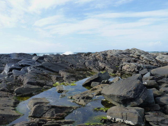
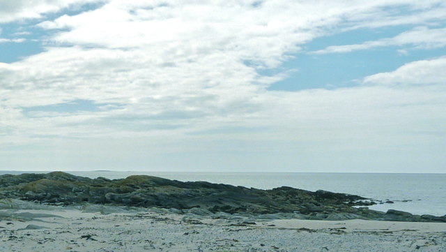
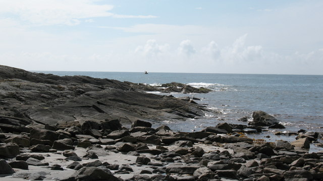
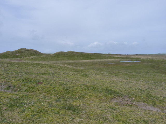
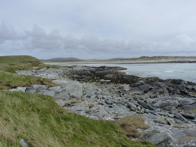
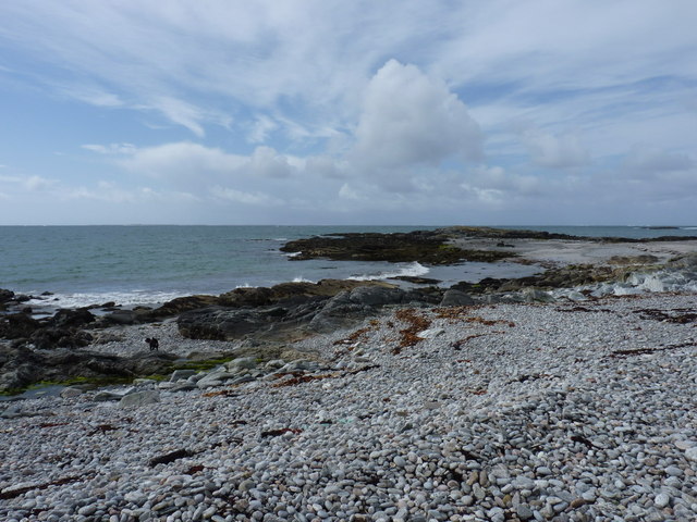
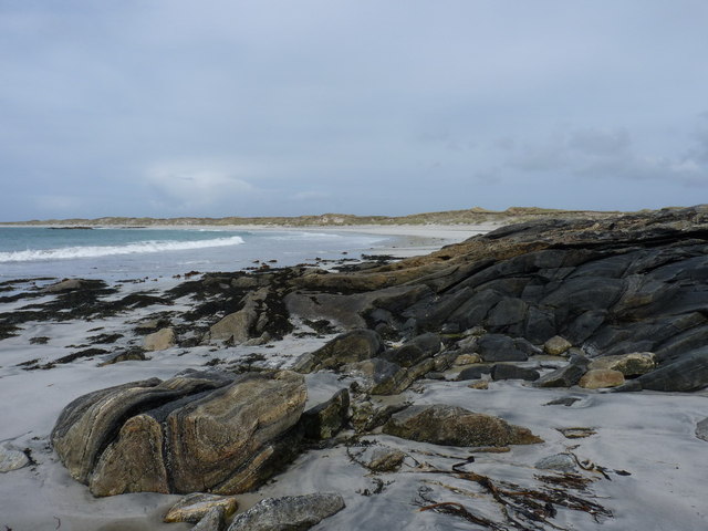
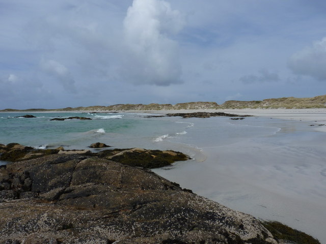
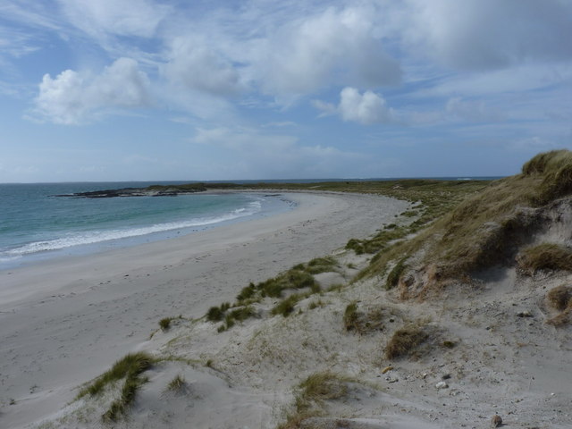
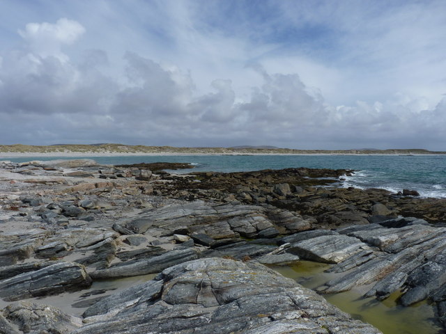
Àirigh Nighean Allein is a prominent headland located in Inverness-shire, Scotland. Situated along the rugged coastline, this coastal feature offers stunning views of the surrounding landscape and the vast expanse of the North Sea. The name Àirigh Nighean Allein translates to "shelter of the daughter of Allein," reflecting the rich history and folklore of the area.

The headland is characterized by sheer cliffs that plunge dramatically into the sea below, creating a striking and picturesque backdrop. The rocky terrain is home to a diverse array of plant and animal life, making it a popular spot for wildlife enthusiasts and nature lovers.

Visitors to Àirigh Nighean Allein can enjoy hiking along the coastal paths, taking in the breathtaking views and exploring the unique rock formations that dot the landscape. The headland is also a popular spot for birdwatching, with a variety of seabirds nesting in the cliffs and soaring overhead.

Overall, Àirigh Nighean Allein offers a serene and awe-inspiring experience for those looking to immerse themselves in the natural beauty of the Scottish coastline.

If you have any feedback on the listing, please let us know in the comments section below.

Àirigh Nighean Allein Images

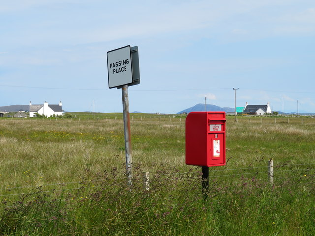
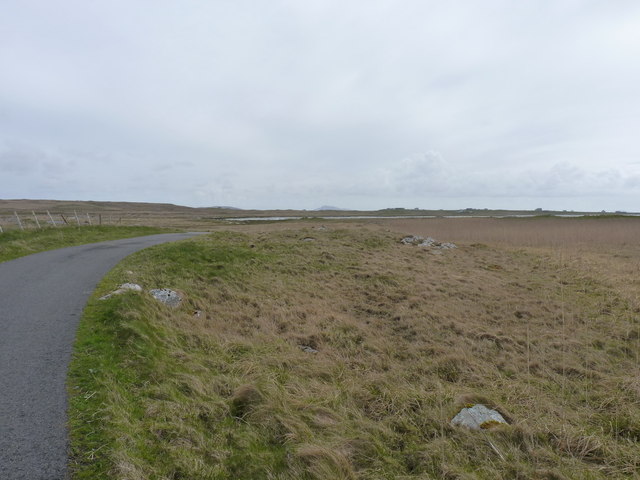
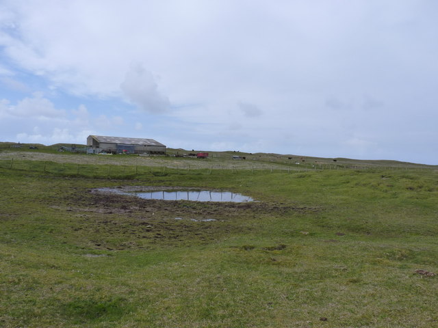
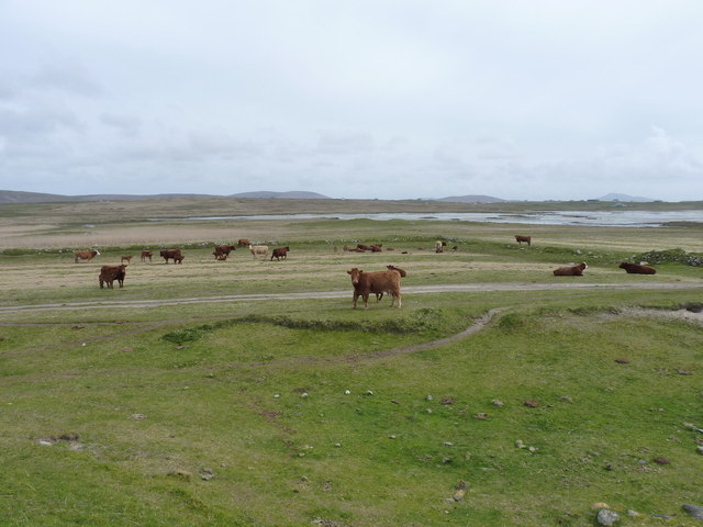
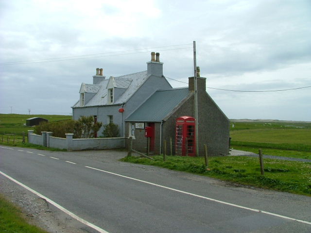
Images are sourced within 2km of 57.58158/-7.4953325 or Grid Reference NF7167. Thanks to Geograph Open Source API. All images are credited.

Incoming tide on Rubha Port Scolpaig The waves of the rising tide break over the rocks about 25 yards ahead of me.
Incoming tide on Rubha Port Scolpaig
The waves of the rising tide break over the rocks about 25 yards ahead of me.
Rubha Port Scolpaig Low spring tides at the full moon exposed more beach than usual.
Rubha Port Scolpaig
Low spring tides at the full moon exposed more beach than usual.
Rubha Port Scolpaig Rocky point that separates two white sand beaches.  RSPB reserve to the north west.
Rubha Port Scolpaig
Rocky point that separates two white sand beaches. RSPB reserve to the north west.
Loch Sanndaraigh The map shows a causeway across this shallow loch and the feature is visible to the left side of the photo.
Loch Sanndaraigh
The map shows a causeway across this shallow loch and the feature is visible to the left side of the photo.
Paiblesgearraidh post box Since Chris Downer was here, the post box appears to have been replaced with a shiny new one.
Paiblesgearraidh post box
Since Chris Downer was here, the post box appears to have been replaced with a shiny new one.
Paibeil phone box Still standing against the Hebridean gales, but at a slightly drunken angle. [leaning into the prevailing wind]
Paibeil phone box
Still standing against the Hebridean gales, but at a slightly drunken angle. [leaning into the prevailing wind]
Metalled road through the marshland near Balranald House The track leads to machair on the nature reserve and a scattering of farm buildings (behind me), whilst the water visible in the middle distance is the tidal inlet of Loch Phaibeil.
Metalled road through the marshland near Balranald House
The track leads to machair on the nature reserve and a scattering of farm buildings (behind me), whilst the water visible in the middle distance is the tidal inlet of Loch Phaibeil.
A barn at Rosamul A low-profile barn, which keeps its head down out of the wind. The surrounding area is extensively grazed by cattle, so the barn presumably provides them with some shelter, as well as storing cattle feed and other farm kit.
A barn at Rosamul
A low-profile barn, which keeps its head down out of the wind. The surrounding area is extensively grazed by cattle, so the barn presumably provides them with some shelter, as well as storing cattle feed and other farm kit.
Cattle grazing at Rosamul
Machair and dunes near Hanglam
Shoreline rocks near the mouth of Loch Phaibeil
Boulder beach and rocks at Hanglam
Rocks at Hanglam, and the beach beyond It's tempting to call the beach Tràigh Hanglam, but it's unnamed on the current maps. Another of the Outer Hebrides' fine shell-sand beaches, backed by a line of dunes, and as crowded as all the others in the area.
Rocks at Hanglam, and the beach beyond
It's tempting to call the beach Tràigh Hanglam, but it's unnamed on the current maps. Another of the Outer Hebrides' fine shell-sand beaches, backed by a line of dunes, and as crowded as all the others in the area.
Port Scolpaig beach Another fine sandy beach, with a scattering of rocky outcrops ('sgeirs') that lurk just below the high water level.
Port Scolpaig beach
Another fine sandy beach, with a scattering of rocky outcrops ('sgeirs') that lurk just below the high water level.
Port Scolpaig beach Along the sweep of the beach, with Rubha Port Scolpaig beyond.
Port Scolpaig beach
Along the sweep of the beach, with Rubha Port Scolpaig beyond.
Wave-cut rocks on Rubha Port Scolpaig
"Who you lookin' at?" Mother and twins on the machair near Balranald.
"Who you lookin' at?"
Mother and twins on the machair near Balranald.
Farm track across the machair
Show me another place!

Àirigh Nighean Allein is located at Grid Ref: NF7167 (Lat: 57.58158, Lng: -7.4953325)

Unitary Authority: Na h-Eileanan an Iar

Police Authority: Highlands and Islands

What 3 Words

///puddles.fallback.rebirth. Near Balivanich, Na h-Eileanan Siar

Related Wikis

Balranald Nature Reserve

The Balranald Nature Reserve is an RSPB reserve on the north west coast of North Uist, Outer Hebrides, Scotland. The reserve is open all year round and...

Aird an Rùnair

Aird an Rùnair is the most westerly point of the island of North Uist in the Western Isles of Scotland. The headland is approximately 4 kilometres (2.5...

Tigharry

Tigharry (Scottish Gaelic: Taigh a' Ghearraidh) is a small village on the west of North Uist. It is mostly a farming community. There are a few rocky beaches...

Ardheisker

Ardheisker (Scottish Gaelic: Àird Heillsgeir) is a settlement on North Uist, in the Outer Hebrides, Scotland. Ardheisker is within the parish of North...

Nearby Amenities

Located within 500m of 57.58158,-7.4953325
Source: PGS
Lat/Long: 57.5793712/-7.4903459
Source: PGS
Lat/Long: 57.5797952/-7.490517
Source: PGS
Lat/Long: 57.5806019/-7.4910261
Source: PGS
Lat/Long: 57.5809613/-7.4913607
Source: PGS
Lat/Long: 57.5812323/-7.491659
Source: PGS
Lat/Long: 57.5817203/-7.4923489
Source: PGS
Lat/Long: 57.5819167/-7.4928269
Source: PGS
Lat/Long: 57.5821554/-7.4933655
Source: PGS
Lat/Long: 57.5823265/-7.4936868
Source: PGS
Lat/Long: 57.5824672/-7.4938413
Source: PGS
Lat/Long: 57.5834346/-7.4930967
Source: PGS
Lat/Long: 57.583679/-7.4929647
Source: PGS
Lat/Long: 57.5841195/-7.4913002
Source: PGS
Lat/Long: 57.5842677/-7.4903185
Source: PGS
Lat/Long: 57.5844364/-7.4895824
Source: PGS
Lat/Long: 57.5849532/-7.4926012
Source: PGS
Lat/Long: 57.5850933/-7.4940312
Source: PGS
Lat/Long: 57.5845832/-7.4940412
Source: PGS
Lat/Long: 57.5847232/-7.4945212
Source: PGS
Lat/Long: 57.5847232/-7.4950012
Source: PGS
Lat/Long: 57.5846132/-7.4952412
Source: PGS
Lat/Long: 57.5844732/-7.4954812
Source: PGS
Lat/Long: 57.5843632/-7.4964412
Source: PGS
Lat/Long: 57.5833332/-7.4964812
Source: PGS
Lat/Long: 57.5832132/-7.4974412
Source: PGS
Lat/Long: 57.5829832/-7.4993612
Source: PGS
Lat/Long: 57.5827432/-7.5003212
Source: PGS
Lat/Long: 57.5826132/-7.5005712
Source: PGS
Lat/Long: 57.5824932/-7.5008112
Source: PGS
Lat/Long: 57.5824932/-7.5012812
Source: PGS
Lat/Long: 57.5826332/-7.5022312
Source: PGS
Lat/Long: 57.5831432/-7.5022112
Source: PGS
Lat/Long: 57.578952/-7.4902772
Source: PGS
Lat/Long: 57.5831629/-7.4933017
Source: PGS
Lat/Long: 57.5850867/-7.4922878
Source: PGS
Lat/Long: 57.5802578/-7.4906903
Source: PGS
Lat/Long: 57.5815351/-7.4919718
Source: PGS
Lat/Long: 57.5780466/-7.4902064
Source: PGS
Lat/Long: 57.5839714/-7.4928762
Source: PGS
Lat/Long: 57.5789549/-7.4894001
Source: PGS
Lat/Long: 57.5793108/-7.4895546
Source: PGS
Lat/Long: 57.5799476/-7.489833
Source: PGS
Lat/Long: 57.5802448/-7.490017
Source: PGS
Lat/Long: 57.5806767/-7.4903448
Source: PGS
Lat/Long: 57.5810692/-7.4907599
Source: PGS
Lat/Long: 57.5813991/-7.4909938
Source: PGS
Lat/Long: 57.5816875/-7.4914997
Source: PGS
Lat/Long: 57.581913/-7.4919305
Source: PGS
Lat/Long: 57.5820634/-7.492269
Source: PGS
Lat/Long: 57.5822877/-7.492652
Source: PGS
Lat/Long: 57.5825077/-7.4928875
Source: PGS
Lat/Long: 57.5826814/-7.4931627
Source: PGS
Lat/Long: 57.5829702/-7.4932561
Source: PGS
Lat/Long: 57.5832275/-7.4931262
Source: PGS
Lat/Long: 57.5835855/-7.4926053
Source: PGS
Lat/Long: 57.5837773/-7.4923183
Source: PGS
Lat/Long: 57.5844761/-7.4910239
Source: PGS
Lat/Long: 57.5841195/-7.4913002
Source: PGS
Lat/Long: 57.5844891/-7.4902193
Source: PGS
Lat/Long: 57.5845701/-7.4894913
The data included in this document is from www.openstreetmap.org. The data is made available under ODbL.

Have you been to Àirigh Nighean Allein?

Leave your review of Àirigh Nighean Allein below (or comments, questions and feedback).