Nèill Geodha Clann

Coastal Feature, Headland, Point in Inverness-shire

Scotland

Nèill Geodha Clann

St Kilda View from Traigh-stir on North Uist at sunset.
St Kilda Credit: Sandy Gerrard

Nèill Geodha Clann is a prominent headland located in Inverness-shire, Scotland. Situated along the rugged coastline, this coastal feature offers stunning views of the surrounding landscape and the North Sea. The name "Nèill Geodha Clann" is derived from Gaelic, with "Nèill" meaning headland, "Geodha" meaning rocky inlet, and "Clann" meaning children or descendants.

The headland is characterized by its rocky cliffs, which jut out into the sea, creating a dramatic and picturesque backdrop. The area is rich in marine life, with seabirds often seen soaring overhead and seals basking on the rocks below. Nèill Geodha Clann is a popular spot for birdwatching, hiking, and photography, attracting visitors from near and far.

In addition to its natural beauty, Nèill Geodha Clann also holds historical significance. The headland is said to have been a strategic lookout point during ancient times, with remnants of ancient settlements and fortifications found in the surrounding area.

Overall, Nèill Geodha Clann is a must-visit destination for nature lovers, history enthusiasts, and anyone looking to experience the rugged beauty of the Scottish coastline.

If you have any feedback on the listing, please let us know in the comments section below.

Nèill Geodha Clann Images

Images are sourced within 2km of 57.809096/-8.5566093 or Grid Reference NF1098. Thanks to Geograph Open Source API. All images are credited.
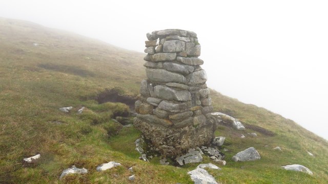
St Kilda View from Traigh-stir on North Uist at sunset.
St Kilda
View from Traigh-stir on North Uist at sunset.
Dùn from Ruabhal A classic view of Dùn.  I had a memorable day on Dùn not helped by falling into the sea when being landed.  It is lucky my camera survived to take these images later.
Dùn from Ruabhal
A classic view of Dùn. I had a memorable day on Dùn not helped by falling into the sea when being landed. It is lucky my camera survived to take these images later.
Village Bay from the side of Ruabhal, Hirta The military encampment is noticeable and this image was taken when the North Uist Rocket Range was extensively used by NATO.
Village Bay from the side of Ruabhal, Hirta
The military encampment is noticeable and this image was taken when the North Uist Rocket Range was extensively used by NATO.
Below The Mistress Stone, St Kilda This stone shared with The Lovers Stone a role in proving fidelity in courtship. Village Bay, Hirta is in the background.
Below The Mistress Stone, St Kilda
This stone shared with The Lovers Stone a role in proving fidelity in courtship. Village Bay, Hirta is in the background.
Mina Stac and the cliffs to its south, Hirta
Radar Tracking Station on Mullach Sgar This radar station, located on Mullach Sgar, is one of two stations on the island which serve the South Uist rocket range. They contain equipment which allows them to track test firings on the range by radar, and to record images of missiles in flight. The second radar station on Hirta is located further north, on the summit of Mullach Mòr.
Radar Tracking Station on Mullach Sgar
This radar station, located on Mullach Sgar, is one of two stations on the island which serve the South Uist rocket range. They contain equipment which allows them to track test firings on the range by radar, and to record images of missiles in flight. The second radar station on Hirta is located further north, on the summit of Mullach Mòr.
Hirta, Mina Stac and the cliffs to its south
Former Quarry Site on Hirta
Dùn and Hirta A view along the coast of Dùn towards Ruabhal, on the island of Hirta, and the narrow strait (Caolas an Dùin) which separates the two islands. View taken from Bhàga a’ Bhaile (Village Bay).
Dùn and Hirta
A view along the coast of Dùn towards Ruabhal, on the island of Hirta, and the narrow strait (Caolas an Dùin) which separates the two islands. View taken from Bhàga a’ Bhaile (Village Bay).
Mina Stac, Hirta Hirta is surrounded by a number of small stacks. Mina Stac rises spectacularly to a height of approximately 70 metres, separated by only a few feet from the spectacular cliffs (the highest sea cliffs in the UK) which descend from the summit Conachair.
Mina Stac, Hirta
Hirta is surrounded by a number of small stacks. Mina Stac rises spectacularly to a height of approximately 70 metres, separated by only a few feet from the spectacular cliffs (the highest sea cliffs in the UK) which descend from the summit Conachair.
St Kilda, Mina Stac Hirta is surrounded by a number of small stacks. Mina Stac rises spectacularly to a height of approximately 70 metres, separated by only a few feet from the spectacular cliffs (the highest sea cliffs in the UK) which descend from the summit of Conachair, the highest point on the island.
St Kilda, Mina Stac
Hirta is surrounded by a number of small stacks. Mina Stac rises spectacularly to a height of approximately 70 metres, separated by only a few feet from the spectacular cliffs (the highest sea cliffs in the UK) which descend from the summit of Conachair, the highest point on the island.
Abhainn Mhòr, Hirta Flowing past the western end of the old village.
Abhainn Mhòr, Hirta
Flowing past the western end of the old village.
Abhainn Mhòr With some of the maintained cleits along the banks.
Abhainn Mhòr
With some of the maintained cleits along the banks.
Soay Sheep, Hirta A very old lineage of sheep, living wild on Hirta and Soay. They are tagged to monitor population fluctuations, which can be quite rapid.
Soay Sheep, Hirta
A very old lineage of sheep, living wild on Hirta and Soay. They are tagged to monitor population fluctuations, which can be quite rapid.
Abhainn Mhòr, Hirta
Abhainn Mhòr, Hirta
Former village, Hirta With Soay Sheep now roaming free on what were the farmed fields.
Former village, Hirta
With Soay Sheep now roaming free on what were the farmed fields.
St Kilda - Trig point below Conachair summit This trig point is located high up on the southern slopes of Conachair. Sadly there was no view on this day with a visibility of around twenty yards and driving fine rain so it wasn't a place to linger.
St Kilda - Trig point below Conachair summit
This trig point is located high up on the southern slopes of Conachair. Sadly there was no view on this day with a visibility of around twenty yards and driving fine rain so it wasn't a place to linger.
Conachair, St Kilda Bagged on a circuit of six Hirta TUMPs on a sunny afternoon.
Name: Conachair
Hill number: 1636
Height: 430m / 1411ft
Section: 25: St Kilda
County/UA: Na h-Eileanan Siar [Western Isles] (UA)
Island: Hirta
Class: Marilyn, HuMP, Tump (400-499m)
Grid ref: NA 09989 00228
Summit feature: no feature 1m W of cairn
Drop: 430m
Col: Sea
Conachair, St Kilda
Bagged on a circuit of six Hirta TUMPs on a sunny afternoon. Name: Conachair Hill number: 1636 Height: 430m / 1411ft Section: 25: St Kilda County/UA: Na h-Eileanan Siar [Western Isles] (UA) Island: Hirta Class: Marilyn, HuMP, Tump (400-499m) Grid ref: NA 09989 00228 Summit feature: no feature 1m W of cairn Drop: 430m Col: Sea
Show me another place!

Nèill Geodha Clann is located at Grid Ref: NF1098 (Lat: 57.809096, Lng: -8.5566093)

Unitary Authority: Na h-Eileanan an Iar

Police Authority: Highlands and Islands

What 3 Words

///exonerate.circular.panicking. Near Balivanich, Na h-Eileanan Siar

Related Wikis

Hirta

Hirta (Scottish Gaelic: Hiort) is the largest island in the St Kilda archipelago, on the western edge of Scotland. The names Hiort (in Scottish Gaelic...

Dùn

Dùn is an island in St Kilda, Scotland. It is nearly 1 mile (1.6 kilometres) long. Its name simply means "fort" in Scottish Gaelic (for more information...

St Kilda, Scotland

St Kilda (Scottish Gaelic: Hiort) is an isolated archipelago situated 64 kilometres (40 mi) west-northwest of North Uist in the North Atlantic Ocean. It...

Stac Levenish

Stac Levenish or Stac Leibhinis (sometimes simply called Levenish/Leibhinis) is a sea stack in the St Kilda archipelago in Scotland. Lying 2.5 kilometres...

Nearby Amenities

Located within 500m of 57.809096,-8.5566093
Oiseabhal
Ele: 289
Name En: Oiseval
Natural: peak
Source: npe
Wikidata: Q24680039
Lat/Long: 57.8129943/-8.5565897
Geodha Clann Nèill
Natural: bay
Source: npe
Lat/Long: 57.8090474/-8.5564441
FIXME: survey actual military type
Military: unspecified
Lat/Long: 57.8105127/-8.5637898
Natural: rock
Seamark Type: rock
Lat/Long: 57.8098955/-8.5634566
Natural: rock
Seamark Type: rock
Lat/Long: 57.8100861/-8.5637249
Rubha Challa
Name En: Point of Coll
Name Gd: Rubha Challa
Natural: cape
Lat/Long: 57.8087542/-8.5600584
Glacan Oiseabhal
Place: locality
Lat/Long: 57.811471/-8.5571724
Cnoc na Gaoithe
Place: locality
Lat/Long: 57.8124997/-8.5526019
The data included in this document is from www.openstreetmap.org. The data is made available under ODbL.

Have you been to Nèill Geodha Clann?

Leave your review of Nèill Geodha Clann below (or comments, questions and feedback).