Cockle Creek

Sea, Estuary, Creek in Suffolk Babergh

England

Cockle Creek

B1456 The Street, Shotley Towards the village and the rest of the world.
B1456 The Street, Shotley Credit: Robin Webster

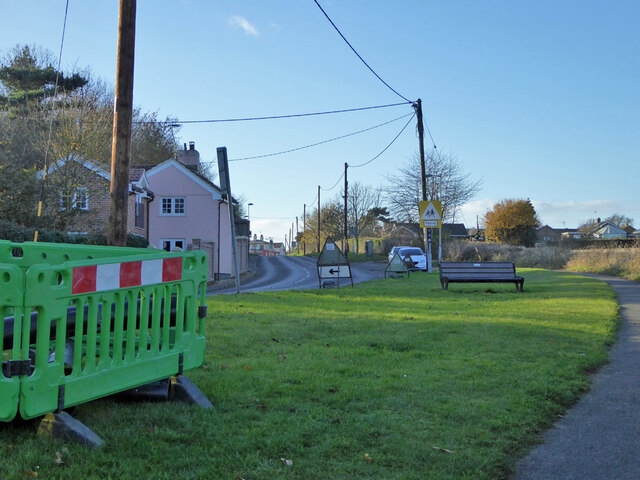
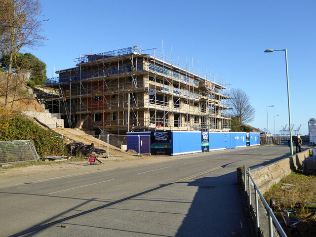
Cockle Creek is a picturesque coastal village located in Suffolk, England. Situated on the eastern coast of the country, it is known for its stunning sea views, expansive estuary, and tranquil creek. The village is a popular destination for tourists and locals alike, offering a peaceful retreat from the bustling city life.

The main attraction of Cockle Creek is its beautiful seafront, which stretches for several miles along the coastline. Visitors can enjoy long walks along the sandy beach, breathe in the fresh sea air, and take in the panoramic views of the North Sea. The beach is also a great spot for birdwatching, with various species of seabirds frequenting the area.

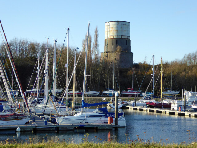
Adjacent to the seafront is the estuary, where the creek flows into the sea. The estuary is a haven for wildlife and is designated as a protected area. It is home to a diverse range of marine life, including fish, crabs, and shellfish, making it a popular spot for fishing enthusiasts.

The creek itself is a narrow waterway that meanders through the village, providing a tranquil setting for boating and kayaking. On either side of the creek, quaint cottages and charming houses line the banks, adding to the idyllic atmosphere of the area.

Cockle Creek is also known for its rich history, with evidence of human habitation dating back centuries. The village has a small museum that showcases artifacts and documents from its past, offering visitors a glimpse into its fascinating heritage.

Overall, Cockle Creek offers a unique blend of natural beauty, wildlife, and cultural heritage, making it a must-visit destination for anyone seeking a peaceful and scenic retreat on the Suffolk coast.

If you have any feedback on the listing, please let us know in the comments section below.

Cockle Creek Images

Images are sourced within 2km of 51.956611/1.2575325 or Grid Reference TM2333. Thanks to Geograph Open Source API. All images are credited.

B1456 The Street, Shotley Towards the village and the rest of the world.
B1456 The Street, Shotley
Towards the village and the rest of the world.
Shore, Shotley Gate
Shore, Shotley Gate
Shotley Lodge under construction, 2017 Flats on a site where there was some sort of house before.
Shotley Lodge under construction, 2017
Flats on a site where there was some sort of house before.
The Bristol Arms, Shotley Gate The barriers are around road work across the road from the pub, not the pub itself.
The Bristol Arms, Shotley Gate
The barriers are around road work across the road from the pub, not the pub itself.
The Bristol Arms - inn sign
Welcome to Shotley Marina An unusually welcoming marina.
Welcome to Shotley Marina
An unusually welcoming marina.
Landing stage, Shotley Marina Used by the small foot ferry to Felixstowe and Harwich. The backdrop is 'Taipei Triumph' alongside at Felixstowe.
Landing stage, Shotley Marina
Used by the small foot ferry to Felixstowe and Harwich. The backdrop is 'Taipei Triumph' alongside at Felixstowe.
Boats out of water, Shotley Marina The serious boat in the middle is 'Titan Discovery', an underwater survey and operations vessel.
Boats out of water, Shotley Marina
The serious boat in the middle is 'Titan Discovery', an underwater survey and operations vessel.
Lock, Shotley Marina A public right-of-way crosses the lower gates. Straight ahead is a Martello tower, with a water tank not very reverentially placed on top.
Lock, Shotley Marina
A public right-of-way crosses the lower gates. Straight ahead is a Martello tower, with a water tank not very reverentially placed on top.
Boats in Shotley Marina Impounded above the lock.
Boats in Shotley Marina
Impounded above the lock.
Martello/water tower above Shotley Marina A grade II listed building, despite the tower from the Napoleonic wars being spoiled by a comparatively modern extension and water tank on top.
Martello/water tower above Shotley Marina
A grade II listed building, despite the tower from the Napoleonic wars being spoiled by a comparatively modern extension and water tank on top.
Pepys buoy, Harwich Haven On the near (SW) side of the deep dredged channel.
Pepys buoy, Harwich Haven
On the near (SW) side of the deep dredged channel.
'Allen Gardiner' turns back up the Orwell A 'river cruise restaurant' from and to Ipswich. The Fagbury buoy is on the left, marking the far (NE) side of the deep channel.
'Allen Gardiner' turns back up the Orwell
A 'river cruise restaurant' from and to Ipswich. The Fagbury buoy is on the left, marking the far (NE) side of the deep channel.
MV 'Allen Gardiner' heads up the Orwell A 'river cruise restaurant' from and to Ipswich. The red buoy, on this side of the deep channel, is called Bamburgh. The yellow buoy, on the other side, marks the start of a 6 knot speed limit up the river, and is just about on the port authority boundary between Harwich Haven and Ipswich.
MV 'Allen Gardiner' heads up the Orwell
A 'river cruise restaurant' from and to Ipswich. The red buoy, on this side of the deep channel, is called Bamburgh. The yellow buoy, on the other side, marks the start of a 6 knot speed limit up the river, and is just about on the port authority boundary between Harwich Haven and Ipswich.
Moored lightship, Harwich Haven Apparently laid up at a Trinity House mooring buoy. There is no obvious identity, viewed from this angle, its last station name would have been fixed on the framework towards the stern. It is not LV 22, which was here a year later.
Moored lightship, Harwich Haven
Apparently laid up at a Trinity House mooring buoy. There is no obvious identity, viewed from this angle, its last station name would have been fixed on the framework towards the stern. It is not LV 22, which was here a year later.
Lock, Shotley Marina The gates have reminders that the speed limit on the Stour and Harwich Harbour is 8 knots, and on the Orwell 6 knots. There is also a warning about cross tides. Although the marina is called Shotley Marina, the lifebelt on the right has 'Shotley Point Marina' on it - an earlier name?
Lock, Shotley Marina
The gates have reminders that the speed limit on the Stour and Harwich Harbour is 8 knots, and on the Orwell 6 knots. There is also a warning about cross tides. Although the marina is called Shotley Marina, the lifebelt on the right has 'Shotley Point Marina' on it - an earlier name?
Landing stage, Shotley Marina Used by the small foot ferry to Felixstowe (Landguard) and Harwich.
Landing stage, Shotley Marina
Used by the small foot ferry to Felixstowe (Landguard) and Harwich.
View from Erwarton churchyard Towards Parkeston Quay.
View from Erwarton churchyard
Towards Parkeston Quay.
Show me another place!

Cockle Creek is located at Grid Ref: TM2333 (Lat: 51.956611, Lng: 1.2575325)

Administrative County: Suffolk

District: Babergh

Police Authority: Suffolk

What 3 Words

///carry.unhelpful.minder. Near Shotley Gate, Suffolk

Nearby Locations

Erwarton Bay Cockle Creek

Related Wikis

Ganges Wood

Ganges Wood is a woodland in Suffolk, England, near the village of Shotley Gate. It covers a total area of 2.21 hectares (5.46 acres). It is owned and...

Shotley Pier

Shotley Pier is a disused 540 feet (160 m) long railway pier in Shotley Gate, Shotley, Suffolk. Built in 1894 by Frederick Hervey, 3rd Marquess of Bristol...

Shotley Gate

Shotley Gate is a settlement in the civil parish of Shotley, in the Babergh district, in the county of Suffolk, England. It is located at the tip of Shotley...

HMS Ganges mast

A ship's mast stands on the site of the Royal Navy shore establishment HMS Ganges at Shotley, Suffolk in England. It was formerly used for mast climbing...

Nearby Amenities

Located within 500m of 51.956611,1.2575325
Turning Circle
Lat/Long: 51.9597036/1.2598497
Shotley Cliff
Naptan AtcoCode: 390010882
Naptan Bearing: W
Naptan BusStopType: CUS
Naptan CommonName: Shotley Cliff
Naptan Indicator: adj
Naptan Landmark: Shotley Cliff
Naptan NaptanCode: sufjtdtm
Naptan Street: Stourside
Naptan Verified: no
Source: naptan_import
Lat/Long: 51.9577538/1.2626546
Shotley Cliff
Naptan AtcoCode: 390010883
Naptan Bearing: E
Naptan BusStopType: CUS
Naptan CommonName: Shotley Cliff
Naptan Indicator: opp
Naptan Landmark: Shotley Cliff
Naptan NaptanCode: sufjtdtp
Naptan Street: Stourside
Naptan Verified: no
Source: naptan_import
Lat/Long: 51.9578906/1.262912
Turning Circle
Lat/Long: 51.9591553/1.258943
Waste Basket
Waste: dog_excrement
Lat/Long: 51.9585643/1.2593928
Leisure: picnic_table
Lat/Long: 51.9581125/1.2604842
Shelter
Shelter Type: picnic_shelter
Lat/Long: 51.9581143/1.2604945
Waste Basket
Lat/Long: 51.9581172/1.2604805
Waste Basket
Lat/Long: 51.959041/1.2581255
Generator Method: photovoltaic
Generator Output Electricity: yes
Generator Source: solar
Generator Type: solar_photovoltaic_panel
Location: roof
Power: generator
Lat/Long: 51.9580818/1.2643772
Barrier: kissing_gate
Foot: yes
Lat/Long: 51.9587702/1.2631051
Barrier: kissing_gate
Foot: yes
Lat/Long: 51.958112/1.2623118
Generator Method: photovoltaic
Generator Output Electricity: yes
Generator Source: solar
Generator Type: solar_photovoltaic_panel
Location: roof
Power: generator
Lat/Long: 51.9575247/1.263983
Generator Method: photovoltaic
Generator Output Electricity: yes
Generator Source: solar
Generator Type: solar_photovoltaic_panel
Location: roof
Power: generator
Lat/Long: 51.9574561/1.2641734
Generator Method: photovoltaic
Generator Output Electricity: yes
Generator Source: solar
Generator Type: solar_photovoltaic_panel
Location: roof
Power: generator
Lat/Long: 51.9592483/1.2594721
Generator Method: photovoltaic
Generator Output Electricity: yes
Generator Source: solar
Generator Type: solar_photovoltaic_panel
Location: roof
Power: generator
Lat/Long: 51.958995/1.2599704
Generator Method: photovoltaic
Generator Output Electricity: yes
Generator Source: solar
Generator Type: solar_photovoltaic_panel
Location: roof
Power: generator
Lat/Long: 51.9599123/1.2616119
Generator Method: photovoltaic
Generator Output Electricity: yes
Generator Source: solar
Generator Type: solar_photovoltaic_panel
Location: roof
Power: generator
Lat/Long: 51.9599065/1.2613343
Generator Method: photovoltaic
Generator Output Electricity: yes
Generator Source: solar
Generator Type: solar_photovoltaic_panel
Location: roof
Power: generator
Lat/Long: 51.9598908/1.2612645
Generator Method: photovoltaic
Generator Output Electricity: yes
Generator Source: solar
Generator Type: solar_photovoltaic_panel
Location: roof
Power: generator
Lat/Long: 51.9598809/1.2608059
Generator Method: photovoltaic
Generator Output Electricity: yes
Generator Source: solar
Generator Type: solar_photovoltaic_panel
Location: roof
Power: generator
Lat/Long: 51.9584495/1.2631676
Generator Method: photovoltaic
Generator Output Electricity: yes
Generator Source: solar
Generator Type: solar_photovoltaic_panel
Location: roof
Power: generator
Lat/Long: 51.9579512/1.2628457
Generator Method: photovoltaic
Generator Output Electricity: yes
Generator Source: solar
Generator Type: solar_photovoltaic_panel
Location: roof
Power: generator
Lat/Long: 51.957976/1.262666
Generator Method: photovoltaic
Generator Output Electricity: yes
Generator Source: solar
Generator Type: solar_photovoltaic_panel
Location: roof
Power: generator
Lat/Long: 51.9578066/1.263244
Generator Method: photovoltaic
Generator Output Electricity: yes
Generator Source: solar
Generator Type: solar_photovoltaic_panel
Location: roof
Power: generator
Lat/Long: 51.9578719/1.263075
Generator Method: photovoltaic
Generator Output Electricity: yes
Generator Source: solar
Generator Type: solar_photovoltaic_panel
Location: roof
Power: generator
Lat/Long: 51.9582454/1.263523
Generator Method: photovoltaic
Generator Output Electricity: yes
Generator Source: solar
Generator Type: solar_photovoltaic_panel
Location: roof
Power: generator
Lat/Long: 51.958371/1.2637912
Generator Method: photovoltaic
Generator Output Electricity: yes
Generator Source: solar
Generator Type: solar_photovoltaic_panel
Location: roof
Power: generator
Lat/Long: 51.9583033/1.2639843
The data included in this document is from www.openstreetmap.org. The data is made available under ODbL.

Have you been to Cockle Creek?

Leave your review of Cockle Creek below (or comments, questions and feedback).