Beaumont Cut

Sea, Estuary, Creek in Essex Tendring

England

Beaumont Cut

Footpath 2 Beaumont Cum Moze The footpath to Cross Hill. Clearly a path less followed, the footbridge over the ditch has almost vanished under brambles.
Footpath 2 Beaumont Cum Moze Credit: Glyn Baker

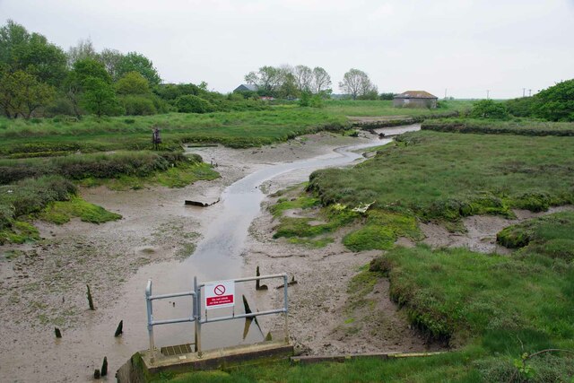
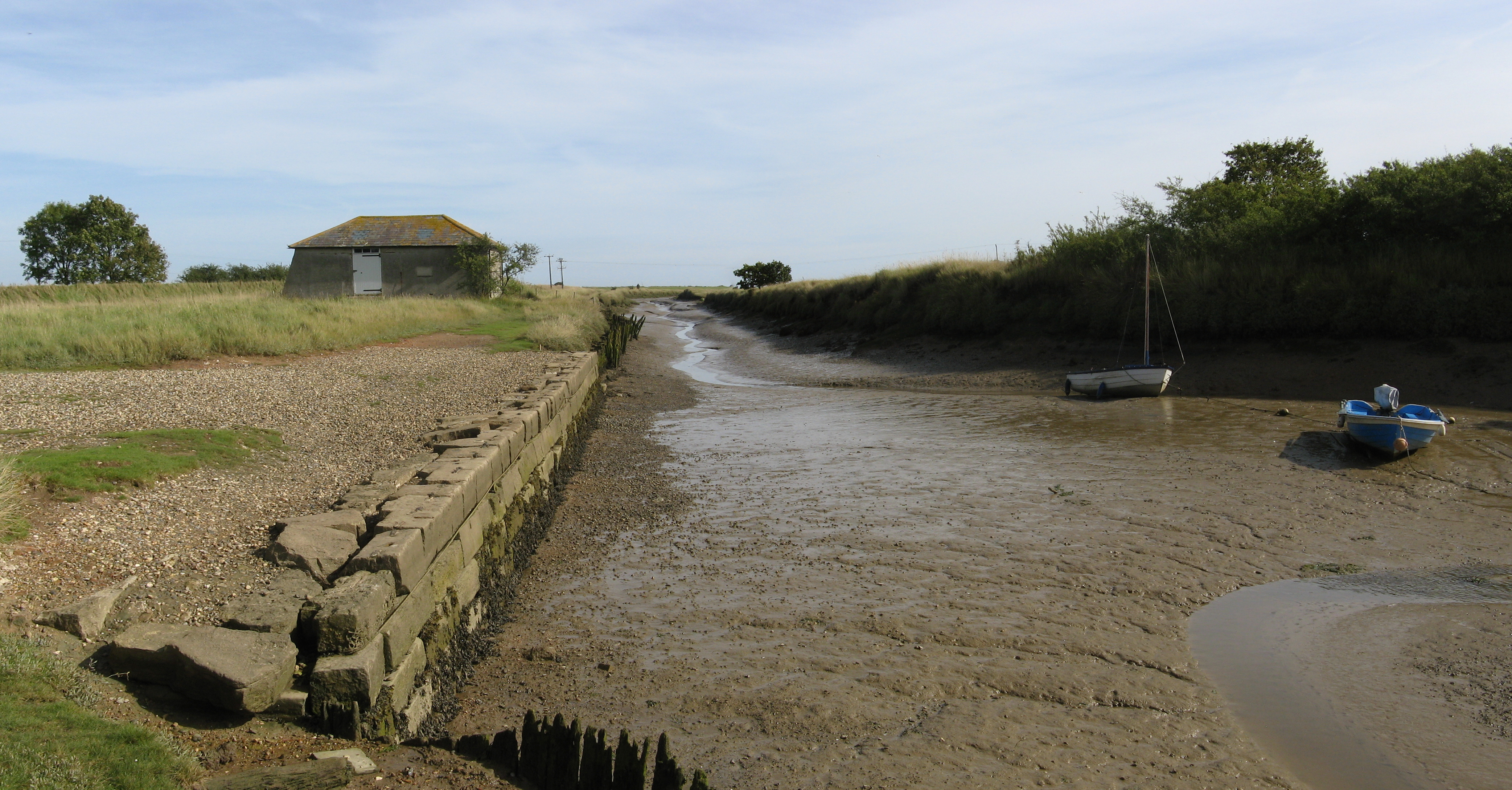
Beaumont Cut is a prominent waterway located in Essex, England. It is primarily known for its role as a sea, estuary, and creek, providing a crucial link between the River Blackwater and the North Sea. The cut stretches for approximately 5 miles, running parallel to the coastline, and acts as an important navigational channel for both commercial and recreational vessels.

This waterway offers a diverse range of habitats, making it a significant ecological site. The estuarine environment of Beaumont Cut supports a wide variety of wildlife, including numerous species of birds, fish, and invertebrates. It serves as an important breeding ground and feeding area for many migratory birds, such as waders and waterfowl.

The cut also plays a vital role in flood management, serving as a natural drainage channel for the surrounding area. During periods of heavy rainfall or high tides, excess water is efficiently channeled through the cut, reducing the risk of flooding in nearby communities.

Beaumont Cut is a popular destination for boating enthusiasts and nature lovers alike. Its calm waters and picturesque surroundings make it an ideal spot for boating, fishing, and wildlife observation. Several marinas and boatyards are situated along its banks, offering facilities and services for both residents and visitors.

Overall, Beaumont Cut in Essex is a significant waterway that fulfills multiple functions. It serves as a vital link between the River Blackwater and the North Sea, supports diverse ecosystems, aids in flood management, and provides recreational opportunities for locals and tourists.

If you have any feedback on the listing, please let us know in the comments section below.
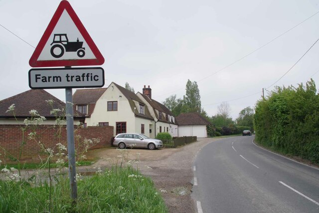
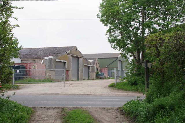
Beaumont Cut Images

Images are sourced within 2km of 51.872662/1.1878435 or Grid Reference TM1924. Thanks to Geograph Open Source API. All images are credited.

Footpath 2 Beaumont Cum Moze The footpath to Cross Hill. Clearly a path less followed, the footbridge over the ditch has almost vanished under brambles.
Footpath 2 Beaumont Cum Moze
The footpath to Cross Hill. Clearly a path less followed, the footbridge over the ditch has almost vanished under brambles.
New Moze Hall Farm Looking along the farm drive.
New Moze Hall Farm
Looking along the farm drive.
Cottages on Harwich Road Looking towards Beaumont Cum Moze on the B1414.
Cottages on Harwich Road
Looking towards Beaumont Cum Moze on the B1414.
Glebehill Cottages on the B1414 The track to the left leads to farmland.
Glebehill Cottages on the B1414
The track to the left leads to farmland.
Footpath 159_11 Past Horseshoes The seat in the garden was decorated with carved horseshoes reflecting the name of the property.
Footpath 159_11 Past Horseshoes
The seat in the garden was decorated with carved horseshoes reflecting the name of the property.
Beaumont Cum Moze Footpath 11 The path crosses the B1414 then joins up with Great Oakley footpath 7 and finally ends up at <a href="https://www.geograph.org.uk/photo/7484308">TM1926 : Footpath 1 Beaumont Cum Moze</a> outside Great Oakley.
Beaumont Cum Moze Footpath 11
The path crosses the B1414 then joins up with Great Oakley footpath 7 and finally ends up at TM1926 : Footpath 1 Beaumont Cum Moze outside Great Oakley.
Old Barn and Footpath 159_10 Beaumont Cum Moze footpath 10 and decaying barn.
Old Barn and Footpath 159_10
Beaumont Cum Moze footpath 10 and decaying barn.
Coronation Villas Beaumont Cum Moze Every one of the houses has been so stripped of original features it is very difficult to work out which coronation was being marked. 1902, 1911 or 1937 . However they do look pre WW2.
Coronation Villas Beaumont Cum Moze
Every one of the houses has been so stripped of original features it is very difficult to work out which coronation was being marked. 1902, 1911 or 1937 . However they do look pre WW2.
Old School House Panorama The thatched house is the old school in Beaumont Cum Moze.
Old School House Panorama
The thatched house is the old school in Beaumont Cum Moze.
Farm Track near Northfield Farm
The Way to Lower Barn Farm Clearly the far has diversified and rents out industrial units.
The Way to Lower Barn Farm
Clearly the far has diversified and rents out industrial units.
Unnamed Stream at Beaumont Bridge
Quay Lane Looking towards <a href="https://www.geograph.org.uk/photo/7484386">TM1824 : Cut Farm</a>
Quay Lane
Looking towards TM1824 : Cut Farm
Cut Farm The sign reads Cut Farm  Beaumont Livery.
Cut Farm
The sign reads Cut Farm Beaumont Livery.
Sea Wall Footpath Beaumont Cum Moze 28 Near Beaumont Quay.
Sea Wall Footpath Beaumont Cum Moze 28
Near Beaumont Quay.
Last Mooring of a Thames Barge In the nineteenth and early twentieth centuries Thames barges would collect hay and straw from farms all over East Anglia and deliver it to London to feed horses. The manure from the horses was shipped back to the farms to fertilise the fields. After WW1 motor transport began to replace horses making the trade uneconomic. Over the years countless barges like this one were moored up in quiet creeks and left to rot.
Last Mooring of a Thames Barge
In the nineteenth and early twentieth centuries Thames barges would collect hay and straw from farms all over East Anglia and deliver it to London to feed horses. The manure from the horses was shipped back to the farms to fertilise the fields. After WW1 motor transport began to replace horses making the trade uneconomic. Over the years countless barges like this one were moored up in quiet creeks and left to rot.
Beaumont Quay Cut Farm Sluice Looking towards <a href="https://www.geograph.org.uk/photo/7484398">TM1924 : Beaumont Quay</a>
Beaumont Quay Cut Farm Sluice
Looking towards TM1924 : Beaumont Quay
Beaumont Quay In former times Thames barges would moor here to load up with hay to feed London's horses. For a close look see <a href="https://www.geograph.org.uk/photo/4078381">TM1924 : Beaumont Quay, Beaumont cum Moze</a>
Beaumont Quay
In former times Thames barges would moor here to load up with hay to feed London's horses. For a close look see TM1924 : Beaumont Quay, Beaumont cum Moze
Show me another place!

Beaumont Cut is located at Grid Ref: TM1924 (Lat: 51.872662, Lng: 1.1878435)

Administrative County: Essex

District: Tendring

Police Authority: Essex

What 3 Words

///divorcing.vacancies.mills. Near Thorpe le Soken, Essex

Nearby Locations

Beaumont Cut

Related Wikis

Landermere Wharf

Landermere Wharf, sometimes called Landermere Quay, is a former dock area suitable for lying at anchor in the Tendring district of Essex, England.The wharf...

Beaumont Cut

Beaumont Cut was a 1-kilometre-long (1,090 yd) canal linking Beaumont Quay, in the parish of Beaumont-cum-Moze, Tendring, Essex, England, with Hamford...

Beaumont-cum-Moze

Beaumont-cum-Moze (grid reference TM175250) is a civil parish in the Tendring district of Essex, England. According to the 2001 census it had a population...

Skipper's Island

Skipper's Island is a 94.3-hectare (233-acre) nature reserve north of Kirby-le-Soken in Essex, England. It is owned and managed by the Essex Wildlife Trust...

Thorpe-le-Soken

Thorpe-le-Soken is a village and civil parish in the Tendring district of Essex, England. It is located east of Colchester, west of Walton-on-the-Naze...

Comarques, Thorpe-le-Soken

Comarques is an 18th-century country house in Thorpe-le-Soken, Essex, England. It has been attributed to the architect, Sir Robert Taylor. Named after...

The Sokens

The Sokens is a name often used to describe the area containing the traditional parishes of Thorpe, Kirby and Walton, which now lie in Tendring district...

Thorpe Hall (Thorpe-le-Soken)

Thorpe Hall was a manor house built in the Georgian style at Thorpe-le-Soken in Essex, England. == History == The Thorpe Manor estate belonged to the Dean...

Nearby Amenities

Located within 500m of 51.872662,1.1878435
Landermere Wharf
Alt Name: Landermere Quay
Place: hamlet
Wikidata: Q6484424
Wikipedia: en:Landermere Wharf
Lat/Long: 51.8702056/1.1929784
Power: pole
Source: bing
Lat/Long: 51.8695955/1.1831071
Power: pole
Source: bing
Lat/Long: 51.8704815/1.1831012
Power: pole
Source: bing
Lat/Long: 51.8713166/1.183113
Power: pole
Source: bing
Lat/Long: 51.8722672/1.1831106
Power: pole
Source: bing
Lat/Long: 51.8729714/1.1836053
Power: pole
Source: bing
Lat/Long: 51.8737264/1.1841333
Power: pole
Source: bing
Lat/Long: 51.8744984/1.1846829
Power: pole
Source: bing
Lat/Long: 51.8751441/1.1851488
Power: pole
Source: bing
Lat/Long: 51.8758494/1.1856258
Power: pole
Source: bing
Lat/Long: 51.8766049/1.1861656
The data included in this document is from www.openstreetmap.org. The data is made available under ODbL.

Have you been to Beaumont Cut?

Leave your review of Beaumont Cut below (or comments, questions and feedback).