Black Fleet

Sea, Estuary, Creek in Suffolk Babergh

England

Black Fleet

Very low cliff, Holbrook Bay Since late Victorian times, about 30 m of land has been lost here.
Very low cliff, Holbrook Bay Credit: Robin Webster

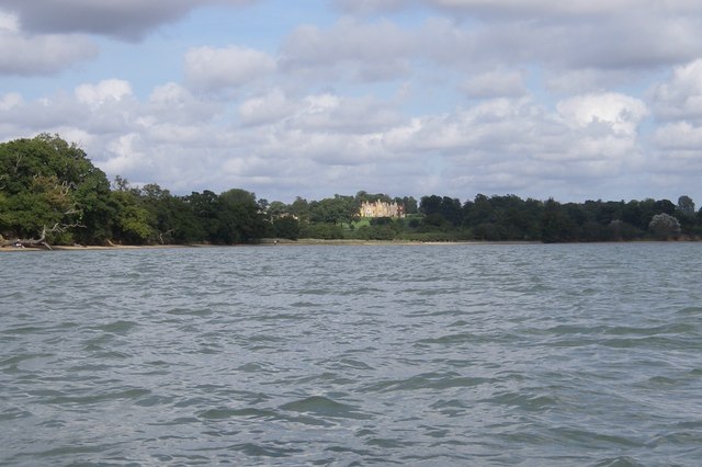
Black Fleet is a prominent waterway located in Suffolk, England, encompassing a diverse range of coastal features, including a sea, estuary, and creek. Situated along the eastern coast of the country, Black Fleet stretches approximately 8 kilometers, offering a picturesque and varied environment for locals and visitors alike.

The sea portion of Black Fleet is characterized by its expansive and open waters. Offering stunning views of the North Sea, this section is popular among water sports enthusiasts, fishermen, and nature lovers. The sea here is known for its turbulent currents and occasional rough waves, attracting experienced surfers seeking a thrilling challenge.

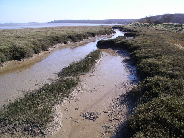
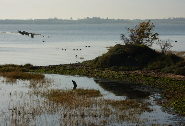
Moving inland, the estuary of Black Fleet is a transitional space where the sea meets the river. It is marked by its brackish water, a mixture of saltwater and freshwater, creating a unique ecosystem that supports a diverse array of marine life. This estuary is an important habitat for various species of fish, birds, and plants, making it a haven for birdwatchers and nature enthusiasts.

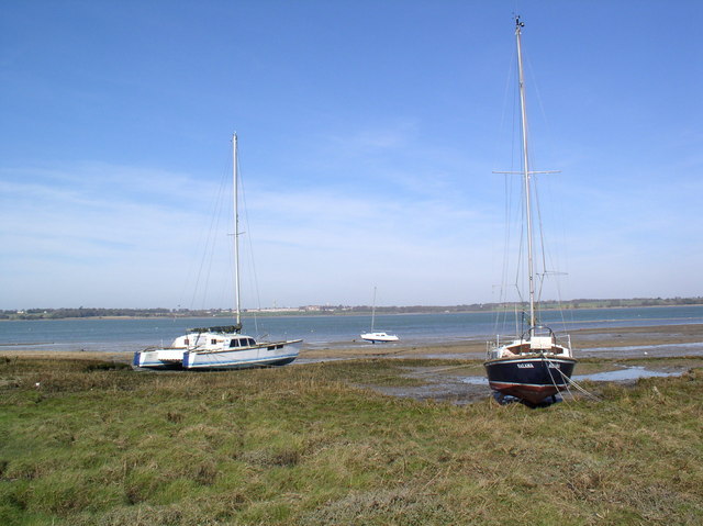
Finally, the creek section of Black Fleet is a narrow and winding waterway that branches off from the estuary. It is characterized by its calm and sheltered waters, providing a serene environment for boating and sailing activities. The creek is flanked by lush vegetation and marshes, creating a tranquil and idyllic atmosphere.

Overall, Black Fleet in Suffolk offers a captivating blend of sea, estuary, and creek environments, providing a range of recreational opportunities and serving as a vital ecosystem for both wildlife and humans to enjoy.

If you have any feedback on the listing, please let us know in the comments section below.
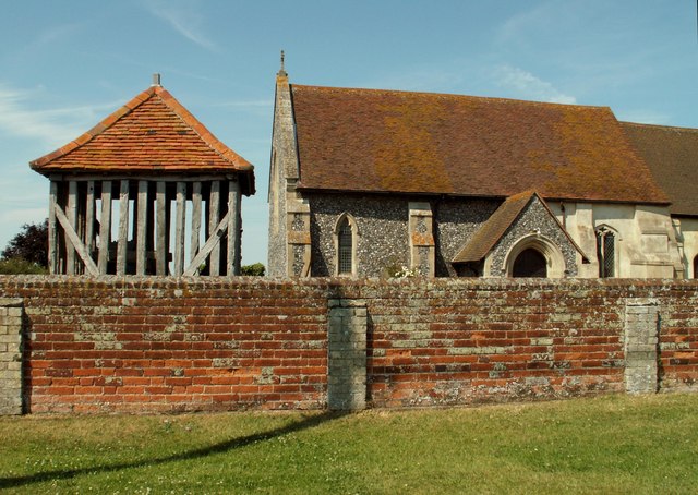
Black Fleet Images

Images are sourced within 2km of 51.953579/1.1472217 or Grid Reference TM1633. Thanks to Geograph Open Source API. All images are credited.

Very low cliff, Holbrook Bay Since late Victorian times, about 30 m of land has been lost here.
Very low cliff, Holbrook Bay
Since late Victorian times, about 30 m of land has been lost here.
Gates to big houses, Stutton Green Stutton House left, The Coach House right. To the left, down the dead-end, is the church.
Gates to big houses, Stutton Green
Stutton House left, The Coach House right. To the left, down the dead-end, is the church.
Churchfield Road, Stutton From Stutton Green to Lower Street.
Churchfield Road, Stutton
From Stutton Green to Lower Street.
Churchfield Road, Stutton From Stutton Green to Lower Street.
Churchfield Road, Stutton
From Stutton Green to Lower Street.
Shelter belt between fields, Stutton Not of great age, the fields were previously one.
Shelter belt between fields, Stutton
Not of great age, the fields were previously one.
Looking over Holbrook Bay and the River Stour This view, from a public footpath through arable land near Lower Holbrook, takes in the boats of Holbrook Creek at the right of the picture to the far shore in Essex on the left.

At this point the river forms a parish boundary with Holbrook in Suffolk, and Wrabness in Essex.
Looking over Holbrook Bay and the River Stour
This view, from a public footpath through arable land near Lower Holbrook, takes in the boats of Holbrook Creek at the right of the picture to the far shore in Essex on the left. At this point the river forms a parish boundary with Holbrook in Suffolk, and Wrabness in Essex.
Church of St Peter, Stutton Green <span class="nowrap"><a title="https://historicengland.org.uk/listing/the-list/list-entry/1285520?section=official-list-entry" rel="nofollow ugc noopener" href="https://historicengland.org.uk/listing/the-list/list-entry/1285520?section=official-list-entry">Link</a><img style="margin-left:2px;" alt="External link" title="External link - shift click to open in new window" src="https://s1.geograph.org.uk/img/external.png" width="10" height="10"/></span>
Church of St Peter, Stutton Green
Small pond next to the road Probably the site of a quarry
Small pond next to the road
Probably the site of a quarry
St. Peter, Stutton
St. Peter, Stutton
All Saints church, Wrabness, Essex This church dates back to the Norman period and, unlike most churches, a later tower was never added to house the bells. Instead, a timber cage-like structure was built to house the bells in the 17th or 18th centuries. It can be seen on the left in this picture, and it was originally weatherboarded.
All Saints church, Wrabness, Essex
This church dates back to the Norman period and, unlike most churches, a later tower was never added to house the bells. Instead, a timber cage-like structure was built to house the bells in the 17th or 18th centuries. It can be seen on the left in this picture, and it was originally weatherboarded.
Stutton ness The ancient oaks of Stutton ness dip their boughs in the salty waters of the Stour estuary.
Stutton ness
The ancient oaks of Stutton ness dip their boughs in the salty waters of the Stour estuary.
Railway bridge over Wheatsheaf Lane
Grass Verge Sign Sign seen on grass verge near to church Lower Street Suffolk.
Grass Verge Sign
Sign seen on grass verge near to church Lower Street Suffolk.
Copperas Bay on the River Stour Coastline near Shore Farm, Wrabness. The Essex Way footpath runs along the bank on the right.
Copperas Bay on the River Stour
Coastline near Shore Farm, Wrabness. The Essex Way footpath runs along the bank on the right.
River Stour shore Looking north (broadly speaking) across to Suffolk, from near Wrabness Hall.
River Stour shore
Looking north (broadly speaking) across to Suffolk, from near Wrabness Hall.
Ragmarsh Farm, Bradfield Taken from the Essex Way footpath.
Ragmarsh Farm, Bradfield
Taken from the Essex Way footpath.
Show me another place!

Black Fleet is located at Grid Ref: TM1633 (Lat: 51.953579, Lng: 1.1472217)

Administrative County: Suffolk

District: Babergh

Police Authority: Suffolk

What 3 Words

///hurtles.mouse.marzipan. Near Holbrook, Suffolk

Related Wikis

Wrabness Nature Reserve

Wrabness Nature Reserve is a 27 hectare Local Nature Reserve on the south bank of the River Stour, west of Wrabness in Essex. It is managed by the Essex...

Oakfield Wood

Oakfield Wood is a 2.8-hectare (6.9-acre) nature reserve west of Wrabness in Essex. It is managed by the Essex Wildlife Trust.This is former farmland which...

Priory Halt railway station

Priory Halt railway station served the district of Tendring, Essex, England, from 1920 to 1965 on the Mayflower Line. == History == The station opened...

Stour Estuary

Stour Estuary is a 2,523 hectare biological and geological Site of Special Scientific Interest which stretches from Manningtree to Harwich in Essex and...

Have you been to Black Fleet?

Leave your review of Black Fleet below (or comments, questions and feedback).