Bells Creek

Sea, Estuary, Creek in Kent Swale

England

Bells Creek

Sluice, Luddenham Gut There are old sea walls going inland some way to either side of the gut, suggesting this area was inned rather later than the rest of the marshes.
Sluice, Luddenham Gut Credit: Robin Webster

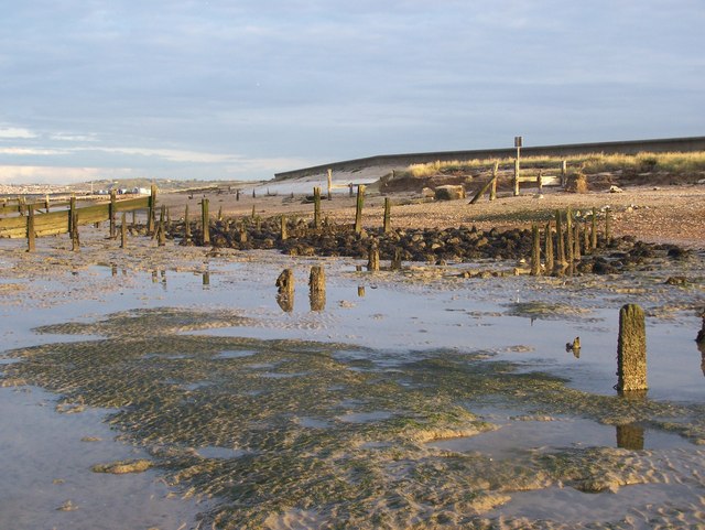
Bells Creek is a picturesque waterway located in Kent, England. It is a small creek that flows into the English Channel, creating an estuary area that is home to a diverse range of flora and fauna.

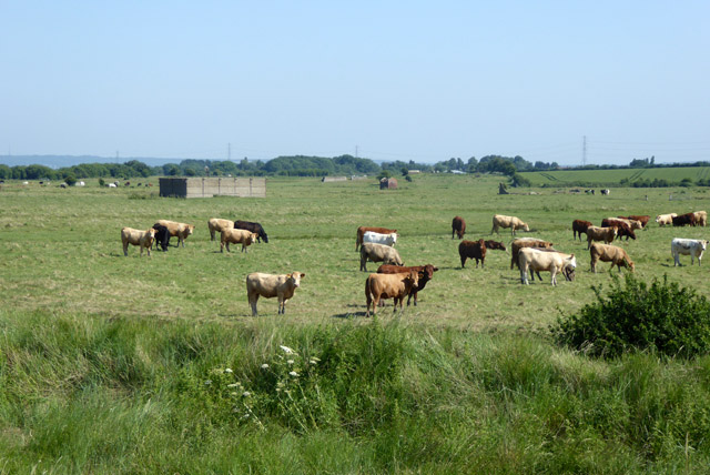
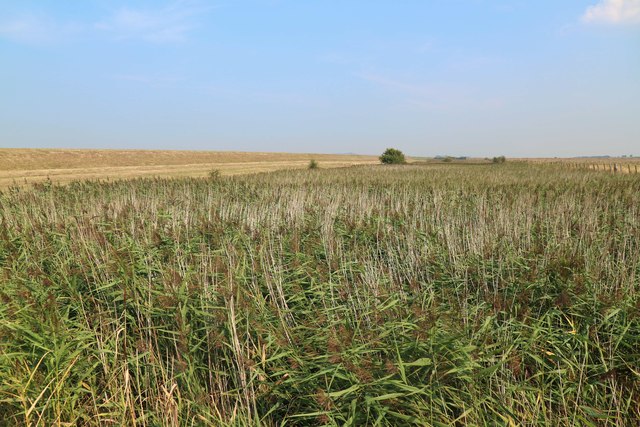
The creek is approximately 2 miles long and is surrounded by beautiful natural scenery, including marshes, reed beds, and salt flats. The surrounding area is largely rural, with scattered residential areas and farmland. Bells Creek is a popular spot for fishing enthusiasts, as it is known for its abundance of fish species such as bass, flounder, and mullet.

The estuary area of Bells Creek is an important habitat for a variety of bird species, making it a popular destination for birdwatchers. Visitors can often spot wading birds such as herons, egrets, and curlews, as well as migratory birds that pass through during certain seasons. The creek is also home to several species of crabs, shrimps, and other marine life.

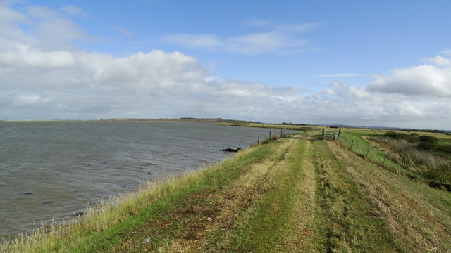
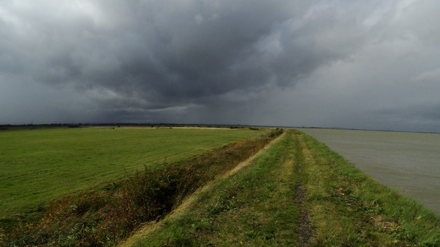
The tidal nature of Bells Creek means that its water levels can vary throughout the day, creating an ever-changing landscape. During high tide, the creek fills with water, allowing boats to navigate its waters. At low tide, the estuary exposes mudflats that are rich in nutrients and attract a range of wildlife.

Overall, Bells Creek in Kent offers a tranquil and scenic environment for nature lovers and those seeking a peaceful retreat by the water. Its diverse ecosystem and stunning natural beauty make it a hidden gem in the region.

If you have any feedback on the listing, please let us know in the comments section below.

Bells Creek Images

Images are sourced within 2km of 51.369103/0.85885261 or Grid Reference TQ9967. Thanks to Geograph Open Source API. All images are credited.

Sluice, Luddenham Gut There are old sea walls going inland some way to either side of the gut, suggesting this area was inned rather later than the rest of the marshes.
Sluice, Luddenham Gut
There are old sea walls going inland some way to either side of the gut, suggesting this area was inned rather later than the rest of the marshes.
Cattle, Luddenham Marshes Extending over a large area beyond the cattle are the widely scattered remains of explosives works and magazines.
Cattle, Luddenham Marshes
Extending over a large area beyond the cattle are the widely scattered remains of explosives works and magazines.
South Deep, Conyer
South Deep, Conyer
Reeds at Teynham Level
Coastal embankment W of Luddenham Gut - view E
Coastal embankment E of Luddenham Gut - at very high tide Nowhere to shelter on this stretch of coast.
Coastal embankment E of Luddenham Gut - at very high tide
Nowhere to shelter on this stretch of coast.
Coastal embankment E of Luddenham Gut - at very high tide One of the highest tides of the year.
Coastal embankment E of Luddenham Gut - at very high tide
One of the highest tides of the year.
Borrowdyke and Boss This Borrowdyke in Emley Nature Reserve is kept clear of reeds so wildfowl feel at home
Borrowdyke and Boss
This Borrowdyke in Emley Nature Reserve is kept clear of reeds so wildfowl feel at home
Spitend Hide This hide is the most easterly one on the Elmley Nature Reserve
Spitend Hide
This hide is the most easterly one on the Elmley Nature Reserve
Windmill Creek The extension of the sea wall has made this creek much smaller than is indicated by the 1940s map
Windmill Creek
The extension of the sea wall has made this creek much smaller than is indicated by the 1940s map
Footpath and fresh cut ditch This footpath runs 14Km from the A249 to Eastchurch looping through Emley Island on the south-west end of the Isle of Sheppey. Here the drainage ditch beside the path has been re-cut to improve drainage.
Footpath and fresh cut ditch
This footpath runs 14Km from the A249 to Eastchurch looping through Emley Island on the south-west end of the Isle of Sheppey. Here the drainage ditch beside the path has been re-cut to improve drainage.
Eastchurch Marshes A view across the flat Eastchurch Marshes towards Elmley. The disused wind pump used to control the water levels in the ditches across Eastchurch Marshes, which have been converted to grassland from arable production.
Eastchurch Marshes
A view across the flat Eastchurch Marshes towards Elmley. The disused wind pump used to control the water levels in the ditches across Eastchurch Marshes, which have been converted to grassland from arable production.
Great Bells Farm Great Bells Farm situated in the middle of Eastchurch Marshes.
Great Bells Farm
Great Bells Farm situated in the middle of Eastchurch Marshes.
Saxon Shore Way footpath between Uplees Marshes and The Swale The Swale Crossing can be seen on the horizon - linking mainland Kent to the Isle of Sheppey.
Saxon Shore Way footpath between Uplees Marshes and The Swale
The Swale Crossing can be seen on the horizon - linking mainland Kent to the Isle of Sheppey.
Sheep Pen on New Rides Farm, Eastchurch
Cattle grazing land, Great Bells Farm, Eastchurch
Reed bed in the vicinity of Great Bells, Eastchurch I would have liked to have walked further south, but it was getting muddier and dark, so turned around and headed back the way I came which was through a disused footpath gate, past the Sheep Shed, along by the old discarded farm equipment and then south.
Reed bed in the vicinity of Great Bells, Eastchurch
I would have liked to have walked further south, but it was getting muddier and dark, so turned around and headed back the way I came which was through a disused footpath gate, past the Sheep Shed, along by the old discarded farm equipment and then south.
Farm buildings in distance from New Rides Farm, Eastchurch
Show me another place!

Bells Creek is located at Grid Ref: TQ9967 (Lat: 51.369103, Lng: 0.85885261)

Administrative County: Kent

District: Swale

Police Authority: Kent

What 3 Words

///awoke.garlic.congested. Near Eastchurch, Kent

Nearby Locations

Bells Creek

Related Wikis

The Swale

The Swale is a tidal channel of the Thames estuary that separates the Isle of Sheppey from the rest of Kent. On its banks is a 6,509.4-hectare (16,085...
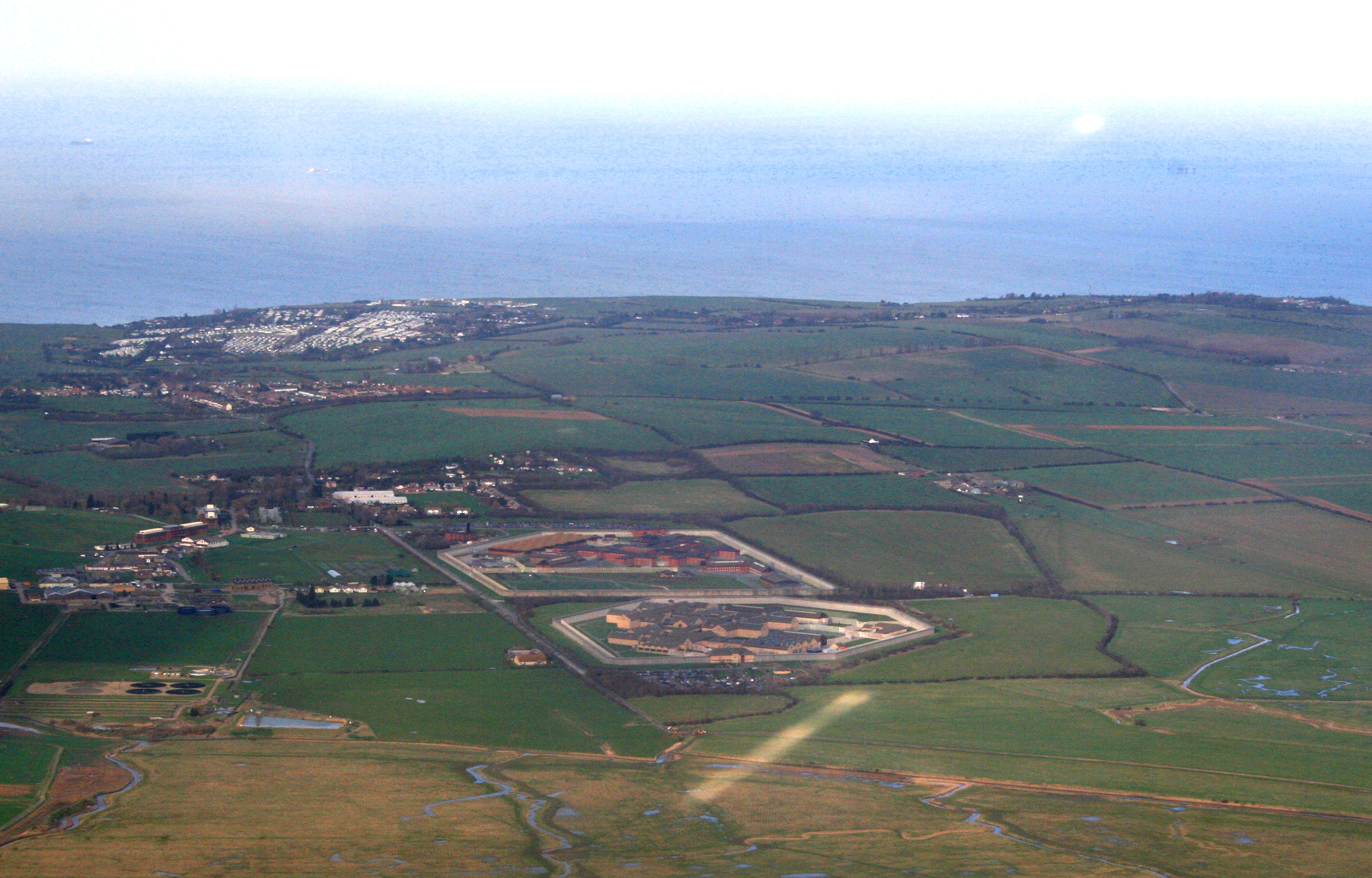
HM Prison Elmley

HM Prison Elmley is a local Category B/C men's prison, located close to the village of Eastchurch on the Isle of Sheppey, Kent. The term 'local' means...

Harty

Harty is a small hamlet on the Isle of Sheppey in Kent consisting of a few cottages, a church and a public house, the Ferry Inn (a Grade II listed building...

HM Prison Swaleside

HM Prison Swaleside is a Category B men's prison, located close to the village of Eastchurch on the Isle of Sheppey, Kent. Swaleside forms part of the...

RAF Eastchurch

Royal Air Force Eastchurch or more simply RAF Eastchurch (formerly RNAS Eastchurch) is a former Royal Air Force station near Eastchurch village, on the...

Uplees

Uplees is a remote hamlet north of Faversham, Kent in southeast England. It was a key part of the Faversham explosives industry during World War I, with...

HM Prison Standford Hill

HM Prison Standford Hill (Sheppey Cluster) is a Category D men's prison, located close to the village of Eastchurch on the Isle of Sheppey, Kent. Standford...
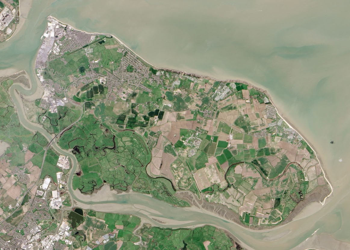
Isle of Sheppey

The Isle of Sheppey is an island off the northern coast of Kent, England, neighbouring the Thames Estuary, centred 42 miles (68 km) from central London...

Nearby Amenities

Located within 500m of 51.369103,0.85885261
The data included in this document is from www.openstreetmap.org. The data is made available under ODbL.

Have you been to Bells Creek?

Leave your review of Bells Creek below (or comments, questions and feedback).