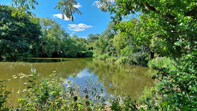
Benfleet Creek

Sea, Estuary, Creek in Essex Castle Point

England

Benfleet Creek

Benfleet Creek
Benfleet Creek Credit: Mark Percy

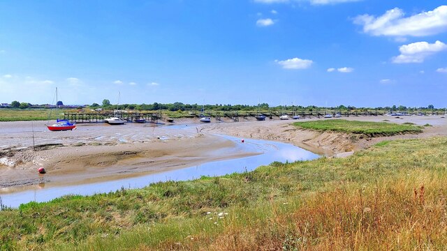
Benfleet Creek is a tidal creek located in Essex, England. It is situated on the northern shore of the Thames Estuary, approximately 30 miles east of London. The creek is formed by the confluence of the River Benfleet and the Hadleigh Ray, which flows into the North Sea.

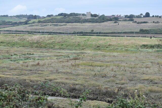
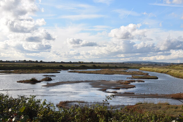
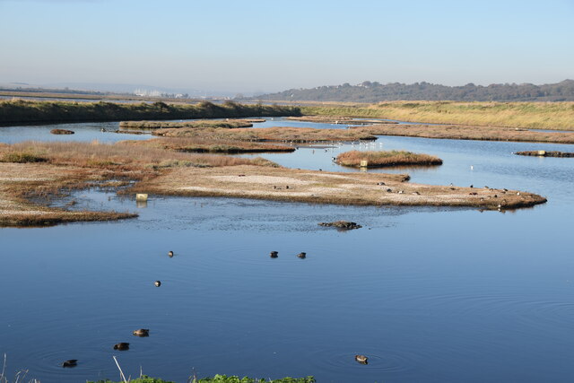
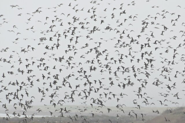
The creek is characterized by its extensive mudflats and saltmarshes, which provide a vital habitat for a diverse range of plant and animal species. The area is designated as a Site of Special Scientific Interest (SSSI) due to its ecological importance and is also part of the Thames Estuary and Marshes Ramsar site, recognizing its international significance for migratory birds.

At low tide, the creek's vast mudflats are exposed, attracting a variety of wading birds such as curlews, oystercatchers, and redshanks. The saltmarshes are home to distinctive plants like samphire and sea lavender, which thrive in the brackish conditions. The creek also supports a rich fish population, including flounder, bass, and mullet.

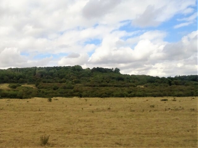
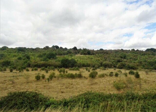
Benfleet Creek is a popular destination for nature enthusiasts, birdwatchers, and walkers who can explore its scenic surroundings. There are several footpaths and trails that wind through the creek, offering stunning views of the estuary and its wildlife. The creek's location near the town of Benfleet provides easy access for visitors, with nearby amenities and public transportation options available.

Overall, Benfleet Creek is a unique and ecologically important area, offering a glimpse into the diverse and vibrant ecosystem of the Thames Estuary.

If you have any feedback on the listing, please let us know in the comments section below.

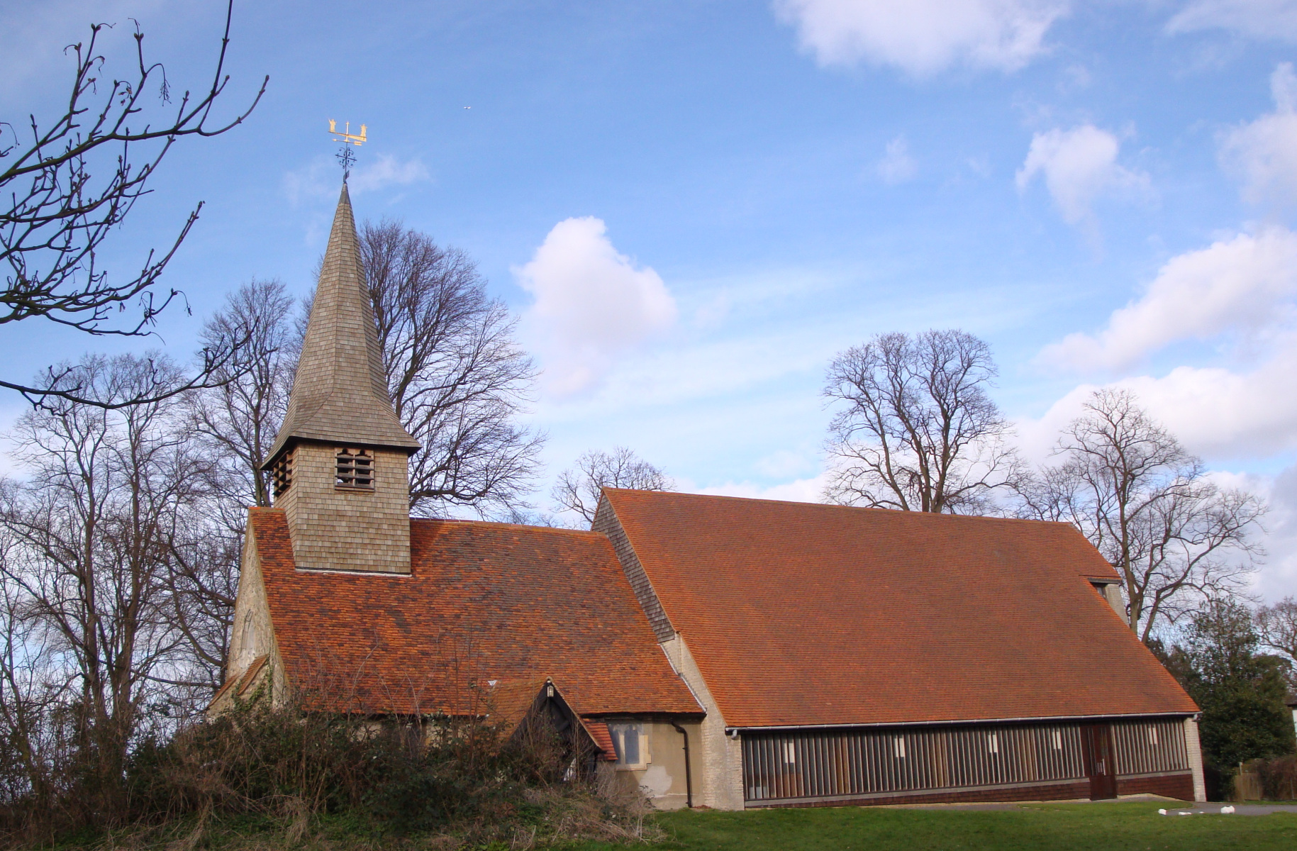
Benfleet Creek Images

Images are sourced within 2km of 51.537786/0.58940265 or Grid Reference TQ7985. Thanks to Geograph Open Source API. All images are credited.

Benfleet Creek
Benfleet Creek
Grazing, Castle Point
Ferry Road, Benfleet
Grazing, Benfleet Downs
Benfleet Flood Barrier Full description at this <span class="nowrap"><a title="https://www.benfleethistory.org.uk/content/browse-articles/areas/the_creek_and_crossing/benfleet-flood-barrier" rel="nofollow ugc noopener" href="https://www.benfleethistory.org.uk/content/browse-articles/areas/the_creek_and_crossing/benfleet-flood-barrier">Link</a><img style="margin-left:2px;" alt="External link" title="External link - shift click to open in new window" src="https://s1.geograph.org.uk/img/external.png" width="10" height="10"/></span>
Benfleet Flood Barrier
Full description at this LinkExternal link
Knightswick pumping station & outfall channel, Canvey Island The watercourse seen here cuts through an area of the island shown on maps as Sunken Marsh and flows into Tewkes Creek. Lakeside Crescent is on the left.
Knightswick pumping station & outfall channel, Canvey Island
The watercourse seen here cuts through an area of the island shown on maps as Sunken Marsh and flows into Tewkes Creek. Lakeside Crescent is on the left.
View across Hadleigh Marsh With the remains of Hadleigh Castle in the distance.
View across Hadleigh Marsh
With the remains of Hadleigh Castle in the distance.
Lagoon on Two Tree Island Looking west across the non-tidal lagoon. It is a prime spot - especially in autumn, winter and spring - for observing waders and other birds. On this visit I saw lapwing, avocets, dunlin, ring plovers, redshank, oyster catchers, curlew, godwits and a kestrel. The whole of Two Tree Island is now a nature reserve run by Essex Wildlife Trust. For a view of the lagoon 16 years ago, and further information see <a href="https://www.geograph.org.uk/photo/41419">TQ8184 : Lagoon on Two Tree Island</a> by contributor Glyn Baker.
Lagoon on Two Tree Island
Looking west across the non-tidal lagoon. It is a prime spot - especially in autumn, winter and spring - for observing waders and other birds. On this visit I saw lapwing, avocets, dunlin, ring plovers, redshank, oyster catchers, curlew, godwits and a kestrel. The whole of Two Tree Island is now a nature reserve run by Essex Wildlife Trust. For a view of the lagoon 16 years ago, and further information see TQ8184 : Lagoon on Two Tree Island by contributor Glyn Baker.
Lagoon, Two Tree Island The lagoon is maintained by Essex Wildlife Trust and is a part of Two Tree nature reserve. For more information and a similar view from 10 years ago, see <a href="https://www.geograph.org.uk/photo/2750194">TQ8184 : Lagoon, Two Tree Island</a>.
Lagoon, Two Tree Island
The lagoon is maintained by Essex Wildlife Trust and is a part of Two Tree nature reserve. For more information and a similar view from 10 years ago, see TQ8184 : Lagoon, Two Tree Island.
A fling of dunlins Fling is (apparently) the collective noun for a flock of dunlin here seen above the lagoon at the western end of Essex Wildlife Two Tree Island Reserve. Some golden plover are among them.
A fling of dunlins
Fling is (apparently) the collective noun for a flock of dunlin here seen above the lagoon at the western end of Essex Wildlife Two Tree Island Reserve. Some golden plover are among them.
Hadleigh Castle The castle was begun around 1215 by Hubert de Burgh, but extensively refortified by Edward III during the Hundred Years War, becoming a favourite residence of the ageing king.
Hadleigh Castle
The castle was begun around 1215 by Hubert de Burgh, but extensively refortified by Edward III during the Hundred Years War, becoming a favourite residence of the ageing king.
Hadleigh Castle The castle was begun around 1215 by Hubert de Burgh, but extensively refortified by Edward III during the Hundred Years War, becoming a favourite residence of the ageing king.

Seen here is one of the three-storey towers at the eastern side which stands to nearly full height with narrow rectangular windows in the upper levels.
Hadleigh Castle
The castle was begun around 1215 by Hubert de Burgh, but extensively refortified by Edward III during the Hundred Years War, becoming a favourite residence of the ageing king. Seen here is one of the three-storey towers at the eastern side which stands to nearly full height with narrow rectangular windows in the upper levels.
Hadleigh Country Park Overlooking the Thames Estuary, Hadleigh Country Park covers 152 hectares (387 acres) making it one of the largest country parks in Essex.  It comprises woodland, pasture, hay meadow and marsh with old hedgerows and ponds.

In 2012 parts of the park became the venue for the Olympic mountain bike events and it continues to attract MTB enthusiasts.
Hadleigh Country Park
Overlooking the Thames Estuary, Hadleigh Country Park covers 152 hectares (387 acres) making it one of the largest country parks in Essex. It comprises woodland, pasture, hay meadow and marsh with old hedgerows and ponds. In 2012 parts of the park became the venue for the Olympic mountain bike events and it continues to attract MTB enthusiasts.
Pond in Hadleigh Country Park
Stubble field, Hadleigh Marsh
Field, Hadleigh Marsh
Sandpit Hill, Hadleigh Park Looking south towards the Thames Estuary with the drought-stricken grassy hillsides of Sandpit Hill in the foreground.
Sandpit Hill, Hadleigh Park
Looking south towards the Thames Estuary with the drought-stricken grassy hillsides of Sandpit Hill in the foreground.
Hadleigh Castle Hadleigh was begun in about 1215 by Hubert de Burgh, but extensively refortified by Edward III during the Hundred Years War, becoming a favourite residence of the ageing king. 
The barbican and two striking drum towers – one later used by Georgian revenue men looking out for smugglers – are part of his substantial building works during the 1360s.
Wikipedia for a fuller history: <span class="nowrap"><a title="http://en.wikipedia.org/wiki/Hadleigh_Castle" rel="nofollow ugc noopener" href="http://en.wikipedia.org/wiki/Hadleigh_Castle">Link</a><img style="margin-left:2px;" alt="External link" title="External link - shift click to open in new window" src="https://s1.geograph.org.uk/img/external.png" width="10" height="10"/></span>
Hadleigh Castle
Hadleigh was begun in about 1215 by Hubert de Burgh, but extensively refortified by Edward III during the Hundred Years War, becoming a favourite residence of the ageing king. The barbican and two striking drum towers – one later used by Georgian revenue men looking out for smugglers – are part of his substantial building works during the 1360s. Wikipedia for a fuller history: LinkExternal link
Show me another place!

Benfleet Creek is located at Grid Ref: TQ7985 (Lat: 51.537786, Lng: 0.58940265)

Administrative County: Essex

District: Castle Point

Police Authority: Essex

What 3 Words

///dwarf.call.forehand. Near Canvey Island, Essex

Nearby Locations

Benfleet Creek

Related Wikis

Castle Point

Castle Point is a local government district with borough status in south Essex, England, lying 30 miles (48 km) east of central London. The borough comprises...

Castle View School

Castle View School is a comprehensive school for ages 11–16, located on Canvey Island in Essex, England, sited on the old Furtherwick School site in the...

Canvey Lake

Canvey Lake is an 8.3 hectare Local Nature Reserve in Canvey Island in Essex. It is owned by Castle Point Borough Council and managed by the council together...

Benfleet Urban District

Benfleet Urban District was an urban district in the county of Essex, England. It was created on 1 October 1929 from the parts of Rochford Rural District...

Castle Point (UK Parliament constituency)

Castle Point is a constituency in Essex represented in the House of Commons of the UK Parliament since 2010 by Rebecca Harris, a Conservative. == Constituency... ==

Hadleigh Farm

Hadleigh Farm is an educational working farm and cross-country cycling venue located in Hadleigh, within the borough of Castle Point, in the county of...
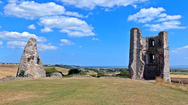
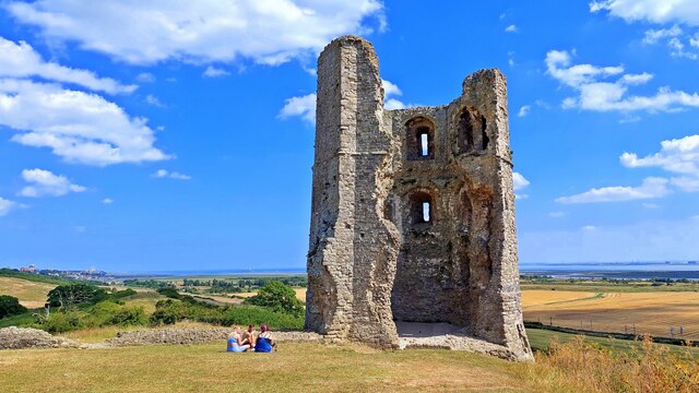
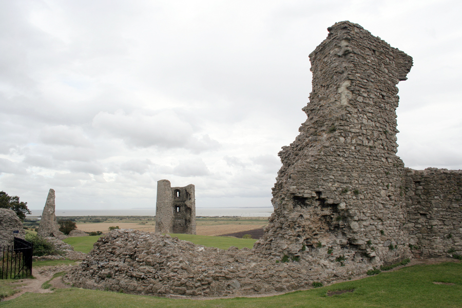
Hadleigh Castle

Hadleigh Castle is a ruined fortification in the English county of Essex, overlooking the Thames Estuary from south of the town of Hadleigh. Built after...

Canvey Island

Canvey Island is a town, civil parish and reclaimed island in the Thames estuary, near Southend-on-Sea, in the Castle Point district, in the county of...

Nearby Amenities

Located within 500m of 51.537786,0.58940265
Source: PGS
Lat/Long: 51.534191/0.5933377
Source: PGS
Lat/Long: 51.5343862/0.5923721
Source: PGS
Lat/Long: 51.5344259/0.5909559
Source: PGS
Lat/Long: 51.5349832/0.5890891
Source: PGS
Lat/Long: 51.5355538/0.5872544
Source: PGS
Lat/Long: 51.5355594/0.5870184
Source: PGS
Lat/Long: 51.5355711/0.5854198
Golf: pin
Lat/Long: 51.5334008/0.5885215
Golf: pin
Lat/Long: 51.5341132/0.5892366
The data included in this document is from www.openstreetmap.org. The data is made available under ODbL.

Have you been to Benfleet Creek?

Leave your review of Benfleet Creek below (or comments, questions and feedback).