Little Powder Creek

Sea, Estuary, Creek in Kent Dartford

England

Little Powder Creek

Ferries at Purfleet Closest to camera is Mazarine operating the Purfleet-Rotterdam route.  the second vessel is Pauline on the Zeebrugge route.
Ferries at Purfleet Credit: Martin Addison

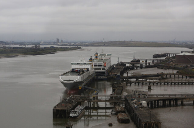
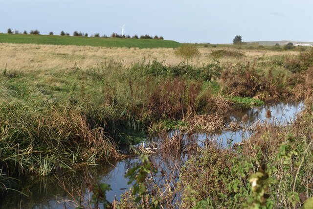
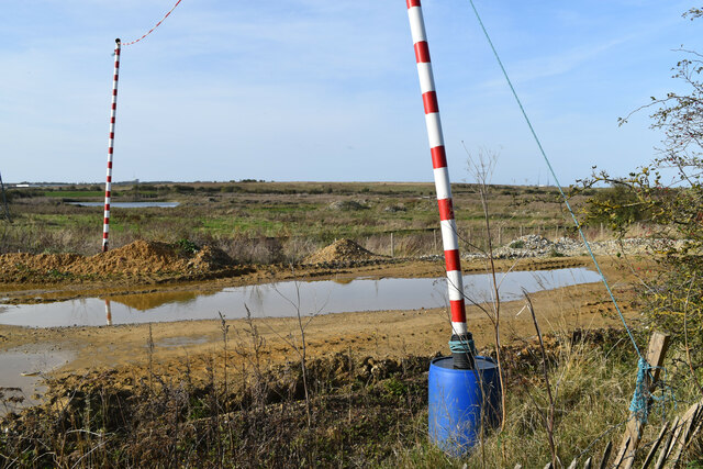
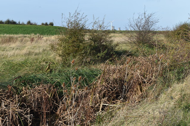
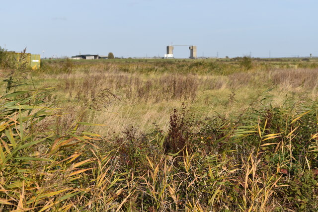
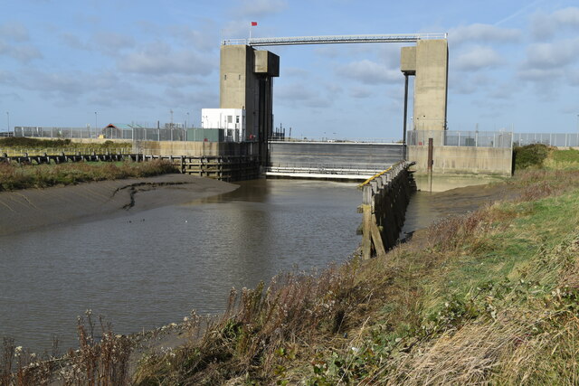
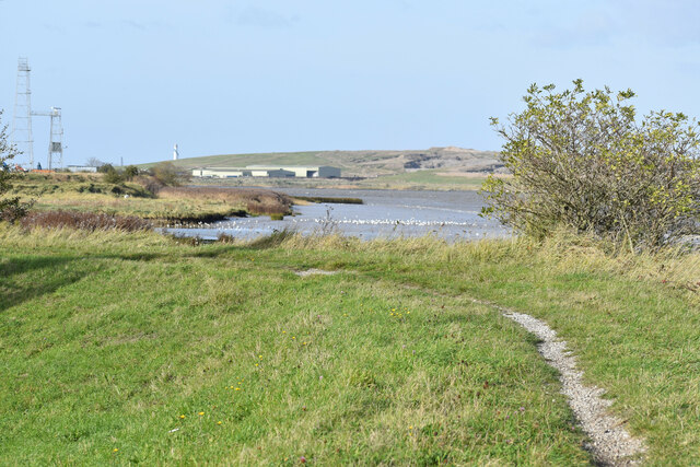
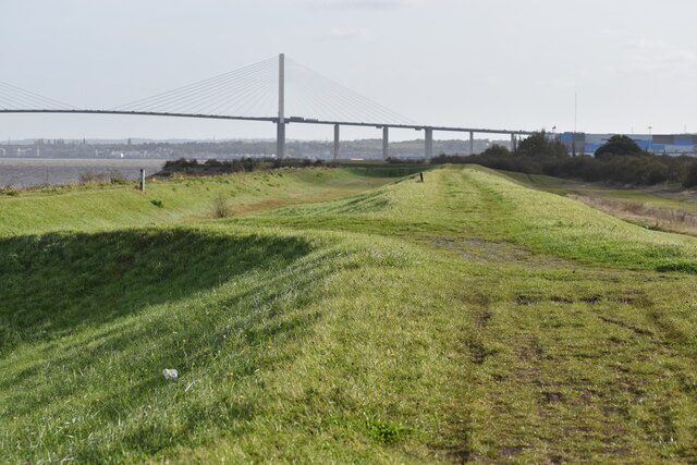
Little Powder Creek is a small creek located in Kent, England. It flows into the North Sea, creating an estuary where the freshwater from the creek mixes with the saltwater from the sea. The creek is surrounded by marshlands and mudflats, providing a rich habitat for various species of birds, fish, and other wildlife.

The water in Little Powder Creek is typically brackish, with a mixture of saltwater and freshwater due to the estuarine environment. The creek is influenced by the tides, with water levels rising and falling throughout the day. It is a popular spot for birdwatching and wildlife enthusiasts, as the marshlands and mudflats attract a diverse range of species.

The surrounding area of Little Powder Creek is also popular for walking and hiking, with scenic views of the estuary and the surrounding countryside. The creek is an important natural feature in the area, providing a habitat for wildlife and contributing to the overall biodiversity of the region.

If you have any feedback on the listing, please let us know in the comments section below.

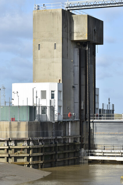
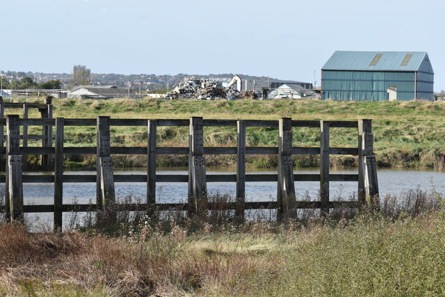
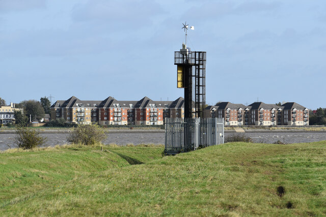
Little Powder Creek Images

Images are sourced within 2km of 51.468971/0.24002239 or Grid Reference TQ5576. Thanks to Geograph Open Source API. All images are credited.

Ferries at Purfleet Closest to camera is Mazarine operating the Purfleet-Rotterdam route.  the second vessel is Pauline on the Zeebrugge route.
Ferries at Purfleet
Closest to camera is Mazarine operating the Purfleet-Rotterdam route. the second vessel is Pauline on the Zeebrugge route.
Apartment block beside Fastrack dedicated bus route For details see <span class="nowrap"><a title="https://www.go-fastrack.co.uk/" rel="nofollow ugc noopener" href="https://www.go-fastrack.co.uk/">Link</a><img style="margin-left:2px;" alt="External link" title="External link - shift click to open in new window" src="https://s1.geograph.org.uk/img/external.png" width="10" height="10"/></span>
Apartment block beside Fastrack dedicated bus route
For details see LinkExternal link
Entrance to Fastrack dedicated bus route For details see <span class="nowrap"><a title="https://www.go-fastrack.co.uk/" rel="nofollow ugc noopener" href="https://www.go-fastrack.co.uk/">Link</a><img style="margin-left:2px;" alt="External link" title="External link - shift click to open in new window" src="https://s1.geograph.org.uk/img/external.png" width="10" height="10"/></span>
Entrance to Fastrack dedicated bus route
For details see LinkExternal link
Fastrack bus route at junction with Marsh Street North For details see <span class="nowrap"><a title="https://www.go-fastrack.co.uk/" rel="nofollow ugc noopener" href="https://www.go-fastrack.co.uk/">Link</a><img style="margin-left:2px;" alt="External link" title="External link - shift click to open in new window" src="https://s1.geograph.org.uk/img/external.png" width="10" height="10"/></span>
Fastrack bus route at junction with Marsh Street North
For details see LinkExternal link
Byway passing office building at The Bridge
Modern housing at Joyce Green Lane
Modern housing in Brunel Way
Houses in Brunel Way, seen from footpath
Drainage ditch beside Joyce Green Lane
Sand and gravel quarrying beside Joyce Green Lane
Ditch and marshland beside Joyce Green Lane The grassy bank on the left is the flood bank beside Dartford Creek, which is not accessible from Joyce Green Lane.
Ditch and marshland beside Joyce Green Lane
The grassy bank on the left is the flood bank beside Dartford Creek, which is not accessible from Joyce Green Lane.
Dartford Marshes View across the marshes to the Dartford Creek Barrier, seen from a bend in Joyce Green Lane.
Dartford Marshes
View across the marshes to the Dartford Creek Barrier, seen from a bend in Joyce Green Lane.
Dartford Creek Flood Barrier The barrier was closed due to an approaching high tide, with the river level in the Thames already a couple of metres above that in the Darent.
Dartford Creek Flood Barrier
The barrier was closed due to an approaching high tide, with the river level in the Thames already a couple of metres above that in the Darent.
West tower of Dartford Creek Flood Barrier A guillotine-style barrier with two moving sections lowered on chains into the river, protecting Dartford Creek and surrounding areas from high water levels in the Thames beyond.
West tower of Dartford Creek Flood Barrier
A guillotine-style barrier with two moving sections lowered on chains into the river, protecting Dartford Creek and surrounding areas from high water levels in the Thames beyond.
Footpath at mouth of the River Darent, with distant view of the Thames
Dartford Creek, just below the flood barrier
Beacon at the mouth of Dartford Creek The riverside apartments are at Purfleet on the opposite bank of the Thames.
Beacon at the mouth of Dartford Creek
The riverside apartments are at Purfleet on the opposite bank of the Thames.
On the Thames flood bank at Dartford Marshes The grass bank is part of the Thames flood protection system. The Queen Elizabeth II Bridge is in the distance.
On the Thames flood bank at Dartford Marshes
The grass bank is part of the Thames flood protection system. The Queen Elizabeth II Bridge is in the distance.
Show me another place!

Little Powder Creek is located at Grid Ref: TQ5576 (Lat: 51.468971, Lng: 0.24002239)

Administrative County: Kent

District: Dartford

Police Authority: Kent

What 3 Words

///pipe.dates.meals. Near Purfleet, Essex

Nearby Locations

Little Powder Creek

Related Wikis

Long Reach sewage treatment works

The Long Reach sewage treatment works is located in Dartford, Kent adjacent to the River Thames. It treats the sewage from a population of 837,000 in a...

Littlebrook Power Station

The Littlebrook Power Station were a series of four oil and coal-fired power stations situated on the south bank of the River Thames, next to the Queen...

Joyce Green Hospital

Joyce Green Hospital was a hospital near Dartford, Kent, England. It opened in 1903 as an isolation hospital. In later years it was a training hospital...

Joyce Green, Kent

Joyce Green is an area of Dartford in Kent, England. The former Joyce Green Hospital and Royal Flying Corps Station Joyce Green used to be in the area...

Nearby Amenities

Located within 500m of 51.468971,0.24002239
Power: transformer
Voltage: 400000;275000
Lat/Long: 51.4650431/0.2380528
Power: transformer
Voltage: 400000;275000
Lat/Long: 51.4648759/0.2383968
Note: Sewer outfall, as indicated by signage on the bank, and can be seen on aerial imagery
Waterway: outfall
Lat/Long: 51.4708047/0.2377215
Long Reach
Place: locality
Source: OS _OpenData_StreetView
Lat/Long: 51.4691299/0.2466385
Loading Dock
Lat/Long: 51.4658638/0.2448346
Loading Dock
Lat/Long: 51.4658925/0.2447742
Loading Dock
Lat/Long: 51.465918/0.2447206
Loading Dock
Lat/Long: 51.4659492/0.2446552
Loading Dock
Lat/Long: 51.4659798/0.2445907
Loading Dock
Lat/Long: 51.4660065/0.2445345
Loading Dock
Lat/Long: 51.466174/0.2441823
Loading Dock
Lat/Long: 51.4662086/0.2441116
Loading Dock
Lat/Long: 51.4662379/0.24405
Loading Dock
Lat/Long: 51.4662655/0.2439919
Loading Dock
Lat/Long: 51.4662962/0.2439276
Loading Dock
Lat/Long: 51.466326/0.2438649
Loading Dock
Lat/Long: 51.4663595/0.2437945
Loading Dock
Lat/Long: 51.4664122/0.2436837
Bus Stop
Amazon LCY3
Bus: yes
Local Ref: W-bound
Naptan AtcoCode: 2400109480
Naptan Bearing: SE
Naptan BusStopType: MKD
Naptan CommonName: Rennie Drive
Naptan Indicator: o/s
Naptan Landmark: Amazon Fulfilment Centre
Naptan NaptanCode: kntjawpd
Naptan RevisionNumber: 1
Naptan Status: act
Naptan Street: Rennie Drive
Naptan Verified: no
Public Transport: platform
Ref: kntjawpd
Shelter: no
Source: NaPTAN DATA
Lat/Long: 51.4646913/0.2418525
Street Lamp
Lat/Long: 51.4664158/0.2365856
Street Lamp
Lat/Long: 51.4662575/0.2367311
Seamark Beacon Cardinal Category: north
Seamark Beacon Cardinal Colour: black;yellow
Seamark Beacon Cardinal Colour Pattern: horizontal
Seamark Beacon Cardinal Shape: pile
Seamark Light Character: VQ
Seamark Light Colour: white
Seamark Name: Intake Caisson
Seamark Topmark Colour: black
Seamark Topmark Shape: 2 cones up
Seamark Type: beacon_cardinal
Lat/Long: 51.4698676/0.2411635
Seamark Beacon Special Purpose Category: pipeline
Seamark Beacon Special Purpose Shape: pile
Seamark Fog Signal Category: horn
Seamark Fog Signal Group: 1
Seamark Fog Signal Period: 20
Seamark Light Character: Fl
Seamark Light Colour: white
Seamark Light Group: 2
Seamark Light Period: 10
Seamark Topmark Colour: black
Seamark Topmark Shape: 2 spheres
Seamark Type: beacon_special_purpose
Lat/Long: 51.4684149/0.2450315
Seamark Light Colour: red
Seamark Type: light_minor
Lat/Long: 51.467025/0.2457827
The data included in this document is from www.openstreetmap.org. The data is made available under ODbL.

Have you been to Little Powder Creek?

Leave your review of Little Powder Creek below (or comments, questions and feedback).