Lawyers' Creek

Sea, Estuary, Creek in Lincolnshire South Holland

England

Lawyers' Creek

Parking below the sea wall at the end of Barge Road
Parking below the sea wall at the end of Barge Road Credit: Jonathan Thacker

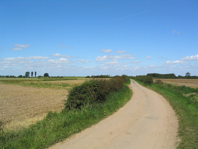
Lawyers' Creek is a natural waterway located in Lincolnshire, a county in eastern England. It is commonly referred to as a creek, although it is also classified as an estuary due to its unique characteristics. The creek extends for approximately 5 miles, running through a picturesque landscape with rolling hills and lush vegetation.

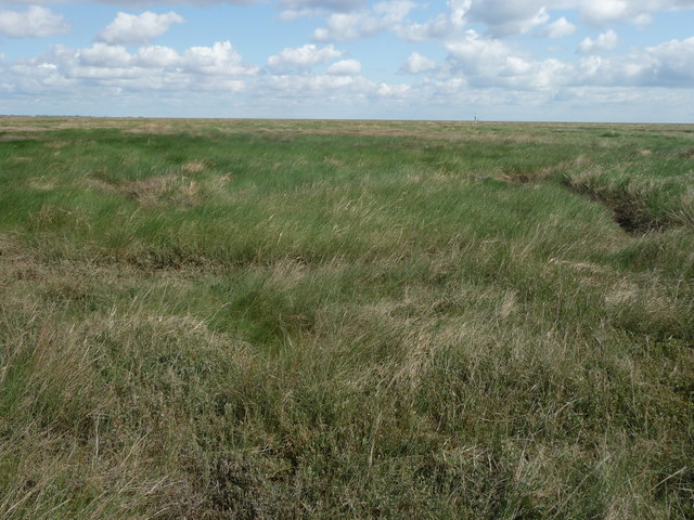
Situated along the coastline, Lawyers' Creek is directly connected to the North Sea, making it subject to tidal movements. During high tide, seawater flows into the creek, creating a brackish environment where freshwater from surrounding rivers and streams mixes with saltwater. This creates a diverse ecosystem, supporting a wide range of flora and fauna.

The creek is surrounded by marshlands and mudflats, which serve as important habitats for various bird species, including waders and waterfowl. The area is also home to several species of fish and invertebrates, which thrive in the rich and nutrient-filled waters.

Lawyers' Creek is renowned for its natural beauty and is a popular destination for outdoor enthusiasts and nature lovers. Visitors can enjoy activities such as birdwatching, walking along the creek's banks, or simply immersing themselves in the tranquil surroundings.

The creek's name, Lawyers' Creek, has an interesting origin. It is believed to have derived from the fact that lawyers from nearby towns used to visit the area for relaxation and leisure activities, hence giving it this unique name.

Overall, Lawyers' Creek is a remarkable natural feature in Lincolnshire, offering a serene and diverse environment that attracts both locals and tourists alike.

If you have any feedback on the listing, please let us know in the comments section below.

Lawyers' Creek Images

Images are sourced within 2km of 52.898135/0.091985518 or Grid Reference TF4035. Thanks to Geograph Open Source API. All images are credited.

Parking below the sea wall at the end of Barge Road
Sea bank near Holbeach St Matthew The sea bank dates from about 1950.
Sea bank near Holbeach St Matthew
The sea bank dates from about 1950.
Out on the saltmarsh On the edge of the RAF Holbeach Danger Area and with an incoming tide, this was as far as I was prepared to go.
Out on the saltmarsh
On the edge of the RAF Holbeach Danger Area and with an incoming tide, this was as far as I was prepared to go.
Channel in the saltmarsh Seen from a path which wanders out into the saltmarsh.
Channel in the saltmarsh
Seen from a path which wanders out into the saltmarsh.
Sea bank near Holbeach St Matthew RAF Holbeach bombing range on the left.
Sea bank near Holbeach St Matthew
RAF Holbeach bombing range on the left.
Lawyers Sluice Lawyers sluice. Draining the land water to the sea
Lawyers Sluice
Lawyers sluice. Draining the land water to the sea
'The Edge of Nowhere' Near Holbeach St Matthew Visiting in January 'because it's there,' I was struck with a genuine feeling that I shouldn't be there! This is a public footpath along the edge of the coast, to the right of which is a military firing range. Enough said.
'The Edge of Nowhere' Near Holbeach St Matthew
Visiting in January 'because it's there,' I was struck with a genuine feeling that I shouldn't be there! This is a public footpath along the edge of the coast, to the right of which is a military firing range. Enough said.
The Thrills and Spills of a Day At The Wash Not your average day trip to the seaside, this.
The Thrills and Spills of a Day At The Wash
Not your average day trip to the seaside, this.
Drainage channel, sea defences and salt marsh
Salt Marshes and the Wash
Barge Road The road leads to a car park, and access to long bridleways and footpaths along the sea banks skirting The Wash
Barge Road
The road leads to a car park, and access to long bridleways and footpaths along the sea banks skirting The Wash
Footpath at Barge Road Car Park Footpath at Barge Road Car Park North of Holbeach St Matthew
Footpath at Barge Road Car Park
Footpath at Barge Road Car Park North of Holbeach St Matthew
saltmarsh and drained land At about 16:12 hrs
saltmarsh and drained land
At about 16:12 hrs
Pillbox on sea wall A remnant from the Second World War, when defences were needed both against the sea, and against what might come from it.
Pillbox on sea wall
A remnant from the Second World War, when defences were needed both against the sea, and against what might come from it.
Salt-marsh on the edge of The Wash On this section of the wash it is possible to venture some distance beyond the sea wall without seeing the sea, particularly at low tide. This is part of the large expanse of salt marsh, beyond which lies several miles of mudflats and sandbanks.
Salt-marsh on the edge of The Wash
On this section of the wash it is possible to venture some distance beyond the sea wall without seeing the sea, particularly at low tide. This is part of the large expanse of salt marsh, beyond which lies several miles of mudflats and sandbanks.
Channel in saltmarsh One of many small channels which drain the saltmarsh on the edge of The Wash.
Channel in saltmarsh
One of many small channels which drain the saltmarsh on the edge of The Wash.
Top of Lawyers' Sluice Piling wall above the sluice draining to The Wash to the left.  Note the unusual weather vane.
Top of Lawyers' Sluice
Piling wall above the sluice draining to The Wash to the left. Note the unusual weather vane.
For sand, read wonderful mud The map says the surface is sand, but the truth is clearly different.  After a long hard slog to get to 'the sands' it was an even harder slog to walk across the area.  But what peace and what beauty!
For sand, read wonderful mud
The map says the surface is sand, but the truth is clearly different. After a long hard slog to get to 'the sands' it was an even harder slog to walk across the area. But what peace and what beauty!
Show me another place!

Lawyers' Creek is located at Grid Ref: TF4035 (Lat: 52.898135, Lng: 0.091985518)

Administrative County: Lincolnshire

District: South Holland

Police Authority: Lincolnshire

What 3 Words

///ballpoint.overjoyed.caller. Near Fishtoft, Lincolnshire

Nearby Locations

Lawyers' Creek

Related Wikis

Holbeach St Matthew

Holbeach St Matthew is a small fenland village in the South Holland district of southern Lincolnshire, England. It lies 6 miles (10 km) north-east from...

River Welland

The River Welland is a lowland river in the east of England, some 65 miles (105 km) long. It drains part of the Midlands eastwards to The Wash. The river...

HM Prison North Sea Camp

HM Prison North Sea Camp is a men's open prison (Category D), located on the edge of the parish of Freiston (near Boston) in Lincolnshire, England. North...

Holbeach St Marks

Holbeach St Marks is a fenland village in the South Holland district of southern Lincolnshire, England. It is 5 miles (8 km) north from Holbeach, 3 miles...

RSPB Frampton Marsh

Frampton Marsh is a nature reserve in Lincolnshire, England. The reserve is situated on the coast of The Wash, some 4 miles from the town of Boston, between...
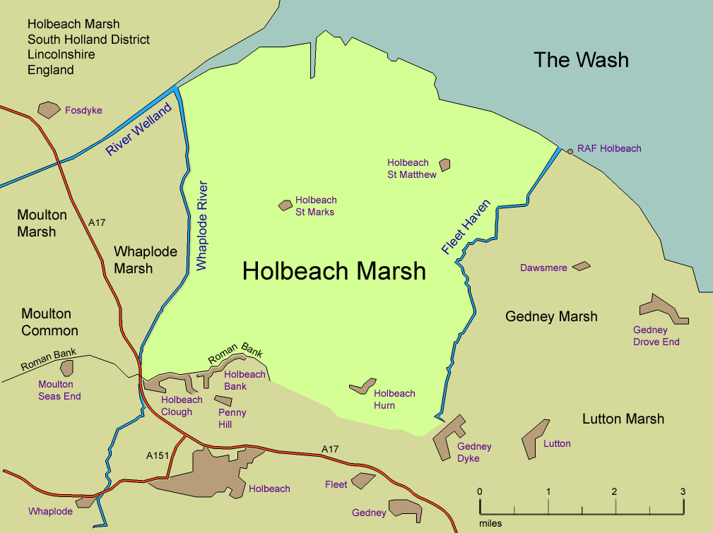
Holbeach Marsh

Holbeach Marsh is a fenland area in the South Holland district of Lincolnshire, England. Holbeach Marsh is situated between the market town of Holbeach...

Pilgrim Fathers Memorial

The Pilgrim Fathers Memorial is located on the north bank of The Haven at the site of the former Scotia Creek, Fishtoft, seaward of Boston in Lincolnshire...

Holbeach Air Weapons Range

Holbeach Air Weapons Range is a United Kingdom Ministry of Defence academic air weapons range (AWR) situated between Boston and King's Lynn in the civil...

Have you been to Lawyers' Creek?

Leave your review of Lawyers' Creek below (or comments, questions and feedback).