Cutmill Creek

Sea, Estuary, Creek in Sussex Chichester

England

Cutmill Creek

Nutbourne Station
Nutbourne Station Credit: David Martin

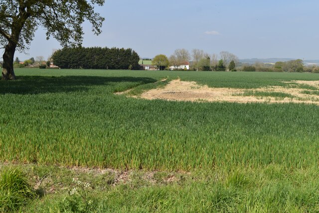
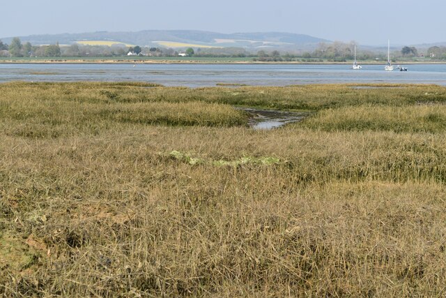
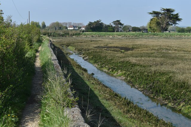
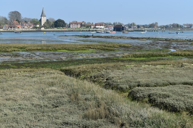
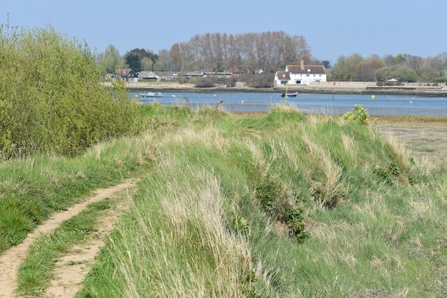
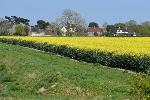
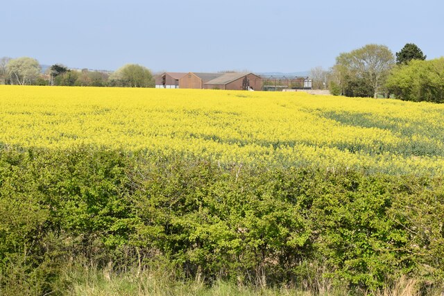
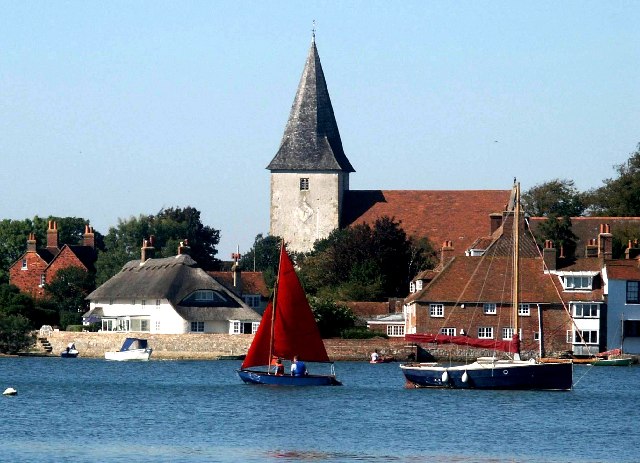
Cutmill Creek is a picturesque waterway located in Sussex, England. It is a small estuary that connects the sea with the land, forming a tranquil creek surrounded by beautiful coastal scenery. The creek is situated near the town of Littlehampton, flowing into the English Channel.

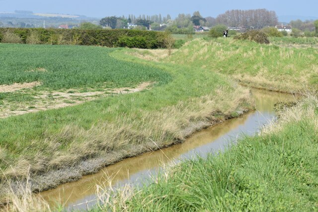
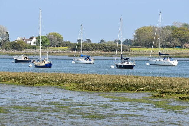
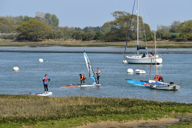
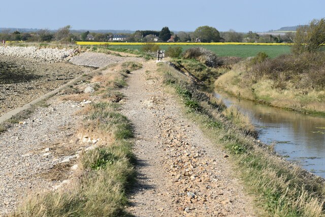
The creek is known for its calm and serene atmosphere, making it an ideal spot for leisure activities such as boating, fishing, and bird watching. The surrounding marshlands and reed beds provide a haven for various bird species, including herons, waders, and ducks, making it a popular destination for bird enthusiasts.

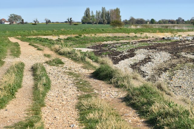
Cutmill Creek is also home to a diverse range of marine life. The nutrient-rich waters support a variety of fish, including mullet, bass, and flounder, attracting anglers from far and wide. During low tide, the creek reveals a vast expanse of mudflats, which attract wading birds and provide a unique habitat for marine invertebrates.

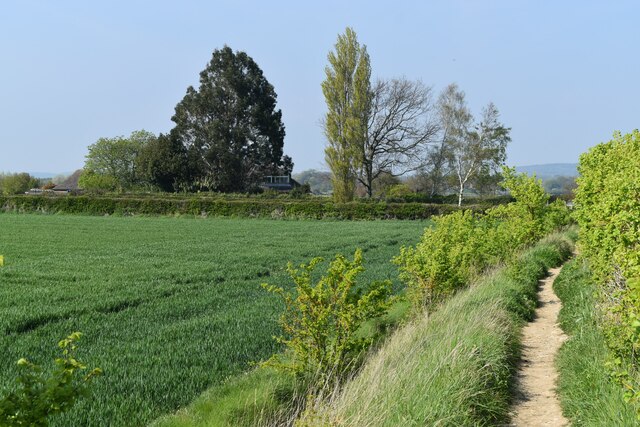
The creek's location near the sea offers stunning views of the surrounding coastline, with sandy beaches and rugged cliffs creating a picturesque backdrop. The nearby nature reserve and walking trails provide opportunities for exploration and discovery, allowing visitors to immerse themselves in the natural beauty of the area.

Overall, Cutmill Creek is a hidden gem in Sussex, offering a peaceful retreat for nature lovers and outdoor enthusiasts alike. Its diverse ecosystem, tranquil waters, and stunning surroundings make it a must-visit destination for anyone seeking a connection with nature in this part of England.

If you have any feedback on the listing, please let us know in the comments section below.

Cutmill Creek Images

Images are sourced within 2km of 50.835114/-0.86698941 or Grid Reference SU7904. Thanks to Geograph Open Source API. All images are credited.

Nutbourne Station
Nutbourne Station
Level crossing at Nutbourne Station
View across fields towards Flat Farm
Small green at the end of Chidham Lane
Northern end of Bosham Channel
On the sea wall at Chidham
On the shore opposite Bosham
Coastal path near Easton Farm
Coastal path beside Bosham Channel
Drainage ditch behind sea wall
Boats moored in Bosham Channel
Sailing down Bosham Channel
Windsurfing lesson in the Bosham Channel I think at this point the instructor was the only one with the sail upright, but I'm not mocking, as I'm sure I couldn't do it!
Windsurfing lesson in the Bosham Channel
I think at this point the instructor was the only one with the sail upright, but I'm not mocking, as I'm sure I couldn't do it!
Chidham village, across oilseed rape field
Coastal path near Chidham Point
Oilseed rape field near Hovel Barn
On the shore at the end of Thorney Channel This is the landward end of the channel that separates Thorney Island from the Chidham Peninsula.
On the shore at the end of Thorney Channel
This is the landward end of the channel that separates Thorney Island from the Chidham Peninsula.
Oilseed rape field, looking towards Nutbourne
Show me another place!

Cutmill Creek is located at Grid Ref: SU7904 (Lat: 50.835114, Lng: -0.86698941)

Administrative County: West Sussex

District: Chichester

Police Authority: Sussex

What 3 Words

///elbowing.blushed.boarded. Near Bosham, West Sussex

Related Wikis

Bosham

Bosham ( ) is a coastal village, ecclesiastical parish and civil parish in the Chichester District of West Sussex,within the historic county of West Sussex...

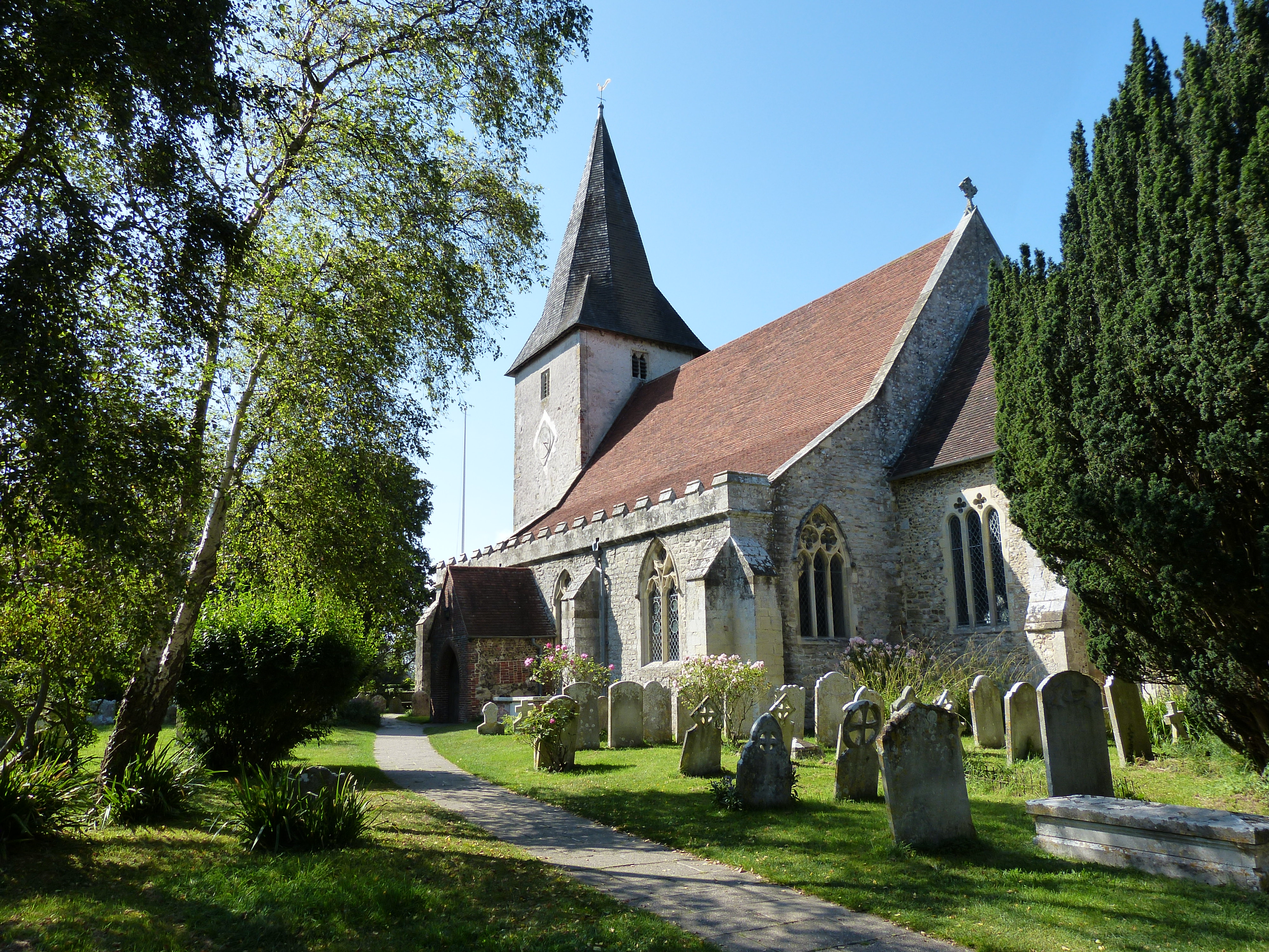
Holy Trinity Church, Bosham

Holy Trinity Church is a Grade I listed Anglican church, a parish church in Bosham, West Sussex. There was a church on this site in Saxon times, and the...

Bosham Sailing Club

Bosham Sailing Club is the oldest sailing club in Chichester Harbour and was founded in 1907 It is located in the historic village of Bosham in West Sussex...

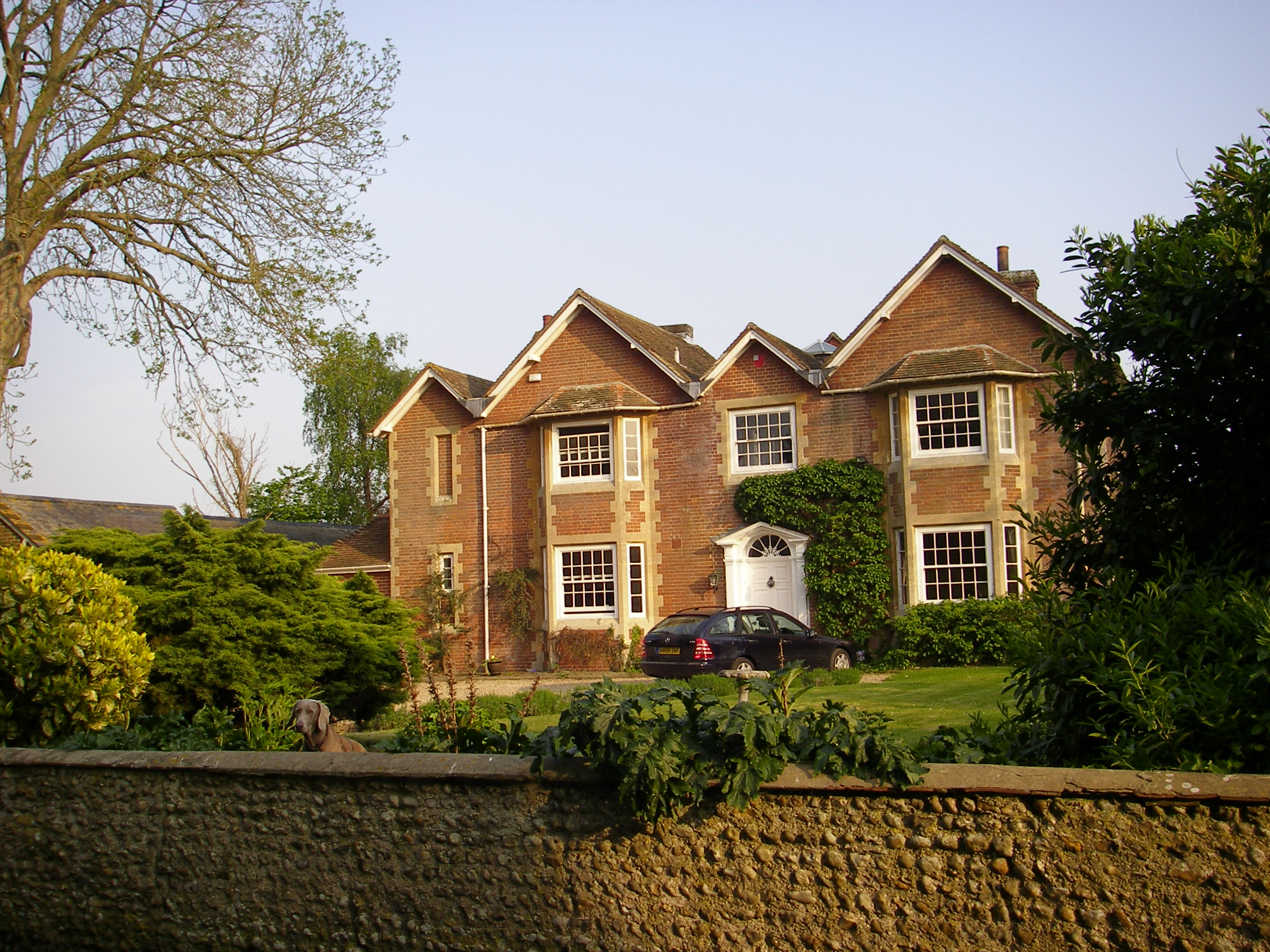
The Old Rectory, Chidham

The Old Rectory is a privately owned historic house located in West Sussex in the village of Chidham. The rectory was Grade II listed in 1986. == References ==

Nearby Amenities

Located within 500m of 50.835114,-0.86698941
Source: PGS
Lat/Long: 50.8312725/-0.8696375
Source: PGS
Lat/Long: 50.8312804/-0.8702146
Source: PGS
Lat/Long: 50.8312693/-0.8706021
Source: PGS
Lat/Long: 50.8331083/-0.8732703
Source: PGS
Lat/Long: 50.833382/-0.8717851
Source: PGS
Lat/Long: 50.8333339/-0.8715352
Source: PGS
Lat/Long: 50.8335654/-0.8707313
Source: PGS
Lat/Long: 50.8336513/-0.8702246
Source: PGS
Lat/Long: 50.8337944/-0.8698487
Source: PGS
Lat/Long: 50.8341355/-0.8696824
Source: PGS
Lat/Long: 50.8348985/-0.870393
Source: PGS
Lat/Long: 50.8363393/-0.8708624
Source: PGS
Lat/Long: 50.8370656/-0.8706738
Source: PGS
Lat/Long: 50.8376607/-0.8702819
Source: PGS
Lat/Long: 50.8385571/-0.869878
Source: PGS
Lat/Long: 50.8391409/-0.8696606
Source: PGS
Lat/Long: 50.8394453/-0.8668513
Source: PGS
Lat/Long: 50.8386047/-0.866486
Source: PGS
Lat/Long: 50.8385054/-0.8664097
Source: PGS
Lat/Long: 50.8383091/-0.8646928
Source: PGS
Lat/Long: 50.8382848/-0.8640046
Source: PGS
Lat/Long: 50.8383178/-0.8629512
Source: PGS
Lat/Long: 50.8383416/-0.8628182
Source: PGS
Lat/Long: 50.8346835/-0.8605111
Source: PGS
Lat/Long: 50.833491/-0.8607745
Seamark Beacon Special Purpose Colour: yellow
Seamark Beacon Special Purpose Shape: stake
Seamark Type: beacon_special_purpose
Lat/Long: 50.8351274/-0.8627486
Seamark Beacon Lateral Category: starboard
Seamark Beacon Lateral Colour: green
Seamark Beacon Lateral Shape: stake
Seamark Beacon Lateral System: iala-a
Seamark Topmark Colour: green
Seamark Topmark Shape: cone, point up
Seamark Type: beacon_lateral
Lat/Long: 50.8348157/-0.8665252
Seamark Beacon Lateral Category: starboard
Seamark Beacon Lateral Colour: green
Seamark Beacon Lateral Shape: stake
Seamark Beacon Lateral System: iala-a
Seamark Topmark Colour: green
Seamark Topmark Shape: cone, point up
Seamark Type: beacon_lateral
Lat/Long: 50.8356559/-0.8676195
Seamark Beacon Lateral Category: port
Seamark Beacon Lateral Colour: red
Seamark Beacon Lateral Shape: stake
Seamark Beacon Lateral System: iala-a
Seamark Topmark Colour: red
Seamark Topmark Shape: cylinder
Seamark Type: beacon_lateral
Lat/Long: 50.8387862/-0.8683813
Source: PGS
Lat/Long: 50.833513/-0.8608872
Cutmill Creek
Place: locality
Lat/Long: 50.8392745/-0.8681632
The data included in this document is from www.openstreetmap.org. The data is made available under ODbL.

Have you been to Cutmill Creek?

Leave your review of Cutmill Creek below (or comments, questions and feedback).