Portchester Lake

Sea, Estuary, Creek in Hampshire

England

Portchester Lake

HMS Queen Elizabeth at Portsmouth Dockyard HMS Queen Elizabeth moored up on the dockside at Portsmouth Naval Dockyard.
Photograph taken looking north from ferry to St. Malo.
HMS Queen Elizabeth at Portsmouth Dockyard Credit: Kevin Pearson

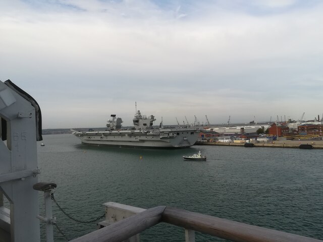
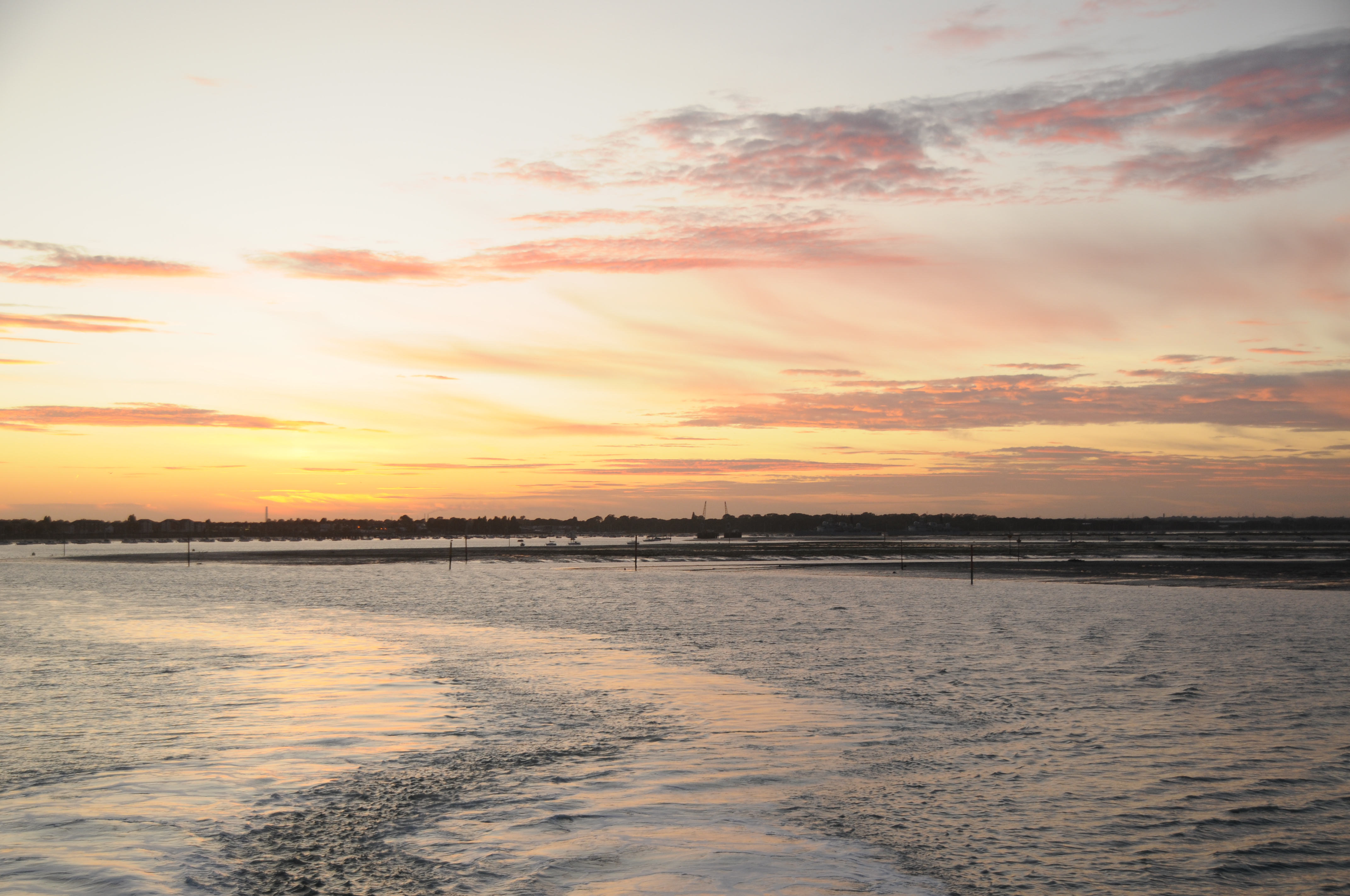
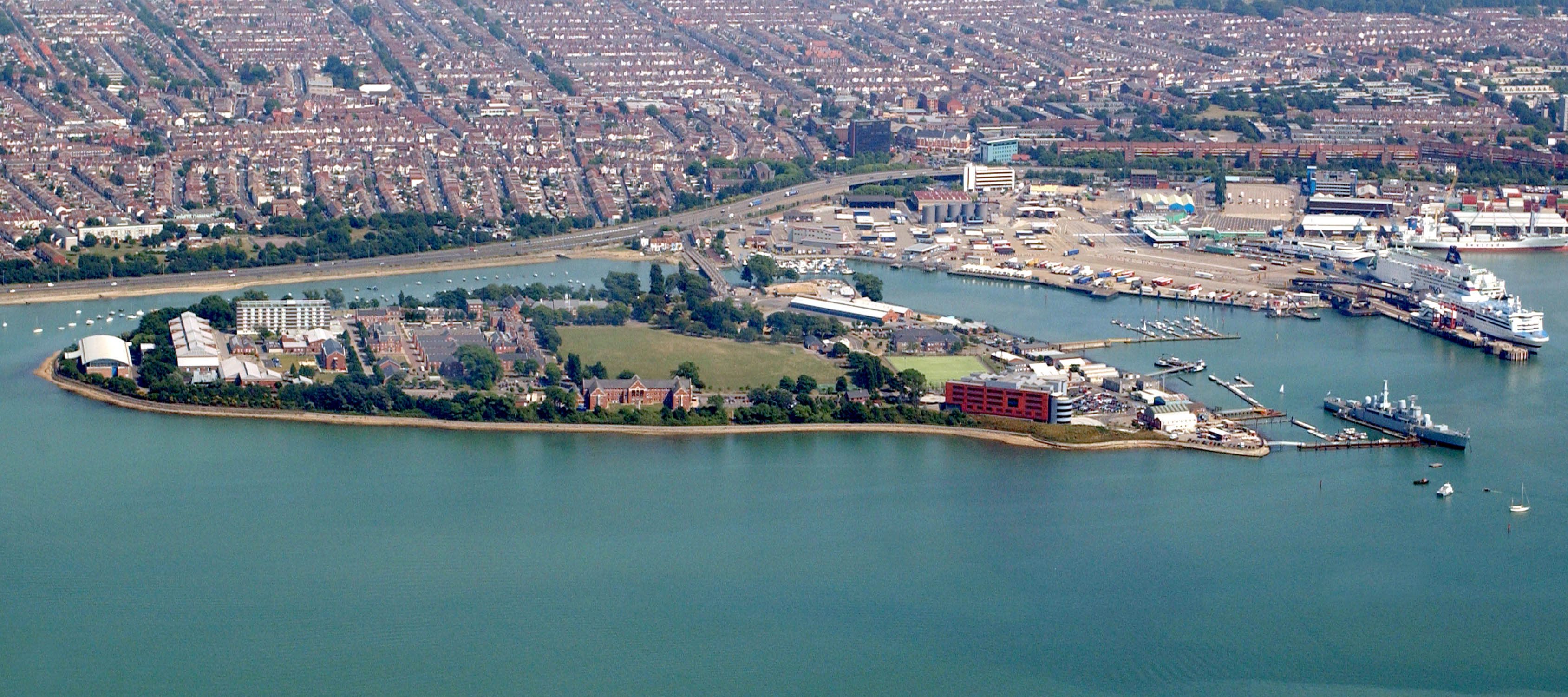
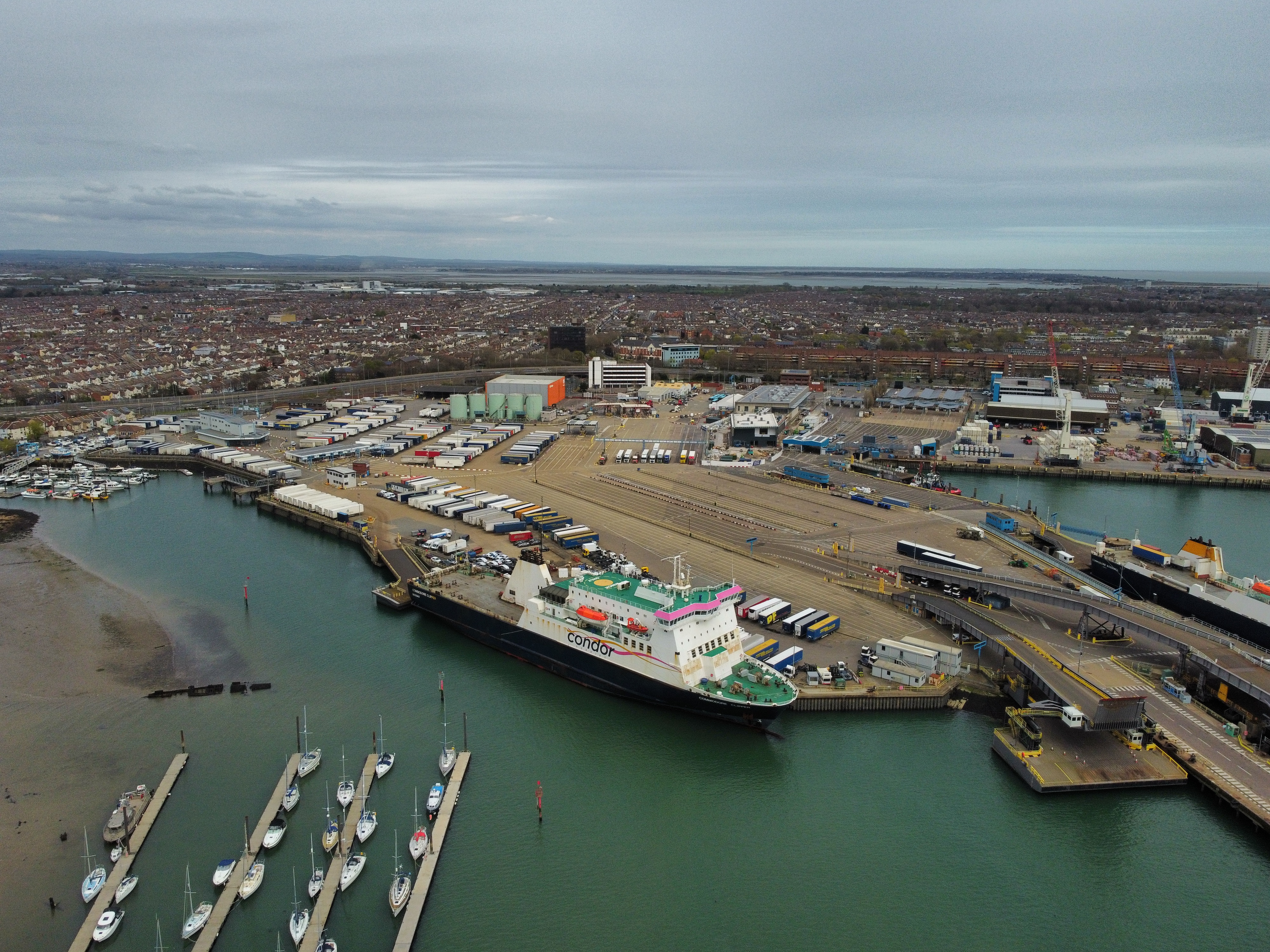
Portchester Lake is a tidal lagoon located in Hampshire, England. It is situated within the larger Portsmouth Harbour, near the town of Portchester. The lake, also referred to as Portchester Creek or Portchester Estuary, serves as a significant natural feature in the area.

With its opening to the English Channel, Portchester Lake experiences the ebb and flow of the tides, making it a saltwater body. This tidal nature creates a unique ecosystem within the lake, supporting a diverse range of flora and fauna. The lake is home to various species of fish, crustaceans, and birds, making it a popular spot for birdwatchers and nature enthusiasts.

The lake is flanked by mudflats and salt marshes, which provide crucial habitats for numerous species of wading birds and waterfowl. During low tide, these mudflats are exposed, creating an expansive area for feeding and roosting. The surrounding wetlands also support a rich variety of plant life, including saltmarsh grasses and reeds.

Portchester Lake has a long history, with evidence of human occupation and use dating back to the Roman era. Today, the lake continues to serve as an important waterway for recreational activities such as sailing, kayaking, and fishing. Its scenic beauty, coupled with its ecological importance, attracts both locals and visitors to enjoy the natural splendor of Portchester Lake.

If you have any feedback on the listing, please let us know in the comments section below.

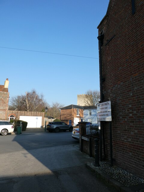
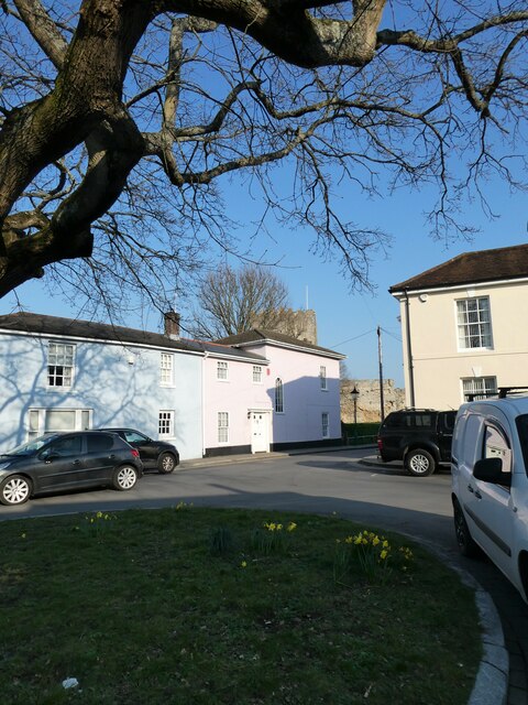
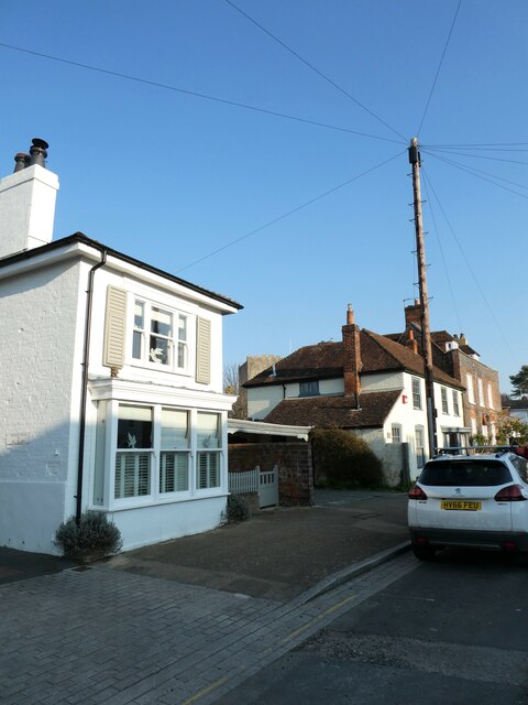
Portchester Lake Images

Images are sourced within 2km of 50.821165/-1.1120499 or Grid Reference SU6202. Thanks to Geograph Open Source API. All images are credited.

HMS Queen Elizabeth at Portsmouth Dockyard HMS Queen Elizabeth moored up on the dockside at Portsmouth Naval Dockyard.
Photograph taken looking north from ferry to St. Malo.
HMS Queen Elizabeth at Portsmouth Dockyard
HMS Queen Elizabeth moored up on the dockside at Portsmouth Naval Dockyard. Photograph taken looking north from ferry to St. Malo.
Hardway Sailing Club Clubhouse for Hardway Sailing Club
Hardway Sailing Club
Clubhouse for Hardway Sailing Club
Cones and Instructions Vehicle waiting area for Brittany Ferries. We were a bit early for our ferry. Not many people were about yet.
Cones and Instructions
Vehicle waiting area for Brittany Ferries. We were a bit early for our ferry. Not many people were about yet.
"Condore Goodwill" at the Quayside One of the large ferries which operate from here, viewed from the top deck of an equally large vessel as we leave the dock.
"Condore Goodwill" at the Quayside
One of the large ferries which operate from here, viewed from the top deck of an equally large vessel as we leave the dock.
Park and Ride The view of Portsmouth Park and ride terminal at J1 of M275.
Park and Ride
The view of Portsmouth Park and ride terminal at J1 of M275.
Well, it seemed a long way when I was three (xiii) Passing The Cormorant
When I was a boy there were two brothers who lived in a cottage in Castle Street. Every evening one went to The Cormorant, the other to The White Hart- shades of Cain and Abel?
Well, it seemed a long way when I was three (xiii)
Passing The Cormorant When I was a boy there were two brothers who lived in a cottage in Castle Street. Every evening one went to The Cormorant, the other to The White Hart- shades of Cain and Abel?
Well, it seemed a long way when I was three (xiv) Castle Street
Well, it seemed a long way when I was three (xiv)
Castle Street
Well, it seemed a long way when I was three (xv) House between Castle Street and Hospital Lane- in my grandparent's day it was the home of Barry Westwood <span class="nowrap"><a title="https://peoplepill.com/people/barry-westwood" rel="nofollow ugc noopener" href="https://peoplepill.com/people/barry-westwood">Link</a><img style="margin-left:2px;" alt="External link" title="External link - shift click to open in new window" src="https://s1.geograph.org.uk/img/external.png" width="10" height="10"/></span>
Well, it seemed a long way when I was three (xv)
House between Castle Street and Hospital Lane- in my grandparent's day it was the home of Barry Westwood LinkExternal link
Well, it seemed a long way when I was three (xvi) Looking from Wicor Path into Castle Street
Well, it seemed a long way when I was three (xvi)
Looking from Wicor Path into Castle Street
Well, it seemed a long way when I was three (xvii) The Castle glimpsed from Castle Street
Well, it seemed a long way when I was three (xvii)
The Castle glimpsed from Castle Street
Well, it seemed a long way when I was three (xviii) Telegraph pole in Castle Street
Well, it seemed a long way when I was three (xviii)
Telegraph pole in Castle Street
Well, it seemed a long way when I was three (xix) Path from Waterside Lane to the foreshore
Well, it seemed a long way when I was three (xix)
Path from Waterside Lane to the foreshore
Well, it seemed a long way when I was three (xx) Houses at the far end of Castle Street
Well, it seemed a long way when I was three (xx)
Houses at the far end of Castle Street
Well, it seemed a long way when I was three (xxi) Looking from Castle Street into Hospital Lane
Well, it seemed a long way when I was three (xxi)
Looking from Castle Street into Hospital Lane
Well, it seemed a long way when I was three (xxii) Looking from Hospital Lane into Castle Street
Well, it seemed a long way when I was three (xxii)
Looking from Hospital Lane into Castle Street
Well, it seemed a long way when I was three (xxiii) I don't know what my grandfather would have said- you now have to pay to park in Waterside Lane
Well, it seemed a long way when I was three (xxiii)
I don't know what my grandfather would have said- you now have to pay to park in Waterside Lane
Well, it seemed a long way when I was three (xxiv) Looking from Castle Street towards The Landgate
Well, it seemed a long way when I was three (xxiv)
Looking from Castle Street towards The Landgate
Well, it seemed a long way when I was three (xxv) Looking from Castle Street into Waterside Lane
Well, it seemed a long way when I was three (xxv)
Looking from Castle Street into Waterside Lane
Show me another place!

Portchester Lake is located at Grid Ref: SU6202 (Lat: 50.821165, Lng: -1.1120499)

Unitary Authority: Portsmouth

Police Authority: Hampshire

What 3 Words

///method.fired.flying. Near Portsmouth, Hampshire

Related Wikis

Portsmouth Harbour

Portsmouth Harbour is a 1,264.2-hectare (3,124-acre)/12.6 km2 (4.9 sq mi) biological Site of Special Scientific Interest between Portsmouth and Gosport...

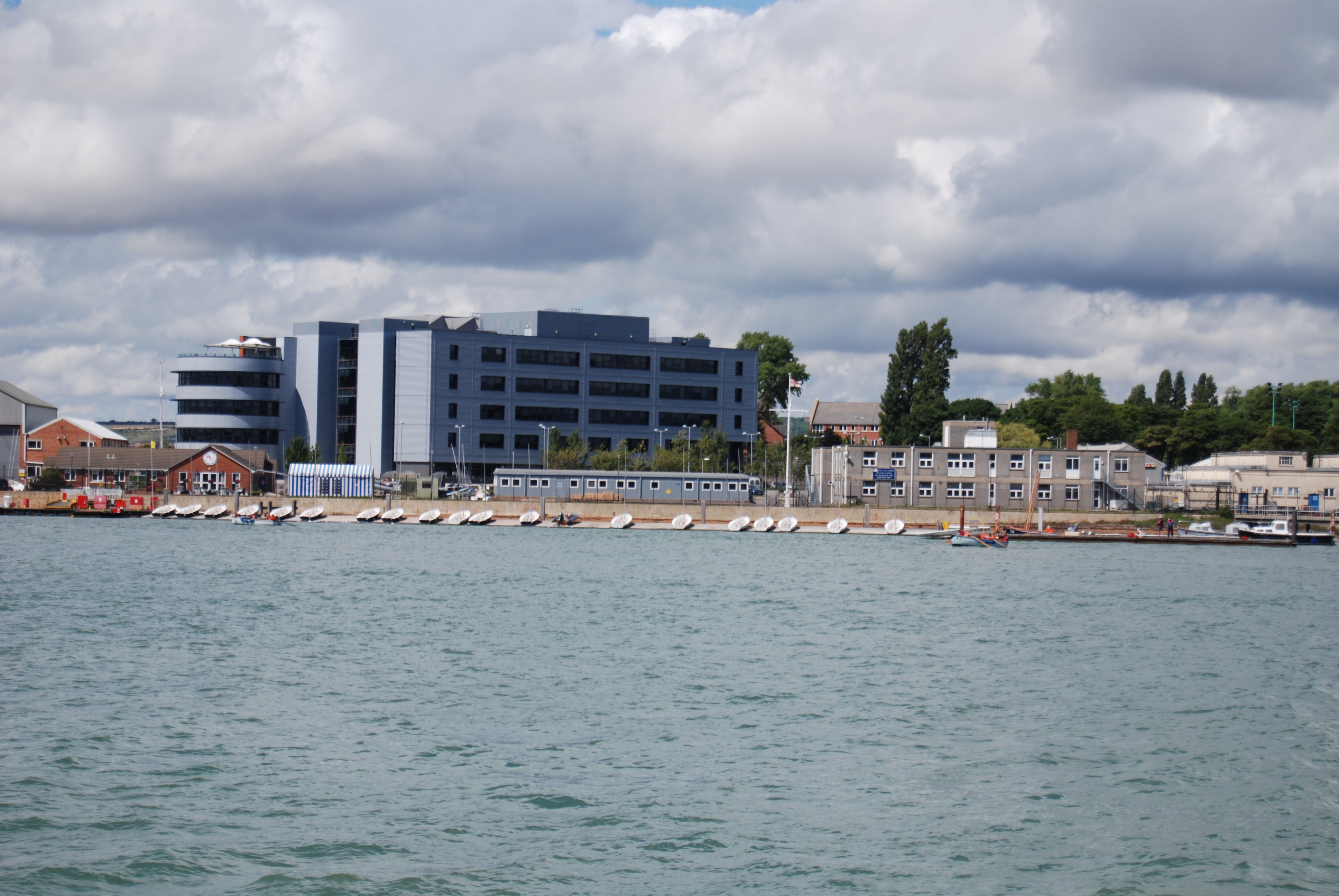
Whale Island, Hampshire

Whale Island is a small island in Portsmouth Harbour, close by Portsea Island. It is home to HMS Excellent, the oldest shore training establishment within...

HMS Excellent (shore establishment)

HMS Excellent is a Royal Navy "stone frigate" (shore establishment) sited on Whale Island near Portsmouth in Hampshire. HMS Excellent is itself part of...

HMS King Alfred (1994 shore establishment)

HMS King Alfred is a Royal Naval Reserve shore establishment in Portsmouth, England. The unit has a complement of over 200 reservists and provides training...
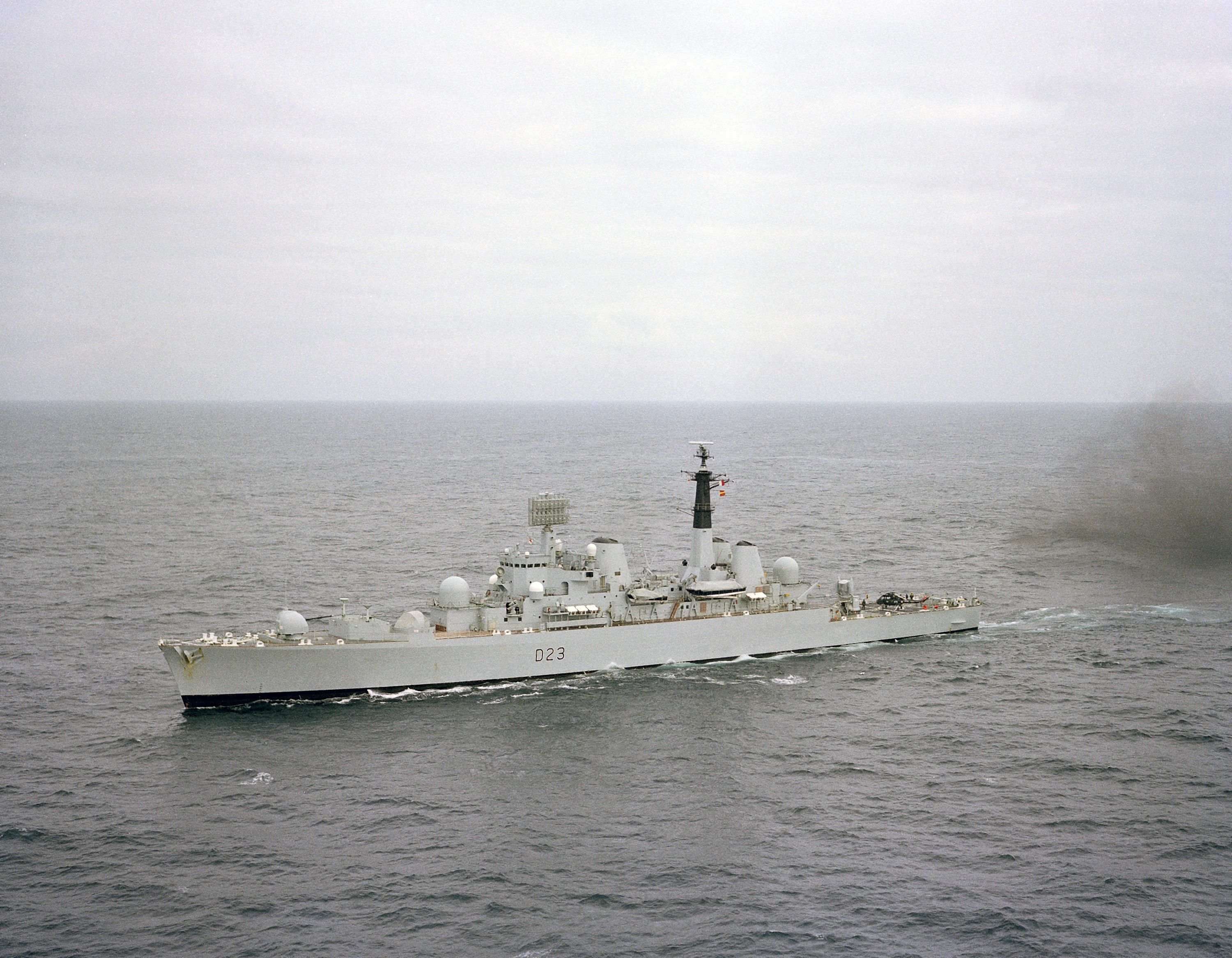
HMS Bristol (D23)

HMS Bristol (D23) was a Type 82 destroyer, the only vessel of her class to be built for the Royal Navy. Bristol was intended to be the first of a class...

Portchester Castle

Portchester Castle is a medieval fortress that was developed within the walls of the Roman Saxon Shore fort of Portus Adurni at Portchester, to the east...

Tipner

Tipner is a residential district of Portsmouth, located on the north western corner of Portsea Island in southern England. It includes a housing estate...

Portsmouth International Port

Portsmouth International Port, also known as Portsmouth Continental Ferry Port, is the harbour authority for the city of Portsmouth, Hampshire, located...

Nearby Amenities

Located within 500m of 50.821165,-1.1120499
Source: PGS
Lat/Long: 50.8251674/-1.1129881
Source: PGS
Lat/Long: 50.8253195/-1.1131796
Seamark Beacon Lateral Category: port
Seamark Beacon Lateral Colour: red
Seamark Beacon Lateral Shape: stake
Seamark Beacon Lateral System: iala-a
Seamark Light Character: Fl
Seamark Light Colour: red
Seamark Light Period: 5
Seamark Name: 63
Seamark Type: beacon_lateral
Lat/Long: 50.823136/-1.1081708
Seamark Beacon Lateral Category: port
Seamark Beacon Lateral Colour: red
Seamark Beacon Lateral Shape: stake
Seamark Beacon Lateral System: iala-a
Seamark Name: 62
Seamark Type: beacon_lateral
Lat/Long: 50.822787/-1.1118051
Seamark Buoy Special Purpose Colour: yellow
Seamark Buoy Special Purpose Shape: spar
Seamark Type: buoy_special_purpose
Lat/Long: 50.8217923/-1.1136532
Seamark Buoy Special Purpose Colour: yellow
Seamark Buoy Special Purpose Shape: spar
Seamark Type: buoy_special_purpose
Lat/Long: 50.8212586/-1.1144418
Seamark Beacon Lateral Category: port
Seamark Beacon Lateral Colour: red
Seamark Beacon Lateral Shape: stake
Seamark Beacon Lateral System: iala-a
Seamark Name: 61
Seamark Type: beacon_lateral
Lat/Long: 50.8216788/-1.1150265
Seamark Beacon Lateral Category: starboard
Seamark Beacon Lateral Colour: green
Seamark Beacon Lateral Shape: stake
Seamark Beacon Lateral System: iala-a
Seamark Light Character: Fl
Seamark Light Colour: green
Seamark Light Period: 5
Seamark Name: 88
Seamark Type: beacon_lateral
Lat/Long: 50.8220414/-1.1057729
Seamark Beacon Lateral Category: starboard
Seamark Beacon Lateral Colour: green
Seamark Beacon Lateral Shape: stake
Seamark Beacon Lateral System: iala-a
Seamark Name: 89
Seamark Type: beacon_lateral
Lat/Long: 50.821018/-1.1078918
Seamark Beacon Lateral Category: starboard
Seamark Beacon Lateral Colour: green
Seamark Beacon Lateral Shape: stake
Seamark Beacon Lateral System: iala-a
Seamark Light Character: LFl
Seamark Light Colour: green
Seamark Light Period: 10
Seamark Name: 90
Seamark Type: beacon_lateral
Lat/Long: 50.8200419/-1.1117005
Seamark Beacon Lateral Category: starboard
Seamark Beacon Lateral Colour: green
Seamark Beacon Lateral Shape: stake
Seamark Beacon Lateral System: iala-a
Seamark Name: 91
Seamark Topmark Colour: green
Seamark Topmark Shape: cone, point up
Seamark Type: beacon_lateral
Lat/Long: 50.8192557/-1.1142326
Seamark Beacon Lateral Category: starboard
Seamark Beacon Lateral Colour: green
Seamark Beacon Lateral Shape: stake
Seamark Beacon Lateral System: iala-a
Seamark Light Character: Fl
Seamark Light Colour: green
Seamark Light Group: 2
Seamark Light Period: 5
Seamark Name: 95
Seamark Type: beacon_lateral
Lat/Long: 50.8181339/-1.1159062
Seamark Buoy Special Purpose Category: mooring
Seamark Buoy Special Purpose Colour: yellow
Seamark Buoy Special Purpose Shape: barrel
Seamark Type: buoy_special_purpose
Lat/Long: 50.8214145/-1.1092973
Seamark Buoy Special Purpose Category: mooring
Seamark Buoy Special Purpose Colour: yellow
Seamark Buoy Special Purpose Shape: barrel
Seamark Type: buoy_special_purpose
Lat/Long: 50.8207875/-1.111604
Seamark Obstruction Water Level: submerged
Seamark Type: obstruction
Lat/Long: 50.8194963/-1.1168665
Seamark Obstruction Water Level: submerged
Seamark Type: obstruction
Lat/Long: 50.8186118/-1.1155737
Seamark Obstruction Water Level: awash
Seamark Type: obstruction
Lat/Long: 50.8229649/-1.1122236
Seamark Obstruction Water Level: awash
Seamark Type: obstruction
Lat/Long: 50.8236748/-1.1101985
Seamark Obstruction Water Level: awash
Seamark Type: obstruction
Lat/Long: 50.823973/-1.108793
The data included in this document is from www.openstreetmap.org. The data is made available under ODbL.

Have you been to Portchester Lake?

Leave your review of Portchester Lake below (or comments, questions and feedback).