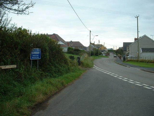
Llansaint

Settlement in Carmarthenshire

Wales

Llansaint

Hillside view of Kidwelly and Trimsaran Looking back down at Kidwelly town from a field on the way to ferryside you can also see Trimsaran in the distance.
Hillside view of Kidwelly and Trimsaran Credit: Mike Williams

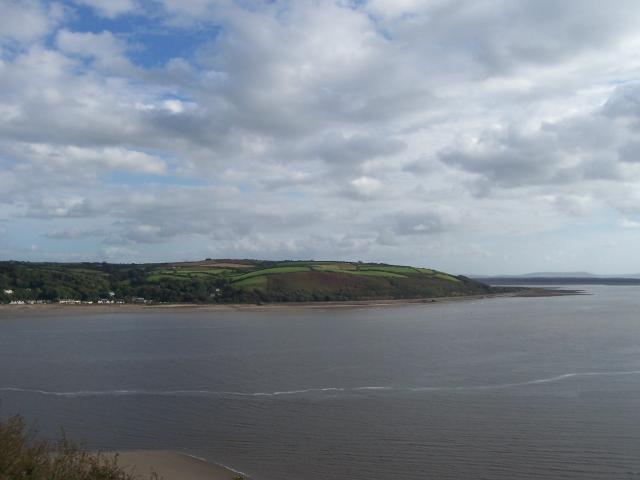
Llansaint is a quaint village located in the county of Carmarthenshire, Wales. Situated on the Loughor Estuary, it offers stunning views of the surrounding countryside, making it an ideal destination for nature lovers and outdoor enthusiasts.

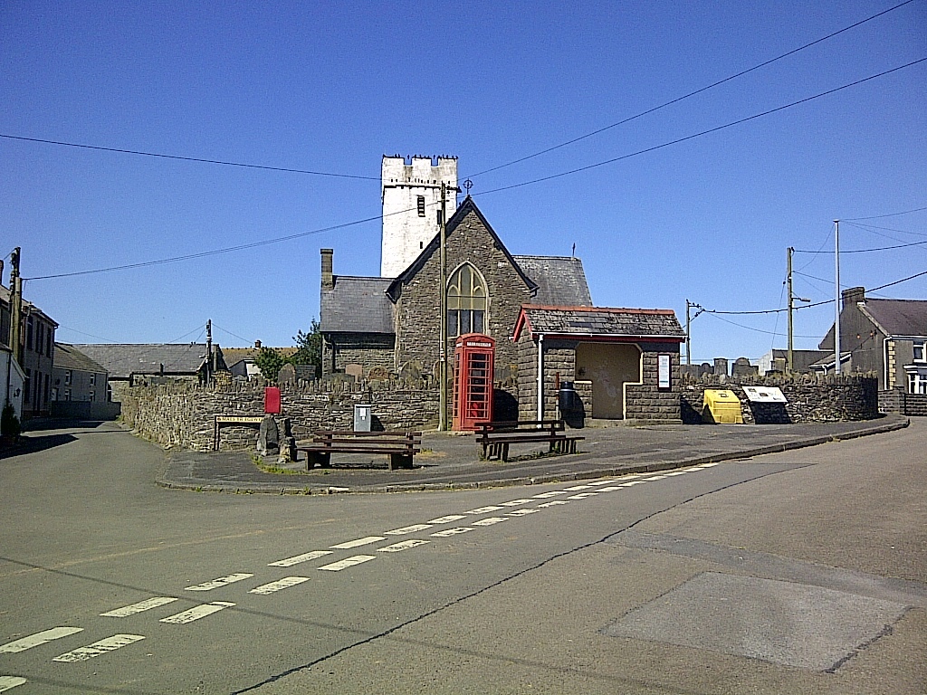
With a population of around 500 residents, Llansaint maintains a close-knit community vibe. The village is known for its peaceful atmosphere and traditional Welsh charm, attracting visitors seeking a tranquil getaway. The village's name translates to "Church of Saints," referring to the historic and prominent St. Saints Church that stands at its heart.

Llansaint boasts a rich history, with evidence of settlement dating back to the Roman times. The village still retains some of its ancient architecture, such as the medieval church tower and the remnants of a 12th-century castle. History enthusiasts will find plenty to explore and admire in Llansaint.

The village offers a range of amenities for locals and visitors alike. A small convenience store provides daily essentials, while a cozy pub offers a friendly setting to meet and socialize. Llansaint is also known for its vibrant community events, including festivals, fairs, and charity fundraisers.

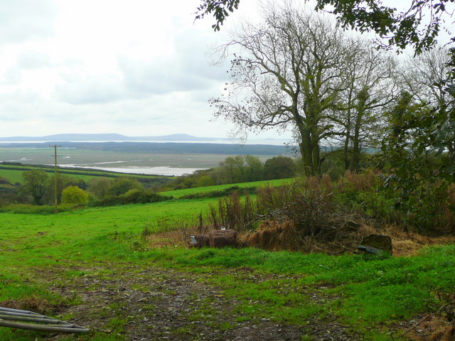
Nature lovers will appreciate the village's proximity to picturesque landscapes. The Loughor Estuary is a haven for birdwatchers, with a variety of species to observe. The surrounding countryside offers scenic walking trails, allowing visitors to immerse themselves in the beauty of the Welsh countryside.

Overall, Llansaint is a charming village that provides a serene escape from the hustle and bustle of modern life. Its historical heritage, stunning natural surroundings, and welcoming community make it a hidden gem within Carmarthenshire.

If you have any feedback on the listing, please let us know in the comments section below.

Llansaint Images

Images are sourced within 2km of 51.748887/-4.338802 or Grid Reference SN3808. Thanks to Geograph Open Source API. All images are credited.

Hillside view of Kidwelly and Trimsaran Looking back down at Kidwelly town from a field on the way to ferryside you can also see Trimsaran in the distance.
Hillside view of Kidwelly and Trimsaran
Looking back down at Kidwelly town from a field on the way to ferryside you can also see Trimsaran in the distance.
Broadlay, near Ferryside - site of early YHA hostel. Broadlay House once stood behind the gated wall, one mile south-east of Ferryside in Carmarthenshire. It served briefly as a YHA hostel in 1937-38, but was demolished some time about 1980.
Broadlay, near Ferryside - site of early YHA hostel.
Broadlay House once stood behind the gated wall, one mile south-east of Ferryside in Carmarthenshire. It served briefly as a YHA hostel in 1937-38, but was demolished some time about 1980.
Sunrise Reflections After the rain in the night, the sunrise.
Sunrise Reflections
After the rain in the night, the sunrise.
The Loughor Estuary Looking toward Pembrey Forest from the Loughor Holiday Park near Kidwelly.
The Loughor Estuary
Looking toward Pembrey Forest from the Loughor Holiday Park near Kidwelly.
Farmland near Llansaint
Farmland near Llansaint Llansaint village is visible in the distance.
Farmland near Llansaint
Llansaint village is visible in the distance.
Llansaint village
Llansaint village
Defender of the crossroads When I found this pill box on a far from strategic crossroads I couldn't help but think of Dad's Army. The notice refers to a local horse-riding establishment.
Defender of the crossroads
When I found this pill box on a far from strategic crossroads I couldn't help but think of Dad's Army. The notice refers to a local horse-riding establishment.
Pen y banc, Broadway Broadway is a hamlet about 1/2 a mile from the village of Llansaint.
Pen y banc, Broadway
Broadway is a hamlet about 1/2 a mile from the village of Llansaint.
Looking towards the sea Farmland near Kidwelly. In the distance can be seen Gwendraeth, the mouth of Gwendraeth Fawr, as it reaches the sea at the same point as the Rivers Towy and Taf.
Looking towards the sea
Farmland near Kidwelly. In the distance can be seen Gwendraeth, the mouth of Gwendraeth Fawr, as it reaches the sea at the same point as the Rivers Towy and Taf.
Level crossing and entrance to Carmarthen Bay Holiday Park
Coleman Farm from Glan yr Afon
View to the coast Looking south from near Pengay Farm over dairy pasture.
In the middle distance is the dark expanse of Pembrey Forest, and beyond that, the hills of The Gower.
View to the coast
Looking south from near Pengay Farm over dairy pasture. In the middle distance is the dark expanse of Pembrey Forest, and beyond that, the hills of The Gower.
Mud and marshes, Gwendraeth Fach estuary View from Kidwelly Quay. This is within the Carmarthen Bay and Estuaries Special Area of Conservation <span class="nowrap"><a title="http://www.cbeems.org.uk/english/cbe_sac.html" rel="nofollow ugc noopener" href="http://www.cbeems.org.uk/english/cbe_sac.html">Link</a><img style="margin-left:2px;" alt="External link" title="External link - shift click to open in new window" src="https://s1.geograph.org.uk/img/external.png" width="10" height="10"/></span> .Carmarthen Bay Holiday Park can be seen in the distance, slightly right of centre.
Mud and marshes, Gwendraeth Fach estuary
View from Kidwelly Quay. This is within the Carmarthen Bay and Estuaries Special Area of Conservation LinkExternal link .Carmarthen Bay Holiday Park can be seen in the distance, slightly right of centre.
Mudflats and marshland View from the railway bridge.
Mudflats and marshland
View from the railway bridge.
Ordnance Survey Cut Mark This OS cut mark can be found on the gatepost at the entrance to Poultry Farm. It marks a point 109.99m above mean sea level.
Ordnance Survey Cut Mark
This OS cut mark can be found on the gatepost at the entrance to Poultry Farm. It marks a point 109.99m above mean sea level.
Ordnance Survey Cut Mark This OS cut mark can be found on the front of the Tabor Chapel. It marks a point 123.58m above mean sea level.
Ordnance Survey Cut Mark
This OS cut mark can be found on the front of the Tabor Chapel. It marks a point 123.58m above mean sea level.
Looking South-east over the dunes of the Gwendraeth estuary The white building at left is part of the Carmarthen Bay Holiday Park.
Looking South-east over the dunes of the Gwendraeth estuary
The white building at left is part of the Carmarthen Bay Holiday Park.
Show me another place!

Llansaint is located at Grid Ref: SN3808 (Lat: 51.748887, Lng: -4.338802)

Unitary Authority: Carmarthenshire

Police Authority: Dyfed Powys

Also known as: Llan-saint

What 3 Words

///activity.lofts.straying. Near Kidwelly, Carmarthenshire

Related Wikis

Llansaint

Llansaint is a village of farmsteads and cottages in Carmarthenshire, Wales. It includes a cluster of 19th century stone-built houses around the church...
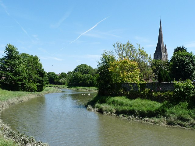
River Gwendraeth

The River Gwendraeth (Welsh: Afon Gwendraeth) is a river in Carmarthenshire in West Wales. It has two almost equal branches that have their confluence...

St Ishmael, Carmarthenshire

St Ishmael (Welsh: Llanismel or Llanishmael) is a hamlet and community in Carmarthenshire, Wales. The community population taken at the 2011 census was...

Kidwelly railway station

Kidwelly railway station serves the town of Kidwelly (Welsh: Cydweli), Carmarthenshire, Wales. The station is situated on the coast just southwest of Kidwelly...

Kidwelly Town Council

Kidwelly Town Council (Welsh: Cyngor Tref Cydweli) is the town council serving the town of Kidwelly and the village of Mynydd-y-Garreg in the county of...

Kidwelly Castle

Kidwelly Castle (Welsh: Castell Cydweli) is a Norman castle overlooking the River Gwendraeth and the town of Kidwelly, Carmarthenshire, Wales. == Early... ==

Kidwelly Priory

Kidwelly Priory was a Benedictine abbey in Kidwelly, Wales (in Welsh, Cydweli). Roger, bishop of Salisbury (d.1139), a Norman invader founded the priory...

Kidwelly Town Hall

Kidwelly Town Hall (Welsh: Neuadd y Dref Cydweli) is a municipal building in Lady Street, Kidwelly, Carmarthenshire, Wales. The structure, which was last...

Nearby Amenities

Located within 500m of 51.748887,-4.338802
Llansaint
Created By: Potlatch 0.10b
Place: hamlet
Wikidata: Q6661740
Lat/Long: 51.7480937/-4.3411944
Power: pole
Lat/Long: 51.747951/-4.3414167
Bus Stop
Bryn Edda
Naptan AtcoCode: 5220WDB48016
Naptan NaptanCode: crmtpjp
Lat/Long: 51.7496869/-4.3399781
Waste Basket
Lat/Long: 51.7476973/-4.3402706
Bench
Lat/Long: 51.7477841/-4.3409563
Barrier: bollard
Lat/Long: 51.7480597/-4.3413705
Waste Basket
Lat/Long: 51.7479585/-4.3413851
Bus Stop
Bryn Edda
Naptan AtcoCode: 5220WDB47991
Naptan NaptanCode: crmtpad
Lat/Long: 51.7496493/-4.3402536
Bus Stop
Llansaint
Naptan AtcoCode: 5220AWG60789
Naptan NaptanCode: crmgpjg
Lat/Long: 51.7478347/-4.3410647
Waste Basket
Lat/Long: 51.749133/-4.34129
Bench
Lat/Long: 51.747963/-4.3413607
Bench
Lat/Long: 51.7478173/-4.3409673
Direction: 235
Generator Method: photovoltaic
Generator Output Electricity: yes
Generator Solar Modules: 13
Generator Source: solar
Generator Type: solar_photovoltaic_panel
Location: roof
Power: generator
Lat/Long: 51.7495868/-4.3396281
Direction: 145
Generator Method: photovoltaic
Generator Output Electricity: yes
Generator Solar Modules: 3
Generator Source: solar
Generator Type: solar_photovoltaic_panel
Location: roof
Power: generator
Lat/Long: 51.7496265/-4.3395755
Direction: 235
Generator Method: photovoltaic
Generator Output Electricity: yes
Generator Solar Modules: 15
Generator Source: solar
Generator Type: solar_photovoltaic_panel
Location: roof
Power: generator
Lat/Long: 51.7493599/-4.3412103
Direction: SE
Generator Method: photovoltaic
Generator Output Electricity: yes
Generator Solar Modules: 14
Generator Source: solar
Generator Type: solar_photovoltaic_panel
Location: roof
Power: generator
Lat/Long: 51.7490162/-4.341791
Direction: 195
Generator Method: photovoltaic
Generator Output Electricity: yes
Generator Solar Modules: 20
Generator Source: solar
Generator Type: solar_photovoltaic_panel
Location: roof
Power: generator
Lat/Long: 51.7483785/-4.3426976
Direction: S
Generator Method: photovoltaic
Generator Output Electricity: yes
Generator Solar Modules: 16
Generator Source: solar
Generator Type: solar_photovoltaic_panel
Location: roof
Power: generator
Lat/Long: 51.746994/-4.3429135
Direction: SSW
Generator Method: photovoltaic
Generator Output Electricity: yes
Generator Solar Modules: 16
Generator Source: solar
Generator Type: solar_photovoltaic_panel
Location: roof
Power: generator
Lat/Long: 51.7467711/-4.3438908
Direction: 165
Generator Method: photovoltaic
Generator Output Electricity: yes
Generator Solar Modules: 16
Generator Source: solar
Generator Type: solar_photovoltaic_panel
Location: roof
Power: generator
Lat/Long: 51.7513418/-4.3329263
Post Box
Post Box Type: lamp
Royal Cypher: EIIR
Royal Cypher Wikidata: Q33102113
Lat/Long: 51.7477731/-4.3410236
Defibrillator
Defibrillator Location: on outside of bus shelter by church in Llansaint
Emergency: defibrillator
Indoor: yes
Ref GB The Circuit: 94171E7D-C67F-4D8D-A030-ABE5008433C8
Lat/Long: 51.7478312/-4.3410466
Pub
Kings Arms
Lat/Long: 51.7478623/-4.3418726
The data included in this document is from www.openstreetmap.org. The data is made available under ODbL.

Have you been to Llansaint?

Leave your review of Llansaint below (or comments, questions and feedback).