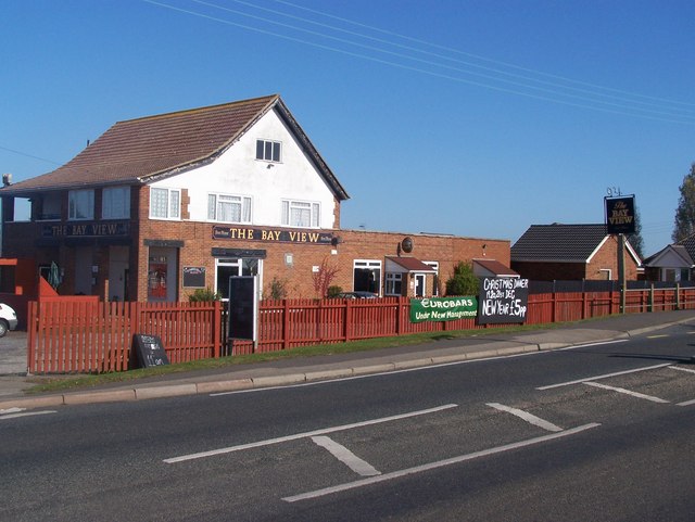
Bay View

Settlement in Kent Swale

England

Bay View

Seafront at Warden Looking towards Leysdown; the far shore is at Whitstable.
Seafront at Warden Credit: David Martin

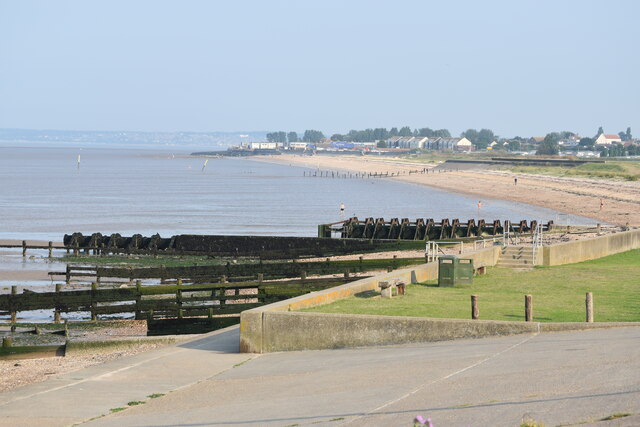
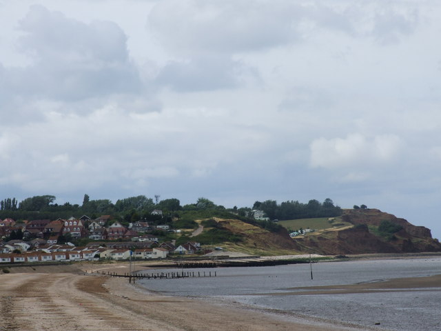
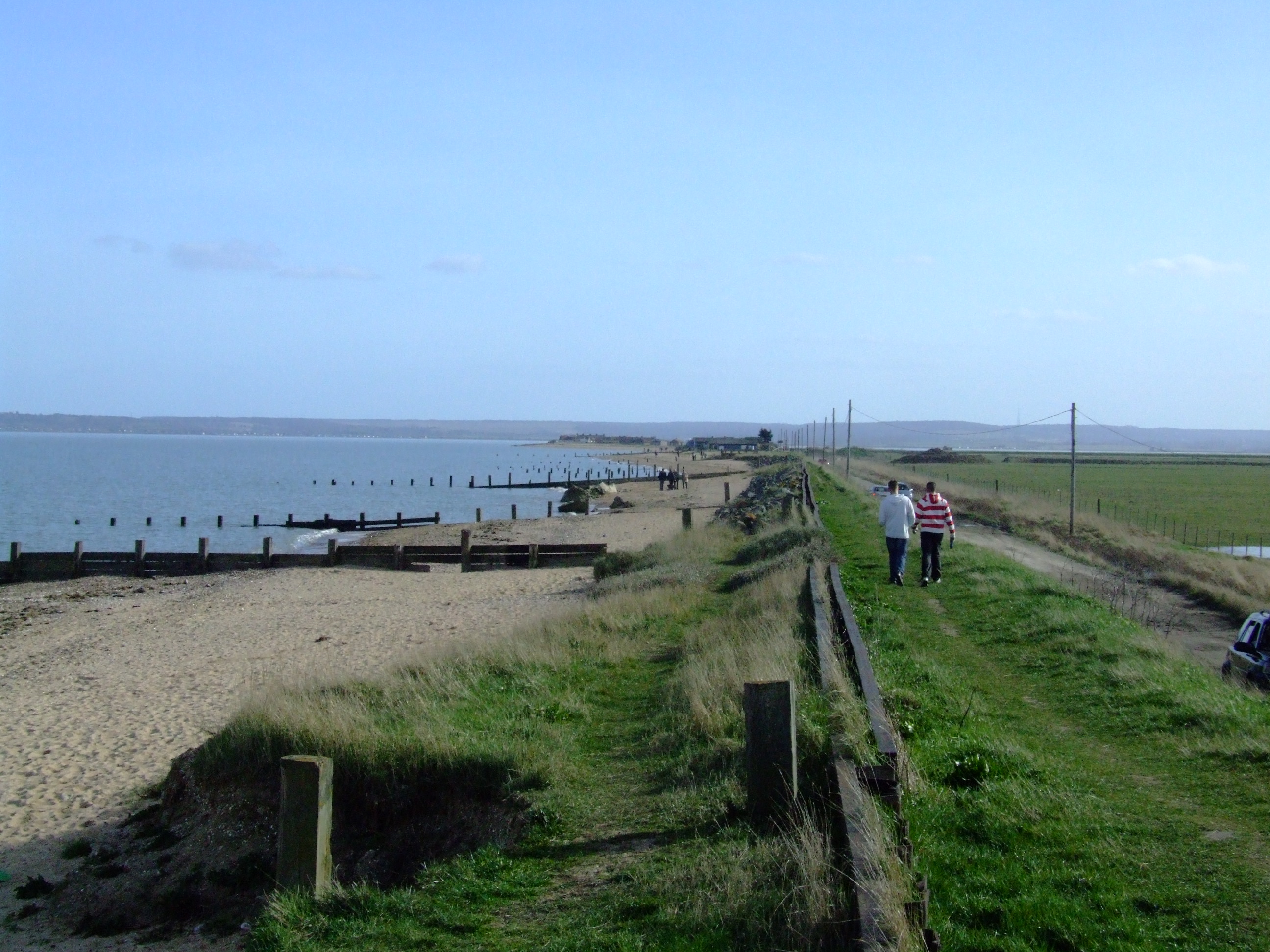
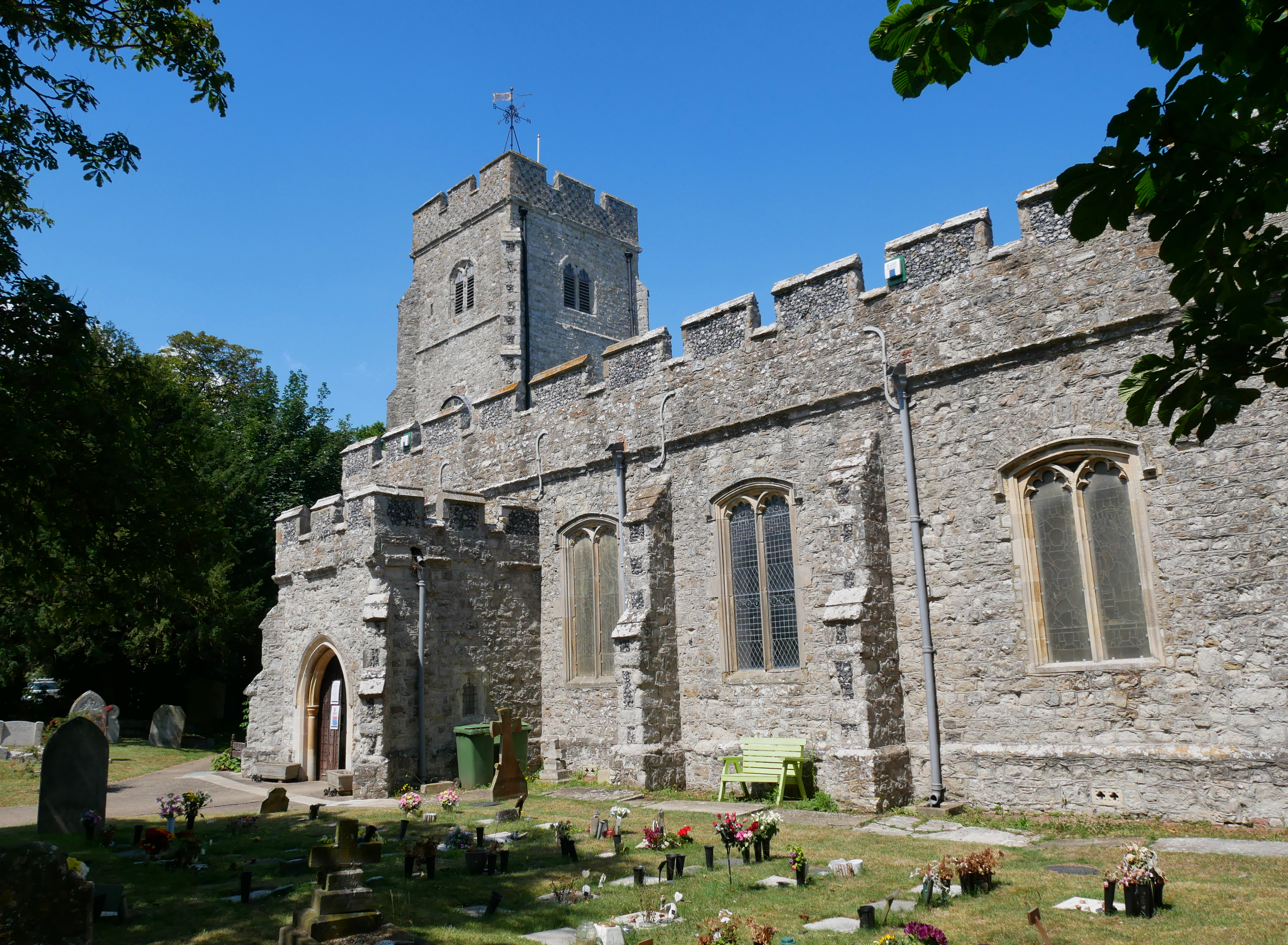
Bay View is a charming coastal village located in the county of Kent, England. Situated on the southeastern coast of the country, it offers breathtaking views of the English Channel and the iconic White Cliffs of Dover. With a population of around 1,500 residents, the village exudes a serene and peaceful atmosphere, making it an ideal destination for those seeking a tranquil seaside retreat.

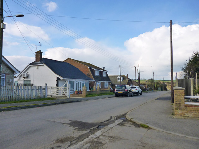
The village is characterized by its quaint and picturesque streets lined with traditional English cottages and well-maintained gardens. The community takes great pride in preserving the village's historic architecture, which adds to its timeless appeal. Bay View's close proximity to the stunning coastline provides residents and visitors with access to beautiful sandy beaches, perfect for leisurely walks, sunbathing, or even a refreshing dip in the sea during the warmer months.

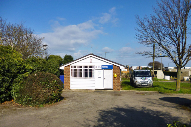
Despite its small size, Bay View offers a range of amenities and services to cater to its residents. The village boasts a handful of local shops, quaint cafes, and traditional pubs where visitors can enjoy a taste of local cuisine and a friendly atmosphere. Additionally, the village is well-served by public transportation, allowing easy access to nearby towns and cities.

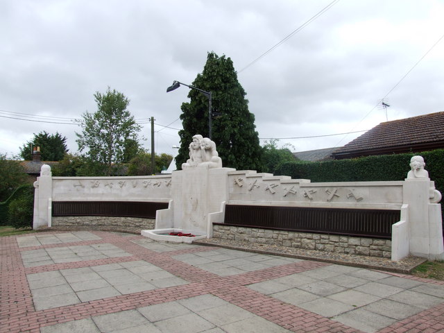
Nature enthusiasts will delight in the abundance of outdoor activities available in Bay View and its surrounding areas. From coastal hikes along the famous White Cliffs to birdwatching in nearby nature reserves, there is something for everyone to enjoy. The village also hosts various community events throughout the year, including summer fairs and festivals, which bring the community together in celebration.

In summary, Bay View is a charming and idyllic coastal village in Kent, offering a peaceful retreat, stunning scenery, and a close-knit community. It provides a perfect balance between natural beauty and modern convenience, making it a desirable place to live or visit.

If you have any feedback on the listing, please let us know in the comments section below.

Bay View Images

Images are sourced within 2km of 51.396368/0.89966009 or Grid Reference TR0170. Thanks to Geograph Open Source API. All images are credited.

Seafront at Warden Looking towards Leysdown; the far shore is at Whitstable.
Seafront at Warden
Looking towards Leysdown; the far shore is at Whitstable.
Dangerous path below eroding cliffs at Warden The sign warns walkers not to pass this point.  For a view from the beach, see <a href="https://www.geograph.org.uk/photo/1884580">TR0272 : The crumbling cliffs of Warden Point</a>
Dangerous path below eroding cliffs at Warden
The sign warns walkers not to pass this point. For a view from the beach, see TR0272 : The crumbling cliffs of Warden Point
Leysdown Village Hall, Wing Road
Leysdown-on-Sea from the air Home to several holiday parks.
Leysdown-on-Sea from the air
Home to several holiday parks.
Warden and Leysdown-on-Sea from the air Warden is on the left.
Warden and Leysdown-on-Sea from the air
Warden is on the left.
Building site, Park Avenue The development of this site is described in Swale Borough Council’s planning applications SW/11/0970 as the “outline planning application to demolish fire damaged dwelling and erect four 2-bed dwellings” and SW/15/501427/FULL as the “erection of two pairs of semi-detached properties, comprising three 3-bed houses and two 1-bed flats”.  This shows the house called <a href="https://www.geograph.org.uk/photo/3055707">TR0370 : Latchmere, Park Avenue, Leysdown</a> that once stood on the site, in its fire-damaged state.
Building site, Park Avenue
The development of this site is described in Swale Borough Council’s planning applications SW/11/0970 as the “outline planning application to demolish fire damaged dwelling and erect four 2-bed dwellings” and SW/15/501427/FULL as the “erection of two pairs of semi-detached properties, comprising three 3-bed houses and two 1-bed flats”. This shows the house called TR0370 : Latchmere, Park Avenue, Leysdown that once stood on the site, in its fire-damaged state.
Bandstand under construction, The Spinney, Leysdown Road The erection of this bandstand is described in Swale Borough Council’s planning 
application SW/14/504034/FULL as “proposed bandstand”.
Bandstand under construction, The Spinney, Leysdown Road
The erection of this bandstand is described in Swale Borough Council’s planning application SW/14/504034/FULL as “proposed bandstand”.
Building site, 349-355, Leysdown Road Planning permission has been granted by Swale Borough Council under application number SW/14/503846/FULL for the “provision of four 3-bedroom houses, seven 2-bedroom houses, two 2-bedroom bungalows and one 2-bedroom disabled persons bungalow with associated parking court, parking spaces and access driveways”.

The site is visible when <a href="https://www.geograph.org.uk/photo/4712649">TR0170 : Looking east-northeast along Leysdown Road</a>.
Building site, 349-355, Leysdown Road
Planning permission has been granted by Swale Borough Council under application number SW/14/503846/FULL for the “provision of four 3-bedroom houses, seven 2-bedroom houses, two 2-bedroom bungalows and one 2-bedroom disabled persons bungalow with associated parking court, parking spaces and access driveways”. The site is visible when TR0170 : Looking east-northeast along Leysdown Road.
Looking east-northeast along Leysdown Road To where there is a <a href="https://www.geograph.org.uk/photo/4712644">TR0170 : Building site, 349-355, Leysdown Road</a>, on the corner of Danes Drive. Planning permission has been granted by Swale Borough Council under application number SW/14/503846/FULL for the “provision of four 3-bedroom houses, seven 2-bedroom houses, two 2-bedroom bungalows and one 2-bedroom disabled persons bungalow with associated parking court, parking spaces and access driveways”.
Looking east-northeast along Leysdown Road
To where there is a TR0170 : Building site, 349-355, Leysdown Road, on the corner of Danes Drive. Planning permission has been granted by Swale Borough Council under application number SW/14/503846/FULL for the “provision of four 3-bedroom houses, seven 2-bedroom houses, two 2-bedroom bungalows and one 2-bedroom disabled persons bungalow with associated parking court, parking spaces and access driveways”.
Bushes with pigeons From a layby on Leysdown Road (B2231).
Bushes with pigeons
From a layby on Leysdown Road (B2231).
Mustards Road On the Bay View estate.
Mustards Road
On the Bay View estate.
Holiday village, Leysdown The majority of Leysdown is composed of compounds of chalets or caravans of one sort or the other. This is a corner of one such compound.
Holiday village, Leysdown
The majority of Leysdown is composed of compounds of chalets or caravans of one sort or the other. This is a corner of one such compound.
Beach between Leysdown and Warden Warden is ahead.
Beach between Leysdown and Warden
Warden is ahead.
Beach recreational zoning The sign says on the left: 'Jet skis, boats please keep this side'; on the right: 'Swimmers please keep this side'. The 'please' is a nice touch.
Beach recreational zoning
The sign says on the left: 'Jet skis, boats please keep this side'; on the right: 'Swimmers please keep this side'. The 'please' is a nice touch.
Fish and Chips, This 'n' That, Leysdown-on-Sea 'This 'n' That' is further explained: 'Beach goods, Toys, Flip-flops, Odds & sods'.
Fish and Chips, This 'n' That, Leysdown-on-Sea
'This 'n' That' is further explained: 'Beach goods, Toys, Flip-flops, Odds & sods'.
Leysdown police office For some reason the vehicle beside it belongs to a tree and garden business.
Leysdown police office
For some reason the vehicle beside it belongs to a tree and garden business.
Leysdown village hall, Wing Road Built in 1928, rebuilt in 2000 according to a sign on the other end, which fronts Shellness Road. However, on this end another inscription records a renovation in 19-something as well.
Leysdown village hall, Wing Road
Built in 1928, rebuilt in 2000 according to a sign on the other end, which fronts Shellness Road. However, on this end another inscription records a renovation in 19-something as well.
JB's Amusements and Coin Castle, Leysdown These appear to be the same business.
JB's Amusements and Coin Castle, Leysdown
These appear to be the same business.
Show me another place!

Bay View is located at Grid Ref: TR0170 (Lat: 51.396368, Lng: 0.89966009)

Administrative County: Kent

District: Swale

Police Authority: Kent

What 3 Words

///advising.relations.takeovers. Near Leysdown-on-Sea, Kent

Nearby Locations

Bay View

Related Wikis

Bay View, Kent

Bay View is a hamlet in the civil parish of Leysdown, on the east side of the Isle of Sheppey in the borough of Swale in Kent, England. In 2020 it had...

Warden, Kent

Warden is a small settlement on the northeast coast of the Isle of Sheppey, Kent, United Kingdom. The largest residential part of Warden is generally called...

Harty Road Halt railway station

Harty Road Halt is a disused railway station between Eastchurch and Leysdown-on-Sea. It opened in 1905 and closed in 1950. == References == == External... ==

Leysdown-on-Sea

Leysdown-on-Sea is a village on the east coast of the Isle of Sheppey, in the borough of Swale in Kent, England. In 2020 it had an estimated population...

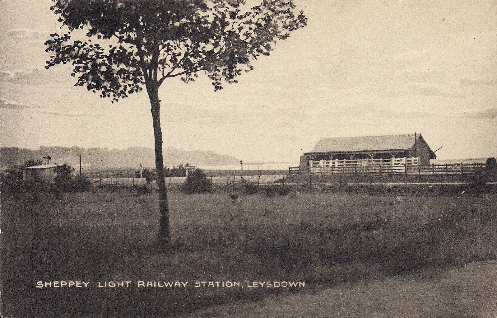
Leysdown railway station

Leysdown is a disused railway station in Leysdown-on-Sea. It opened in 1901 and closed in 1950. There are no remains of the station. == References... ==

Eastchurch

Eastchurch is a village and civil parish on the Isle of Sheppey, in the English county of Kent, two miles east of Minster. The village website claims the...

Memorial to the Home of Aviation

The Memorial to the Home of Aviation is a stone memorial sculpture at Eastchurch, on the Isle of Sheppey in the English county of Kent. The Grade II* listed...

Eastchurch railway station

Eastchurch is a disused railway station serving Eastchurch on the Isle of Sheppey. It opened in 1901 and closed in 1950. == References == == External... ==

Nearby Amenities

Located within 500m of 51.396368,0.89966009
Bus Stop
Bay View Hotel
Bus: yes
Naptan AtcoCode: 2400A016190A
Naptan Bearing: E
Naptan CommonName: Bay View Hotel
Naptan Indicator: adj
Naptan Landmark: Bay View Hotel
Naptan NaptanCode: kntapwmt
Naptan Street: Leysdown Road
Naptan Verified: no
Public Transport: platform
Source: naptan_import
Lat/Long: 51.3965443/0.9003838
Bus Stop
Bay View Hotel
Bus: yes
Naptan AtcoCode: 2400A016310A
Naptan Bearing: W
Naptan CommonName: Bay View Hotel
Naptan Indicator: opp
Naptan Landmark: Bay View Hotel
Naptan NaptanCode: kntapwtj
Naptan Street: Leysdown Road
Naptan Verified: no
Public Transport: platform
Source: naptan_import
Lat/Long: 51.3962367/0.8992098
Bus Stop
Danes Drive
Bus: yes
Naptan AtcoCode: 2400A016320A
Naptan Bearing: W
Naptan CommonName: Danes Drive
Naptan Indicator: Opp
Naptan Landmark: Bay View
Naptan NaptanCode: kntapwtm
Naptan Street: Leysdown Rd
Naptan Verified: no
Public Transport: platform
Source: naptan_import
Lat/Long: 51.3963281/0.8936944
Post Box
Brand: Royal Mail
Brand Wikidata: Q638098
Brand Wikipedia: en:Royal Mail
Collection Times: Mo-Fr 16:30; Sa 11:15
Operator: Royal Mail
Operator Wikidata: Q638098
Post Box Type: lamp
Ref: ME12 5
Royal Cypher: EIIR
Royal Cypher Wikidata: Q33102113
Lat/Long: 51.3965341/0.8997113
Bay View
Place: hamlet
Wikidata: Q4874145
Lat/Long: 51.396806/0.8987471
Generator Method: photovoltaic
Generator Output Electricity: yes
Generator Source: solar
Generator Type: solar_photovoltaic_panel
Location: roof
Power: generator
Lat/Long: 51.3969077/0.9023287
Generator Method: photovoltaic
Generator Output Electricity: yes
Generator Source: solar
Generator Type: solar_photovoltaic_panel
Location: roof
Power: generator
Lat/Long: 51.3973096/0.902043
Generator Method: photovoltaic
Generator Output Electricity: yes
Generator Source: solar
Generator Type: solar_photovoltaic_panel
Location: roof
Power: generator
Lat/Long: 51.3975737/0.901898
Generator Method: photovoltaic
Generator Output Electricity: yes
Generator Source: solar
Generator Type: solar_photovoltaic_panel
Location: roof
Power: generator
Lat/Long: 51.39678/0.9011741
Generator Method: photovoltaic
Generator Output Electricity: yes
Generator Source: solar
Generator Type: solar_photovoltaic_panel
Location: roof
Power: generator
Lat/Long: 51.397759/0.8981827
Generator Method: photovoltaic
Generator Output Electricity: yes
Generator Source: solar
Generator Type: solar_photovoltaic_panel
Location: roof
Power: generator
Lat/Long: 51.3979506/0.8962709
Generator Method: photovoltaic
Generator Output Electricity: yes
Generator Source: solar
Generator Type: solar_photovoltaic_panel
Location: roof
Power: generator
Lat/Long: 51.3979439/0.8961314
Generator Method: photovoltaic
Generator Output Electricity: yes
Generator Source: solar
Generator Type: solar_photovoltaic_panel
Location: roof
Power: generator
Lat/Long: 51.3979472/0.8960295
Generator Method: photovoltaic
Generator Output Electricity: yes
Generator Source: solar
Generator Type: solar_photovoltaic_panel
Location: roof
Power: generator
Lat/Long: 51.3979573/0.8953804
Generator Method: photovoltaic
Generator Output Electricity: yes
Generator Source: solar
Generator Type: solar_photovoltaic_panel
Location: roof
Power: generator
Lat/Long: 51.3990438/0.8990833
Generator Method: photovoltaic
Generator Output Electricity: yes
Generator Source: solar
Generator Type: solar_photovoltaic_panel
Location: roof
Power: generator
Lat/Long: 51.3965531/0.8981619
Generator Method: photovoltaic
Generator Output Electricity: yes
Generator Source: solar
Generator Type: solar_photovoltaic_panel
Location: roof
Power: generator
Lat/Long: 51.397039/0.8984759
Generator Method: photovoltaic
Generator Output Electricity: yes
Generator Source: solar
Generator Type: solar_photovoltaic_panel
Location: roof
Power: generator
Lat/Long: 51.3970423/0.8985105
Generator Method: photovoltaic
Generator Output Electricity: yes
Generator Source: solar
Generator Type: solar_photovoltaic_panel
Location: roof
Power: generator
Lat/Long: 51.3968769/0.8992901
Generator Method: photovoltaic
Generator Output Electricity: yes
Generator Source: solar
Generator Type: solar_photovoltaic_panel
Location: roof
Power: generator
Lat/Long: 51.3968831/0.8993572
Crossing
Crossing: unmarked
Crossing Island: yes
Crossing Markings: no
Tactile Paving: no
Lat/Long: 51.3965572/0.8932277
Generator Method: photovoltaic
Generator Output Electricity: yes
Generator Source: solar
Generator Type: solar_photovoltaic_panel
Location: roof
Power: generator
Lat/Long: 51.3972613/0.8934788
Generator Method: photovoltaic
Generator Output Electricity: yes
Generator Source: solar
Generator Type: solar_photovoltaic_panel
Location: roof
Power: generator
Lat/Long: 51.3972215/0.8935436
Generator Method: photovoltaic
Generator Output Electricity: yes
Generator Source: solar
Generator Type: solar_photovoltaic_panel
Location: roof
Power: generator
Lat/Long: 51.3972606/0.8936223
Generator Method: photovoltaic
Generator Output Electricity: yes
Generator Source: solar
Generator Type: solar_photovoltaic_panel
Location: roof
Power: generator
Lat/Long: 51.3968504/0.8954469
Crossing
Crossing: unmarked
Crossing Island: yes
Crossing Markings: no
Tactile Paving: no
Lat/Long: 51.3964162/0.9000133
Information: board
Tourism: information
Lat/Long: 51.3965815/0.8997197
Waste Basket
Lat/Long: 51.3965685/0.8997243
Grit Bin
Lat/Long: 51.3965955/0.8997158
The data included in this document is from www.openstreetmap.org. The data is made available under ODbL.

Have you been to Bay View?

Leave your review of Bay View below (or comments, questions and feedback).