Wyre Sound

Sea, Estuary, Creek in Orkney

Scotland

Wyre Sound

Boats in Rousay
Boats in Rousay Credit: stalked

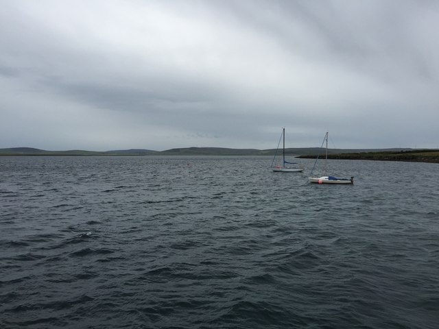
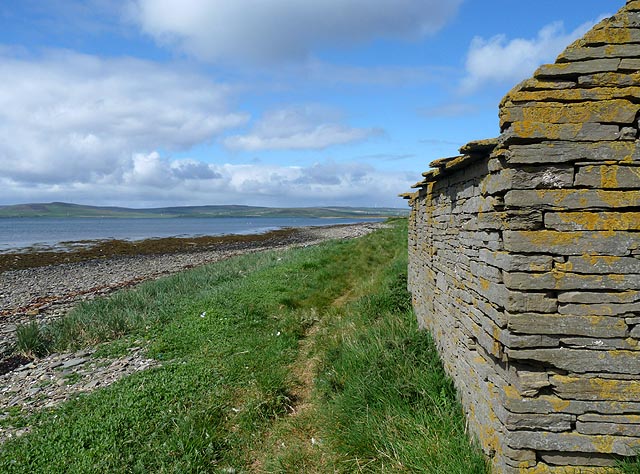
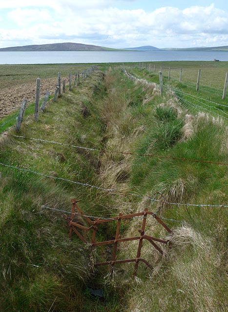
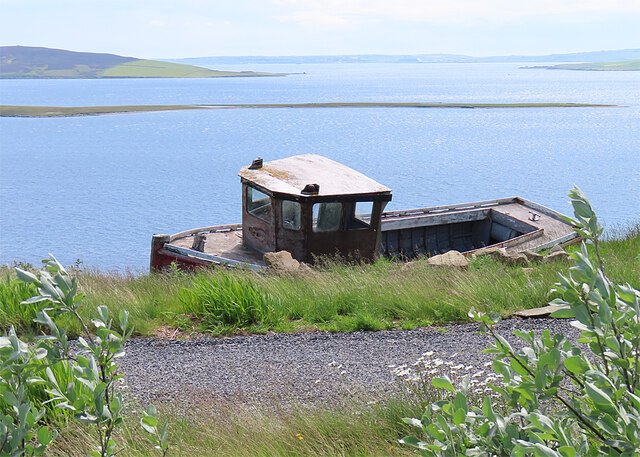
Wyre Sound is a picturesque sea inlet located on the northeastern coast of the Orkney Islands in Scotland. It is situated between the mainland of Orkney and the island of Wyre, after which it is named. The sound forms a natural estuary where the tidal waters of the North Sea flow inland, creating a sheltered and serene environment.

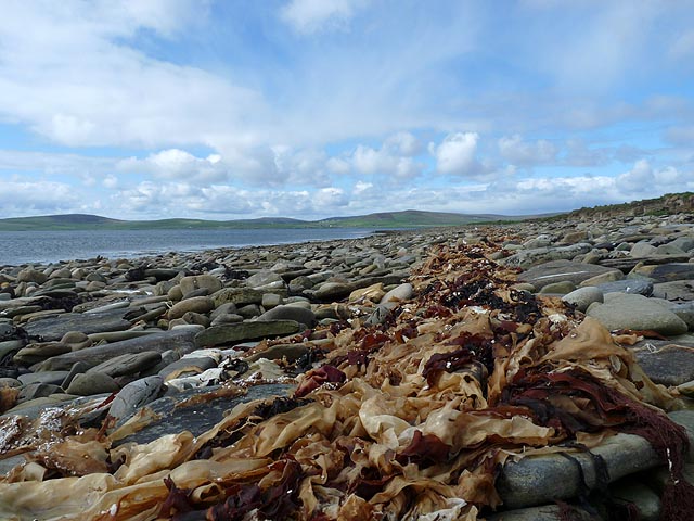
Measuring approximately 2.5 kilometers in length, Wyre Sound is known for its stunning natural beauty and diverse wildlife. The area is renowned for its rich marine biodiversity, with a plethora of fish species, including cod, haddock, and flatfish, inhabiting its waters. Seals and otters are frequently spotted frolicking in the sound, and a variety of seabirds, such as puffins and guillemots, can be observed nesting along the cliffs.

The tides in Wyre Sound are influenced by the powerful Atlantic currents, resulting in strong tidal flows. This makes it an ideal spot for boating enthusiasts and sailors seeking challenging conditions. The sound also offers excellent opportunities for kayaking and paddleboarding, allowing visitors to explore the rugged coastline and admire the awe-inspiring scenery.

The picturesque village of Wyre is located near the mouth of the sound, and it serves as a gateway for tourists to explore this captivating area. The village offers accommodation options, including cozy cottages and bed and breakfasts, for those wishing to immerse themselves in the tranquility of the surroundings.

Overall, Wyre Sound is a captivating and biodiverse natural feature in the Orkney Islands, offering visitors a chance to experience the rugged beauty and rich marine life that this region is renowned for.

If you have any feedback on the listing, please let us know in the comments section below.
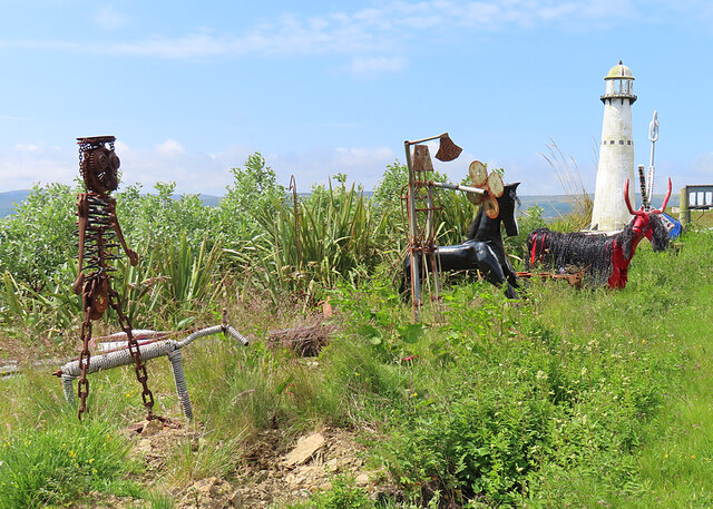
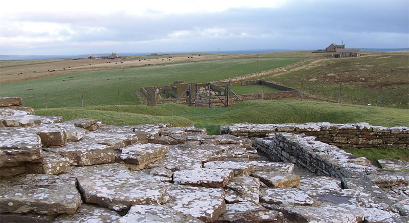
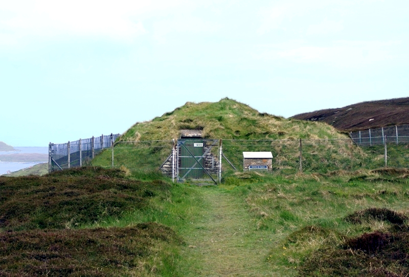
Wyre Sound Images

Images are sourced within 2km of 59.11334/-3.0144967 or Grid Reference HY4225. Thanks to Geograph Open Source API. All images are credited.

Boats in Rousay
Boats in Rousay
Modern Boundary Marker by the B9064, Rousay Parish Parish Boundary Marker by the B9064, in parish of Rousay (District), bend in road West of Trumland Home Farm, on verge between road and a dry stone wall, South side of road.

Inscription reads:- : FROTOFT : : BRINIAN :

Surveyed

Milestone Society National ID: OR_ROU03pb
Modern Boundary Marker by the B9064, Rousay Parish
Parish Boundary Marker by the B9064, in parish of Rousay (District), bend in road West of Trumland Home Farm, on verge between road and a dry stone wall, South side of road. Inscription reads:- : FROTOFT : : BRINIAN : Surveyed Milestone Society National ID: OR_ROU03pb
View from Blackhammer Cairn The grassy hillside east of Blackhammer, the neolithic chambered cairn. Cows are grazing on the slopes of Green Hill. Only a few scattered farm buildings are visible from the cairn.
View from Blackhammer Cairn
The grassy hillside east of Blackhammer, the neolithic chambered cairn. Cows are grazing on the slopes of Green Hill. Only a few scattered farm buildings are visible from the cairn.
Noust, Wyre, Orkney Looking west towards Orkney Mainland.
Noust, Wyre, Orkney
Looking west towards Orkney Mainland.
The Taing, Wyre, Orkney Looking towards Orkney Mainland.
The Taing, Wyre, Orkney
Looking towards Orkney Mainland.
Ditch, Wyre, Orkney Looking towards the island of Gairsay with Orkney Mainland behind.

The ruined building by the shore can be seen at <a href="https://www.geograph.org.uk/photo/3067932">HY4325 : Noust, Wyre, Orkney</a>.
Ditch, Wyre, Orkney
Looking towards the island of Gairsay with Orkney Mainland behind. The ruined building by the shore can be seen at HY4325 : Noust, Wyre, Orkney.
The view from inside the chambered cairn The concrete is the modern entrance. Looking down to the Knowe of Hunclett on the coast.
The view from inside the chambered cairn
The concrete is the modern entrance. Looking down to the Knowe of Hunclett on the coast.
Looking down to Eynhallow Sound
Grassland above Nearhouse
Roadside sculptures near Taversoe A charmingly bizarre collection. Even the lighthouse is a model.
Roadside sculptures near Taversoe
A charmingly bizarre collection. Even the lighthouse is a model.
Metal Art Artefacts created from scrap metal stand beside the road.
Metal Art
Artefacts created from scrap metal stand beside the road.
Metal Art Artefacts created from scrap metal stand beside the road.
Metal Art
Artefacts created from scrap metal stand beside the road.
Midgard A modern house with a standing stone near the gate.
Midgard
A modern house with a standing stone near the gate.
Nearhouse The farm of Nearhouse is on the slope below the public road. In the distance is the northern part of Mainland.
Nearhouse
The farm of Nearhouse is on the slope below the public road. In the distance is the northern part of Mainland.
Fields and Dykes Somewhere on the shore down there are the remains of a broch on the Knowe of Hunclett. See <span class="nowrap"><a title="https://portal.historicenvironment.scot/designation/SM1456" rel="nofollow ugc noopener" href="https://portal.historicenvironment.scot/designation/SM1456">Link</a><img style="margin-left:2px;" alt="External link" title="External link - shift click to open in new window" src="https://s1.geograph.org.uk/img/external.png" width="10" height="10"/></span> for details of this Scheduled Ancient Monument.
Fields and Dykes
Somewhere on the shore down there are the remains of a broch on the Knowe of Hunclett. See LinkExternal link for details of this Scheduled Ancient Monument.
Horses One heavy horse and one of more usual size, grazing in the corner of a field above Nearhouse.
Horses
One heavy horse and one of more usual size, grazing in the corner of a field above Nearhouse.
Nearhouse The farm of Nearhouse is on the slope below the public road.
Nearhouse
The farm of Nearhouse is on the slope below the public road.
Boat Going Nowhere I'm not even sure that this is a full-sized boat, but it's in need of some serious attention if it is to take to the water again. Meantime it's very picturesque.
Boat Going Nowhere
I'm not even sure that this is a full-sized boat, but it's in need of some serious attention if it is to take to the water again. Meantime it's very picturesque.
Show me another place!

Wyre Sound is located at Grid Ref: HY4225 (Lat: 59.11334, Lng: -3.0144967)

Unitary Authority: Orkney Islands

Police Authority: Highlands and Islands

What 3 Words

///ordering.gagging.tasks. Near Brinian, Orkney Islands

Related Wikis

Taversöe Tuick

Taversöe Tuick (or Taversoe Tuick) is a Neolithic burial cairn on Rousay, Orkney, Scotland, thought to date from between 4000 and 2500 BCE. The monument...

Blackhammer Chambered Cairn

Blackhammer Chambered Cairn is a Neolithic chambered cairn located on the island of Rousay, in Orkney, Scotland. The tomb, constructed around 3000 BC,...

Cobbie Row's Castle

Cobbie Row's (or Cubbie Roo's) Castle is the oldest medieval castle known to exist in Scotland. The castle ruins are located on the island of Wyre in Orkney...

St. Mary's Chapel, Wyre

St. Mary's Chapel is a ruined 12th century chapel found on the island of Wyre, in Orkney, Scotland. It is thought to have been built by a Norse chieftain...

Trumland

Trumland is a Category B listed house and associated estate on Rousay, in Orkney, Scotland, built in its present form in the 1870s. Designed by David...

Brinian

Brinian is a village on the island of Rousay, in Orkney, Scotland. Trumland is situated to the west of the village, with Taversöe Tuick nearby. Brinian...

Wyre, Orkney

Wyre (historically known as Viera and Veira) is one of the Orkney Islands, lying south-east of Rousay. It is 311 hectares (1.20 sq mi) and 32 metres (105...

Knowe of Yarso chambered cairn

Knowe of Yarso chambered cairn is a Neolithic burial monument located on the island of Rousay in Orkney, Scotland. The site was excavated in the 1930s...

Nearby Amenities

Located within 500m of 59.11334,-3.0144967
Post-Medieval kelp pits
Historic: archaeological_site
Lat/Long: 59.1134675/-3.0111495
The data included in this document is from www.openstreetmap.org. The data is made available under ODbL.

Have you been to Wyre Sound?

Leave your review of Wyre Sound below (or comments, questions and feedback).