South Deep

Sea, Estuary, Creek in Fife

Scotland

South Deep

Reed Bed, Firth of Tay At the upstream entrance to the South Deep, the main shipping channel out of Perth.
Reed Bed, Firth of Tay Credit: Richard Webb

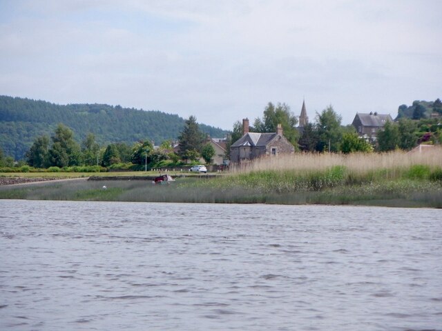
South Deep is a picturesque coastal area located in Fife, Scotland. Situated along the eastern coast of the country, it encompasses a diverse range of natural features, including a sea, estuary, and creek. The area is renowned for its stunning beauty and abundant wildlife, making it a popular destination for nature enthusiasts and tourists alike.

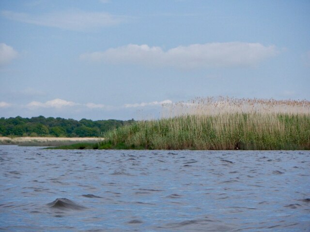
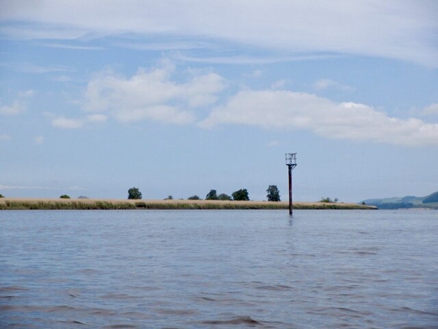
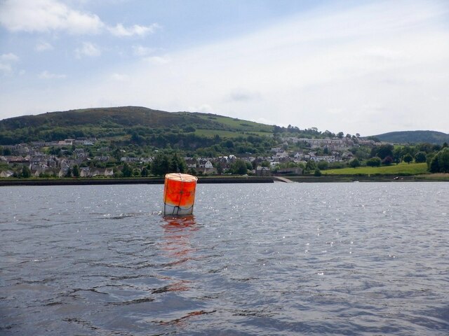
The South Deep sea offers breathtaking views of the North Sea, with its deep blue waters stretching as far as the eye can see. The crashing waves and sandy beaches provide the perfect backdrop for long walks and relaxation. The sea is also a haven for various marine creatures, such as seals, dolphins, and a variety of seabirds.

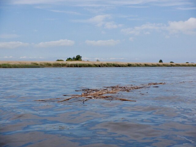
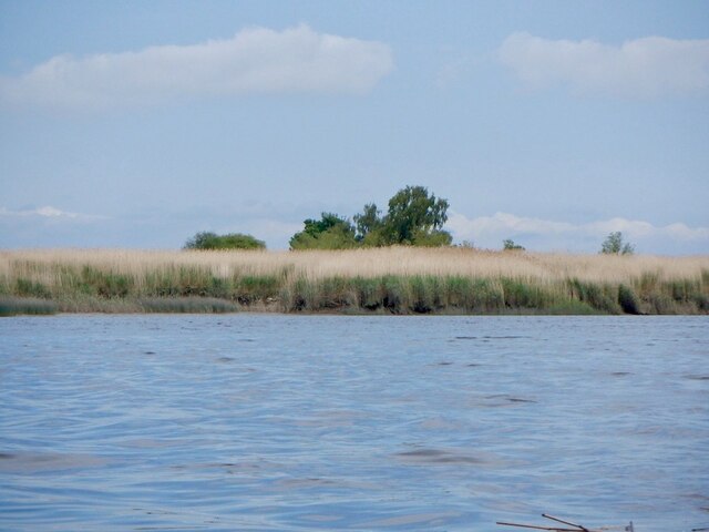
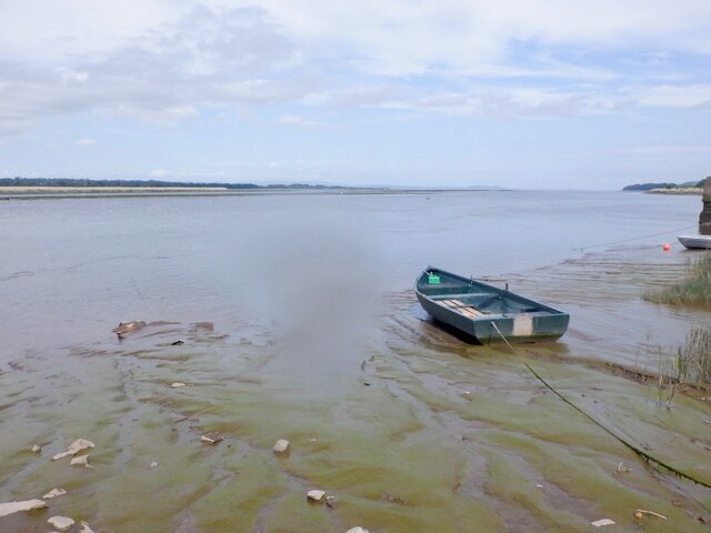
Adjacent to the sea, the South Deep estuary is a significant feature of the area. The estuary is formed where a river meets the sea, creating a unique ecosystem that supports a wide range of plant and animal life. It is home to numerous species of fish, including salmon and trout, making it a popular spot for fishing enthusiasts.

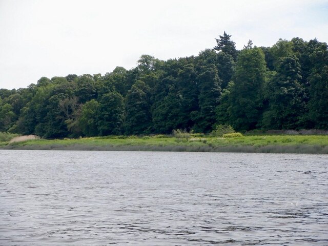
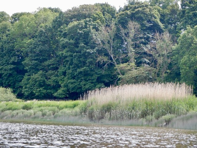
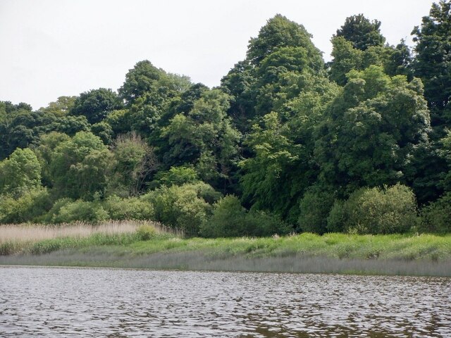
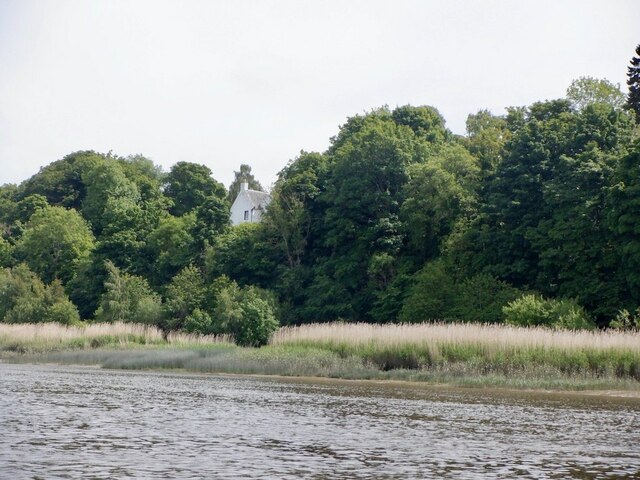
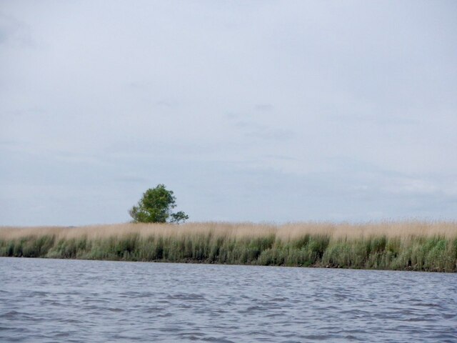
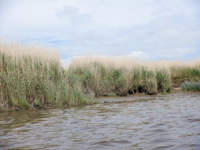
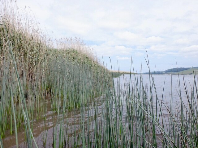
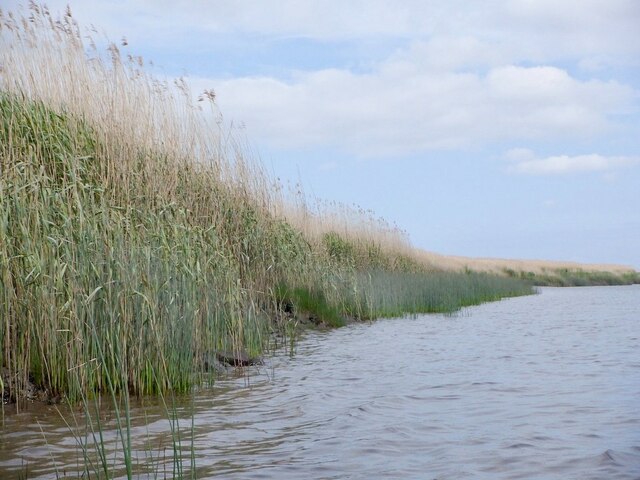
Within the South Deep area, there is a tranquil creek that winds its way through the surrounding landscape. The creek offers a peaceful and scenic setting, attracting visitors who enjoy boating, kayaking, or simply taking in the natural beauty. The banks of the creek are lined with lush vegetation, providing a habitat for various bird species and small mammals.

Overall, South Deep in Fife is a captivating coastal destination that showcases the natural wonders of Scotland. Its combination of sea, estuary, and creek creates a diverse and thriving ecosystem, offering visitors a chance to immerse themselves in the beauty and tranquility of the area.

If you have any feedback on the listing, please let us know in the comments section below.
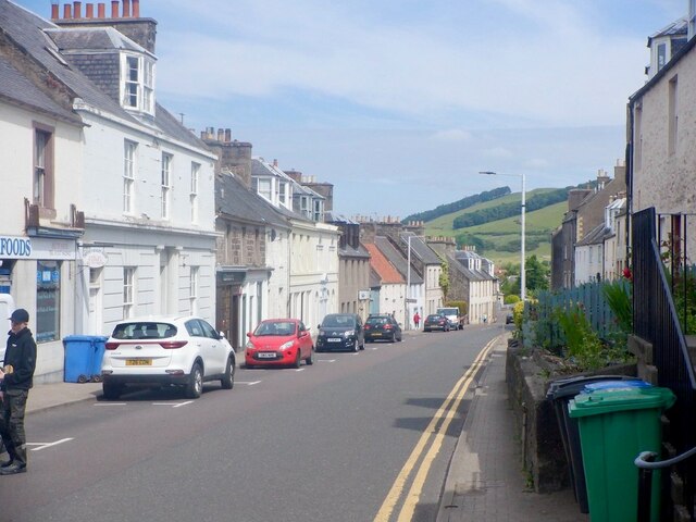
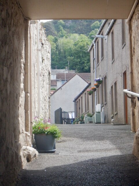
South Deep Images

Images are sourced within 2km of 56.354052/-3.2525106 or Grid Reference NO2218. Thanks to Geograph Open Source API. All images are credited.

Reed Bed, Firth of Tay At the upstream entrance to the South Deep, the main shipping channel out of Perth.
Reed Bed, Firth of Tay
At the upstream entrance to the South Deep, the main shipping channel out of Perth.
Reeds floating down the South Deep Ebb tide on the shipping channel in the Firth of Tay with Mugdrum Island in the background.
Reeds floating down the South Deep
Ebb tide on the shipping channel in the Firth of Tay with Mugdrum Island in the background.
Mugdrum Island View from the South Deep.
Mugdrum Island
View from the South Deep.
Woodland beside the Firth of Tay
Navigation beacon, Firth of Tay Marking the South Deep shipping channel.
Navigation beacon, Firth of Tay
Marking the South Deep shipping channel.
South bank of the Firth of Tay Near Newburgh.
South bank of the Firth of Tay
Near Newburgh.
South bank of the Firth of Tay Near Newburgh.
South bank of the Firth of Tay
Near Newburgh.
Mugdrum House Near Newburgh
Mugdrum House
Near Newburgh
Newburgh seen from the South Deep Newburgh offers some escape routes off the water without too much interaction with the mud. Make sure you are on the right side of The Hard though. The ebb tide runs fast close to the shore here, unlike the slower flow by Mugdrum Island.
Newburgh seen from the South Deep
Newburgh offers some escape routes off the water without too much interaction with the mud. Make sure you are on the right side of The Hard though. The ebb tide runs fast close to the shore here, unlike the slower flow by Mugdrum Island.
Navigation marker off Newburgh One of a pair of bright orange marker barrels off Mugdrum Island.
Navigation marker off Newburgh
One of a pair of bright orange marker barrels off Mugdrum Island.
Mugdrum Island
Mugdrum Island
Reed beds, Mugdrum Island There is a sea wall around the centre of the island this is surrounded by  extensive reed beds.
Reed beds, Mugdrum Island
There is a sea wall around the centre of the island this is surrounded by extensive reed beds.
Reed beds, Mugdrum Island
Newburgh Harbour A relatively mud free corner enabled a clean exit off the river at around 2 hours before low water. I would not want to have got here much later. 
I had also just dropped my camera in the not so silvery Tay and was glad for a quick retrieval although it would have soon turned up as the tide fell.

The way out is by the metal ladder.
Newburgh Harbour
A relatively mud free corner enabled a clean exit off the river at around 2 hours before low water. I would not want to have got here much later. I had also just dropped my camera in the not so silvery Tay and was glad for a quick retrieval although it would have soon turned up as the tide fell. The way out is by the metal ladder.
Newburgh Harbour and the South Deep The mud was avoidable when taking out - just.
Newburgh Harbour and the South Deep
The mud was avoidable when taking out - just.
High Street, Newburgh
Reef Mog A close off Newburgh High Street.
Reef Mog
A close off Newburgh High Street.
Show me another place!

South Deep is located at Grid Ref: NO2218 (Lat: 56.354052, Lng: -3.2525106)

Unitary Authority: Perth and Kinross

Police Authority: Tayside

What 3 Words

///sifts.loser.racetrack. Near Newburgh, Fife

Related Wikis

Mugdrum Island

Mugdrum Island lies in the Firth of Tay, offshore from the town of Newburgh, Fife, in the east of Scotland. == Geography == Mugdrum is low-lying and reedy...

Newburgh railway station

See also Parbold railway station which was originally named "Newburgh railway station". There have been several railway stations serving the town of Newburgh...

Newburgh, Fife

Newburgh is a royal burgh and parish in Fife, Scotland, at the south shore of the Firth of Tay. The town has a population of 2,171 (in 2011), which constitutes...

Lindores Abbey

Lindores Abbey was a Tironensian abbey on the outskirts of Newburgh in Fife, Scotland. Now a reduced ruin, it lies on the southern banks of the River Tay...

Nearby Amenities

Located within 500m of 56.354052,-3.2525106
Created By: almien_coastlines
Lat/Long: 56.357411/-3.255688
Created By: almien_coastlines
Lat/Long: 56.357412/-3.255227
Created By: almien_coastlines
Lat/Long: 56.357671/-3.253845
Created By: almien_coastlines
Lat/Long: 56.35793/-3.252463
Created By: almien_coastlines
Lat/Long: 56.358187/-3.252003
Created By: almien_coastlines
Lat/Long: 56.356405/-3.246918
Created By: almien_coastlines
Lat/Long: 56.356277/-3.247149
Created By: almien_coastlines
Lat/Long: 56.356147/-3.247839
Created By: almien_coastlines
Lat/Long: 56.356146/-3.2483
Created By: almien_coastlines
Lat/Long: 56.355628/-3.251064
Created By: almien_coastlines
Lat/Long: 56.3555/-3.251294
Created By: almien_coastlines
Lat/Long: 56.355371/-3.251523
Created By: almien_coastlines
Lat/Long: 56.35537/-3.251985
Created By: almien_coastlines
Lat/Long: 56.355111/-3.253367
Created By: almien_coastlines
Lat/Long: 56.35485/-3.256132
Created By: almien_coastlines
Lat/Long: 56.354722/-3.256363
Created By: almien_coastlines
Lat/Long: 56.354465/-3.256822
Created By: almien_coastlines
Lat/Long: 56.353818/-3.259815
Created By: almien_coastlines
Lat/Long: 56.357413/-3.254766
Created By: almien_coastlines
Lat/Long: 56.358444/-3.251544
Created By: almien_coastlines
Lat/Long: 56.356148/-3.247378
Created By: almien_coastlines
Lat/Long: 56.356018/-3.248531
Created By: almien_coastlines
Lat/Long: 56.355889/-3.24876
Created By: almien_coastlines
Lat/Long: 56.355369/-3.252446
Created By: almien_coastlines
Lat/Long: 56.355111/-3.253828
Created By: almien_coastlines
Lat/Long: 56.35511/-3.254289
Created By: almien_coastlines
Lat/Long: 56.354336/-3.257051
Created By: almien_coastlines
Lat/Long: 56.354078/-3.257972
Created By: almien_coastlines
Lat/Long: 56.354077/-3.258433
Created By: almien_coastlines
Lat/Long: 56.353819/-3.259354
Created By: almien_coastlines
Lat/Long: 56.353817/-3.260276
The data included in this document is from www.openstreetmap.org. The data is made available under ODbL.

Have you been to South Deep?

Leave your review of South Deep below (or comments, questions and feedback).