Skinham Creek

Sea, Estuary, Creek in Cornwall

England

Skinham Creek

Eastbound A38 near Burraton Blue signs giving advance notice of toll charges on the Tamar Bridge ahead (although traffic will have to negotiate the Saltash Tunnel before reaching the bridge).
Eastbound A38 near Burraton Credit: David Dixon

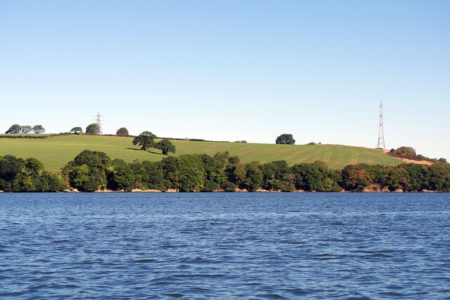
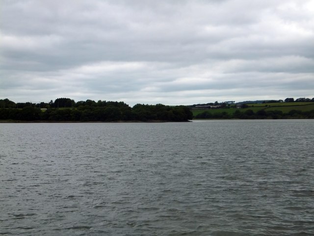
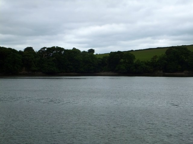
Skinham Creek is a picturesque waterway located in Cornwall, England. It is situated on the southern coast of the county, near the village of Skinham. The creek is formed by the convergence of the sea and an estuary, creating a unique ecosystem that is home to a variety of flora and fauna.

The creek is characterized by its tranquil and scenic surroundings, with its calm waters reflecting the beauty of the surrounding landscape. The creek is primarily fed by freshwater streams that flow into the estuary, resulting in a mix of brackish water that provides a suitable habitat for various marine and estuarine species.

The diverse ecosystem of Skinham Creek supports a rich array of wildlife. The creek is known for its abundance of bird species, including herons, kingfishers, and wading birds, which can often be spotted along the banks or soaring above the water. The creek also provides a habitat for various fish species, such as mullet and flounder, as well as crustaceans like crabs and shrimps.

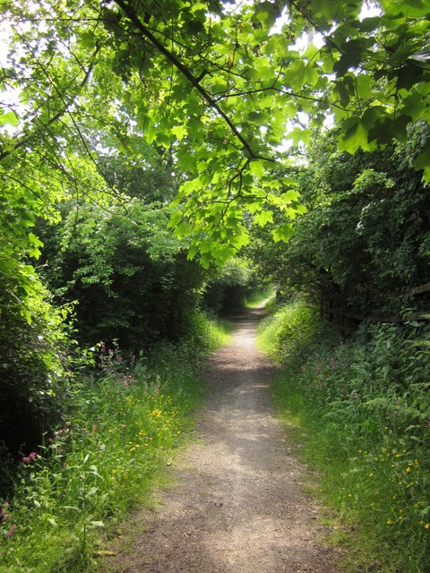
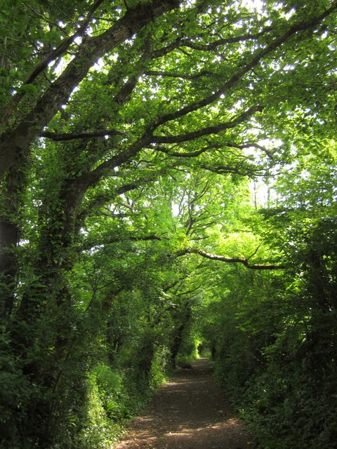
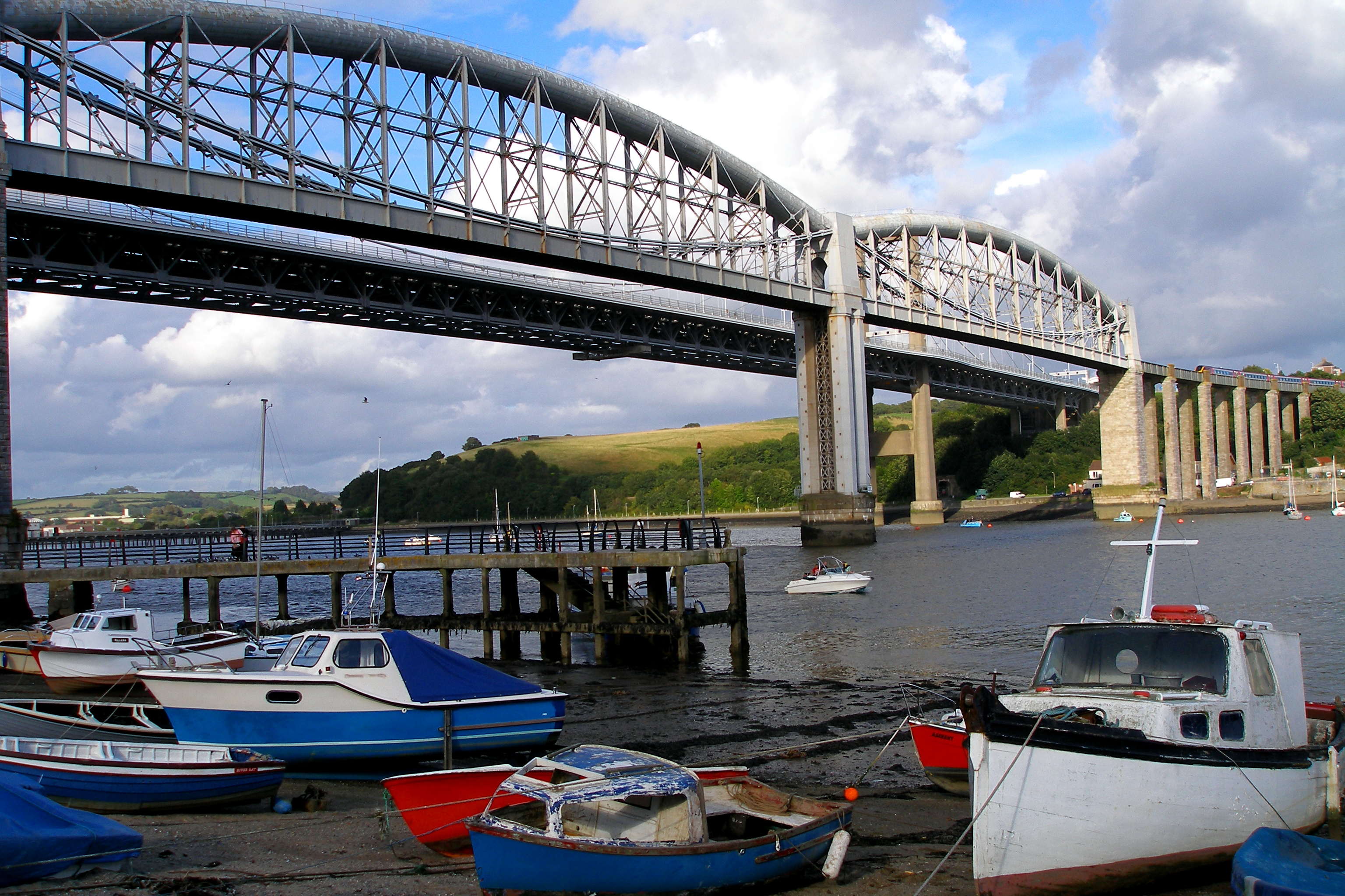
Skinham Creek is not only a haven for wildlife but also offers recreational opportunities for visitors. It is a popular spot for boating, kayaking, and fishing, with its calm waters providing an ideal setting for water-based activities. The creek's scenic beauty also attracts nature enthusiasts who enjoy exploring the surrounding marshes and wetlands.

In conclusion, Skinham Creek is a picturesque waterway in Cornwall, offering a unique blend of sea and estuary environments. Its diverse ecosystem supports a range of wildlife and provides recreational opportunities for visitors to enjoy the natural beauty of the area.

If you have any feedback on the listing, please let us know in the comments section below.

Skinham Creek Images

Images are sourced within 2km of 50.423651/-4.2224013 or Grid Reference SX4260. Thanks to Geograph Open Source API. All images are credited.

Eastbound A38 near Burraton Blue signs giving advance notice of toll charges on the Tamar Bridge ahead (although traffic will have to negotiate the Saltash Tunnel before reaching the bridge).
Eastbound A38 near Burraton
Blue signs giving advance notice of toll charges on the Tamar Bridge ahead (although traffic will have to negotiate the Saltash Tunnel before reaching the bridge).
Westbound A38 at Carkeel The A38 is a major A-class trunk route. When first designated in 1922, it ran from Derby to Plymouth but it was later extended at both ends so that it now runs for 292 miles from Mansfield in Nottinghamshire to Bodmin in Cornwall.

Prior to the opening of the M5 motorway in the 1960s and 1970s, the A38 formed the main "holiday route" from the Midlands to Somerset, Devon and Cornwall and the south-western section was notorious at holiday times for the congestion. Nowadays, for most of the southern section, the A38 is a fairly quiet road shadowing the M5 extremely closely; often running alongside the motorway as a single carriageway road. The section between Exeter and Plymouth is, however, a busy dual carriageway which serves as the southern extension of the M5 and is known as “the Devon Expressway”.

More information at <span class="nowrap"><a title="http://en.wikipedia.org/wiki/A38_road" rel="nofollow ugc noopener" href="http://en.wikipedia.org/wiki/A38_road">Link</a><img style="margin-left:2px;" alt="External link" title="External link - shift click to open in new window" src="https://s1.geograph.org.uk/img/external.png" width="10" height="10"/></span>  (Wikipedia) and <span class="nowrap"><a title="http://www.sabre-roads.org.uk/wiki/index.php?title=A38" rel="nofollow ugc noopener" href="http://www.sabre-roads.org.uk/wiki/index.php?title=A38">Link</a><img style="margin-left:2px;" alt="External link" title="External link - shift click to open in new window" src="https://s1.geograph.org.uk/img/external.png" width="10" height="10"/></span>  (SABRE).
Westbound A38 at Carkeel
The A38 is a major A-class trunk route. When first designated in 1922, it ran from Derby to Plymouth but it was later extended at both ends so that it now runs for 292 miles from Mansfield in Nottinghamshire to Bodmin in Cornwall. Prior to the opening of the M5 motorway in the 1960s and 1970s, the A38 formed the main "holiday route" from the Midlands to Somerset, Devon and Cornwall and the south-western section was notorious at holiday times for the congestion. Nowadays, for most of the southern section, the A38 is a fairly quiet road shadowing the M5 extremely closely; often running alongside the motorway as a single carriageway road. The section between Exeter and Plymouth is, however, a busy dual carriageway which serves as the southern extension of the M5 and is known as “the Devon Expressway”. More information at LinkExternal link (Wikipedia) and LinkExternal link (SABRE).
'Firestorm' off Skinham Point The yacht plods gently downstream along the River Tamar north of Saltash.
'Firestorm' off Skinham Point
The yacht plods gently downstream along the River Tamar north of Saltash.
River Tamar, near Landulph Looking from the water to the bank on the Cornish side between Neal Point and Weir Point.
River Tamar, near Landulph
Looking from the water to the bank on the Cornish side between Neal Point and Weir Point.
St Mary's Church
St Mary's Church
Former Botus Fleming Wesleyan Chapel
Saltash Travelodge
Saltash Travelodge
Saltash: Waitrose Off the A388 and close to its junction with the A38 trunk road, north of Saltash town
Saltash: Waitrose
Off the A388 and close to its junction with the A38 trunk road, north of Saltash town
Meadow, Tamar Park A flower-filled field beside Pill Lane, south of <a href="https://www.geograph.org.uk/photo/66868">SX4260 : China Fleet Country Club, Saltash</a>.
Meadow, Tamar Park
A flower-filled field beside Pill Lane, south of SX4260 : China Fleet Country Club, Saltash.
Gravestones, Botusfleming In the churchyard of St Mary's church.
Gravestones, Botusfleming
In the churchyard of St Mary's church.
Bridleway to Pill Lane A little further down bridleway 636/9/1 shown in <a href="https://www.geograph.org.uk/photo/817860">SX4160 : Bridleway from Carkeel</a>.
Bridleway to Pill Lane
A little further down bridleway 636/9/1 shown in SX4160 : Bridleway from Carkeel.
Pill Lane A reverse view of <a href="https://www.geograph.org.uk/photo/817784">SX4260 : Green Lane near Pill Farm</a>, with a route with public access following the green lane as a continuation of bridleway 636/9/1.
Pill Lane
A reverse view of SX4260 : Green Lane near Pill Farm, with a route with public access following the green lane as a continuation of bridleway 636/9/1.
Skinham Point seen from the Tamar The wooded point is the end of the Kingsmill Lake inlet.  The tide was high so the inlet was full of water
Skinham Point seen from the Tamar
The wooded point is the end of the Kingsmill Lake inlet. The tide was high so the inlet was full of water
The bay on the Tamar at Parsons Quay A wooded bay on the Cornish bank of the river, whose access is now a riverside footpath
The bay on the Tamar at Parsons Quay
A wooded bay on the Cornish bank of the river, whose access is now a riverside footpath
Houses at Carkeel On the A388, opposite Dirty Lane.
Houses at Carkeel
On the A388, opposite Dirty Lane.
Dirty Lane, Carkeel A route with public access leading away from the A388, and towards a bridleway to Trematon. I presume the speed derestriction sign means you can drive at up to 60mph, but it might be unwise to aim for half that.
Dirty Lane, Carkeel
A route with public access leading away from the A388, and towards a bridleway to Trematon. I presume the speed derestriction sign means you can drive at up to 60mph, but it might be unwise to aim for half that.
Dirty Lane, Carkeel A closer look down the route with public access shown in <a href="https://www.geograph.org.uk/photo/3540962">SX4060 : Dirty Lane, Carkeel</a>.
Dirty Lane, Carkeel
A closer look down the route with public access shown in SX4060 : Dirty Lane, Carkeel.
Houses at Carkeel The house on the left appears on the right of <a href="https://www.geograph.org.uk/photo/3540956">SX4060 : Houses at Carkeel</a>. View from Dirty Lane.
Houses at Carkeel
The house on the left appears on the right of SX4060 : Houses at Carkeel. View from Dirty Lane.
Show me another place!

Skinham Creek is located at Grid Ref: SX4260 (Lat: 50.423651, Lng: -4.2224013)

Unitary Authority: Cornwall

Police Authority: Devon and Cornwall

What 3 Words

///gala.confining.cuddled. Near Saltash, Cornwall

Related Wikis

South Pill

South Pill is a suburb of Saltash in the civil parish of Saltash, east Cornwall, England, the word "pill" deriving from a tidal pool related to the estuary...

Carkeel

Carkeel is a hamlet north of Saltash in southeast Cornwall, England. == References ==

Landulph

Landulph (Cornish: Lanndhylyk) is a hamlet and a rural civil parish in south-east Cornwall, England, United Kingdom. It is about 3 miles (5 km) north of...

Burraton

Burraton is a northern suburb of Saltash, Cornwall, England, UK. == References == == External links == Media related to Burraton at Wikimedia Commons
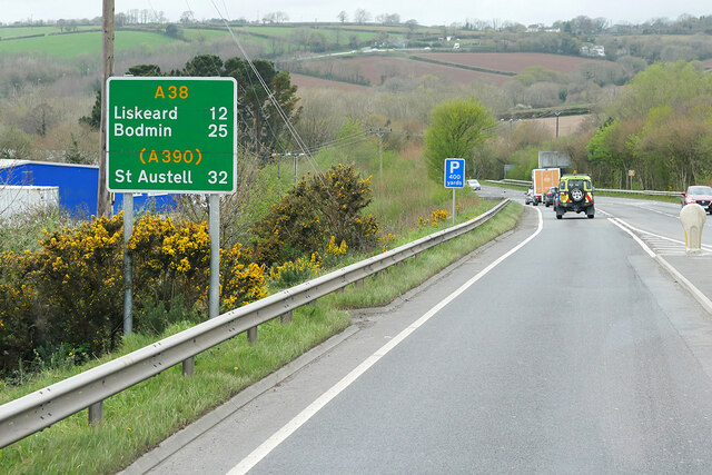
Saltash Tunnel

The Saltash Tunnel is a road tunnel on the A38 at Saltash in Cornwall, UK and was opened in 1988. The central lane operates as a reversible lane to cope...

Saltash United F.C.

Saltash United Football Club is an English football club based in Saltash, Cornwall. They currently play in the Western League Premier Division. Since...

Burraton Coombe

Burraton Coombe is a village forming a suburb on the west side of Saltash in Cornwall, England. == References ==

Saltash

Saltash (Cornish: Essa) is a town and civil parish in south Cornwall, England. It had a population of 16,184 in 2011 census. Saltash faces the city of...

Nearby Amenities

Located within 500m of 50.423651,-4.2224013
Source: PGS
Lat/Long: 50.4261431/-4.2165675
Source: PGS
Lat/Long: 50.4258854/-4.2165453
Source: PGS
Lat/Long: 50.4258125/-4.2168817
Source: PGS
Lat/Long: 50.4256635/-4.2183257
Source: PGS
Lat/Long: 50.4250704/-4.2191095
Source: PGS
Lat/Long: 50.4251117/-4.2200246
Source: PGS
Lat/Long: 50.4251595/-4.2212237
Source: PGS
Lat/Long: 50.4251747/-4.2218267
Source: PGS
Lat/Long: 50.4265074/-4.22408
Source: PGS
Lat/Long: 50.4270019/-4.2244429
Source: PGS
Lat/Long: 50.4272029/-4.2250378
Source: PGS
Lat/Long: 50.4261433/-4.2219248
Source: PGS
Lat/Long: 50.4260705/-4.2218377
Source: PGS
Lat/Long: 50.425954/-4.2211727
Source: PGS
Lat/Long: 50.4260488/-4.2200658
Source: PGS
Lat/Long: 50.4265433/-4.2191635
Source: PGS
Lat/Long: 50.4266843/-4.219204
Source: PGS
Lat/Long: 50.4266884/-4.2189309
Source: PGS
Lat/Long: 50.4269278/-4.2187504
Source: PGS
Lat/Long: 50.4248851/-4.2191962
The data included in this document is from www.openstreetmap.org. The data is made available under ODbL.

Have you been to Skinham Creek?

Leave your review of Skinham Creek below (or comments, questions and feedback).