Corran Narrows

Sea, Estuary, Creek in Argyllshire / Inverness-shire

Scotland

Corran Narrows

Very Static Caravan Quite a surprise to come across this caravan in the Ardgour woodland as at first glance there is no obvious access route.
Very Static Caravan Credit: Robert Struthers

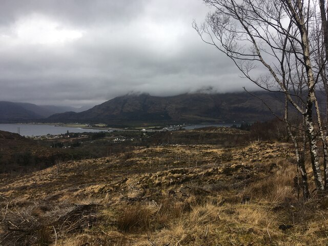
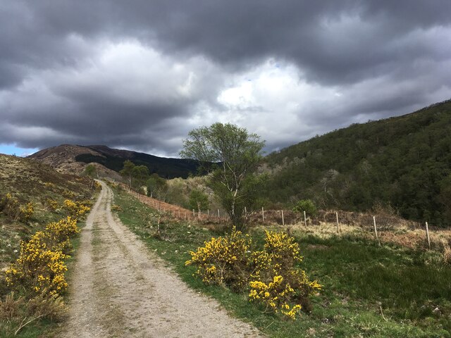
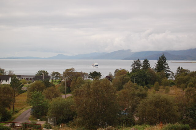
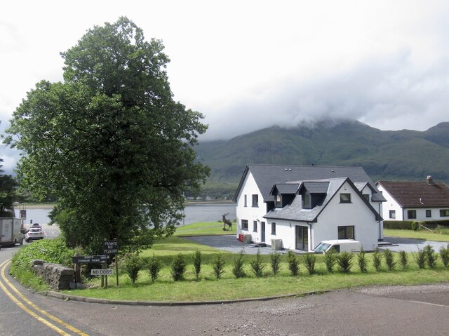
Corran Narrows is a natural marvel located in the western part of Scotland, specifically in the counties of Argyllshire and Inverness-shire. It is a narrow sea channel that connects the vast Loch Linnhe with the famous Loch Eil, forming a picturesque estuary and creek.

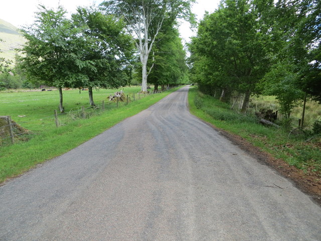
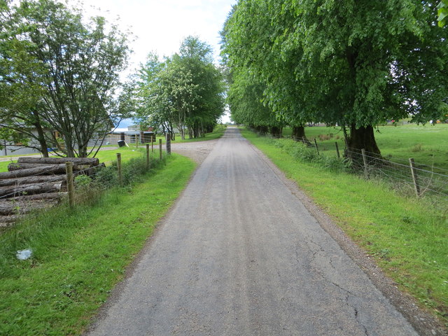
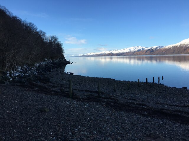
The Corran Narrows stretch for about 600 meters and are nestled between towering mountains on both sides, creating a breathtakingly beautiful landscape. The surrounding area is rich in natural beauty, with lush greenery and stunning views of the Scottish Highlands.

The narrows are renowned for their strong tidal currents, which can reach speeds of up to 8 knots during peak times. These currents make Corran Narrows a popular spot for adventure seekers and water sports enthusiasts, particularly kayakers and paddleboarders who enjoy the exciting challenges provided by the turbulent waters.

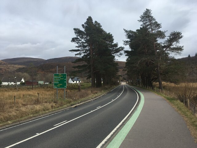
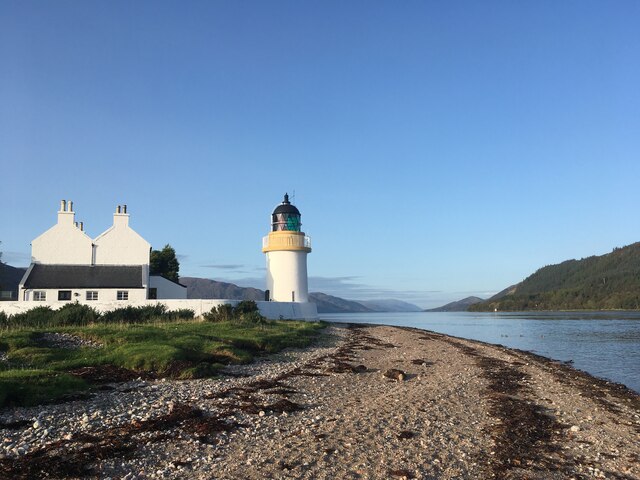
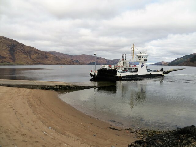
In addition to its natural beauty, Corran Narrows also plays a significant role in transportation. The area is home to the Corran Ferry, which operates between Nether Lochaber and Ardgour. The ferry provides a vital link for locals and visitors, allowing them to cross the narrows without having to travel a considerable distance around the lochs.

Overall, Corran Narrows in Argyllshire and Inverness-shire is a stunning natural feature that offers both beauty and adventure. Its awe-inspiring landscape and powerful tidal currents make it a must-visit destination for nature lovers and thrill-seekers alike.

If you have any feedback on the listing, please let us know in the comments section below.

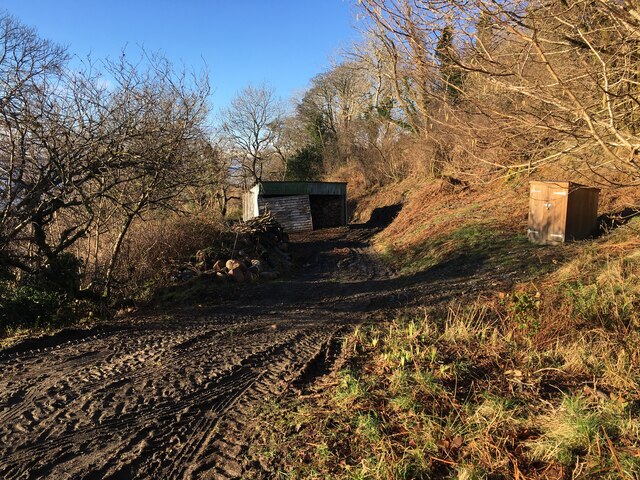
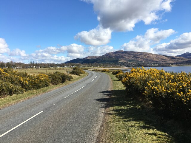
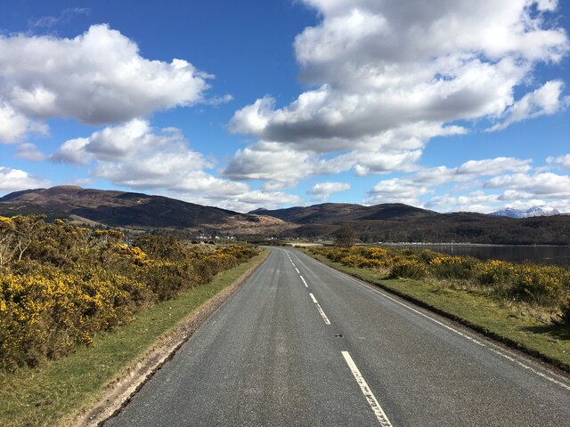
Corran Narrows Images

Images are sourced within 2km of 56.719596/-5.2409135 or Grid Reference NN0163. Thanks to Geograph Open Source API. All images are credited.

Very Static Caravan Quite a surprise to come across this caravan in the Ardgour woodland as at first glance there is no obvious access route.
Very Static Caravan
Quite a surprise to come across this caravan in the Ardgour woodland as at first glance there is no obvious access route.
Minor road to Clovullin Looking north-eastward.
Minor road to Clovullin
Looking north-eastward.
Minor road from Clovullin to A861 at Blar Ruatharach Looking south-westward.
Minor road from Clovullin to A861 at Blar Ruatharach
Looking south-westward.
Clear-felled forestry above Inchree
Clear-felled forestry, Inchree
Track junction above Inchree
A82 with no traffic Photo taken during the initial Covid pandemic lockdown.
A82 with no traffic
Photo taken during the initial Covid pandemic lockdown.
Track from Onich to Glen Righ
Corran Lighthouse and shoreline at Corran Narrows
Loch Linnhe from Inchree Looking from Inchree over Bunree towards Loch Linnhe.
Loch Linnhe from Inchree
Looking from Inchree over Bunree towards Loch Linnhe.
Forestry road and evidence of harvesting, Inchree
Old water tank, Corran
Shoreline of Loch Linnhe at Bunree
Track and shed near Onich
Corran Ferry at Ardgour
A861 past Clovullin
A861 past Clovullin
A861 past Clovullin
A861 past Clovullin
New house by the ferry queue, Nether Lochaber There has been a lot of development here in the past few years.
New house by the ferry queue, Nether Lochaber
There has been a lot of development here in the past few years.
Show me another place!

Corran Narrows is located at Grid Ref: NN0163 (Lat: 56.719596, Lng: -5.2409135)

Unitary Authority: Highland

Police Authority: Highlands and Islands

What 3 Words

///cage.punctured.reform. Near Glencoe, Highland

Related Wikis

Corran Ferry

The Corran Ferry crosses Loch Linnhe at the Corran Narrows, south of Fort William, Scotland. == Description == Operated by Highland Council, the Corran...

Corran, Lochaber

Corran (Scottish Gaelic: An Corran) is a former fishing village, situated on Corran Point, on the west side of the Corran Narrows of Loch Linnhe, in Lochaber...

Inchree

Inchree (Scottish Gaelic: Innis an Ruighe) is a small hamlet, situated at the northern end of the village of Onich. It is 7 miles south of the town of...

Onich

Onich (; Gaelic: Omhanaich, 'abounding in froth, frothy place'), also spelled Ounich, is a village in the historic county of Inverness-shire on the east...

Loch Linnhe

Loch Linnhe ( lokh LIN-ee) is a sea loch on the west coast of Scotland. The part upstream of Corran is known in Gaelic as An Linne Dhubh (the black pool...

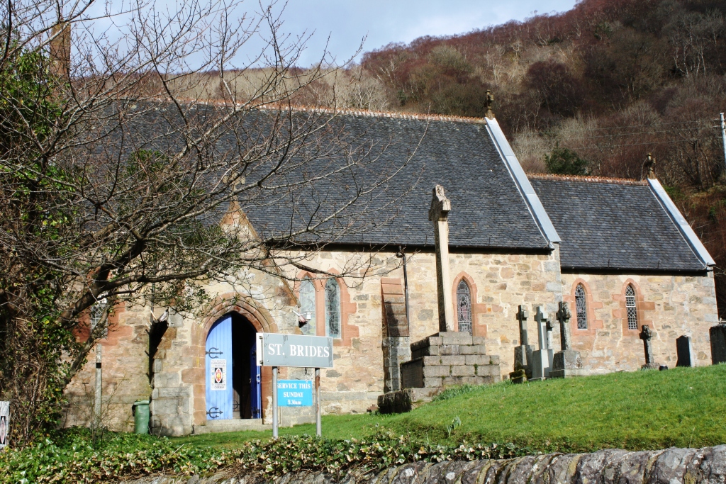
St Bride's Church, Onich

St Bride's Church (alternatively, Saint Brigid of Kildare Church) is an Episcopal parish church in North Ballachulish in the Scottish Highlands, within...

Nether Lochaber

Nether Lochaber ( NEDH-ər lokh-AH-bər) in Lochaber, Highland, Scotland, is the modern (1950s) name for the Parish of Ballachulish and Onich. This Parish...

Beinn na Gucaig

Beinn na Gucaig (616 m) is a mountain in the Grampian Mountains of Scotland, located south of Fort William in Lochaber. The peak takes up much of the eastern...

Nearby Amenities

Located within 500m of 56.719596,-5.2409135
Source: PGS
Lat/Long: 56.72229/-5.2344846
Source: PGS
Lat/Long: 56.7219803/-5.2351085
Source: PGS
Lat/Long: 56.7218223/-5.2352228
Source: PGS
Lat/Long: 56.7213059/-5.2355218
Source: PGS
Lat/Long: 56.7208664/-5.2359391
Source: PGS
Lat/Long: 56.7203054/-5.236399
Source: PGS
Lat/Long: 56.7200558/-5.2369734
Source: PGS
Lat/Long: 56.7196376/-5.2375354
Source: PGS
Lat/Long: 56.7194742/-5.2379312
Source: PGS
Lat/Long: 56.7192047/-5.2383804
Source: PGS
Lat/Long: 56.7187754/-5.2389557
Source: PGS
Lat/Long: 56.7185879/-5.2393994
Source: PGS
Lat/Long: 56.718415/-5.2397037
Source: PGS
Lat/Long: 56.717557/-5.239868
Source: PGS
Lat/Long: 56.717166/-5.2399334
Source: PGS
Lat/Long: 56.7167115/-5.2402112
Source: PGS
Lat/Long: 56.7163216/-5.2406246
Source: PGS
Lat/Long: 56.7163061/-5.2402556
Source: PGS
Lat/Long: 56.7154967/-5.2392907
Source: PGS
Lat/Long: 56.7153783/-5.2392435
Source: PGS
Lat/Long: 56.7152161/-5.2393553
Bunree
Name En: Bunree
Name Gd: Bun Ruighe
Place: hamlet
Lat/Long: 56.7170977/-5.2363979
Bus Stop
Inn
Bus: yes
Naptan AtcoCode: 6700712359
Naptan Bearing: SE
Naptan CommonName: Inn
Naptan Indicator: o/s
Naptan Landmark: Ardgour Slipway
Naptan NaptanCode: 45327685
Naptan Street: A861
Naptan Verified: no
Public Transport: platform
Source: naptan_import
Lat/Long: 56.7225042/-5.2435603
Bus Stop
Slipway
Bus: yes
Local Ref: AT
Naptan AtcoCode: 6700713267
Naptan Bearing: E
Naptan CommonName: Slipway
Naptan Indicator: at
Naptan Landmark: Corran Ferry
Naptan NaptanCode: 45325269
Naptan Street: Ferry Slipway
Public Transport: platform
Shelter: yes
Source: naptan_import
Lat/Long: 56.7214274/-5.2346715
Power: pole
Lat/Long: 56.7202971/-5.233885
Power: pole
Lat/Long: 56.720877/-5.2341229
Power: pole
Lat/Long: 56.7196036/-5.2331901
Ferry Terminal
Ferry: yes
Public Transport: station
Source: PGS
Lat/Long: 56.7214959/-5.2355014
Booth: K6
Removed Amenity: telephone
Source: survey
Lat/Long: 56.7229284/-5.2444884
Toilets
Check Date: 2023-05-27
Fee: no
Source: survey
Lat/Long: 56.7224071/-5.2437159
Seamark Light Character: Fl
Seamark Light Colour: red
Seamark Light Height: 7
Seamark Light Period: 5
Seamark Light Range: 3
Seamark Light Reference: A 4132.4
Seamark Type: light_minor
Source: US NGA Pub. 114. 2011-05-26.
Lat/Long: 56.7233244/-5.2440865
Ardgour War Memorial
Historic: memorial
Memorial: war_memorial
Lat/Long: 56.7204778/-5.2441655
WWI RMLI Gun Battery
Historic: ruins
Lat/Long: 56.7206119/-5.2434354
Pub
Ardgour Bar
Lat/Long: 56.7224912/-5.2437886
Power: pole
Lat/Long: 56.7228431/-5.2461728
Power: pole
Lat/Long: 56.7222154/-5.2469695
Ferry Terminal
Ferry: yes
Public Transport: station
Lat/Long: 56.7227128/-5.243101
Man Made: mast
Tower Type: communication
Lat/Long: 56.7207486/-5.2457156
Power: pole
Lat/Long: 56.7225914/-5.2454942
Material: wood
Power: pole
Lat/Long: 56.7220071/-5.2445206
Power: pole
Lat/Long: 56.7215008/-5.2436999
Power: pole
Lat/Long: 56.7212121/-5.2432114
Power: pole
Lat/Long: 56.7197161/-5.2341919
Power: pole
Lat/Long: 56.7191286/-5.2345011
Power: pole
Lat/Long: 56.7184605/-5.2348437
Power: pole
Lat/Long: 56.717686/-5.2352567
Power: pole
Lat/Long: 56.717121/-5.2355542
Power: pole
Lat/Long: 56.7172993/-5.234415
Ferry Terminal
Corran Ferry
Ferry: yes
Phone: +44 1855 841243
Public Transport: station
Website: https://www.highland.gov.uk/homepage/62/corran_ferry
Lat/Long: 56.7214329/-5.2348018
Ferry Terminal
Corran Ferry (Ardgour)
Ferry: yes
Phone: +44 1855 841243
Public Transport: station
Website: https://www.highland.gov.uk/homepage/62/corran_ferry
Lat/Long: 56.7226022/-5.2436941
Crossing
Crossing: uncontrolled
Lat/Long: 56.7214862/-5.2351474
The data included in this document is from www.openstreetmap.org. The data is made available under ODbL.

Have you been to Corran Narrows?

Leave your review of Corran Narrows below (or comments, questions and feedback).