Llanmadog

Settlement in Glamorgan

Wales

Llanmadog

The Britannia Inn, Llanmadoc This is a pretty looking wayside pub with tables out front, beer garden to the rear and offering potential customers all the usual grog plus temptations such as Joe's ice cream, Ferrari's coffee and cream teas, cakes and teacakes, according to their various signage and A-boards.
The Britannia Inn, Llanmadoc Credit: Jeremy Bolwell

Llanmadog is a village located in the county of Glamorgan, Wales. It sits on the Gower Peninsula, a designated Area of Outstanding Natural Beauty. Llanmadog is surrounded by breathtaking landscapes, with rolling hills, lush green fields, and stunning coastal views.

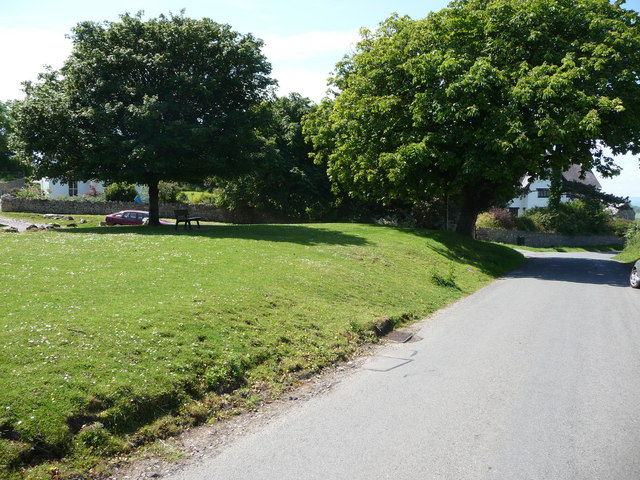
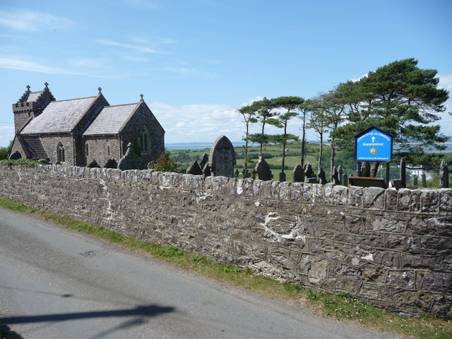
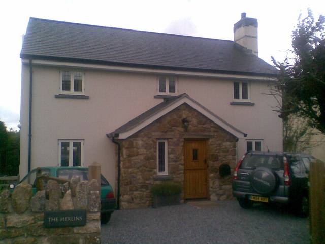
The village itself is small and picturesque, with a population of around 400 people. It is characterized by its charming traditional stone cottages and narrow winding lanes. Llanmadog has a strong sense of community, with a local church, a primary school, and a village hall serving as the heart of the community.

The natural beauty of Llanmadog and its surroundings make it a popular destination for nature lovers and outdoor enthusiasts. The nearby Llanmadoc Hill offers panoramic views of the peninsula and the sea, making it a favorite spot for hikers and walkers. The coastline is also a haven for wildlife, with various bird species and seals often spotted in the area.

For those interested in history, Llanmadog has a rich heritage. The village is home to several ancient burial sites and standing stones, indicating its long-standing human presence. It also has a connection to the famous Welsh poet, Dylan Thomas, who spent time in Llanmadog and drew inspiration from its natural beauty.

Overall, Llanmadog is a tranquil and idyllic village that offers a perfect blend of natural beauty, community spirit, and historical significance. It is a hidden gem on the Gower Peninsula, inviting visitors to explore its scenic landscapes and immerse themselves in its rich cultural heritage.

If you have any feedback on the listing, please let us know in the comments section below.

Llanmadog Images

Images are sourced within 2km of 51.615505/-4.252196 or Grid Reference SS4493. Thanks to Geograph Open Source API. All images are credited.

The Britannia Inn, Llanmadoc This is a pretty looking wayside pub with tables out front, beer garden to the rear and offering potential customers all the usual grog plus temptations such as Joe's ice cream, Ferrari's coffee and cream teas, cakes and teacakes, according to their various signage and A-boards.
The Britannia Inn, Llanmadoc
This is a pretty looking wayside pub with tables out front, beer garden to the rear and offering potential customers all the usual grog plus temptations such as Joe's ice cream, Ferrari's coffee and cream teas, cakes and teacakes, according to their various signage and A-boards.
What will the neighbours say? When out walking I never quite know what may catch my imagination and my eye and today I saw an ex-British military ambulance parked on a hard standing (possibly once a greenhouse foundation) in this garden, stripped of its cam pattern and presumably awaiting exterior restoration.
What will the neighbours say?
When out walking I never quite know what may catch my imagination and my eye and today I saw an ex-British military ambulance parked on a hard standing (possibly once a greenhouse foundation) in this garden, stripped of its cam pattern and presumably awaiting exterior restoration.
The village green in Llanmadoc The old village green remains in the centre of the village, raised above the road and surmounted by a Horse-Chestnut tree to the right. The large imposing white house is the old vicarage.
The village green in Llanmadoc
The old village green remains in the centre of the village, raised above the road and surmounted by a Horse-Chestnut tree to the right. The large imposing white house is the old vicarage.
The church of Saint Madoc, Llanmadoc Saint Madoc a Celtic saint is said to have founded a church on or near this site in the 6th century. This church building seems to have 13th century origins and was 'restored' by the Victorians in 1865.
The church of Saint Madoc, Llanmadoc
Saint Madoc a Celtic saint is said to have founded a church on or near this site in the 6th century. This church building seems to have 13th century origins and was 'restored' by the Victorians in 1865.
Entrance to the National Trust site at Cwm Ivy The footpath passes through the smaller gate here and enters the Cwm Ivy estate area.
Entrance to the National Trust site at Cwm Ivy
The footpath passes through the smaller gate here and enters the Cwm Ivy estate area.
Part of Cwm Ivy Marsh The marsh is fenced off here and is grazed by a herd of cattle. The marsh meadows are bisected by drainage ditches and contain large reed beds and various habitat areas, including some old stands of pines and firs. A footpath circumnavigates the whole marsh.
Part of Cwm Ivy Marsh
The marsh is fenced off here and is grazed by a herd of cattle. The marsh meadows are bisected by drainage ditches and contain large reed beds and various habitat areas, including some old stands of pines and firs. A footpath circumnavigates the whole marsh.
Shaded path on the edge of Cwm Ivy Marsh The mature fir trees provide a shaded avenue that carries the footpath around this section of the marshes.
Shaded path on the edge of Cwm Ivy Marsh
The mature fir trees provide a shaded avenue that carries the footpath around this section of the marshes.
On the edge of The Groose salt marsh This vast flat salt marsh area is pretty densely dotted with happily grazing sheep and lambs. I bet the meat is fantastic when ready.
On the edge of The Groose salt marsh
This vast flat salt marsh area is pretty densely dotted with happily grazing sheep and lambs. I bet the meat is fantastic when ready.
Part of Cwm Ivy Marsh The cattle that graze the marsh meadows can be seen in the distance.
Part of Cwm Ivy Marsh
The cattle that graze the marsh meadows can be seen in the distance.
Footpath onto Llanmadoc Hill The footpath here ascends onto the open moorland of the hill and offers views over the rooftops of Llanmadoc and Cwm Ivy towards the glorious Loughor Estuary.
Footpath onto Llanmadoc Hill
The footpath here ascends onto the open moorland of the hill and offers views over the rooftops of Llanmadoc and Cwm Ivy towards the glorious Loughor Estuary.
View from the footpath up to The Bulwark on Llanmadoc Hill The Foxgloves are growing tall above the young bracken, skylarks sing and a strong onshore breeze is fresh in my face.
View from the footpath up to The Bulwark on Llanmadoc Hill
The Foxgloves are growing tall above the young bracken, skylarks sing and a strong onshore breeze is fresh in my face.
View northwards from The Bulwark on Llanmadoc Hill The old Iron Age ditch and ramparts of The Bulwark are an exceptional spot from which to take in the huge views on all sides. In this shot the view is northwards over the villages of Llanmadoc and Cwm Ivy to Cwm Ivt Tor, Whiteford Burrows and beach and the sandbanks and waters of the Loughor Estuary and to Burry Port on the other shore.
View northwards from The Bulwark on Llanmadoc Hill
The old Iron Age ditch and ramparts of The Bulwark are an exceptional spot from which to take in the huge views on all sides. In this shot the view is northwards over the villages of Llanmadoc and Cwm Ivy to Cwm Ivt Tor, Whiteford Burrows and beach and the sandbanks and waters of the Loughor Estuary and to Burry Port on the other shore.
One of the cairns on Llanmadoc Hill, Gower This is just one of around a dozen or so Bronze Age burial cairns on this hill. What a spot. It commands massive views along the coastline, especially to the north and north west, and also inland to the mountains of South Wales.
One of the cairns on Llanmadoc Hill, Gower
This is just one of around a dozen or so Bronze Age burial cairns on this hill. What a spot. It commands massive views along the coastline, especially to the north and north west, and also inland to the mountains of South Wales.
The trig point on Llanmadoc Hill, Gower This trig point has exceptional coastal views, which include Worms Head and Rhossili Down seen here.
The trig point on Llanmadoc Hill, Gower
This trig point has exceptional coastal views, which include Worms Head and Rhossili Down seen here.
Young ferns and bracken beside the path below Llanmadoc Hill The path here contours around the hill.
Young ferns and bracken beside the path below Llanmadoc Hill
The path here contours around the hill.
View northwards from the footpath below Llanmadoc Hill The footpath here follows the edge of the hillside and its open moorland and looks down over fields towards one of several static caravan parks in this area of Gower. Wonderfully sited, they all back major beaches. This one is near Broughton Bay.
View northwards from the footpath below Llanmadoc Hill
The footpath here follows the edge of the hillside and its open moorland and looks down over fields towards one of several static caravan parks in this area of Gower. Wonderfully sited, they all back major beaches. This one is near Broughton Bay.
A well maintained little lane near Llanmadoc This little lane carries a footpath and is in exceptionally good nick; the stone wall in intact, the brambles are cut back, there are no trip hazards and the fence is not overgrown. Maybe it is someone's shortcut back from the pub of a night?
A well maintained little lane near Llanmadoc
This little lane carries a footpath and is in exceptionally good nick; the stone wall in intact, the brambles are cut back, there are no trip hazards and the fence is not overgrown. Maybe it is someone's shortcut back from the pub of a night?
Llanmadoc The Merlins.
Llanmadoc
The Merlins.
Show me another place!

Llanmadog is located at Grid Ref: SS4493 (Lat: 51.615505, Lng: -4.252196)

Unitary Authority: Swansea

Police Authority: South Wales

Also known as: Llanmadoc

What 3 Words

///neckline.clouding.complies. Near Rhossili, Swansea

Related Wikis

Llangennith, Llanmadoc and Cheriton

Llangennith, Llanmadoc and Cheriton is a rural community on the Gower Peninsula, Swansea, south Wales. It comprises the villages of Llangennith, Llanmadoc...

Whiteford Sands

Whiteford Sands is a two-mile expanse of beach on the northern side of the Gower Peninsula, south Wales. It is the most northerly beach on Gower and sits...

Llanmadoc Hill

Llanmadoc Hill is a 186-metre-high hill at the northwestern corner of the Gower Peninsula west of Swansea in South Wales. The summit at the western end...

Llangennith

Llangennith (Welsh: Llangenydd/Llangynydd) is a village in the City and County of Swansea, South Wales. It is located in the Gower. Moor Lane leads westwards...

Nearby Amenities

Located within 500m of 51.615505,-4.252196
Llanmadoc
Name Cy: Llanmadog
Place: village
Wikidata: Q13129658
Lat/Long: 51.6170561/-4.2501976
Tourism: picnic_site
Lat/Long: 51.6183002/-4.2543918
Bus Stop
Llanmadoc Post Office
Bus: yes
Naptan AtcoCode: 5810AWC50553
Naptan Bearing: NW
Naptan CommonName: Llanmadoc PO
Naptan Landmark: Llanmadoc Post Office
Naptan NaptanCode: swagtpg
Naptan Street: Main Road
Naptan Verified: no
Public Transport: platform
Source: naptan_import
Lat/Long: 51.6171956/-4.2535109
Place Of Worship
St. Madoc's
Denomination: anglican
Religion: christian
Wikidata: Q29489964
Lat/Long: 51.6180352/-4.2563062
Barrier: stile
Bicycle: no
Foot: yes
Lat/Long: 51.6173474/-4.2502566
Bench
Lat/Long: 51.6171565/-4.2531561
Telephone
Booth: K6
Covered: booth
Listed Status: Grade II
Operator: BT
Operator Wikidata: Q593786
Phone: +44 1792 386237
Lat/Long: 51.6171736/-4.253543
Post Box
Post Box Type: wall
Lat/Long: 51.6171811/-4.2535926
Direction: 170
Generator Method: photovoltaic
Generator Output Electricity: yes
Generator Solar Modules: 6
Generator Source: solar
Generator Type: solar_photovoltaic_panel
Location: roof
Power: generator
Lat/Long: 51.6164202/-4.2545004
Direction: SSW
Generator Method: photovoltaic
Generator Output Electricity: yes
Generator Solar Modules: 14
Generator Source: solar
Generator Type: solar_photovoltaic_panel
Location: roof
Power: generator
Lat/Long: 51.616085/-4.2512616
Direction: S
Generator Method: photovoltaic
Generator Output Electricity: yes
Generator Solar Modules: 16
Generator Source: solar
Generator Type: solar_photovoltaic_panel
Location: roof
Power: generator
Lat/Long: 51.6160377/-4.2501316
Direction: SSW
Generator Method: photovoltaic
Generator Output Electricity: yes
Generator Solar Modules: 16
Generator Source: solar
Generator Type: solar_photovoltaic_panel
Location: roof
Power: generator
Lat/Long: 51.6164914/-4.2482252
Direction: S
Generator Method: photovoltaic
Generator Output Electricity: yes
Generator Solar Modules: 12
Generator Source: solar
Generator Type: solar_photovoltaic_panel
Location: roof
Power: generator
Lat/Long: 51.6169969/-4.2479211
Direction: SW
Generator Method: photovoltaic
Generator Output Electricity: yes
Generator Solar Modules: 9
Generator Source: solar
Generator Type: solar_photovoltaic_panel
Location: roof
Power: generator
Lat/Long: 51.6174422/-4.2502774
Direction: SE
Generator Method: photovoltaic
Generator Output Electricity: yes
Generator Solar Modules: 6
Generator Source: solar
Generator Type: solar_photovoltaic_panel
Location: roof
Power: generator
Lat/Long: 51.6174506/-4.2503609
Direction: 175
Generator Method: photovoltaic
Generator Output Electricity: yes
Generator Solar Modules: 14
Generator Source: solar
Generator Type: solar_photovoltaic_panel
Location: roof
Power: generator
Lat/Long: 51.6173372/-4.252158
Direction: 170
Generator Method: photovoltaic
Generator Output Electricity: yes
Generator Solar Modules: 5
Generator Source: solar
Generator Type: solar_photovoltaic_panel
Location: roof
Power: generator
Lat/Long: 51.6173861/-4.2536918
Direction: SSE
Generator Method: photovoltaic
Generator Output Electricity: yes
Generator Solar Modules: 13
Generator Source: solar
Generator Type: solar_photovoltaic_panel
Location: roof
Power: generator
Lat/Long: 51.6189251/-4.2561073
Direction: SW
Generator Method: photovoltaic
Generator Output Electricity: yes
Generator Solar Modules: 16
Generator Source: solar
Generator Type: solar_photovoltaic_panel
Location: roof
Power: generator
Lat/Long: 51.6170742/-4.2562103
Direction: 170
Generator Method: photovoltaic
Generator Output Electricity: yes
Generator Solar Modules: 14
Generator Source: solar
Generator Type: solar_photovoltaic_panel
Location: roof
Power: generator
Lat/Long: 51.6164018/-4.2546965
Direction: 170
Generator Method: photovoltaic
Generator Output Electricity: yes
Generator Solar Modules: 17
Generator Source: solar
Generator Type: solar_photovoltaic_panel
Location: roof
Power: generator
Lat/Long: 51.6164446/-4.2542301
Defibrillator
Defibrillator Location: pub wall
Emergency: defibrillator
Indoor: no
Lat/Long: 51.6161595/-4.2455421
Bus Stop
Britannia Inn
Bus: yes
Naptan AtcoCode: 5810AWC50551
Naptan Bearing: SE
Naptan NaptanCode: swagtpj
Public Transport: platform
Lat/Long: 51.6161044/-4.2462236
Bus Stop
Britannia Inn
Bus: yes
Naptan AtcoCode: 5810AWC50552
Naptan Bearing: NW
Naptan NaptanCode: swagtpm
Public Transport: platform
Lat/Long: 51.6160873/-4.2463623
The data included in this document is from www.openstreetmap.org. The data is made available under ODbL.

Have you been to Llanmadog?

Leave your review of Llanmadog below (or comments, questions and feedback).