Mylor Creek

Sea, Estuary, Creek in Cornwall

England

Mylor Creek

Farmland, Mylor Beside Tregew Road, a crop of, perhaps, broccoli given the protection of plastic.
Farmland, Mylor Credit: Andrew Smith

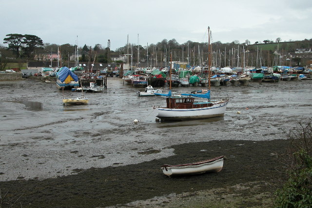
Mylor Creek is a picturesque waterway located in the county of Cornwall, England. It is situated on the southern coast of the county, near the village of Mylor Bridge. The creek is formed by the convergence of the Mylor and Restronguet Creeks, flowing into the Carrick Roads estuary, which eventually leads to the English Channel.

With its stunning natural beauty and tranquil atmosphere, Mylor Creek is a popular destination for both locals and tourists alike. The creek offers a unique blend of sea, estuary, and creek environments, creating a diverse ecosystem that is home to a wide range of wildlife.

The creek is surrounded by lush greenery and rolling hills, providing a picturesque backdrop for visitors. Boating and sailing enthusiasts are particularly drawn to Mylor Creek, as it provides excellent conditions for water activities. The calm and sheltered waters are perfect for beginners and experienced sailors alike.

Mylor Creek is also well-known for its thriving marine life. The creek is teeming with a variety of fish species, including bass, mackerel, and mullet, making it a popular spot for fishing. Birdwatchers will also find Mylor Creek to be a haven, with the chance to spot a variety of coastal and wading birds, such as herons and egrets.

In addition to its natural beauty, Mylor Creek is home to a small community of boathouses, marinas, and waterfront cottages. These provide a unique charm to the area and offer a glimpse into the maritime history and culture of Cornwall.

Overall, Mylor Creek is a captivating destination that showcases the stunning natural landscapes and maritime heritage of Cornwall. Whether you are seeking relaxation, outdoor activities, or a chance to connect with nature, Mylor Creek offers a little something for everyone.

If you have any feedback on the listing, please let us know in the comments section below.
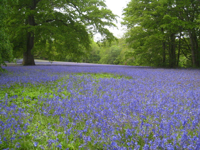
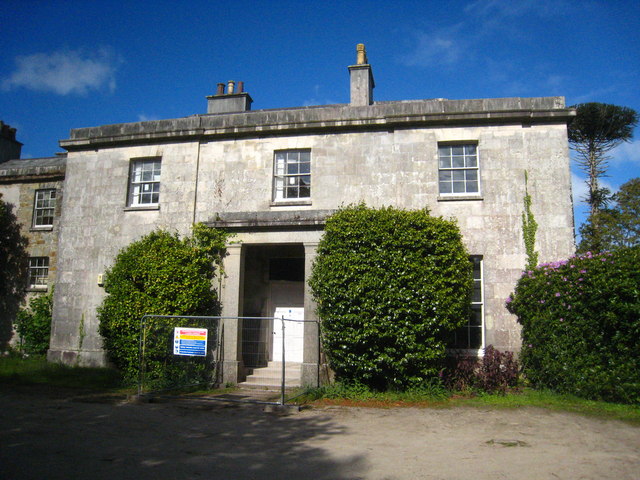
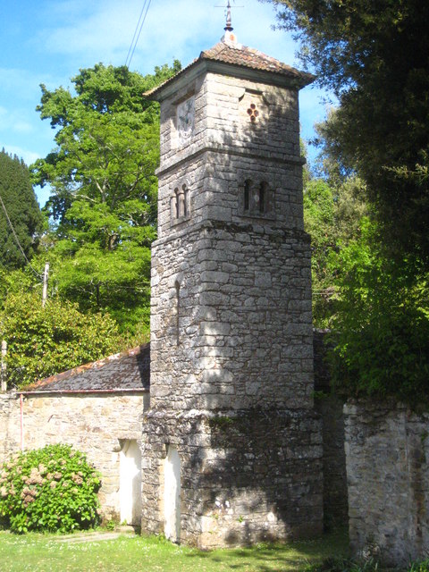
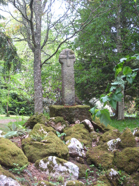
Mylor Creek Images

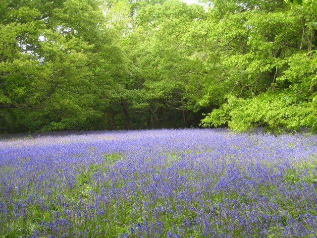
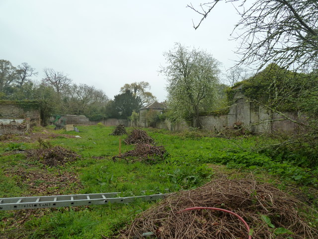
Images are sourced within 2km of 50.18058/-5.0690166 or Grid Reference SW8035. Thanks to Geograph Open Source API. All images are credited.

Farmland, Mylor Beside Tregew Road, a crop of, perhaps, broccoli given the protection of plastic.
Farmland, Mylor
Beside Tregew Road, a crop of, perhaps, broccoli given the protection of plastic.
Estuary, Penryn An inlet below Bissom on the northern side of the Penryn River at high tide.
Estuary, Penryn
An inlet below Bissom on the northern side of the Penryn River at high tide.
Cross In Enys Gardens there is a Cornish Cross, which, according to this Wikipedia article, originally stood at Sancreed in Kerrier and was set up at Enys in 1848.
<span class="nowrap"><a title="https://en.m.wikipedia.org/wiki/Stone_crosses_in_Cornwall" rel="nofollow ugc noopener" href="https://en.m.wikipedia.org/wiki/Stone_crosses_in_Cornwall">Link</a><img style="margin-left:2px;" alt="External link" title="External link - shift click to open in new window" src="https://s1.geograph.org.uk/img/external.png" width="10" height="10"/></span>

Milestone Society National ID: CWKE_SGL02
Cross
In Enys Gardens there is a Cornish Cross, which, according to this Wikipedia article, originally stood at Sancreed in Kerrier and was set up at Enys in 1848. LinkExternal link Milestone Society National ID: CWKE_SGL02
Bluebells (Hyacinthoides non-scripta) at Enys Gardens The gardens at Enys are renowned for their bluebell display, particularly in the meadow area known as Parc Lye.
Bluebells (Hyacinthoides non-scripta) at Enys Gardens
The gardens at Enys are renowned for their bluebell display, particularly in the meadow area known as Parc Lye.
Bluebells at Parc Lye on the Enys Estate The gardens at Enys are famous for the bluebell display every May.
Bluebells at Parc Lye on the Enys Estate
The gardens at Enys are famous for the bluebell display every May.
Enys House The Enys family were resident in the area from the time of Edward I. The house originally on this site was an Elizabethan or Jacobean mansion. Various alterations were carried out but that building burnt down in the 1820s. The house was rebuilt in the 1830s. The Dutch Navy occupied the house during the Second World War and after the war the house was occupied briefly again by the family. They found it impossible to afford sufficient staff to run the house satisfactorily and it was occupied by a private school for a short time, since which it has been empty. Renovation works are currently in progress. The house and various other buildings on the estate are Grade II Listed <span class="nowrap"><a title="http://www.imagesofengland.org.uk/Details/Default.aspx?id=66521&mode=adv" rel="nofollow ugc noopener" href="http://www.imagesofengland.org.uk/Details/Default.aspx?id=66521&mode=adv">Link</a><img style="margin-left:2px;" alt="External link" title="External link - shift click to open in new window" src="https://s1.geograph.org.uk/img/external.png" width="10" height="10"/></span>.
Enys House
The Enys family were resident in the area from the time of Edward I. The house originally on this site was an Elizabethan or Jacobean mansion. Various alterations were carried out but that building burnt down in the 1820s. The house was rebuilt in the 1830s. The Dutch Navy occupied the house during the Second World War and after the war the house was occupied briefly again by the family. They found it impossible to afford sufficient staff to run the house satisfactorily and it was occupied by a private school for a short time, since which it has been empty. Renovation works are currently in progress. The house and various other buildings on the estate are Grade II Listed LinkExternal link.
Clock tower on the Enys Estate Built in the Italianate style.
Clock tower on the Enys Estate
Built in the Italianate style.
Medieval cross at Enys Standing in the Victorian rockery, this was originally a wayside cross in the parish of Sancreed in west Penwith. It was supplied to John Samuel Enys in 1848 by the Revd Henry Comyn in return for a 'cartload of things' - the Victorians clearly didn't have much sense of historical context!
Medieval cross at Enys
Standing in the Victorian rockery, this was originally a wayside cross in the parish of Sancreed in west Penwith. It was supplied to John Samuel Enys in 1848 by the Revd Henry Comyn in return for a 'cartload of things' - the Victorians clearly didn't have much sense of historical context!
Cattle in the parkland at Enys The parkland is separated from the formal gardens by a ha-ha.
Cattle in the parkland at Enys
The parkland is separated from the formal gardens by a ha-ha.
Formal gardens at Enys Separated from the cattle in the park by the stone parapet and a ha-ha.
Formal gardens at Enys
Separated from the cattle in the park by the stone parapet and a ha-ha.
Oak tree in the parkland at Enys One of many fine specimen trees on the estate.
Oak tree in the parkland at Enys
One of many fine specimen trees on the estate.
Bluebells at Parc Lye on the Enys estate The oak tree has yet to come into leaf.
Bluebells at Parc Lye on the Enys estate
The oak tree has yet to come into leaf.
Bluebells and young beech leaves At Parc Lye on the Enys estate - always a beautiful colour combination.
Bluebells and young beech leaves
At Parc Lye on the Enys estate - always a beautiful colour combination.
Bluebells (Hyacinthoides non-scripta) and wild garlic (Allium ursinum) Beside the drive alongside Parc Lye at Enys.
Bluebells (Hyacinthoides non-scripta) and wild garlic (Allium ursinum)
Beside the drive alongside Parc Lye at Enys.
Flower of Common Bistort (Persicaria bistorta) On Parc Lye at Enys.
Flower of Common Bistort (Persicaria bistorta)
On Parc Lye at Enys.
Enys Gardens - walled garden A trust is gradually restoring these gardens and this walled area is a work in progress. The door was open so I took this shot through it.
Enys Gardens - walled garden
A trust is gradually restoring these gardens and this walled area is a work in progress. The door was open so I took this shot through it.
Bluebells and beech tree at Parc Lye on the Enys Estate Enys is famous locally for the amazing display of bluebells and this year is a particularly good one.
Bluebells and beech tree at Parc Lye on the Enys Estate
Enys is famous locally for the amazing display of bluebells and this year is a particularly good one.
Bluebells at Parc Lye on the Enys Estate
Show me another place!

Mylor Creek is located at Grid Ref: SW8035 (Lat: 50.18058, Lng: -5.0690166)

Unitary Authority: Cornwall

Police Authority: Devon and Cornwall

What 3 Words

///remarried.streetcar.quest. Near Mylor Bridge, Cornwall

Nearby Locations

Mylor Creek

Related Wikis

Mylor Creek

Mylor Creek (Cornish: Pol Scathow, meaning creek of boats) is a tidal ria in south Cornwall, United Kingdom. It is a tributary of Carrick Roads, the estuary...

Mylor, Cornwall

Mylor is a civil parish in Cornwall, England, United Kingdom. It is situated approximately five miles north of Falmouth.The church town of the ecclesiastical...

Trelew, Cornwall

Trelew is a hamlet in south west Cornwall in England, United Kingdom. It is in the civil parish of Mylor. The settlement is between the villages of Mylor...

Mylor Bridge

Mylor Bridge (Cornish: Ponsnowyth) is a village in Cornwall, England, United Kingdom. It is in Mylor civil parish at the head of Mylor Creek, about five...

Nearby Amenities

Located within 500m of 50.18058,-5.0690166
Created By: almien_coastlines
Source: PGS
Lat/Long: 50.178301/-5.063031
Source: PGS
Lat/Long: 50.1784043/-5.063725
Source: PGS
Lat/Long: 50.1783677/-5.0649031
Source: PGS
Lat/Long: 50.1800147/-5.0707785
Source: PGS
Lat/Long: 50.1804077/-5.0716175
Created By: almien_coastlines
Source: PGS
Lat/Long: 50.181088/-5.072135
Source: PGS
Lat/Long: 50.1811609/-5.0725473
Source: PGS
Lat/Long: 50.1812871/-5.0728326
Source: PGS
Lat/Long: 50.1817548/-5.0736643
Source: PGS
Lat/Long: 50.1818403/-5.073784
Source: PGS
Lat/Long: 50.1831288/-5.0733507
Source: PGS
Lat/Long: 50.1829705/-5.0728344
Source: PGS
Lat/Long: 50.1828227/-5.0725026
Source: PGS
Lat/Long: 50.1824526/-5.0711899
Source: PGS
Lat/Long: 50.1821511/-5.0693663
Created By: almien_coastlines
Source: PGS
Lat/Long: 50.181525/-5.069159
Created By: almien_coastlines
Source: PGS
Lat/Long: 50.181162/-5.067945
Created By: almien_coastlines
Source: PGS
Lat/Long: 50.180654/-5.067724
Source: PGS
Lat/Long: 50.1798663/-5.0659704
Post Box
Brand: Royal Mail
Brand Wikidata: Q638098
Brand Wikipedia: en:Royal Mail
Collection Plate: CP7D
Collection Times: Mo-Fr 09:00; Sa 07:00; Su off
Drive Through: no
Operator: Royal Mail
Operator Wikidata: Q638098
Post Box Mounting: wall
Post Box Type: lamp
Ref: TR11 24D
Royal Cypher: EIIR
Royal Cypher Wikidata: Q33102113
Source: survey;streetlevel imagery;aerial imagery
Lat/Long: 50.1784903/-5.0667032
Bus Stop
Six Turnings
Bus: yes
Naptan AtcoCode: 0800COZ06230
Naptan Bearing: W
Naptan CommonName: Six Turnings
Naptan Crossing: Pillars Road
Naptan NaptanCode: corawajd
Naptan Street: Saltbox Road
Naptan Verified: no
Public Transport: platform
Source: naptan_import
Lat/Long: 50.1806428/-5.0747505
Bus Stop
Six Turnings
Bus: yes
Naptan AtcoCode: 0800FWV38498
Naptan Bearing: SE
Naptan CommonName: Six Turnings
Naptan Crossing: Waterings Road
Naptan NaptanCode: corawagm
Naptan Street: Saltbox Road
Naptan Verified: no
Public Transport: platform
Source: naptan_import
Lat/Long: 50.1809458/-5.0755405
Bus Stop
Six Turnings
Bus: yes
Naptan AtcoCode: 0800FWV38499
Naptan Bearing: SE
Naptan CommonName: Six Turnings
Naptan Crossing: Saltbox Road
Naptan NaptanCode: corawajp
Naptan Street: Waterings Road
Naptan Verified: no
Public Transport: platform
Source: naptan_import
Lat/Long: 50.1809328/-5.0746711
Mylor Creek
Natural: bay
Lat/Long: 50.1807607/-5.0689438
Direction: SW
Generator Method: photovoltaic
Generator Output Electricity: small_installation
Generator Source: solar
Generator Type: solar_photovoltaic_panel
Location: roof
Power: generator
Source: bing;survey
Survey Date: 2020-07-25
Lat/Long: 50.1807951/-5.0759525
Direction: SW
Generator Method: photovoltaic
Generator Output Electricity: small_installation
Generator Source: solar
Generator Type: solar_photovoltaic_panel
Location: roof
Power: generator
Source: bing;survey
Survey Date: 2020-07-25
Lat/Long: 50.1808354/-5.0758382
Direction: SE
Generator Method: photovoltaic
Generator Output Electricity: small_installation
Generator Source: solar
Generator Type: solar_photovoltaic_panel
Location: roof
Power: generator
Source: bing;survey
Survey Date: 2020-07-25
Lat/Long: 50.1808522/-5.0736398
Post Box
Brand: Royal Mail
Brand Wikidata: Q638098
Collection Times: Mo-Fr 16:45; Sa 10:30; Su off
Drive Through: no
Operator: Royal Mail
Operator Wikidata: Q638098
Post Box Mounting: telegraph_pole
Post Box Type: lamp
Ref: TR11 52
Royal Cypher: EIIR
Royal Cypher Wikidata: Q33102113
Source: survey;streetlevel imagery;aerial imagery
Lat/Long: 50.1808678/-5.0748033
The data included in this document is from www.openstreetmap.org. The data is made available under ODbL.

Have you been to Mylor Creek?

Leave your review of Mylor Creek below (or comments, questions and feedback).