Caolas Eilean Ighe

Sea, Estuary, Creek in Inverness-shire

Scotland

Caolas Eilean Ighe

Farm road, Achraig The road doesn't appear to go anywhere in particular, but there is a good view towards the craggy slopes of Creag Mhor.
Farm road, Achraig Credit: Gordon Hatton

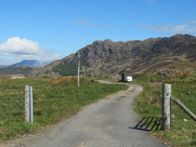
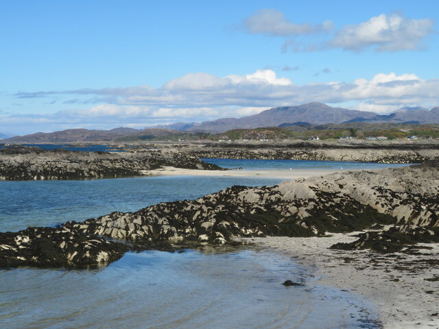
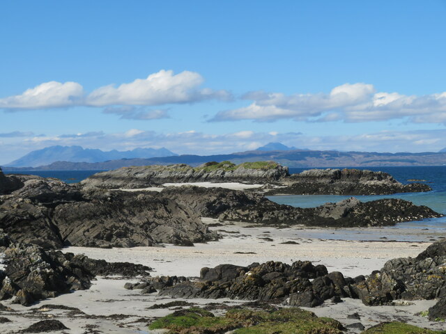
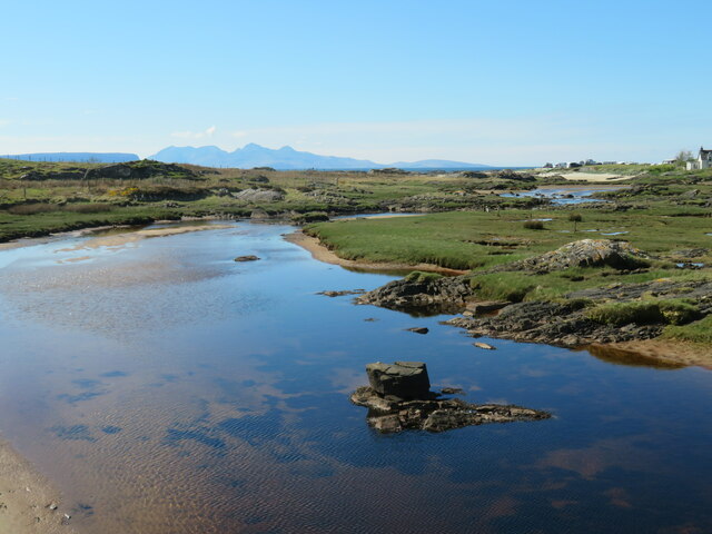
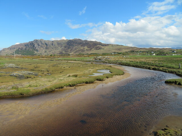
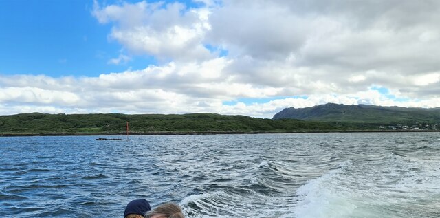
Caolas Eilean Ighe is a picturesque area located in Inverness-shire, Scotland. It is situated on the west coast of Scotland, near the town of Inverness. Caolas Eilean Ighe is known for its stunning sea views, tranquil estuary, and winding creek.

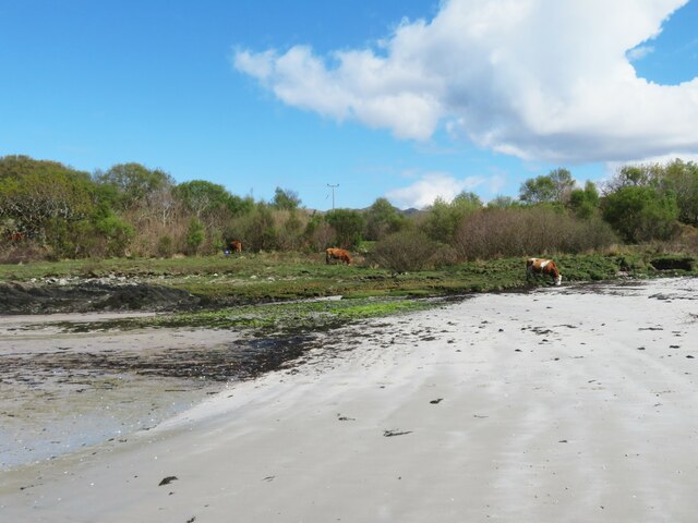
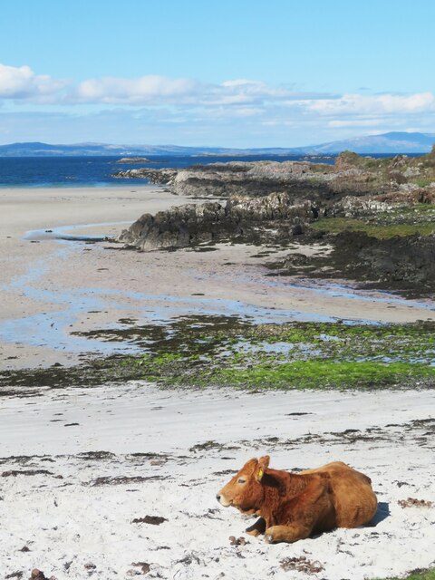
The area is surrounded by rugged cliffs and rolling hills, providing a beautiful backdrop for visitors to enjoy. The sea at Caolas Eilean Ighe is a deep blue color, with crystal clear waters that are perfect for swimming, fishing, and boating.

The estuary at Caolas Eilean Ighe is a haven for wildlife, with a diverse range of bird species making their home in the area. Visitors can often spot herons, seals, and even dolphins frolicking in the estuary waters.

The creek at Caolas Eilean Ighe winds its way through the landscape, providing a peaceful spot for visitors to relax and enjoy the natural beauty of the area. The creek is surrounded by lush greenery and wildflowers, making it a popular spot for picnics and leisurely walks.

Overall, Caolas Eilean Ighe is a stunning natural area that offers visitors a tranquil escape from the hustle and bustle of everyday life.

If you have any feedback on the listing, please let us know in the comments section below.

Caolas Eilean Ighe Images

Images are sourced within 2km of 56.921849/-5.8836211 or Grid Reference NM6387. Thanks to Geograph Open Source API. All images are credited.

Farm road, Achraig The road doesn't appear to go anywhere in particular, but there is a good view towards the craggy slopes of Creag Mhor.
Farm road, Achraig
The road doesn't appear to go anywhere in particular, but there is a good view towards the craggy slopes of Creag Mhor.
White sand at Gortenachullish White sand beach at the road end from Back of Keppoch.
White sand at Gortenachullish
White sand beach at the road end from Back of Keppoch.
Beach bovine Just lazing on the beach and soaking up the spring sunshine at Gortenachullish.
Beach bovine
Just lazing on the beach and soaking up the spring sunshine at Gortenachullish.
Mini camping Mini enthusiasts with mini tents at Back of Keppoch.
Mini camping
Mini enthusiasts with mini tents at Back of Keppoch.
Coastline near Port Ban A fretted coastline of small sandy bays and rocky reefs.
Coastline near Port Ban
A fretted coastline of small sandy bays and rocky reefs.
Shoreline near Gortenchullish One can work one's way around the shoreline here at low tide, but further progress towards Eilean Ighe wasn't possible on this occasion via the shore, whilst any landward route has plenty of 'Private Keep Out' notices.
Shoreline near Gortenchullish
One can work one's way around the shoreline here at low tide, but further progress towards Eilean Ighe wasn't possible on this occasion via the shore, whilst any landward route has plenty of 'Private Keep Out' notices.
Allt Cam Carach heading seawards The last few metres of this burn which by this point has brackish waters. The mountains of Rum can be seen on the horizon.
Allt Cam Carach heading seawards
The last few metres of this burn which by this point has brackish waters. The mountains of Rum can be seen on the horizon.
Upstream along  Allt Cam Carach A slow and sluggish burn which drains a large area of low lying bog and scrubland known as Mointeach Mhor.
Upstream along Allt Cam Carach
A slow and sluggish burn which drains a large area of low lying bog and scrubland known as Mointeach Mhor.
Loch nan Ceall Taking a trip from Arisaig to Eigg
Loch nan Ceall
Taking a trip from Arisaig to Eigg
In Loch nan Ceall Heading for Eigg
In Loch nan Ceall
Heading for Eigg
In Loch nan Ceall Heading for Eigg
In Loch nan Ceall
Heading for Eigg
Back of Keppoch
Back of Keppoch
Sgeir Ghainmheach at low tide Rocks only visible at low tide, with sand and seaweed. View west across other rocks, small islands and Eigg and Rum on the horizon.
Sgeir Ghainmheach at low tide
Rocks only visible at low tide, with sand and seaweed. View west across other rocks, small islands and Eigg and Rum on the horizon.
Looking out to the Sound of Sleat from Sunnyside Croft Touring & Camping Site, 2 Bunacaimb
Sunnyside Croft Touring & Camping Site, 2 Bunacaimb
Newly born lambs at Bunacaimb
Dilapidated building at Bunacaimb The green posts in the foreground are electric hook-up points for touring caravans.
Dilapidated building at Bunacaimb
The green posts in the foreground are electric hook-up points for touring caravans.
Newly built caravan site building At Bunacaimb.
Newly built caravan site building
At Bunacaimb.
Show me another place!

Caolas Eilean Ighe is located at Grid Ref: NM6387 (Lat: 56.921849, Lng: -5.8836211)

Unitary Authority: Highland

Police Authority: Highlands and Islands

What 3 Words

///green.wanted.signified. Near Arisaig, Highland

Related Wikis

Eilean Ighe

Eilean Ighe is a small tidal island near Arisaig in the Inner Hebrides of Scotland. The area is popular for sea kayaking and a challenge for larger boats...
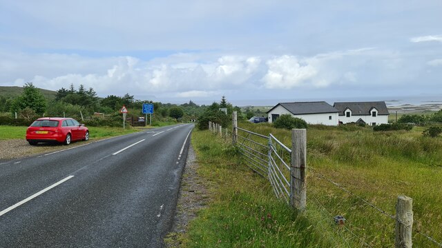
Back of Keppoch

Back of Keppoch (Gaelic: Cùl na Ceapaich) is a small coastal settlement in the northwest Scottish Highlands, 40 miles (65 kilometres) west of Fort William...

Portnaluchaig

Portnaluchaig is a coastal hamlet, located 2 miles north of Arisaig in the Highlands of Scotland and is also in the council area of Highland. The Small...
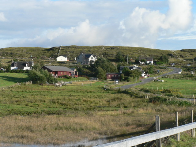
Arisaig

Arisaig (Scottish Gaelic: Àrasaig) is a village in Lochaber, Inverness-shire. It lies 7 miles (11 kilometres) south of Mallaig on the west coast of the...

Related Videos

Back of Keppoch Beach(?) - Walking in Scotland - Virtual Walk

Another short walk to a "hidden" beach. Can't find the name anywhere, so I am assuming it's part of the Back of Keppoch. not the ...

Probably the best view in Scotland.. The mountain with no name.

Spectacular views of Eigg & Rum from an unnamed hill. Mountain stream scrambling & parenting advise. Music - Bowing 737 by ...

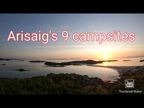
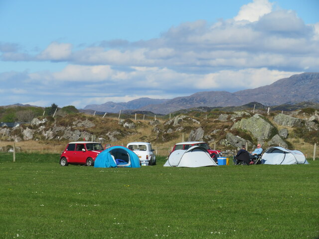
Campsites at Arisaig

Duing are stay at silversands at Arisaig we decided to walk to all the 9 campsites around Arisaig.

Nearby Amenities

Located within 500m of 56.921849,-5.8836211
Created By: dmgroom_coastlines
Source: PGS
Lat/Long: 56.918239/-5.886658
Created By: dmgroom_coastlines
Source: PGS
Lat/Long: 56.918356/-5.887135
Created By: dmgroom_coastlines
Source: PGS
Lat/Long: 56.918479/-5.88738
Created By: dmgroom_coastlines
Source: PGS
Lat/Long: 56.918729/-5.887633
Created By: dmgroom_coastlines
Source: PGS
Lat/Long: 56.918867/-5.887175
Created By: dmgroom_coastlines
Source: PGS
Lat/Long: 56.919134/-5.886727
Created By: dmgroom_coastlines
Source: PGS
Lat/Long: 56.919356/-5.886437
Created By: dmgroom_coastlines
Source: PGS
Lat/Long: 56.919528/-5.886289
Created By: dmgroom_coastlines
Source: PGS
Lat/Long: 56.91955/-5.885354
Created By: dmgroom_coastlines
Source: PGS
Lat/Long: 56.919294/-5.885335
Created By: dmgroom_coastlines
Source: PGS
Lat/Long: 56.919188/-5.886104
Created By: dmgroom_coastlines
Source: PGS
Lat/Long: 56.918761/-5.88623
Created By: dmgroom_coastlines
Source: PGS
Lat/Long: 56.91875/-5.886698
Created By: dmgroom_coastlines
Source: PGS
Lat/Long: 56.925154/-5.886724
Created By: dmgroom_coastlines
Source: PGS
Lat/Long: 56.925036/-5.886246
Created By: dmgroom_coastlines
Source: PGS
Lat/Long: 56.924802/-5.885291
Created By: dmgroom_coastlines
Source: PGS
Lat/Long: 56.924568/-5.884336
Source: PGS
Lat/Long: 56.9242713/-5.8841871
Source: PGS
Lat/Long: 56.9249682/-5.8838791
Source: PGS
Lat/Long: 56.9248554/-5.8828844
Source: PGS
Lat/Long: 56.9244942/-5.8822041
Source: PGS
Lat/Long: 56.9239882/-5.8819301
Source: PGS
Lat/Long: 56.9240942/-5.8828751
Source: PGS
Lat/Long: 56.9242172/-5.8831201
Source: PGS
Lat/Long: 56.9243392/-5.8833631
Created By: dmgroom_coastlines
Source: PGS
Lat/Long: 56.923685/-5.8838
Created By: dmgroom_coastlines
Source: PGS
Lat/Long: 56.923535/-5.884725
Created By: dmgroom_coastlines
Source: PGS
Lat/Long: 56.923402/-5.88495
Created By: dmgroom_coastlines
Source: PGS
Lat/Long: 56.923268/-5.885173
Source: PGS
Lat/Long: 56.923478/-5.8860788
Created By: dmgroom_coastlines
Source: PGS
Lat/Long: 56.922613/-5.885826
Created By: dmgroom_coastlines
Source: PGS
Lat/Long: 56.922102/-5.885786
Created By: dmgroom_coastlines
Source: PGS
Lat/Long: 56.920573/-5.885433
Source: PGS
Lat/Long: 56.9202926/-5.8865723
Created By: dmgroom_coastlines
Source: PGS
Lat/Long: 56.920913/-5.887333
Created By: dmgroom_coastlines
Source: PGS
Lat/Long: 56.921036/-5.887578
Created By: dmgroom_coastlines
Source: PGS
Lat/Long: 56.921158/-5.88782
Created By: dmgroom_coastlines
Source: PGS
Lat/Long: 56.921281/-5.888065
Created By: dmgroom_coastlines
Source: PGS
Lat/Long: 56.921403/-5.888308
Created By: dmgroom_coastlines
Source: PGS
Lat/Long: 56.921392/-5.888775
Created By: dmgroom_coastlines
Source: PGS
Lat/Long: 56.921259/-5.889
Created By: dmgroom_coastlines
Source: PGS
Lat/Long: 56.921125/-5.889223
Created By: dmgroom_coastlines
Source: PGS
Lat/Long: 56.920848/-5.890139
Created By: dmgroom_coastlines
Source: PGS
Lat/Long: 56.920715/-5.890363
Created By: dmgroom_coastlines
Source: PGS
Lat/Long: 56.920545/-5.890424
Created By: dmgroom_coastlines
Source: PGS
Lat/Long: 56.920465/-5.890109
Created By: dmgroom_coastlines
Source: PGS
Lat/Long: 56.919953/-5.890069
Created By: dmgroom_coastlines
Source: PGS
Lat/Long: 56.919943/-5.890537
Created By: dmgroom_coastlines
Source: PGS
Lat/Long: 56.920362/-5.89073
Created By: dmgroom_coastlines
Source: PGS
Lat/Long: 56.920571/-5.891054
Source: PGS
Lat/Long: 56.9244383/-5.8772811
Created By: dmgroom_coastlines
Source: PGS
Lat/Long: 56.924097/-5.87704
Source: PGS
Lat/Long: 56.92356/-5.8773884
Source: PGS
Lat/Long: 56.923063/-5.877429
Source: PGS
Lat/Long: 56.922752/-5.877367
Created By: dmgroom_coastlines
Source: PGS
Lat/Long: 56.923036/-5.878597
Created By: dmgroom_coastlines
Source: PGS
Lat/Long: 56.922875/-5.87999
Source: PGS
Lat/Long: 56.9227871/-5.8804139
Source: PGS
Lat/Long: 56.9227403/-5.880886
Created By: dmgroom_coastlines
Source: PGS
Lat/Long: 56.922716/-5.881383
Created By: dmgroom_coastlines
Source: PGS
Lat/Long: 56.923227/-5.881422
Source: PGS
Lat/Long: 56.9228222/-5.8822593
Source: PGS
Lat/Long: 56.923197/-5.8832464
Created By: dmgroom_coastlines
Source: PGS
Lat/Long: 56.922166/-5.882981
Created By: dmgroom_coastlines
Source: PGS
Lat/Long: 56.92011/-5.88329
Source: PGS
Lat/Long: 56.9198944/-5.8834395
Source: PGS
Lat/Long: 56.919707/-5.8833107
Created By: dmgroom_coastlines
Source: PGS
Lat/Long: 56.919359/-5.882529
Created By: dmgroom_coastlines
Source: PGS
Lat/Long: 56.918842/-5.882724
Created By: dmgroom_coastlines
Source: PGS
Lat/Long: 56.918576/-5.883172
Source: PGS
Lat/Long: 56.9178916/-5.8834609
Created By: dmgroom_coastlines
Source: PGS
Lat/Long: 56.91842/-5.88433
Created By: dmgroom_coastlines
Source: PGS
Lat/Long: 56.91841/-5.884798
Created By: dmgroom_coastlines
Source: PGS
Lat/Long: 56.918143/-5.885246
Source: PGS
Lat/Long: 56.9174582/-5.8843192
Source: PGS
Lat/Long: 56.9174465/-5.8832893
Tourism: camp_site
Lat/Long: 56.921852/-5.8802882
Source: PGS
Lat/Long: 56.9244497/-5.8834846
The data included in this document is from www.openstreetmap.org. The data is made available under ODbL.

Have you been to Caolas Eilean Ighe?

Leave your review of Caolas Eilean Ighe below (or comments, questions and feedback).