South Channel

Sea, Estuary, Creek in Argyllshire / Inverness-shire

Scotland

South Channel

Fish Pond Originally used to conduct research into fish farming.
Fish Pond Credit: Mick Garratt

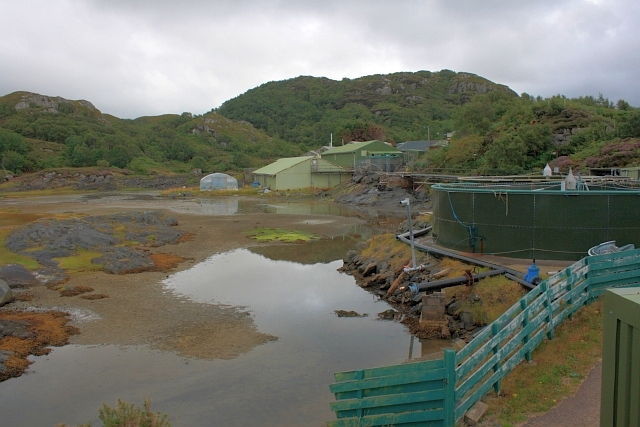
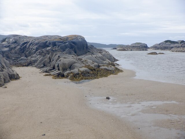
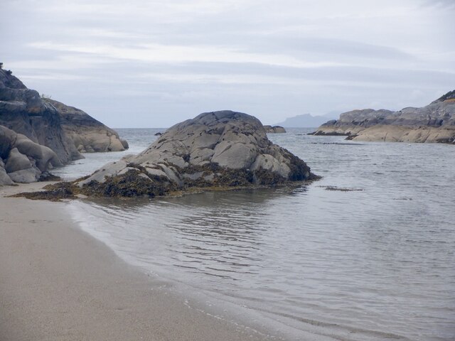
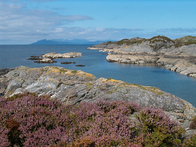
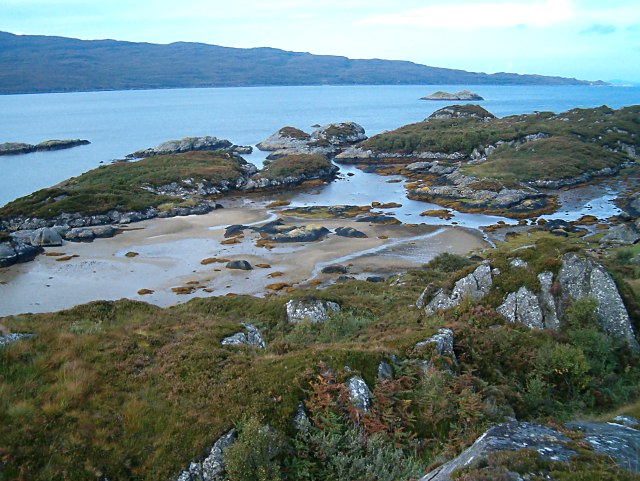
South Channel is a picturesque body of water located in Argyllshire / Inverness-shire, Scotland. It is a sea channel that stretches along the western coast of the country, connecting the Atlantic Ocean to the mainland. The channel is formed by the meeting of several estuaries and creeks, creating a unique and diverse landscape.

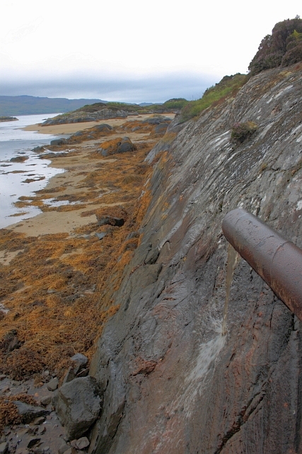
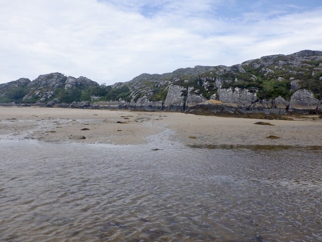
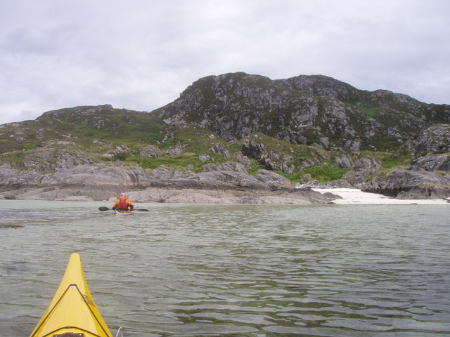
The South Channel is known for its stunning natural beauty, with its clear blue waters and scenic surroundings. The area is home to a variety of marine life, including seals, dolphins, and seabirds, making it a popular spot for wildlife enthusiasts and birdwatchers.

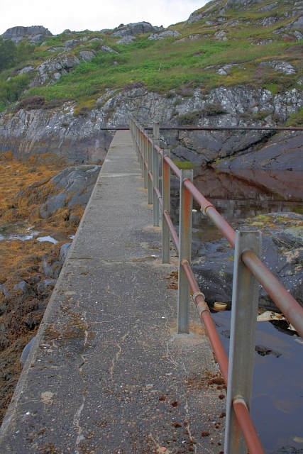
The channel is also a hub for recreational activities, such as boating, fishing, and sailing. Its calm and sheltered waters provide an ideal environment for water sports and leisurely cruises. Many visitors enjoy exploring the numerous small islands and secluded beaches that dot the channel's coastline.

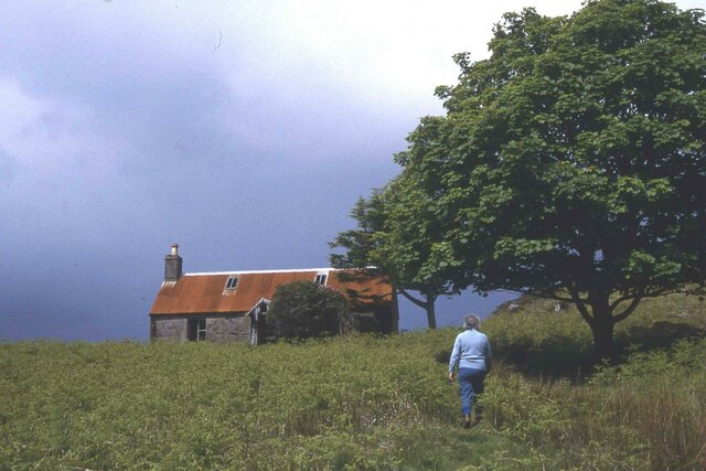
In addition to its natural attractions, the South Channel has a rich history and cultural heritage. It has been an important transportation route for centuries, with fishing and trade being vital industries in the area. The channel is dotted with small fishing villages and harbors, which offer a glimpse into the traditional way of life in the region.

Overall, South Channel in Argyllshire / Inverness-shire is a captivating destination that showcases the beauty of Scotland's coastal landscape. It offers a range of activities and sights for visitors to enjoy, making it a must-visit location for nature lovers and those seeking a peaceful escape.

If you have any feedback on the listing, please let us know in the comments section below.

South Channel Images

Images are sourced within 2km of 56.786559/-5.8859266 or Grid Reference NM6272. Thanks to Geograph Open Source API. All images are credited.

Fish Pond Originally used to conduct research into fish farming.
Fish Pond
Originally used to conduct research into fish farming.
Discharge Pipe Possibly to divert fresh water away from the nearby fish pond where research into fish farming was carried out.
Discharge Pipe
Possibly to divert fresh water away from the nearby fish pond where research into fish farming was carried out.
Dam Wall Constructed to provide a fish pond in which research into fish farming was conducted.
Dam Wall
Constructed to provide a fish pond in which research into fish farming was conducted.
Sàilean Dubh A small drying inlet at Ardtoe.
Sàilean Dubh
A small drying inlet at Ardtoe.
Rocks, Ardtoe Low water, Sàilean Dubh.
Rocks, Ardtoe
Low water, Sàilean Dubh.
Sàilean Dubh
Sàilean Dubh
Beach, Ardtoe Between the rocky islets at low water.
Beach, Ardtoe
Between the rocky islets at low water.
A rocky islet, Ardtoe Tidal rock set in the beach off Ardtoe.
A rocky islet, Ardtoe
Tidal rock set in the beach off Ardtoe.
Beach at Ardtoe Looking up the beach towards the northern dam.
Beach at Ardtoe
Looking up the beach towards the northern dam.
Ardtoe Marine Research Facility Initially set up by the White Fish Authority, research has been conducted here on the farming of fish such as turbot, sole and halibut, amongst others.
Ardtoe Marine Research Facility
Initially set up by the White Fish Authority, research has been conducted here on the farming of fish such as turbot, sole and halibut, amongst others.
Dam at fishery research station Built to hold sea water for fish ponds.
<a href="https://www.geograph.org.uk/photo/3096388">NM6271 : Dam Wall</a>
Dam at fishery research station
Built to hold sea water for fish ponds. NM6271 : Dam Wall
Interesting rocky shoreline I think this is lava that cooled under very high pressure but I'm not sure.
Interesting rocky shoreline
I think this is lava that cooled under very high pressure but I'm not sure.
The beach, Ardtoe Behind the beach is the Ardtoe Marine Research Facility, which has been a world leader in the development of marine aquaculture, science and technology for half a century.
The beach, Ardtoe
Behind the beach is the Ardtoe Marine Research Facility, which has been a world leader in the development of marine aquaculture, science and technology for half a century.
Eilean Shona - Arien Cottage
Lagoon off Shona. Shell sand Lagoon, off Aonach on Eilean Shona.
Lagoon off Shona.
Shell sand Lagoon, off Aonach on Eilean Shona.
Heather on the rocks at Ardtoe With a view to the Isle of Eigg with Rum nestling behind it.
Heather on the rocks at Ardtoe
With a view to the Isle of Eigg with Rum nestling behind it.
Sun, sea, sand and Rum A fantastic little cove at Ardtoe. What a pity we hadn't brought our bathing togs.
Sun, sea, sand and Rum
A fantastic little cove at Ardtoe. What a pity we hadn't brought our bathing togs.
Sailean Dubh Part of the rocky shoreline near Ardtoe, with the Ardnamurchan peninsula the other side of the bay. The Isle of Muck is just visible offshore at the end of the land.
Sailean Dubh
Part of the rocky shoreline near Ardtoe, with the Ardnamurchan peninsula the other side of the bay. The Isle of Muck is just visible offshore at the end of the land.
Show me another place!

South Channel is located at Grid Ref: NM6272 (Lat: 56.786559, Lng: -5.8859266)

Unitary Authority: Highland

Police Authority: Highlands and Islands

What 3 Words

///encrusted.trombone.booms. Near Arisaig, Highland

Related Wikis

Ardtoe

Ardtoe (Scottish Gaelic: Àird Tobha) is a place on the coast of Ardnamurchan, Lochaber, in the Highland council area of Scotland. It has sandy beaches...

Eilean Shona

Eilean Shona (Scottish Gaelic: Eilean Seòna) is a tidal island in Loch Moidart, Scotland. The modern name may be from the Old Norse for "sea island". The...

Newton of Ardtoe

Newton of Ardtoe is a scattered crofting hamlet near Acharacle in Lochaber, Scottish Highlands and is in the council area of Highland.

Castle Tioram

Castle Tioram (; Scottish Gaelic: Caisteal Tioram, meaning "dry castle") is a ruined castle that sits on the tidal island Eilean Tioram in Loch Moidart...

Nearby Amenities

Located within 500m of 56.786559,-5.8859266
Source: PGS
Lat/Long: 56.7864809/-5.8856358
Source: PGS
Lat/Long: 56.786745/-5.8857431
Source: PGS
Lat/Long: 56.787074/-5.885574
Source: PGS
Lat/Long: 56.7872418/-5.8852105
Source: PGS
Lat/Long: 56.7872989/-5.8848575
Source: PGS
Lat/Long: 56.7873934/-5.8837293
Source: PGS
Lat/Long: 56.7872902/-5.8829449
Source: PGS
Lat/Long: 56.7873286/-5.8830511
Source: PGS
Lat/Long: 56.7870049/-5.8829797
Source: PGS
Lat/Long: 56.7869136/-5.8844544
Source: PGS
Lat/Long: 56.7866939/-5.8845988
Source: PGS
Lat/Long: 56.7839668/-5.8800208
Source: PGS
Lat/Long: 56.7839177/-5.8800657
Source: PGS
Lat/Long: 56.7836576/-5.8804197
Source: PGS
Lat/Long: 56.7834682/-5.8810929
Source: PGS
Lat/Long: 56.7832554/-5.8813133
Source: PGS
Lat/Long: 56.7832315/-5.8820237
Source: PGS
Lat/Long: 56.7833399/-5.883281
Source: PGS
Lat/Long: 56.7836702/-5.8819811
Source: PGS
Lat/Long: 56.7841103/-5.8821985
Source: PGS
Lat/Long: 56.7845529/-5.8829349
Source: PGS
Lat/Long: 56.7843297/-5.8840756
Source: PGS
Lat/Long: 56.7847309/-5.8838927
Source: PGS
Lat/Long: 56.7852553/-5.885267
Source: PGS
Lat/Long: 56.7853858/-5.8859235
Source: PGS
Lat/Long: 56.7853415/-5.8866712
Source: PGS
Lat/Long: 56.785127/-5.8872259
Source: PGS
Lat/Long: 56.7849484/-5.8874648
Source: PGS
Lat/Long: 56.7844988/-5.887919
Source: PGS
Lat/Long: 56.783975/-5.8878456
Source: PGS
Lat/Long: 56.7841414/-5.8882296
Source: PGS
Lat/Long: 56.7840531/-5.8884932
Source: PGS
Lat/Long: 56.7838366/-5.8884853
Source: PGS
Lat/Long: 56.7830144/-5.8885748
Source: PGS
Lat/Long: 56.7826706/-5.8891641
The data included in this document is from www.openstreetmap.org. The data is made available under ODbL.

Have you been to South Channel?

Leave your review of South Channel below (or comments, questions and feedback).