Am Brù

Sea, Estuary, Creek in Argyllshire

Scotland

Am Brù

Slopes of Beinn Eolasary A sharp reentrant which is marked as a fault on the solid geology map.
Slopes of Beinn Eolasary Credit: Richard Webb

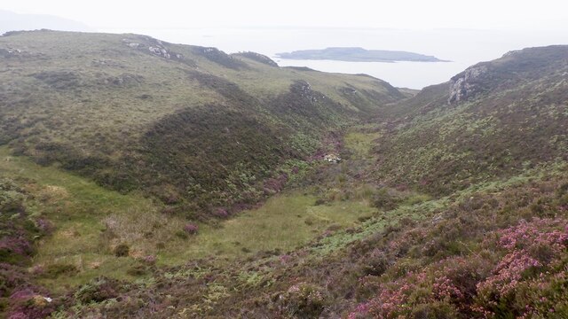
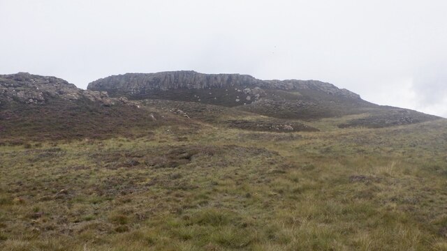
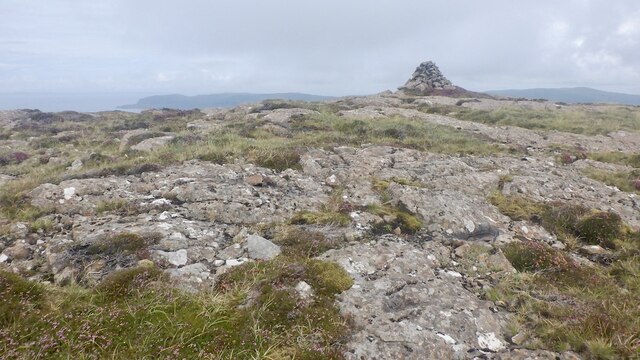
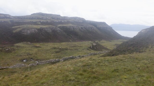
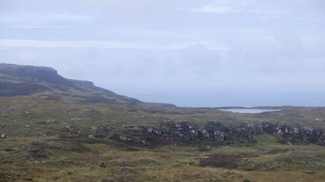
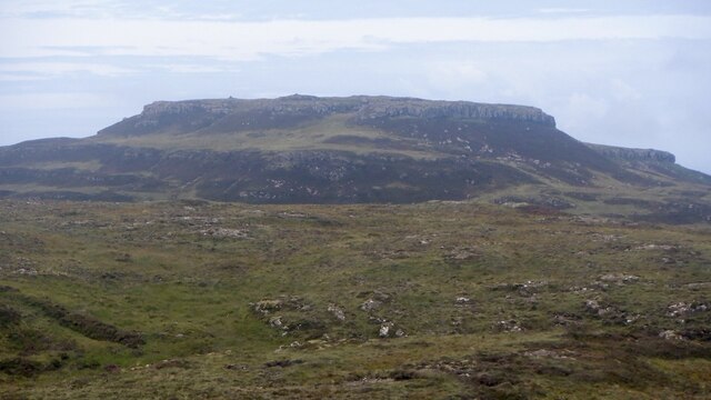
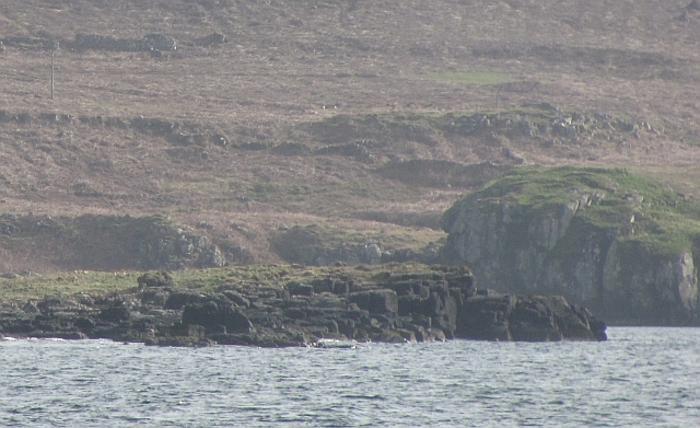
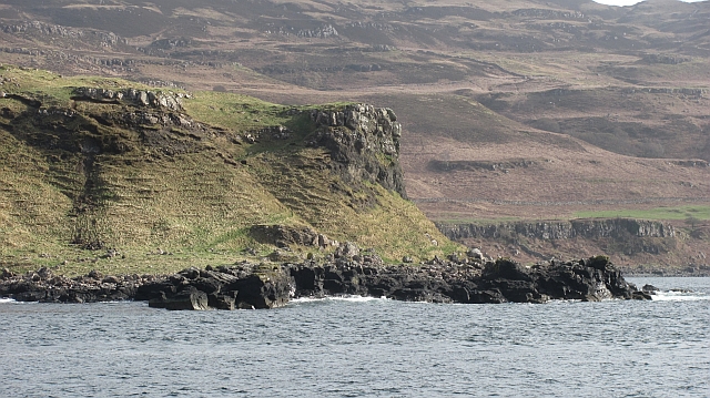
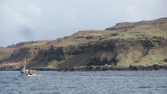
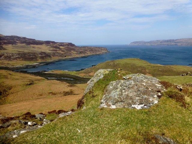
Am Brù is a picturesque coastal area located in Argyllshire, Scotland. Nestled along the western coast, it is renowned for its stunning sea views, estuary, and creek. The name "Am Brù" translates to "the edge" in Scottish Gaelic, which aptly describes its location on the edge of the mainland.

The area's most prominent feature is its breathtaking sea. The pristine waters of the Atlantic Ocean stretch as far as the eye can see, offering a captivating sight for visitors. The ever-changing tides create a dynamic landscape, with calm waters during low tide and powerful waves crashing against the rocky shores during high tide.

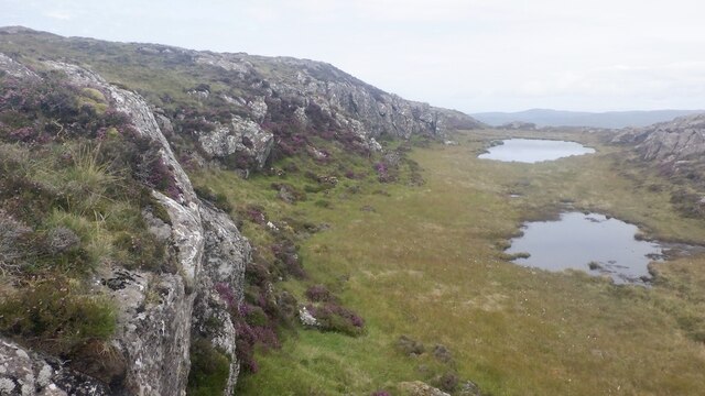
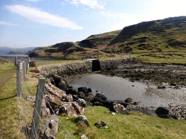
Adjacent to the sea, Am Brù is blessed with a beautiful estuary. This natural inlet serves as a transitional zone where the freshwater from nearby rivers merges with the saline seawater. The estuary is home to a diverse range of flora and fauna, including various species of fish, birds, and marine mammals. It provides an ideal habitat for wildlife enthusiasts and birdwatchers to observe and appreciate the region's rich biodiversity.

Furthermore, Am Brù boasts a charming creek that meanders through the landscape. The creek is a small, narrow waterway that winds its way inland, surrounded by lush greenery and picturesque cliffs. It provides a tranquil setting for leisurely walks or boating activities, allowing visitors to immerse themselves in the peace and serenity of the area.

Overall, Am Brù in Argyllshire is a captivating coastal destination that offers a stunning sea view, an enchanting estuary, and a serene creek. Its natural beauty and diverse ecosystems make it a must-visit location for nature lovers and those seeking a peaceful retreat.

If you have any feedback on the listing, please let us know in the comments section below.

Am Brù Images

Images are sourced within 2km of 56.493551/-6.2509324 or Grid Reference NM3841. Thanks to Geograph Open Source API. All images are credited.

Slopes of Beinn Eolasary A sharp reentrant which is marked as a fault on the solid geology map.
Slopes of Beinn Eolasary
A sharp reentrant which is marked as a fault on the solid geology map.
Top layer of the cake: Beinn Eolasary The highest lava flow in Ulva's traps makes an impressive crag. The rock is very slippery though as I found out the hard way when trying to get through at a weakness.
Top layer of the cake: Beinn Eolasary
The highest lava flow in Ulva's traps makes an impressive crag. The rock is very slippery though as I found out the hard way when trying to get through at a weakness.
Summit, Beinn Eolasary A flat basalt table on top of Ulva's highest trap lava flow.
Summit, Beinn Eolasary
A flat basalt table on top of Ulva's highest trap lava flow.
On Beinn Eolasary The crags are the upper lava flow on Ulva, the top layer in the stepped landscape of the island.
On Beinn Eolasary
The crags are the upper lava flow on Ulva, the top layer in the stepped landscape of the island.
Dry stone dyke, Ulva A wall running across the island between Beinn Eolasary and Beinn Chreagach, the two main hills.
Dry stone dyke, Ulva
A wall running across the island between Beinn Eolasary and Beinn Chreagach, the two main hills.
The lochan on Beinn an Lochain, Ulva Trap landscape seen from moorland on Beinn Chreagach
The lochan on Beinn an Lochain, Ulva
Trap landscape seen from moorland on Beinn Chreagach
Traps, Beinn Eolasary Ulva's distinctive stepped landscape, seen from Beinn Chreagach.
Traps, Beinn Eolasary
Ulva's distinctive stepped landscape, seen from Beinn Chreagach.
Moorland, Beinn Eolasary On one of the traps looking over the collection of small islands between Little Colonsay and Ulva.
Moorland, Beinn Eolasary
On one of the traps looking over the collection of small islands between Little Colonsay and Ulva.
South side of Beinn Eolasary Moorland above a very steep scarp on the south side of Ulva. There are feral sheep here, descendants of those who escaped the round up when farming ceased here.  It is hoped to open up the island to agriculture again but not as one unit.  Highland cattle are already grazing the hill.

The distant island is Staffa.
South side of Beinn Eolasary
Moorland above a very steep scarp on the south side of Ulva. There are feral sheep here, descendants of those who escaped the round up when farming ceased here. It is hoped to open up the island to agriculture again but not as one unit. Highland cattle are already grazing the hill. The distant island is Staffa.
Eilean a' Choire A small flat island just off Ulva.
Eilean a' Choire
A small flat island just off Ulva.
Eilean a' Choire The northern end of a skerry off Ulva.
Eilean a' Choire
The northern end of a skerry off Ulva.
Rubha Chulinish Headland on the north coast of Ulva.
Rubha Chulinish
Headland on the north coast of Ulva.
Passing Rubha Chulinish Jessica Louise passes Rubha Chulinish bound for Ulva Ferry.
Passing Rubha Chulinish
Jessica Louise passes Rubha Chulinish bound for Ulva Ferry.
The entrance to Am Brù Am Brù is the narrow channel (dry at low tide) which separates the Isles of Ulva (to the left) from Gometra.
The entrance to Am Brù
Am Brù is the narrow channel (dry at low tide) which separates the Isles of Ulva (to the left) from Gometra.
Beinn Eolasary Sixth TuMP of a bright sunny day with Jim Bloomer and Richard Tibbetts.
Name: Beinn Eolasary
Hill number: 102179
Height: 306m / 1004ft
Area: 17E: Mull and Nearby Islands
Class: 3
Grid ref: NM389403 (est)
Drop: 69m
Col: 237m
Beinn Eolasary
Sixth TuMP of a bright sunny day with Jim Bloomer and Richard Tibbetts. Name: Beinn Eolasary Hill number: 102179 Height: 306m / 1004ft Area: 17E: Mull and Nearby Islands Class: 3 Grid ref: NM389403 (est) Drop: 69m Col: 237m
Cnoc Rubha Dubh First TuMP of a bright sunny day with Jim Bloomer and Richard Tibbetts after a military march from the Ulva Ferry.

Name: Cnoc Rubha Dubh
Hill number: 102451
Height: 67m / 220ft
Area: 17E: Mull and Nearby Islands
Class: 0
Grid ref: NM375412 (est)
Drop: 38m
Col: 29m
Cnoc Rubha Dubh
First TuMP of a bright sunny day with Jim Bloomer and Richard Tibbetts after a military march from the Ulva Ferry. Name: Cnoc Rubha Dubh Hill number: 102451 Height: 67m / 220ft Area: 17E: Mull and Nearby Islands Class: 0 Grid ref: NM375412 (est) Drop: 38m Col: 29m
Torr Mor NE Top Second TuMP today with Jim Bloomer and Richard Tibbetts.
Name: Torr Mor NE Top
Hill number: 102436
Height: 74m / 243ft
Area: 17E: Mull and Nearby Islands
Class: 0
Grid ref: NM370409 (est)
Drop: 31m
Col: 43m
Torr Mor NE Top
Second TuMP today with Jim Bloomer and Richard Tibbetts. Name: Torr Mor NE Top Hill number: 102436 Height: 74m / 243ft Area: 17E: Mull and Nearby Islands Class: 0 Grid ref: NM370409 (est) Drop: 31m Col: 43m
The Bridge This is the view from Gometra back across the bridge that connects it with Ulva.  Gometra is a tidal island next to Ulva.
The Bridge
This is the view from Gometra back across the bridge that connects it with Ulva. Gometra is a tidal island next to Ulva.
Show me another place!

Am Brù is located at Grid Ref: NM3841 (Lat: 56.493551, Lng: -6.2509324)

Unitary Authority: Argyll and Bute

Police Authority: Argyll and West Dunbartonshire

What 3 Words

///novel.darkest.tweezers. Near Calgary, Argyll & Bute

Related Wikis

Gometra

Gometra (Scottish Gaelic: Gòmastra) is an island in the Inner Hebrides of Scotland, lying west of Mull. It lies immediately west of Ulva, to which it is...

Ulva

Ulva (; Scottish Gaelic: Ulbha) is a small island in the Inner Hebrides of Scotland, off the west coast of Mull. It is separated from Mull by a narrow...

Loch Tuath

Loch Tuath (Scottish Gaelic: Loch-a-Tuath) is a sea loch in the Inner Hebrides, Scotland that separates the Isle of Mull and the island of Ulva. Loch Tuath...

Achleck

Achleck is a small settlement in the north-west of the Isle of Mull in Argyll and Bute, Scotland. == References ==

Nearby Amenities

Located within 500m of 56.493551,-6.2509324
Source: PGS
Lat/Long: 56.4920233/-6.25219
Source: PGS
Lat/Long: 56.4922152/-6.2517134
Source: PGS
Lat/Long: 56.4925762/-6.2520721
Source: PGS
Lat/Long: 56.4927162/-6.2522599
Source: PGS
Lat/Long: 56.4928874/-6.2522553
Source: PGS
Lat/Long: 56.4930418/-6.2522306
Source: PGS
Lat/Long: 56.4930156/-6.2516661
Source: PGS
Lat/Long: 56.4928521/-6.250948
Source: PGS
Lat/Long: 56.4935335/-6.250263
Source: PGS
Lat/Long: 56.4958992/-6.2495081
Source: PGS
Lat/Long: 56.4962612/-6.2495854
Source: PGS
Lat/Long: 56.4964649/-6.2494469
Source: PGS
Lat/Long: 56.4965431/-6.2491909
Source: PGS
Lat/Long: 56.4966432/-6.2490314
Source: PGS
Lat/Long: 56.4967309/-6.2488244
Source: PGS
Lat/Long: 56.4967678/-6.2487665
Source: PGS
Lat/Long: 56.49686/-6.2484786
Source: PGS
Lat/Long: 56.4969482/-6.2476137
Source: PGS
Lat/Long: 56.4972236/-6.2464738
The data included in this document is from www.openstreetmap.org. The data is made available under ODbL.

Have you been to Am Brù?

Leave your review of Am Brù below (or comments, questions and feedback).