Caolas Annraidh

Sea, Estuary, Creek in Argyllshire

Scotland

Caolas Annraidh

Eilean Dubh na Ciste Eilean Dubh na Ciste is a rocky skerry at the NNE end of Bull Hole, a narrow channel and anchorage between Iona and the Ross of Mull. Its advantage from my perspective is that the two main rocks are linked by a small sandy tombolo beach which provides a convenient place to land a sea kayak and wander around getting the best views. This view looks northwards to more skerries outside Kinta harbour, where the water is a lot calmer than on my last visit <a href="https://www.geograph.org.uk/photo/5796448">NM3125 : Paddling into the sun - Eilean Corrach</a>.
Eilean Dubh na Ciste Credit: Andy Waddington

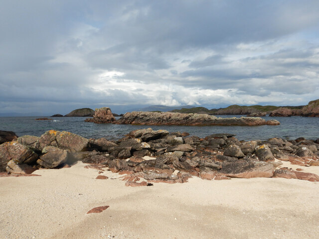
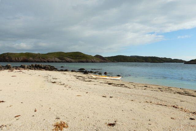
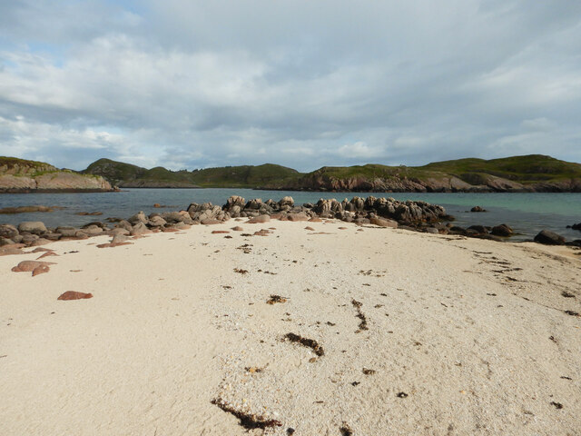
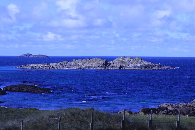
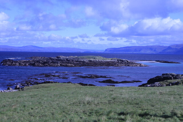
Caolas Annraidh is a picturesque sea inlet located in Argyllshire, Scotland. Nestled between rolling hills and rugged coastline, this estuary offers breathtaking views and a serene atmosphere.

The caolas, or sea channel, connects the open waters of the Atlantic Ocean to a smaller creek, creating a natural haven for marine life and bird species. The crystal-clear waters are home to a diverse range of marine species, including seals, dolphins, and various fish species. Birdwatchers flock to this area to catch glimpses of rare seabirds such as puffins and guillemots.

The surrounding landscape is characterized by lush greenery, with towering cliffs and rocky outcrops adding to its dramatic beauty. The estuary is surrounded by a mix of grassy meadows and heather-covered moorlands, creating a striking contrast against the deep blue of the sea.

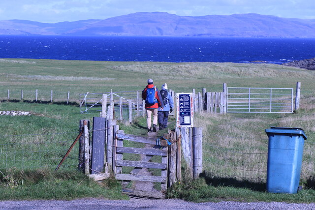
Caolas Annraidh is also a popular destination for outdoor enthusiasts. Visitors can partake in activities such as kayaking, sailing, and fishing. The calm waters of the creek offer an ideal setting for beginners to try their hand at water sports.

For those seeking tranquility and natural beauty, Caolas Annraidh is a hidden gem. Its unspoiled surroundings and abundant wildlife make it a must-visit destination for nature lovers and those looking to immerse themselves in the stunning Scottish landscape.

If you have any feedback on the listing, please let us know in the comments section below.

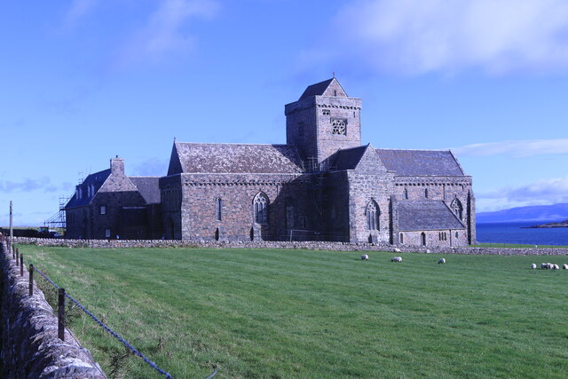
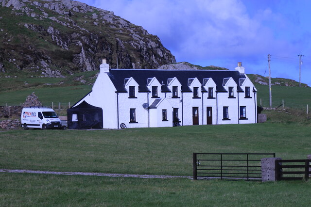
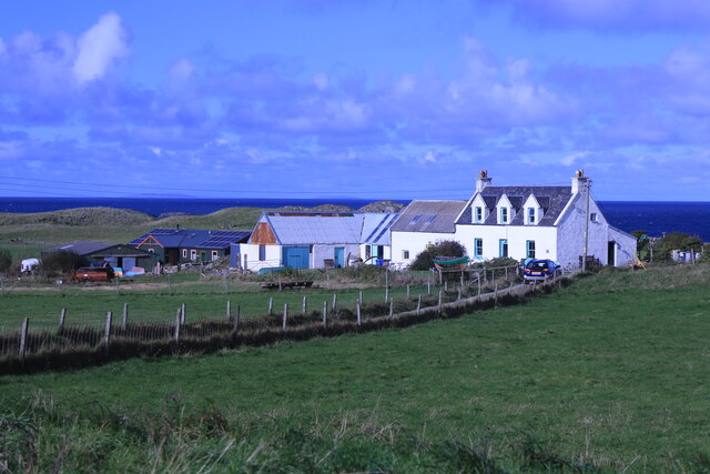
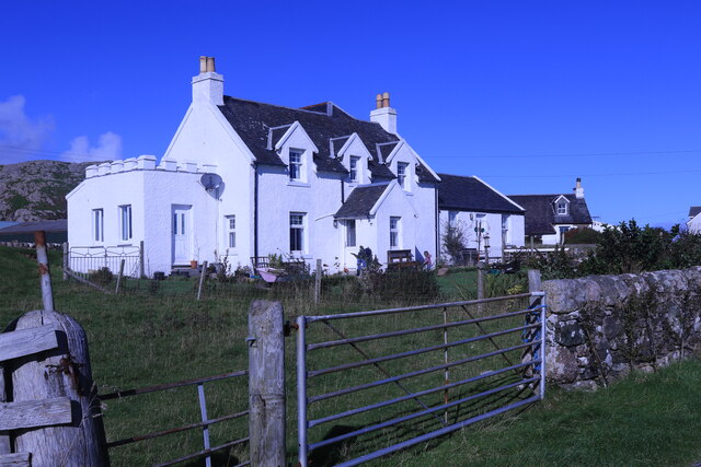
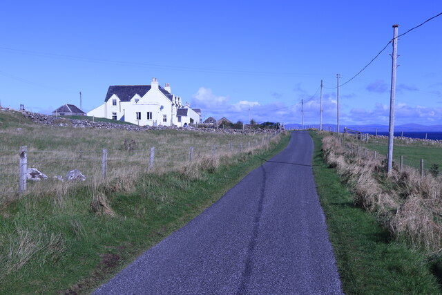
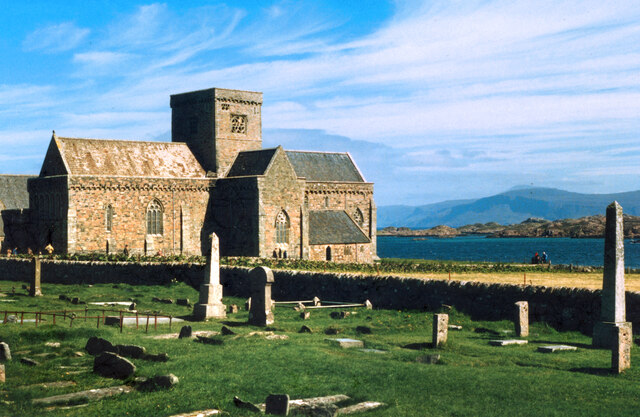
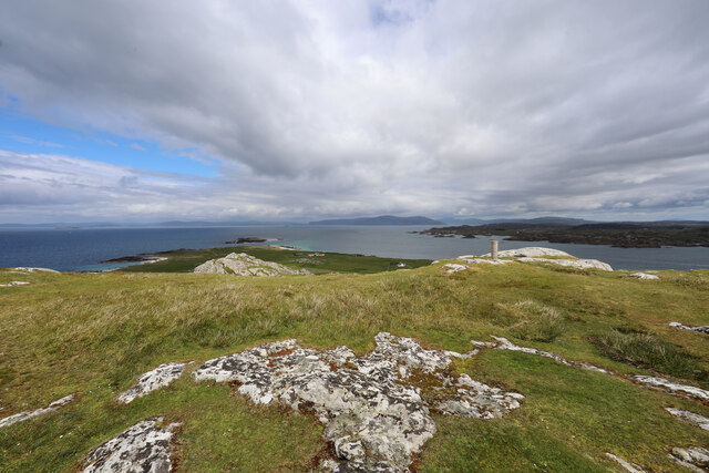
Caolas Annraidh Images

Images are sourced within 2km of 56.349687/-6.3806648 or Grid Reference NM2926. Thanks to Geograph Open Source API. All images are credited.

Eilean Dubh na Ciste Eilean Dubh na Ciste is a rocky skerry at the NNE end of Bull Hole, a narrow channel and anchorage between Iona and the Ross of Mull. Its advantage from my perspective is that the two main rocks are linked by a small sandy tombolo beach which provides a convenient place to land a sea kayak and wander around getting the best views. This view looks northwards to more skerries outside Kinta harbour, where the water is a lot calmer than on my last visit <a href="https://www.geograph.org.uk/photo/5796448">NM3125 : Paddling into the sun - Eilean Corrach</a>.
Eilean Dubh na Ciste
Eilean Dubh na Ciste is a rocky skerry at the NNE end of Bull Hole, a narrow channel and anchorage between Iona and the Ross of Mull. Its advantage from my perspective is that the two main rocks are linked by a small sandy tombolo beach which provides a convenient place to land a sea kayak and wander around getting the best views. This view looks northwards to more skerries outside Kinta harbour, where the water is a lot calmer than on my last visit NM3125 : Paddling into the sun - Eilean Corrach.
Landing on Eilean Dubh na Ciste Eilean Dubh na Ciste is a rocky skerry at the NNE end of Bull Hole, a narrow channel and anchorage between Iona and the Ross of Mull. Its advantage from my perspective is that the two main rocks are linked by a small sandy tombolo beach which provides a convenient place to land a sea kayak and wander around getting the best views. This is the full extent of the beach - my back is almost against the rocks looking over my landing spot towards the bay south of Kintra.
Landing on Eilean Dubh na Ciste
Eilean Dubh na Ciste is a rocky skerry at the NNE end of Bull Hole, a narrow channel and anchorage between Iona and the Ross of Mull. Its advantage from my perspective is that the two main rocks are linked by a small sandy tombolo beach which provides a convenient place to land a sea kayak and wander around getting the best views. This is the full extent of the beach - my back is almost against the rocks looking over my landing spot towards the bay south of Kintra.
Sand on Eilean Dubh na Ciste Eilean Dubh na Ciste is a rocky skerry at the NNE end of Bull Hole, a narrow channel and anchorage between Iona and the Ross of Mull. Its advantage from my perspective is that the two main rocks are linked by a small sandy tombolo beach which provides a convenient place to land a sea kayak and wander around getting the best views. These are the rocks on the eastern edge of the beach, beyond which lie the shallow bays and rocky coast hiding the settlement of Kintra.
Sand on Eilean Dubh na Ciste
Eilean Dubh na Ciste is a rocky skerry at the NNE end of Bull Hole, a narrow channel and anchorage between Iona and the Ross of Mull. Its advantage from my perspective is that the two main rocks are linked by a small sandy tombolo beach which provides a convenient place to land a sea kayak and wander around getting the best views. These are the rocks on the eastern edge of the beach, beyond which lie the shallow bays and rocky coast hiding the settlement of Kintra.
Dunsmeorach House Near Iona Abbey.
Dunsmeorach House
Near Iona Abbey.
St Mary's Abbey, Iona Category A listed. Listing reference LB12310.
Dating from the 13th century. Heavily restored in the first half of the 20th century.
St Mary's Abbey, Iona
Category A listed. Listing reference LB12310. Dating from the 13th century. Heavily restored in the first half of the 20th century.
Bishops Walk Row of houses on Iona.
Bishops Walk
Row of houses on Iona.
Lagandorain House The most northerly property on Iona.
Lagandorain House
The most northerly property on Iona.
Eilean Chalbha An island off the north coast of Iona.
Eilean Chalbha
An island off the north coast of Iona.
Eilean Annraidh An island off the north coast of Iona.
Eilean Annraidh
An island off the north coast of Iona.
Track down to Traigh Bhan On the north coast of Iona.
Track down to Traigh Bhan
On the north coast of Iona.
Trekking north Near Summer House, Iona.
Trekking north
Near Summer House, Iona.
The Summer House Near Traigh Bhan, Iona.
The Summer House
Near Traigh Bhan, Iona.
House on Iona Opposite the memorial cross.
House on Iona
Opposite the memorial cross.
House on Iona Near Clachanach.
House on Iona
Near Clachanach.
Road north on Iona Towards Clachanach.
Road north on Iona
Towards Clachanach.
Abbey and Graveyard St Mary's Abbey with some of the monuments in the adjacent cemetery.
Abbey and Graveyard
St Mary's Abbey with some of the monuments in the adjacent cemetery.
From cairn to trig point on Dun I Dun I is a relatively easy ascent from the road north of the Abbey, but approaching from the interior, one feels as though one has climbed a much bigger and rougher hill than the 101m summit seen here. The cairn sits a little higher than the trig point to the NE and offers a super view over the tip of Iona to Staffa, the Treshnish Isles and the Wilderness coast of Mull.
From cairn to trig point on Dun I
Dun I is a relatively easy ascent from the road north of the Abbey, but approaching from the interior, one feels as though one has climbed a much bigger and rougher hill than the 101m summit seen here. The cairn sits a little higher than the trig point to the NE and offers a super view over the tip of Iona to Staffa, the Treshnish Isles and the Wilderness coast of Mull.
Descending from Dun I The descent from Dun I to the road back towards the Abbey has a short steep bit, but is otherwise straightforward and would have seemed almost busy were it not by comparison with the east coast's hordes of tourists (many of them sporting identical red cagoules marking them as inmates of the cruise/prison hulk anchored in the south end of the Sound). Well, as I once told a photographer who was complaining at the crowds, if we'd wanted it to ourselves we'd have come at dawn in February...
Descending from Dun I
The descent from Dun I to the road back towards the Abbey has a short steep bit, but is otherwise straightforward and would have seemed almost busy were it not by comparison with the east coast's hordes of tourists (many of them sporting identical red cagoules marking them as inmates of the cruise/prison hulk anchored in the south end of the Sound). Well, as I once told a photographer who was complaining at the crowds, if we'd wanted it to ourselves we'd have come at dawn in February...
Show me another place!

Caolas Annraidh is located at Grid Ref: NM2926 (Lat: 56.349687, Lng: -6.3806648)

Unitary Authority: Argyll and Bute

Police Authority: Argyll and West Dunbartonshire

What 3 Words

///berated.strutted.reservoir. Near Fionnphort, Argyll & Bute

Related Wikis

St Oran's Chapel

St Oran's Chapel (Odhráin/Orain/Odran) is a medieval chapel located on the island of Iona in the Inner Hebrides off the west coast of Scotland. Built in...

Iona Abbey

Iona Abbey is an abbey located on the island of Iona, just off the Isle of Mull on the West Coast of Scotland. It is one of the oldest Christian religious...

Bishop's House, Iona

Bishop's House is a retreat house for the Scottish Episcopal Church, located on the island of Iona, off the west coast of Scotland. == History == It was...

Kintra

Kintra (Scottish Gaelic: Ceann na Tràgha), literally "country" in Scots is a settlement on the North-Western coast of the Ross of Mull, Scotland. The settlement...

Nearby Amenities

Located within 500m of 56.349687,-6.3806648
Source: PGS
Lat/Long: 56.3523496/-6.377887
Source: PGS
Lat/Long: 56.3530265/-6.3778861
Source: PGS
Lat/Long: 56.3535215/-6.3772215
Source: PGS
Lat/Long: 56.3529492/-6.375203
Source: PGS
Lat/Long: 56.3527431/-6.3758308
Source: PGS
Lat/Long: 56.3526549/-6.375904
Source: PGS
Lat/Long: 56.3522857/-6.3764225
Source: PGS
Lat/Long: 56.3522895/-6.3766274
Source: PGS
Lat/Long: 56.3524002/-6.3767185
Source: PGS
Lat/Long: 56.3523673/-6.376976
Source: PGS
Lat/Long: 56.3523207/-6.377608
Source: PGS
Lat/Long: 56.3500098/-6.3863229
Source: PGS
Lat/Long: 56.3508833/-6.3875529
Source: PGS
Lat/Long: 56.3508549/-6.3869822
Source: PGS
Lat/Long: 56.3509056/-6.3869647
Source: PGS
Lat/Long: 56.3507844/-6.3855716
Source: PGS
Lat/Long: 56.3501844/-6.3856172
Source: PGS
Lat/Long: 56.3499982/-6.3850708
Source: PGS
Lat/Long: 56.3498011/-6.3838247
Source: PGS
Lat/Long: 56.3496535/-6.3831206
Source: PGS
Lat/Long: 56.3499666/-6.3828443
Source: PGS
Lat/Long: 56.3499765/-6.3826006
Source: PGS
Lat/Long: 56.3495683/-6.3821056
Source: PGS
Lat/Long: 56.349568/-6.3818513
Source: PGS
Lat/Long: 56.3495055/-6.3819128
Source: PGS
Lat/Long: 56.3487379/-6.381392
Source: PGS
Lat/Long: 56.3486659/-6.3813765
Source: PGS
Lat/Long: 56.3477998/-6.3826733
Source: PGS
Lat/Long: 56.3475633/-6.3828169
Source: PGS
Lat/Long: 56.3473947/-6.3829693
Source: PGS
Lat/Long: 56.3467707/-6.3836107
Source: PGS
Lat/Long: 56.3463166/-6.3837614
Source: PGS
Lat/Long: 56.3458895/-6.3838825
Source: PGS
Lat/Long: 56.3455732/-6.383887
The data included in this document is from www.openstreetmap.org. The data is made available under ODbL.

Have you been to Caolas Annraidh?

Leave your review of Caolas Annraidh below (or comments, questions and feedback).