Caolas Fuaigh

Sea, Estuary, Creek in Ross-shire

Scotland

Caolas Fuaigh

West coast of Great Bernera This is the west side of a spit of land extending south of Tobson. The ground is rocky with a thin covering of grass.

In the distance, on the left is the tip of the island of Pabaigh Mor .. and on the right Geodha Mor (west of Tobson).
West coast of Great Bernera Credit: Rob Burke

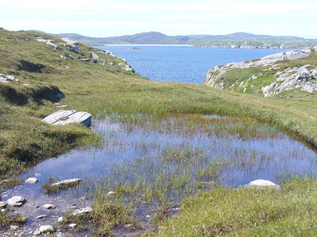
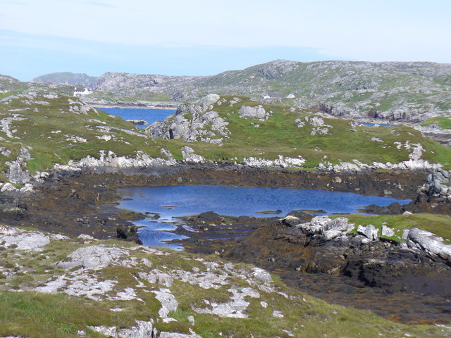
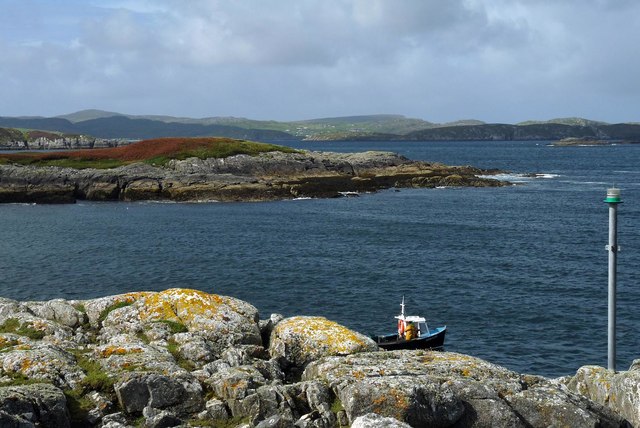
Caolas Fuaigh is a picturesque coastal area located in Ross-shire, Scotland. Situated at the mouth of a sea loch, it encompasses a beautiful combination of sea, estuary, and creek, making it a haven for nature enthusiasts and photographers.

The area is characterized by its stunning natural beauty. The sea surrounding Caolas Fuaigh offers breathtaking views of rolling waves crashing against rocky cliffs and sandy beaches. The estuary, formed where a river meets the sea, provides a unique habitat for a variety of bird species, including herons, oystercatchers, and terns. This makes it an ideal spot for birdwatching and observing wildlife in their natural habitats.

The creek within Caolas Fuaigh adds to the charm of the area. Its calm and tranquil waters wind their way through lush greenery and provide a peaceful retreat for visitors seeking solace amidst nature. The creek is also a popular spot for fishing, attracting anglers with its abundance of fish species.

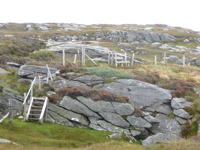
In addition to its natural wonders, Caolas Fuaigh has a rich cultural history. The area is dotted with ancient ruins and archaeological sites, providing a glimpse into its past. Visitors can explore stone circles, standing stones, and burial sites, which tell stories of the people who once inhabited the region.

Overall, Caolas Fuaigh in Ross-shire is a captivating coastal area that offers a blend of stunning landscapes, diverse wildlife, and a glimpse into its ancient history. It is a must-visit destination for those seeking a peaceful retreat in the midst of Scotland's natural beauty.

If you have any feedback on the listing, please let us know in the comments section below.

Caolas Fuaigh Images

Images are sourced within 2km of 58.214636/-6.8815771 or Grid Reference NB1335. Thanks to Geograph Open Source API. All images are credited.

West coast of Great Bernera This is the west side of a spit of land extending south of Tobson. The ground is rocky with a thin covering of grass.

In the distance, on the left is the tip of the island of Pabaigh Mor .. and on the right Geodha Mor (west of Tobson).
West coast of Great Bernera
This is the west side of a spit of land extending south of Tobson. The ground is rocky with a thin covering of grass. In the distance, on the left is the tip of the island of Pabaigh Mor .. and on the right Geodha Mor (west of Tobson).
Beach north of Bhalasaigh
Waymarked coastal walk There are clear waymarks on the route from the community centre to Bosta on Great Bernera. Return by the same route or on the road.
Waymarked coastal walk
There are clear waymarks on the route from the community centre to Bosta on Great Bernera. Return by the same route or on the road.
Bridge at Bhalasaigh Looking back to the road end on the main island of Great Bernera.
Bridge at Bhalasaigh
Looking back to the road end on the main island of Great Bernera.
Tob Bhalasaigh Tidal lagoon with a mix of rare seaweeds on Great Bernera / Bearnaraigh.
<span class="nowrap"><a title="http://www.uigandbernera.com/" rel="nofollow ugc noopener" href="http://www.uigandbernera.com/">Link</a><img style="margin-left:2px;" alt="External link" title="External link - shift click to open in new window" src="https://s1.geograph.org.uk/img/external.png" width="10" height="10"/></span>
Tob Bhalasaigh
Tidal lagoon with a mix of rare seaweeds on Great Bernera / Bearnaraigh. LinkExternal link
Valasay Bridge Carrying the single track road across an outlet of the tidal lagoon, Tob Bhalasaigh on Great Bernera / Bearnaraigh.
<span class="nowrap"><a title="http://www.uigandbernera.com/" rel="nofollow ugc noopener" href="http://www.uigandbernera.com/">Link</a><img style="margin-left:2px;" alt="External link" title="External link - shift click to open in new window" src="https://s1.geograph.org.uk/img/external.png" width="10" height="10"/></span>
Valasay Bridge
Carrying the single track road across an outlet of the tidal lagoon, Tob Bhalasaigh on Great Bernera / Bearnaraigh. LinkExternal link
Shoreline at Tob Bhalasaigh Rocks and heather at the edge of the tidal lagoon in Valasay.
<span class="nowrap"><a title="http://www.uigandbernera.com/" rel="nofollow ugc noopener" href="http://www.uigandbernera.com/">Link</a><img style="margin-left:2px;" alt="External link" title="External link - shift click to open in new window" src="https://s1.geograph.org.uk/img/external.png" width="10" height="10"/></span>
Shoreline at Tob Bhalasaigh
Rocks and heather at the edge of the tidal lagoon in Valasay. LinkExternal link
Valasay Footbridge The bridge across the tidal Tob Bhalasaigh was built in 1898.
<span class="nowrap"><a title="http://www.uigandbernera.com/" rel="nofollow ugc noopener" href="http://www.uigandbernera.com/">Link</a><img style="margin-left:2px;" alt="External link" title="External link - shift click to open in new window" src="https://s1.geograph.org.uk/img/external.png" width="10" height="10"/></span>
Valasay Footbridge
The bridge across the tidal Tob Bhalasaigh was built in 1898. LinkExternal link
Tidal Lagoon, Valasay Tob Bhalasaigh, on the island of Great Bernera / Bearnaraigh.
<span class="nowrap"><a title="http://www.uigandbernera.com/" rel="nofollow ugc noopener" href="http://www.uigandbernera.com/">Link</a><img style="margin-left:2px;" alt="External link" title="External link - shift click to open in new window" src="https://s1.geograph.org.uk/img/external.png" width="10" height="10"/></span>
Tidal Lagoon, Valasay
Tob Bhalasaigh, on the island of Great Bernera / Bearnaraigh. LinkExternal link
Tob Bhalasaigh from the Footbridge View northwards, along the narrow tidal lagoon, to Tobson 2 kilometres away in the distance.
Tob Bhalasaigh from the Footbridge
View northwards, along the narrow tidal lagoon, to Tobson 2 kilometres away in the distance.
Poll Ula On the indistinct coastal path along the west coast of great Bernera / Bearnaraigh. Well placed wooden marker posts are easy to follow.
<span class="nowrap"><a title="http://www.uigandbernera.com/" rel="nofollow ugc noopener" href="http://www.uigandbernera.com/">Link</a><img style="margin-left:2px;" alt="External link" title="External link - shift click to open in new window" src="https://s1.geograph.org.uk/img/external.png" width="10" height="10"/></span>
Poll Ula
On the indistinct coastal path along the west coast of great Bernera / Bearnaraigh. Well placed wooden marker posts are easy to follow. LinkExternal link
Above Geodha nan Uan On the Bernera coastal path with view across the sound to Traigh na Beirigh at Valtos.
<span class="nowrap"><a title="http://www.uigandbernera.com/" rel="nofollow ugc noopener" href="http://www.uigandbernera.com/">Link</a><img style="margin-left:2px;" alt="External link" title="External link - shift click to open in new window" src="https://s1.geograph.org.uk/img/external.png" width="10" height="10"/></span>
Above Geodha nan Uan
On the Bernera coastal path with view across the sound to Traigh na Beirigh at Valtos. LinkExternal link
Tob Lathach Small tidal lagoon on the west coast of Great Bernera / Bearnaraigh.
<span class="nowrap"><a title="http://www.uigandbernera.com/" rel="nofollow ugc noopener" href="http://www.uigandbernera.com/">Link</a><img style="margin-left:2px;" alt="External link" title="External link - shift click to open in new window" src="https://s1.geograph.org.uk/img/external.png" width="10" height="10"/></span>
Tob Lathach
Small tidal lagoon on the west coast of Great Bernera / Bearnaraigh. LinkExternal link
Morning RIB Commute Seatrek worker on morning commute to work at Miabhaig on a RIB. Photo taken from the MV Lochlann.
Morning RIB Commute
Seatrek worker on morning commute to work at Miabhaig on a RIB. Photo taken from the MV Lochlann.
Coastline, Rubha Domhain, Great Bernera Looking towards the island of Eunaigh Mòr.  The part of the island shown in the photo also lies within the grid square.
Coastline, Rubha Domhain, Great Bernera
Looking towards the island of Eunaigh Mòr. The part of the island shown in the photo also lies within the grid square.
Playing in the tidal rapid at Bhalasaigh We'd earlier paddled up into Tob Bhalasaigh with the end of the rising tide, then up towards its northern end to await the ebb gaining a bit of speed. On our return to Bhalasaigh, our timing proved excellent as there was a lot of water emptying out of the loch at some speed under the bridge. "High crossing" is a game usually played by white water kayakers, and not in the normal "remit" of sea kayakers, as the sea doesn't often cooperate in this way ! However we spent a good hour playing in this tidal rapid as the level changed until tempus fugit and we had to be elsewhere...
Playing in the tidal rapid at Bhalasaigh
We'd earlier paddled up into Tob Bhalasaigh with the end of the rising tide, then up towards its northern end to await the ebb gaining a bit of speed. On our return to Bhalasaigh, our timing proved excellent as there was a lot of water emptying out of the loch at some speed under the bridge. "High crossing" is a game usually played by white water kayakers, and not in the normal "remit" of sea kayakers, as the sea doesn't often cooperate in this way ! However we spent a good hour playing in this tidal rapid as the level changed until tempus fugit and we had to be elsewhere...
A tricky spot on the Great Bernera Coastal Path On the way from Tobson to Valasay.
A tricky spot on the Great Bernera Coastal Path
On the way from Tobson to Valasay.
Raven by the path A raven atop one of the waymarks on the Great Bernera Coastal Path from Valasay to Tobson.
Raven by the path
A raven atop one of the waymarks on the Great Bernera Coastal Path from Valasay to Tobson.
Show me another place!

Caolas Fuaigh is located at Grid Ref: NB1335 (Lat: 58.214636, Lng: -6.8815771)

Unitary Authority: Na h-Eileanan an Iar

Police Authority: Highlands and Islands

What 3 Words

///whistle.hippy.retrieves. Near Carloway, Na h-Eileanan Siar

Related Wikis

Fuaigh Mòr

Fuaigh Mòr (sometimes anglicised as Vuia Mor) is an island in the Outer Hebrides of Scotland. It is off the west coast of Lewis near Great Bernera in...

Loch Ròg

Loch Ròg or Loch Roag is a large sea loch on the west coast of Lewis, Outer Hebrides. It is broadly divided into East Loch Roag and West Loch Roag with...

Dun Bharabhat, Great Bernera

Dun Bharabhat (or Dun Baravat) is an Iron Age galleried dun or "semi-broch" situated on the island of Great Bernera near Lewis in Scotland (grid reference...

Fuaigh Beag

Fuaigh Beag or Vuia Be(a)g is an island in the Outer Hebrides. It is off the west coast of Lewis near Great Bernera in Loch Roag. Its name means "little...

Have you been to Caolas Fuaigh?

Leave your review of Caolas Fuaigh below (or comments, questions and feedback).