Barrepta Cove

Sea, Estuary, Creek in Cornwall

England

Barrepta Cove

St Ives Harbour
St Ives Harbour Credit: David Robinson

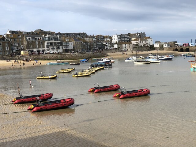
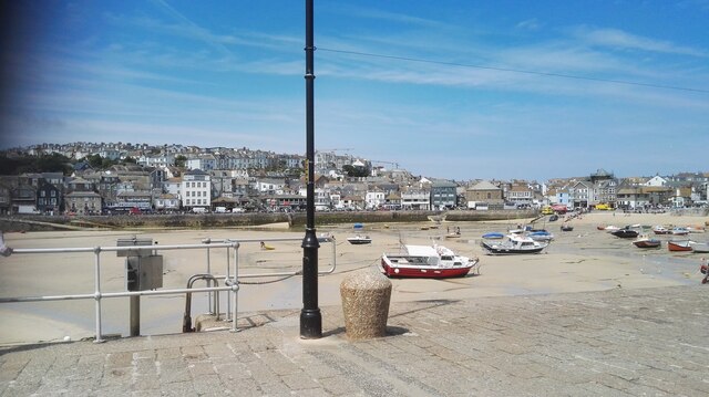
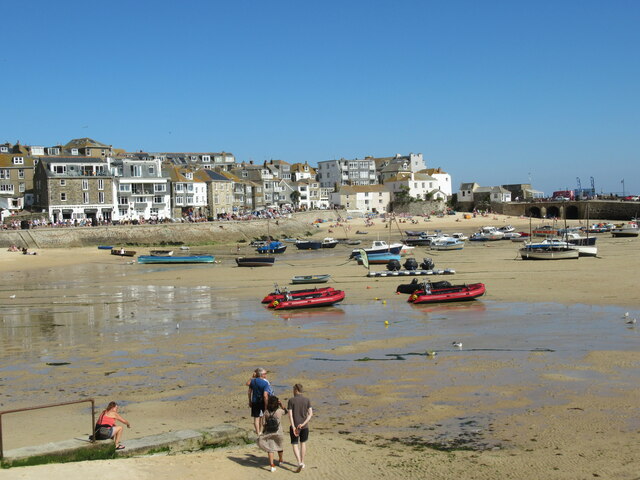
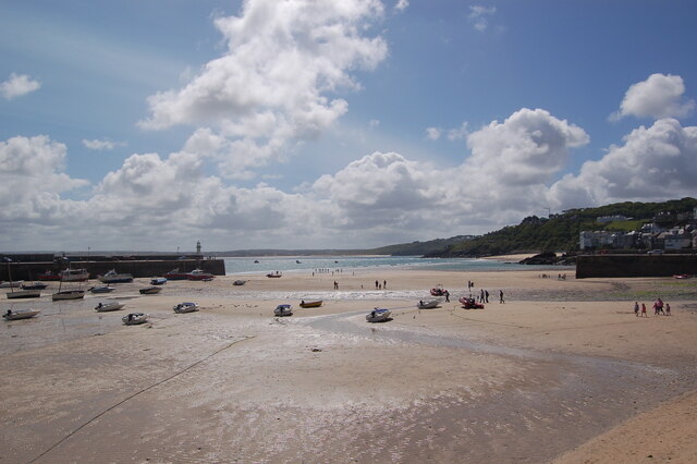
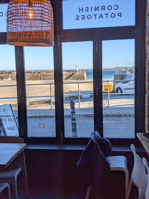
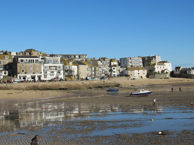
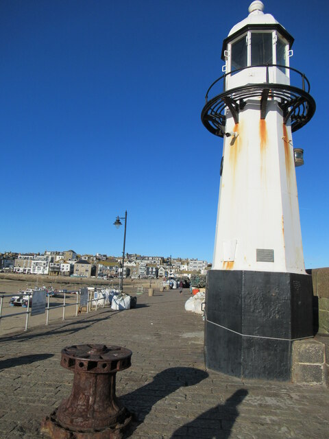
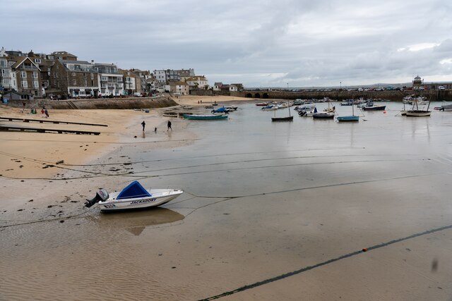
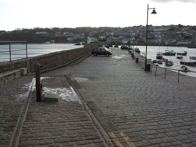
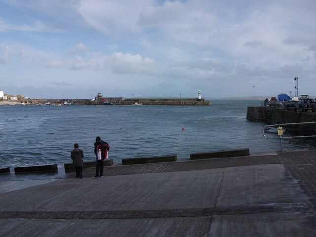
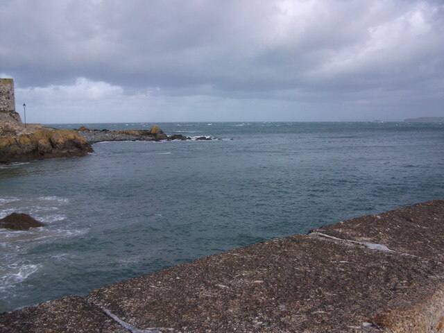
Barrepta Cove is a picturesque coastal area located in Cornwall, England. Situated along the rugged coastline, the cove offers stunning views of the sea and surrounding cliffs. The clear blue waters of the cove provide a perfect setting for swimming, snorkeling, and other water activities.

Barrepta Cove is also known for its diverse marine life, with visitors often spotting seals, dolphins, and a variety of seabirds in the area. The cove is a popular destination for birdwatchers and nature enthusiasts, who come to observe the rich wildlife that calls the cove home.

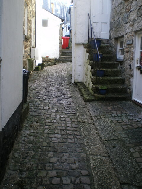
In addition to its natural beauty, Barrepta Cove is also home to a small estuary and creek, adding to the charm of the area. The estuary provides a habitat for a variety of plant and animal species, while the creek offers a tranquil spot for kayaking and paddleboarding.

Overall, Barrepta Cove is a hidden gem along the Cornwall coastline, offering visitors a peaceful retreat surrounded by the beauty of nature. Whether exploring the sea, estuary, or creek, visitors are sure to be captivated by the natural wonders of this stunning coastal area.

If you have any feedback on the listing, please let us know in the comments section below.

Barrepta Cove Images

Images are sourced within 2km of 50.199515/-5.4646891 or Grid Reference SW5239. Thanks to Geograph Open Source API. All images are credited.

St Ives Harbour
St Ives Harbour
St. Ives Harbour A view over St. Ives Harbour, taken looking south from Smeaton's Pier.
St. Ives Harbour
A view over St. Ives Harbour, taken looking south from Smeaton's Pier.
St Ives harbour
St Ives harbour
St Ives beach at low tide Many small boats stranded by the receding tide in St Ives Harbour.
St Ives beach at low tide
Many small boats stranded by the receding tide in St Ives Harbour.
St Ives harbour from the Harbour Fish & Chips Restaurant
Fish & Chip lunches, Harbour Fish & Chips Restaurant, St Ives
Low tide reflections, St Ives harbour
Christmas tree at St Ives harbour
Smeaton's Pier, St Ives
Harbour Sand beach at St Ives
Cobbled street surface on Carnglaze Place One of several parts of Carnglaze Place where the original 17th/18th century granite cobblestones are still in situ; the whole area was Grade II listed for this reason <span class="nowrap"><a title="https://britishlistedbuildings.co.uk/101327771-the-street-surface-st-ives#.Yc-P7GjP3IU" rel="nofollow ugc noopener" href="https://britishlistedbuildings.co.uk/101327771-the-street-surface-st-ives#.Yc-P7GjP3IU">Link</a><img style="margin-left:2px;" alt="External link" title="External link - shift click to open in new window" src="https://s1.geograph.org.uk/img/external.png" width="10" height="10"/></span> & <span class="nowrap"><a title="https://historicengland.org.uk/listing/the-list/list-entry/1327771" rel="nofollow ugc noopener" href="https://historicengland.org.uk/listing/the-list/list-entry/1327771">Link</a><img style="margin-left:2px;" alt="External link" title="External link - shift click to open in new window" src="https://s1.geograph.org.uk/img/external.png" width="10" height="10"/></span> in 1972.
Cobbled street surface on Carnglaze Place
One of several parts of Carnglaze Place where the original 17th/18th century granite cobblestones are still in situ; the whole area was Grade II listed for this reason LinkExternal link & LinkExternal link in 1972.
Smeatons Pier Smeatons Pier in St. Ives, photographed from beside the Harbour Master's Office.
Smeatons Pier
Smeatons Pier in St. Ives, photographed from beside the Harbour Master's Office.
Slipway by RNLI Station in St. Ives The slipway by the lifeboat station in St. Ives, looking over the harbour to Smeatons Pier.
Slipway by RNLI Station in St. Ives
The slipway by the lifeboat station in St. Ives, looking over the harbour to Smeatons Pier.
View from Smeatons Pier, St. Ives A view out to sea from Smeatons Pier in St. Ives.  Godrevy Island is visible in the far distance.
View from Smeatons Pier, St. Ives
A view out to sea from Smeatons Pier in St. Ives. Godrevy Island is visible in the far distance.
View over St. Ives Harbour A view of St. Ives Harbour, looking back from Smeatons Pier.
View over St. Ives Harbour
A view of St. Ives Harbour, looking back from Smeatons Pier.
The Rum & Crab bar, The Wharf Originally built in the early 19th century, and presumably used in connection with the fishing trade or as a wharfside store, this unusual-looking building was known as the Copper Kettle (cafe?) and Wimpy Bar by the time it was Grade II listed <span class="nowrap"><a title="https://britishlistedbuildings.co.uk/101327835-the-copper-kettle-and-wimpey-bar-st-ives#.Ydi9vP7P3IU" rel="nofollow ugc noopener" href="https://britishlistedbuildings.co.uk/101327835-the-copper-kettle-and-wimpey-bar-st-ives#.Ydi9vP7P3IU">Link</a><img style="margin-left:2px;" alt="External link" title="External link - shift click to open in new window" src="https://s1.geograph.org.uk/img/external.png" width="10" height="10"/></span> & <span class="nowrap"><a title="https://historicengland.org.uk/listing/the-list/list-entry/1327835" rel="nofollow ugc noopener" href="https://historicengland.org.uk/listing/the-list/list-entry/1327835">Link</a><img style="margin-left:2px;" alt="External link" title="External link - shift click to open in new window" src="https://s1.geograph.org.uk/img/external.png" width="10" height="10"/></span> in 1972.
The Rum & Crab bar, The Wharf
Originally built in the early 19th century, and presumably used in connection with the fishing trade or as a wharfside store, this unusual-looking building was known as the Copper Kettle (cafe?) and Wimpy Bar by the time it was Grade II listed LinkExternal link & LinkExternal link in 1972.
Cobbled street surface in Custom House Passage Unlike some of the other 18th century street surfaces around St Ives such as <a href="https://www.geograph.org.uk/photo/4928337">SW5140 : Fore Street, St Ives</a> <a href="https://www.geograph.org.uk/photo/3135725">SW5140 : Bailey's Lane, St. Ives</a> and <a href="https://www.geograph.org.uk/photo/7057826">SW5140 : Cobbled street surface on Mount Zion</a>, Custom House Passage seems to have avoided being listed. That must be an oversight, as these stones look even less disturbed and relaid than many on the more heavily trafficked roads.
Cobbled street surface in Custom House Passage
Unlike some of the other 18th century street surfaces around St Ives such as SW5140 : Fore Street, St Ives SW5140 : Bailey's Lane, St. Ives and SW5140 : Cobbled street surface on Mount Zion, Custom House Passage seems to have avoided being listed. That must be an oversight, as these stones look even less disturbed and relaid than many on the more heavily trafficked roads.
Cobbled street surface on Fore Street, looking north Part of the extensive granite cobbled street surface of Fore Street, which dates back probably to the 18th century, and was Grade II listed <span class="nowrap"><a title="https://britishlistedbuildings.co.uk/101143372-the-street-surface-st-ives#.YeRDX_7P3IU" rel="nofollow ugc noopener" href="https://britishlistedbuildings.co.uk/101143372-the-street-surface-st-ives#.YeRDX_7P3IU">Link</a><img style="margin-left:2px;" alt="External link" title="External link - shift click to open in new window" src="https://s1.geograph.org.uk/img/external.png" width="10" height="10"/></span> & <span class="nowrap"><a title="https://historicengland.org.uk/listing/the-list/list-entry/1143372" rel="nofollow ugc noopener" href="https://historicengland.org.uk/listing/the-list/list-entry/1143372">Link</a><img style="margin-left:2px;" alt="External link" title="External link - shift click to open in new window" src="https://s1.geograph.org.uk/img/external.png" width="10" height="10"/></span> in 1972.
Cobbled street surface on Fore Street, looking north
Part of the extensive granite cobbled street surface of Fore Street, which dates back probably to the 18th century, and was Grade II listed LinkExternal link & LinkExternal link in 1972.
Show me another place!

Barrepta Cove is located at Grid Ref: SW5239 (Lat: 50.199515, Lng: -5.4646891)

Unitary Authority: Cornwall

Police Authority: Devon and Cornwall

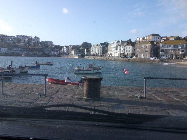
Also known as: Carbis Bay

What 3 Words

///local.corkscrew.replied. Near St Ives, Cornwall

Related Wikis

47th G7 summit

The 47th G7 summit was held from 11 to 13 June 2021 in Cornwall, England, during the United Kingdom's tenure of the presidency of the Group of Seven (G7...

Carbis Bay Hotel

Carbis Bay Hotel is a hotel in Carbis Bay near St Ives, Cornwall. It is the most prominent building in Carbis Bay, overlooking the beach. == History... ==

Carbis Bay railway station

Carbis Bay railway station (Cornish: Porthreptor) is on the St Ives Bay Line in Cornwall, England, United Kingdom and serves the village and beach of Carbis...

Carbis Bay

Carbis Bay (Cornish: Karrbons, meaning "causeway") is a seaside resort and village in Cornwall, England. It lies 1 mile (1.6 km) southeast of St Ives,...

Nearby Amenities

Located within 500m of 50.199515,-5.4646891
Carbis Bay
Is In: Cornwall, England, UK
Is In Country: England
Is In Country Code: GB
Is In County: Cornwall
Name Br: Porthreptor
Name Kw: Porthreptor
Place: village
Source: npe
Source Name Br: proper translation
Wikidata: Q5037874
Wikipedia: en:Carbis Bay
Lat/Long: 50.1967914/-5.4646327
Carbis Bay
Naptan AtcoCode: 9100CARBISB
Network: National Rail
Network Website: https://www.nationalrail.co.uk/stations/cbb/
Network Wikidata: Q26334
Operator: Great Western Railway
Operator Website: https://www.gwr.com/stations-and-destinations/stations/carbis-bay
Operator Wikidata: Q1419438
Public Transport: station
Railway: station
Ref Crs: CBB
Train: yes
Wheelchair: yes
Wikidata: Q2652764
Wikipedia: en:Carbis Bay railway station
Lat/Long: 50.1970953/-5.4637047
Bus Stop
Scotties Bar
Bus: yes
Naptan AtcoCode: 0800COD40460
Naptan Bearing: N
Naptan CommonName: Scotties Bar
Naptan NaptanCode: coragmta
Naptan Street: Porthrepta Road
Naptan Verified: no
Public Transport: platform
Source: naptan_import
Lat/Long: 50.195837/-5.4616303
Bus Stop
Scotties Bar
Bus: yes
Naptan AtcoCode: 0800COD40462
Naptan Bearing: S
Naptan CommonName: Scotties Bar
Naptan Crossing: Headland Road
Naptan Indicator: Opp
Naptan NaptanCode: coragmtg
Naptan Street: Porthrepta Road
Naptan Verified: no
Public Transport: platform
Source: naptan_import
Lat/Long: 50.1960272/-5.4615881
Bus Stop
Boskerris Hotel
Bus: yes
Naptan AtcoCode: 0800COD40466
Naptan Bearing: NE
Naptan CommonName: Boskerris Hotel
Naptan NaptanCode: coragmgp
Naptan Street: Boskerris Road
Naptan Verified: no
Public Transport: platform
Source: naptan_import
Lat/Long: 50.1961176/-5.4651356
Post Box
Collection Times: Mo-Fr 09:00; Sa 07:00
Operator: Royal Mail
Operator Wikidata: Q638098
Post Box Type: lamp
Ref: TR26 137D
Royal Cypher: EIIR
Royal Cypher Wikidata: Q33102113
Source: survey
Survey Date: 2015-10-01
Lat/Long: 50.1979281/-5.4659334
Post Box
Collection Times: Mo-Fr 17:15; Sa 11:30
Operator: Royal Mail
Operator Wikidata: Q638098
Post Box Type: lamp
Ref: TR26 144
Royal Cypher: EIIR
Royal Cypher Wikidata: Q33102113
Source: survey
Survey Date: 2015-10-01
Lat/Long: 50.1969043/-5.4627151
Telephone
Booth: KX100
Covered: booth
Operator: BT
Operator Wikidata: Q593786
Payment Coins: no
Payment Credit Cards: no
Payment Telephone Cards: no
Lat/Long: 50.1969056/-5.4627467
Barrier: kissing_gate
Foot: yes
Lat/Long: 50.1999196/-5.4714314
Fernhill
Building: apartments
Lat/Long: 50.1963614/-5.4695235
Post Box
Collection Times: Mo-Fr 09:00; Sa 07:00
Operator: Royal Mail
Operator Wikidata: Q638098
Post Box Type: wall
Ref: TR26 138D
Royal Cypher: VR
Royal Cypher Wikidata: Q33102356
Source: survey
Survey Date: 2015-10-01
Lat/Long: 50.1955767/-5.461574
Post Box
Collection Times: Mo-Fr 09:00; Sa 07:00
Operator: Royal Mail
Operator Wikidata: Q638098
Post Box Type: wall
Ref: TR26 208D
Royal Cypher: GVIR
Royal Cypher Wikidata: Q33102169
Source: survey
Survey Date: 2015-10-01
Lat/Long: 50.1973403/-5.469093
Bench
Source: GPS survey
Lat/Long: 50.1968519/-5.4613115
Bicycle Parking
Lat/Long: 50.1969013/-5.4627693
Hiking: yes
Information: guidepost
Source: GPS survey
Tourism: information
Lat/Long: 50.1969571/-5.4644738
Hiking: yes
Information: guidepost
Source: GPS survey
Tourism: information
Lat/Long: 50.2009035/-5.4707582
Hiking: yes
Information: guidepost
Source: GPS survey
Tourism: information
Lat/Long: 50.2011035/-5.4708065
Generator Method: photovoltaic
Generator Output Electricity: small_installation
Generator Source: solar
Generator Type: solar_photovoltaic_panel
Location: roof
Power: generator
Source: bing
Lat/Long: 50.1982483/-5.4702553
Generator Method: photovoltaic
Generator Output Electricity: small_installation
Generator Source: solar
Generator Type: solar_photovoltaic_panel
Location: roof
Power: generator
Source: bing
Lat/Long: 50.1988097/-5.4711297
Generator Method: photovoltaic
Generator Output Electricity: small_installation
Generator Source: solar
Generator Type: solar_photovoltaic_panel
Location: roof
Power: generator
Source: bing
Lat/Long: 50.199524/-5.4706979
Generator Method: photovoltaic
Generator Output Electricity: small_installation
Generator Source: solar
Generator Type: solar_photovoltaic_panel
Location: roof
Power: generator
Source: bing
Lat/Long: 50.1985522/-5.4688418
Generator Method: photovoltaic
Generator Output Electricity: small_installation
Generator Source: solar
Generator Type: solar_photovoltaic_panel
Location: roof
Power: generator
Source: bing
Lat/Long: 50.1965347/-5.4696223
Generator Method: photovoltaic
Generator Output Electricity: small_installation
Generator Source: solar
Generator Type: solar_photovoltaic_panel
Location: roof
Power: generator
Source: bing
Lat/Long: 50.1953671/-5.4624313
Direction: 190
Information: board
Tourism: information
Lat/Long: 50.1969772/-5.463775
Carbis Hotel
Power: substation
Voltage: 11000
Lat/Long: 50.19795/-5.4659034
Tir Gwel Carbis Bay
Power: substation
Voltage: 11000
Lat/Long: 50.1963488/-5.4660255
Carbis Valley
Power: substation
Voltage: 11000
Lat/Long: 50.1962274/-5.468064
Bench
Backrest: yes
Material: wood
Lat/Long: 50.1972424/-5.4629657
Toilets
Lat/Long: 50.1982405/-5.4653783
The data included in this document is from www.openstreetmap.org. The data is made available under ODbL.

Have you been to Barrepta Cove?

Leave your review of Barrepta Cove below (or comments, questions and feedback).