Cliff Reach
Sea, Estuary, Creek in Suffolk Ipswich
England
Cliff Reach

Cliff Reach is a picturesque coastal area located in Suffolk, England. Nestled between the North Sea, an estuary, and a creek, this stunning location offers breathtaking views and a tranquil atmosphere to visitors and residents alike.
The area is renowned for its rugged cliffs that stretch along the coast, framing the beautiful sandy beaches below. These cliffs not only add to the natural beauty of the landscape but also provide shelter to a variety of seabirds, making it a popular spot for birdwatchers. The crashing waves of the North Sea create a soothing soundtrack, perfect for those seeking a peaceful retreat.
The estuary, which flows into the sea, is a haven for marine life. It is home to a diverse range of species, including fish, shellfish, and various waterfowl. The intertidal mudflats and salt marshes that border the estuary provide an important habitat for these creatures and offer a unique opportunity for visitors to observe them in their natural environment.
At the heart of Cliff Reach is the creek, a small waterway that winds its way through the countryside. The creek is lined with reeds and grasses and is a popular spot for boating and fishing enthusiasts. It offers a peaceful and idyllic setting, where visitors can relax and enjoy the tranquility of nature.
Overall, Cliff Reach in Suffolk is a stunning coastal area that seamlessly combines the beauty of the sea, estuary, and creek. Its rugged cliffs, sandy beaches, diverse wildlife, and serene atmosphere make it a must-visit destination for nature lovers and those seeking a peaceful escape from the hustle and bustle of everyday life.
If you have any feedback on the listing, please let us know in the comments section below.
Cliff Reach Images
Images are sourced within 2km of 52.041203/1.1591241 or Grid Reference TM1642. Thanks to Geograph Open Source API. All images are credited.


Cliff Reach is located at Grid Ref: TM1642 (Lat: 52.041203, Lng: 1.1591241)
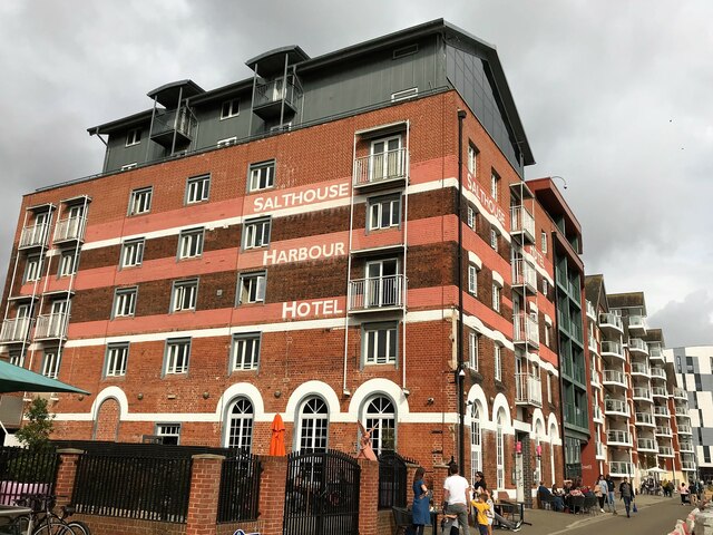
Administrative County: Suffolk
District: Ipswich
Police Authority: Suffolk
What 3 Words
///scare.adverbs.lends. Near Ipswich, Suffolk
Nearby Locations
Related Wikis

Cliff Brewery
The Cliff Brewery is a Grade II listed former brewery in Ipswich, England. The building dates to 1896 and was designed by William Bradford. == Location... ==
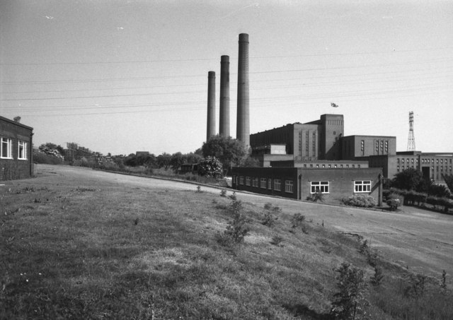
Cliff Quay Power Station
Cliff Quay Power Station was a coal-fired power station situated to the south of Ipswich, Suffolk in the East of England. The station was designed by Sir...

Ipswich engine shed
Ipswich engine shed was an engine shed located in Ipswich, Suffolk on the Great Eastern Main Line. It was located just south of Stoke tunnel and the current...

Ipswich Stoke Hill railway station
Ipswich Stoke Hill railway station was the northern terminus of the Eastern Union Railway line from Colchester to Ipswich from its opening in June 1846...

Stoke High School – Ormiston Academy
Stoke High School is a coeducational secondary school with academy status, located in Maidenhall, Ipswich, Suffolk, England.The school converted to academy...

Stoke Tunnel Cutting, Ipswich
Stoke Tunnel Cutting, Ipswich is a 2.2-hectare (5.4-acre) geological Site of Special Scientific Interest in Ipswich in Suffolk. It is a Geological Conservation...
Stoke, Suffolk
Stoke is the south west part of Ipswich, Suffolk, bounded by the River Orwell and Belstead Brook. To the west lie the Chantry estates. Stoke is associated...
Greenwich, Ipswich
Greenwich is a suburban area of Ipswich, in the Ipswich district, in the county of Suffolk, England. For many years it was a hamlet included in the parish...
Nearby Amenities
Located within 500m of 52.041203,1.1591241Have you been to Cliff Reach?
Leave your review of Cliff Reach below (or comments, questions and feedback).