Hook Reach

Sea, Estuary, Creek in Suffolk Babergh

England

Hook Reach

View across the Stour estuary from The Walls at dusk Looking north-northwest.
View across the Stour estuary from The Walls at dusk Credit: Robert Lamb

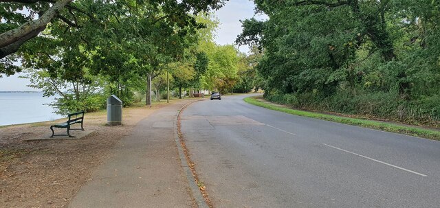
Hook Reach is a picturesque area located in Suffolk, England, known for its stunning natural landscapes and rich biodiversity. Situated along the coast, it encompasses a combination of sea, estuary, and creek environments, making it a haven for nature lovers and wildlife enthusiasts.

The sea surrounding Hook Reach provides breathtaking views and is a popular spot for activities such as swimming, sailing, and fishing. The coastal area boasts sandy beaches and rugged cliffs, offering visitors a chance to explore and admire the beauty of the English coastline.

The estuary in Hook Reach is formed by the convergence of several rivers, creating a unique ecosystem that supports a diverse range of flora and fauna. The estuary serves as an important breeding ground for various species of fish and birds, making it a magnet for birdwatchers and anglers alike. Commonly spotted bird species include avocets, oystercatchers, and redshanks.

The creek in Hook Reach is a tranquil waterway that winds through the countryside, providing a peaceful setting for boating and kayaking. Surrounded by lush greenery and reed beds, the creek offers a serene escape from the hustle and bustle of city life.

Visitors to Hook Reach can also enjoy the numerous walking trails and nature reserves in the area. These provide opportunities to explore the diverse ecosystems and spot rare plants and animals. The abundance of wildlife and natural beauty make Hook Reach a prime destination for those seeking a relaxing and immersive experience in the heart of Suffolk's countryside.

If you have any feedback on the listing, please let us know in the comments section below.
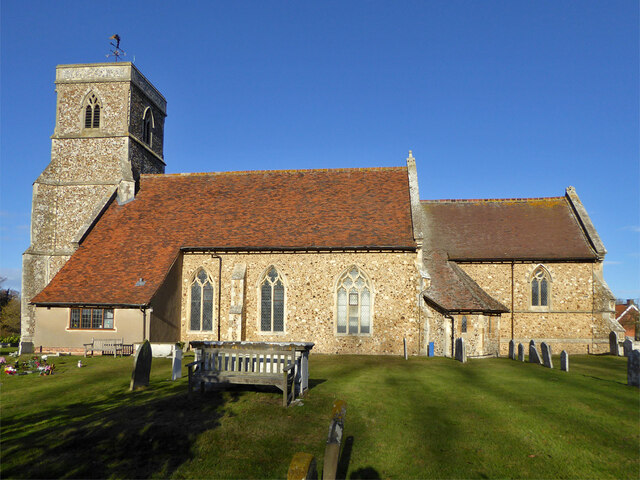
Hook Reach Images

Images are sourced within 2km of 51.951438/1.0758079 or Grid Reference TM1132. Thanks to Geograph Open Source API. All images are credited.

View across the Stour estuary from The Walls at dusk Looking north-northwest.
View across the Stour estuary from The Walls at dusk
Looking north-northwest.
View across the River Stour estuary from The Walls Looking north-northwest.
View across the River Stour estuary from The Walls
Looking north-northwest.
View of St. Mary & St. Michael's Church in Mistley from The Walls Looking south-southeast.
View of St. Mary & St. Michael's Church in Mistley from The Walls
Looking south-southeast.
View of Mistley Towers from the village square Looking north-northeast.
View of Mistley Towers from the village square
Looking north-northeast.
View of the EDME Malt Extract chimney towering above a house in Mistley from the village square Looking south-southeast.
View of the EDME Malt Extract chimney towering above a house in Mistley from the village square
Looking south-southeast.
View of the fingerpost sign on a bench in the village square Looks like a vehicle has crashed into the traditional fingerpost sign (as well as a nearby lamp post) on Mistley's village square and, rather ingeniously, the sign has been maintained by someone placing it on the nearby bench. Looking south-southwest.
View of the fingerpost sign on a bench in the village square
Looks like a vehicle has crashed into the traditional fingerpost sign (as well as a nearby lamp post) on Mistley's village square and, rather ingeniously, the sign has been maintained by someone placing it on the nearby bench. Looking south-southwest.
Brantham church The Church of St Michael and All Angels is a grade II*(star) listed building. Medieval with extensive 19th century rebuilding and restorations.
Brantham church
The Church of St Michael and All Angels is a grade II*(star) listed building. Medieval with extensive 19th century rebuilding and restorations.
Gargoyle, Brantham church tower Draining the tower roof at the SW corner.
Gargoyle, Brantham church tower
Draining the tower roof at the SW corner.
Gargoyle, Brantham church tower Draining the tower roof at the NW corner.
Gargoyle, Brantham church tower
Draining the tower roof at the NW corner.
St. Michael's Pre-school, Brantham Mapped as an 'Institute'.
St. Michael's Pre-school, Brantham
Mapped as an 'Institute'.
Mistley, St Mary & St Michael
Old Milestone, B1352, High Street, Mistley The milestone was originally located on the High Street, Mistley at TM 1181 3178. It was later moved against the wall of a building on Mistley Quay, see <a title="https://www.geograph.org.uk/photo/6045295" href="https://www.geograph.org.uk/photo/6045295">Link</a> , then temporarily put in to store during property development, and has now been re-installed in the Swan Basin, High Street. Parish of Mistley (Tendring District), Carved stone post, originally erected in the 19th century. A replacement for the cast iron post that would later have been fitted to the milestone is located close by, see <a title="https://www.geograph.org.uk/photo/7148738" href="https://www.geograph.org.uk/photo/7148738">Link</a>

Inscription reads:-
LXI / Colchester / 10 / Mistley  : : (Harwich / 11)

Milestone Society National ID: EX_COHH61
Old Milestone, B1352, High Street, Mistley
The milestone was originally located on the High Street, Mistley at TM 1181 3178. It was later moved against the wall of a building on Mistley Quay, see Link , then temporarily put in to store during property development, and has now been re-installed in the Swan Basin, High Street. Parish of Mistley (Tendring District), Carved stone post, originally erected in the 19th century. A replacement for the cast iron post that would later have been fitted to the milestone is located close by, see Link Inscription reads:- LXI / Colchester / 10 / Mistley : : (Harwich / 11) Milestone Society National ID: EX_COHH61
Replacement Milestone, B1352, High St, Mistley, Swan Basin This milestone is located in the Swan Basin, against the far wall to the right of the original stone milestone EX_COHH61, <a title="https://www.geograph.org.uk/photo/7148662" href="https://www.geograph.org.uk/photo/7148662">Link</a>. Parish of Mistley (Tendring District). It is a replacement for the original cast iron post, Bendall iron casting design, erected by the Essex Second District turnpike trust in the 19th century. Cast iron posts on this Colchester to Harwich route were made to be bolted on to the original stone milestones.

Inscription reads:-
HARWICH / 11  : : COLCHESTER / 10  : :  MISTLEY / TO / LONDON / 61  :  : BENDALL / IRON AND BRASS / FOUNDERS / PLOUGH AND MACHINE / MAKER / LAWFORD / ESSEX /1834

Milestone Society National ID: EX_COHH61AR
Replacement Milestone, B1352, High St, Mistley, Swan Basin
This milestone is located in the Swan Basin, against the far wall to the right of the original stone milestone EX_COHH61, Link. Parish of Mistley (Tendring District). It is a replacement for the original cast iron post, Bendall iron casting design, erected by the Essex Second District turnpike trust in the 19th century. Cast iron posts on this Colchester to Harwich route were made to be bolted on to the original stone milestones. Inscription reads:- HARWICH / 11 : : COLCHESTER / 10 : : MISTLEY / TO / LONDON / 61 : : BENDALL / IRON AND BRASS / FOUNDERS / PLOUGH AND MACHINE / MAKER / LAWFORD / ESSEX /1834 Milestone Society National ID: EX_COHH61AR
The Walls, Manningtree
Mistley war memorial and Mistley Tower
High Street, Manningtree
Farmland by the Stour Estuary
Show me another place!

Hook Reach is located at Grid Ref: TM1132 (Lat: 51.951438, Lng: 1.0758079)

Administrative County: Suffolk

District: Babergh

Police Authority: Suffolk

What 3 Words

///silly.impulsive.blissful. Near Manningtree, Essex

Related Wikis

Mistley Towers

Mistley Towers are the twin towers of the now demolished Church of St. Mary the Virgin at Mistley in Essex (sometimes known as Mistley Thorn(e) Church...

Mistley

Mistley is a village and civil parish in the Tendring district of northeast Essex, England. It is around 11 miles northeast of Colchester and is east of...

Mistley railway station

Mistley railway station is on the Mayflower Line, a branch of the Great Eastern Main Line in the East of England, serving the village of Mistley, Essex...

Corn Exchange, Manningtree

The Corn Exchange is a commercial building in the High Street in Manningtree, Essex, England. The structure, which is now used as a public library, is...

Have you been to Hook Reach?

Leave your review of Hook Reach below (or comments, questions and feedback).