Devil's Reach

Sea, Estuary, Creek in Essex Rochford

England

Devil's Reach

Land drain heading due south One of the former land drains from the time when this was all sterile arable - now Wallasea RSPB Reserve, seen from the seasonally opened Pools Path.
Land drain heading due south Credit: Trevor Harris

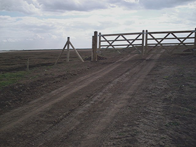
Devil's Reach is a prominent geographical feature located in Essex, England. It is an estuary that extends from the North Sea, forming a creek that runs inland towards the town of Southminster. This natural formation has gained notoriety due to its treacherous waters and challenging navigation conditions.

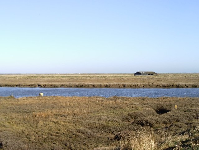
The Sea End of Devil's Reach is where the estuary meets the North Sea. The strong tides and often turbulent waters make this area hazardous for seafarers, earning it the reputation of being a formidable passage to navigate. The constant interaction between the estuary and the sea creates a dynamic environment, with changing water levels and shifting sandbanks.

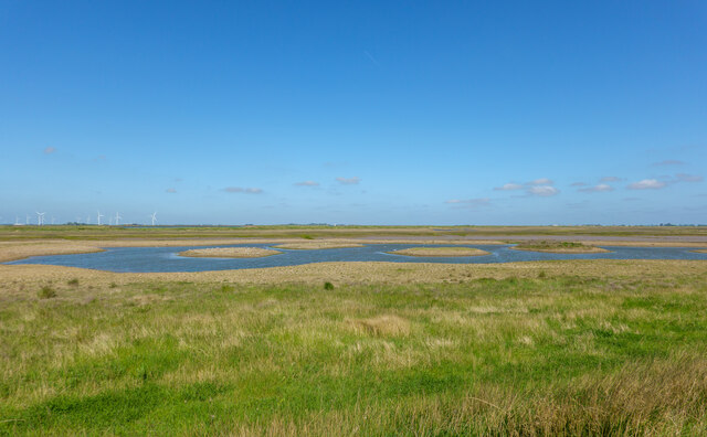
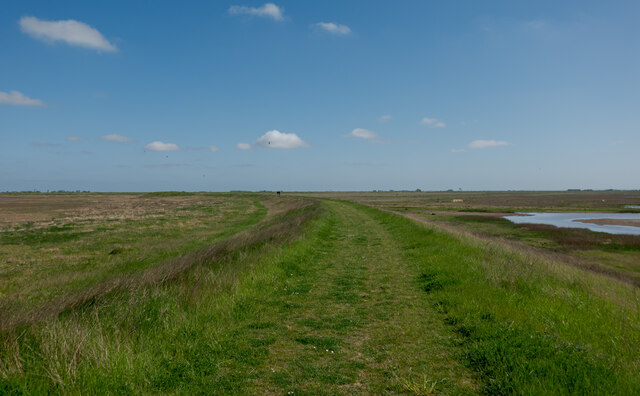
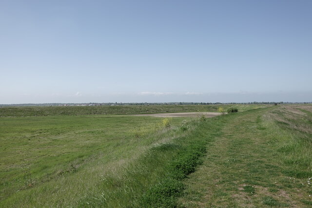
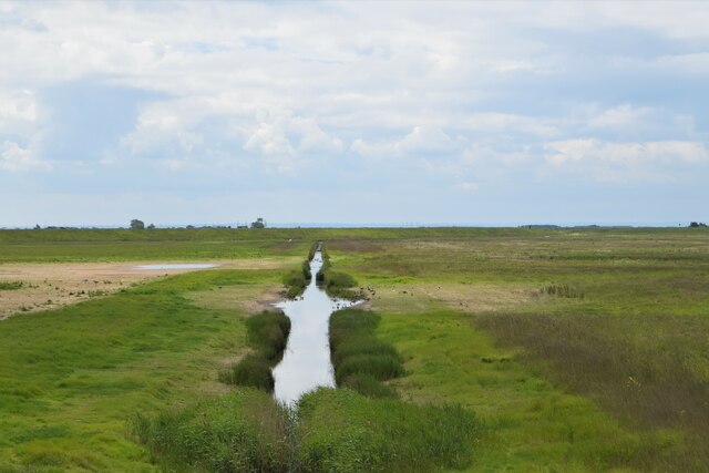
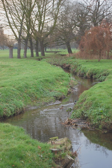
As the estuary moves inland, it gradually transforms into a winding creek. The Creek End of Devil's Reach is characterized by its narrow channels and marshy banks. These marshes serve as important habitats for a variety of bird species, including wading birds and waterfowl. The surrounding area also features rich salt marshes, which support a diverse ecosystem of plants and animals.

Historically, Devil's Reach played a crucial role in the maritime trade of the region. The estuary provided a natural harbor for ships, allowing them to transport goods to and from local towns. However, the challenging conditions of Devil's Reach required skilled pilots to navigate the waters safely.

Today, Devil's Reach remains a significant landmark in Essex, attracting visitors who are drawn to its natural beauty and historical significance. It is a place where the forces of nature are evident, showcasing the delicate balance between the sea, estuary, and creek.

If you have any feedback on the listing, please let us know in the comments section below.

Devil's Reach Images

Images are sourced within 2km of 51.59565/0.84231943 or Grid Reference TQ9692. Thanks to Geograph Open Source API. All images are credited.

Land drain heading due south One of the former land drains from the time when this was all sterile arable - now Wallasea RSPB Reserve, seen from the seasonally opened Pools Path.
Land drain heading due south
One of the former land drains from the time when this was all sterile arable - now Wallasea RSPB Reserve, seen from the seasonally opened Pools Path.
Pool, RSPB Wallasea Island Reserve The line of the former land drain can be seen. The RSPB is transforming Wallasea from an area of sterile arable to an invaluable diverse mixed wetland. Taken from the relatively new and seasonally open Pool Path.
Pool, RSPB Wallasea Island Reserve
The line of the former land drain can be seen. The RSPB is transforming Wallasea from an area of sterile arable to an invaluable diverse mixed wetland. Taken from the relatively new and seasonally open Pool Path.
Pool with small islands - RSPB Wallasea Island The following adapted from the RSPB website <span class="nowrap"><a title="https://www.rspb.org.uk/reserves-and-events/reserves-a-z/wallasea-island/" rel="nofollow ugc noopener" href="https://www.rspb.org.uk/reserves-and-events/reserves-a-z/wallasea-island/">Link</a><img style="margin-left:2px;" alt="External link" title="External link - shift click to open in new window" src="https://s1.geograph.org.uk/img/external.png" width="10" height="10"/></span>

"The reserve covers more than 740ha, with all of the arable farmland now transformed to saltmarsh, mudflats, lagoons and grazing marsh.

There are six walking trails – Jubilee Marsh, Allfleets Marsh, Marsh Flats, South Trail, New Pool Trail and Beagle Trail, making over 15km of trail on the reserve. At the ends of Allfleets Marsh trail and Jubilee Marsh trail are two shelters providing a comfortable place to sit overlooking the river.

To create this magical landscape of marshland, lagoons, ditches and sea, more than three million tonnes of earth was brought by boat from the tunnels and shafts created by the Crossrail scheme in London. This allowed us to raise the land above sea level and place the soil in a way that created a new 115-hectare intertidal area of saltmarsh, islands and mudflats (known as Jubilee Marsh).

In addition, Crossrail helped us create saline lagoons, a creek network and grazing marsh. All of which means Wallasea Island is now a wildlife-rich habitat and a great place to visit.

Wallasea Island sits within a Special Protection Area which covers the Crouch and Roach estuaries, and which is special for overwintering waders and wildfowl including Brent Geese. Our work here increases the habitat for these birds both whilst roosting and feeding, as well as creating new grassland areas (wet and dry). The intertidal areas have been designed with climate change in mind, with long shallow slopes from the new seawall providing space for the saltmarsh to creep up as sea levels rise."
Pool with small islands - RSPB Wallasea Island
The following adapted from the RSPB website LinkExternal link "The reserve covers more than 740ha, with all of the arable farmland now transformed to saltmarsh, mudflats, lagoons and grazing marsh. There are six walking trails – Jubilee Marsh, Allfleets Marsh, Marsh Flats, South Trail, New Pool Trail and Beagle Trail, making over 15km of trail on the reserve. At the ends of Allfleets Marsh trail and Jubilee Marsh trail are two shelters providing a comfortable place to sit overlooking the river. To create this magical landscape of marshland, lagoons, ditches and sea, more than three million tonnes of earth was brought by boat from the tunnels and shafts created by the Crossrail scheme in London. This allowed us to raise the land above sea level and place the soil in a way that created a new 115-hectare intertidal area of saltmarsh, islands and mudflats (known as Jubilee Marsh). In addition, Crossrail helped us create saline lagoons, a creek network and grazing marsh. All of which means Wallasea Island is now a wildlife-rich habitat and a great place to visit. Wallasea Island sits within a Special Protection Area which covers the Crouch and Roach estuaries, and which is special for overwintering waders and wildfowl including Brent Geese. Our work here increases the habitat for these birds both whilst roosting and feeding, as well as creating new grassland areas (wet and dry). The intertidal areas have been designed with climate change in mind, with long shallow slopes from the new seawall providing space for the saltmarsh to creep up as sea levels rise."
Jubilee Marsh Trail - RSPB Wallasea Island Looking south, see also:
<a href="https://www.geograph.org.uk/photo/7168017">TQ9693 : Jubilee Marsh Trail - RSPB Wallasea Island</a>
Jubilee Marsh Trail - RSPB Wallasea Island
Jubilee Marsh Trail - RSPB Wallasea Island Looking north, see also:
<a href="https://www.geograph.org.uk/photo/7168015">TQ9793 : Jubilee Marsh Trail - RSPB Wallasea Island</a>
Jubilee Marsh Trail - RSPB Wallasea Island
Land drain on Tillets Marsh A section of one of the dead-straight, north-south land drains which divided up the island prior to the RSPB's "Wild Coast Project. This is one of only a few remaining and the most easterly. Assorted ducks and geese are taking advantage of this less visited part of the island
Land drain on Tillets Marsh
A section of one of the dead-straight, north-south land drains which divided up the island prior to the RSPB's "Wild Coast Project. This is one of only a few remaining and the most easterly. Assorted ducks and geese are taking advantage of this less visited part of the island
Confluence of River Roach & Paglesham Pool (1) Paglesham Pool is the creek that can be seen top left. Taken from the mainland with Wallasea Island (left) and Potton Island (right).
Confluence of River Roach & Paglesham Pool (1)
Paglesham Pool is the creek that can be seen top left. Taken from the mainland with Wallasea Island (left) and Potton Island (right).
Confluence of River Roach & Paglesham Pool (2) Paglesham Pool is the creek nearest the camera while the Roach follows the horizon. Taken from the mainland with Wallsea Island (left) and Potton Island on the right of the horizon.
Confluence of River Roach & Paglesham Pool (2)
Paglesham Pool is the creek nearest the camera while the Roach follows the horizon. Taken from the mainland with Wallsea Island (left) and Potton Island on the right of the horizon.
Paglesham Pool Taken looking upstream from near Paglesham Point which is where Paglesham Pool joins Paglesham Reach of the River Roach. The land opposite is Wallasea Island.
Paglesham Pool
Taken looking upstream from near Paglesham Point which is where Paglesham Pool joins Paglesham Reach of the River Roach. The land opposite is Wallasea Island.
Borrowdyke at Paglesham Point
A view of River Roach; from top of pillbox
Paglesham Creek; looking north from the pillbox
Gates at end of new sea wall A new sea wall running roughly straight between this point and Grasslands Point is under construction and the area south of the old sea wall is being dug out to provide new salt marsh.
Gates at end of new sea wall
A new sea wall running roughly straight between this point and Grasslands Point is under construction and the area south of the old sea wall is being dug out to provide new salt marsh.
Saltings Saltings - east bank of Paglesham Creek
Saltings
Saltings - east bank of Paglesham Creek
Farm track from seawall The crop in the field to the north is peas - lots of peas.
Farm track from seawall
The crop in the field to the north is peas - lots of peas.
Boat on saltings River Roach just east of the head of Paglesham Creek.
Boat on saltings
River Roach just east of the head of Paglesham Creek.
Land drain The land drains on Wallasea are cut arrow straight at regular intervals and run north/south with almost military precision. Consequently pretty much the only map features on Wallasea are thin blue lines. Identifying the grid lines takes a little more care here.
Land drain
The land drains on Wallasea are cut arrow straight at regular intervals and run north/south with almost military precision. Consequently pretty much the only map features on Wallasea are thin blue lines. Identifying the grid lines takes a little more care here.
Old Pool outfall Sluice at Old Pool
Old Pool outfall
Sluice at Old Pool
Show me another place!

Devil's Reach is located at Grid Ref: TQ9692 (Lat: 51.59565, Lng: 0.84231943)

Administrative County: Essex

District: Rochford

Police Authority: Essex

What 3 Words

///skies.teaspoons.postage. Near Burnham-on-Crouch, Essex

Nearby Locations

Devil's Reach Potton Point

Related Wikis

Wallasea Island

Wallasea Island lies in Essex, England. It is bounded to the north by the River Crouch, to the south east by the River Roach, and to the west by Paglesham...

HMS Beagle

HMS Beagle was a Cherokee-class 10-gun brig-sloop of the Royal Navy, one of more than 100 ships of this class. The vessel, constructed at a cost of £7...

Potton Island

Potton Island is a sparsely populated island west of Foulness in Essex, England. It is connected to the mainland by a swing bridge with a traffic light...

Wallasea Wetlands

Wallasea Wetlands is a reclaimed wetlands area located in Essex, England. It has been created as part of a government-funded wetlands scheme to halt the...

New England Island

New England Island is an uninhabited island in Essex, England. One road crosses the island, connecting it with bridges to Foulness and to the mainland...

River Roach

The River Roach is a river that flows entirely through the English county of Essex. It is one of four main streams that originate in the Rayleigh Hills...

Havengore Island

Havengore Island is a low-lying, marshy island in the civil parish of Foulness, in the Rochford district, in the county of Essex, England. It is bounded...

Rushley Island

Rushley Island is a small uninhabited island in Essex, England. It is the smallest of six islands comprising an archipelago in Essex, and is privately...

Nearby Amenities

Located within 500m of 51.59565,0.84231943
Source: PGS
Lat/Long: 51.5962978/0.8494744
Source: PGS
Lat/Long: 51.5967843/0.8459768
Source: PGS
Lat/Long: 51.5969709/0.8452473
Created By: dmgroom_coastlines
Source: PGS
Lat/Long: 51.597104/0.844505
Created By: dmgroom_coastlines
Source: PGS
Lat/Long: 51.5972196/0.843682
Created By: dmgroom_coastlines
Source: PGS
Lat/Long: 51.5974233/0.8426377
Created By: dmgroom_coastlines
Source: PGS
Lat/Long: 51.59766/0.8407199
Created By: dmgroom_coastlines
Source: PGS
Lat/Long: 51.5978203/0.8382676
Created By: dmgroom_coastlines
Source: PGS
Lat/Long: 51.597832/0.837466
Created By: dmgroom_coastlines
Source: PGS
Lat/Long: 51.5980192/0.8362048
Source: PGS
Lat/Long: 51.5952074/0.8352121
Source: PGS
Lat/Long: 51.5948742/0.8363065
The data included in this document is from www.openstreetmap.org. The data is made available under ODbL.

Have you been to Devil's Reach?

Leave your review of Devil's Reach below (or comments, questions and feedback).