Dartford Creek

Sea, Estuary, Creek in Kent Dartford

England

Dartford Creek

Apartment block beside Fastrack dedicated bus route For details see <span class="nowrap"><a title="https://www.go-fastrack.co.uk/" rel="nofollow ugc noopener" href="https://www.go-fastrack.co.uk/">Link</a><img style="margin-left:2px;" alt="External link" title="External link - shift click to open in new window" src="https://s1.geograph.org.uk/img/external.png" width="10" height="10"/></span>
Apartment block beside Fastrack dedicated bus route Credit: David Martin

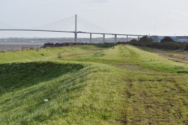
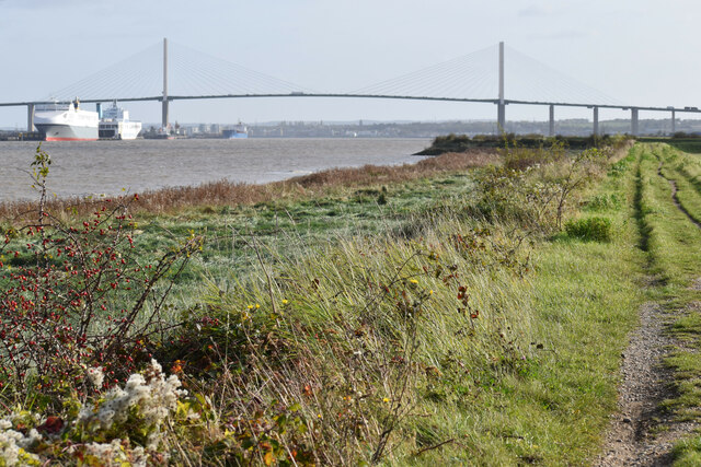
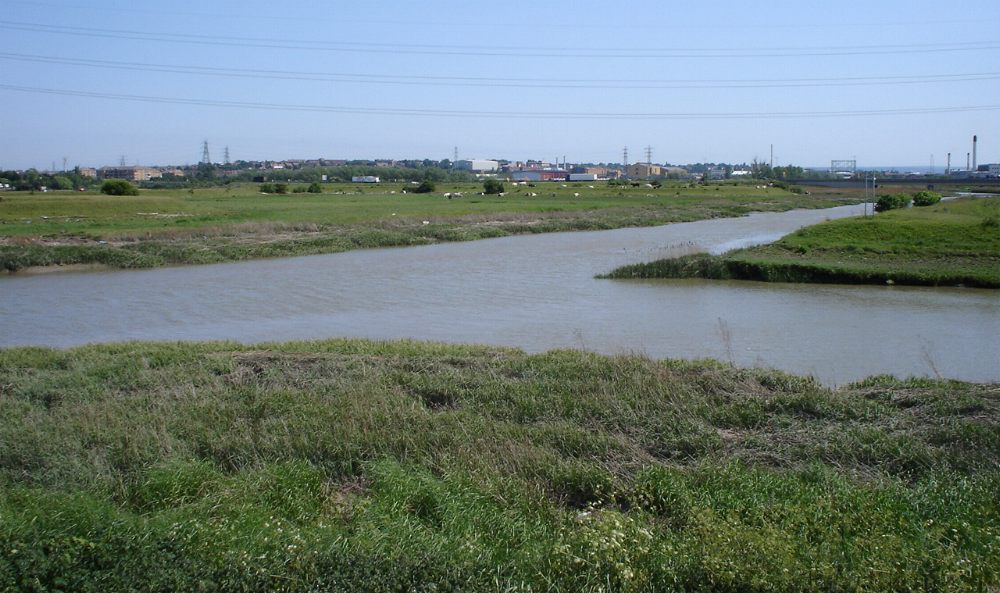
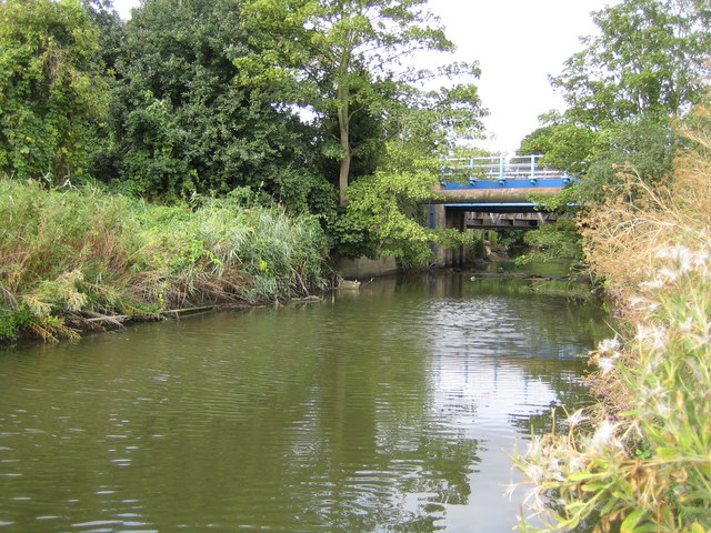
Dartford Creek is a tidal estuary located in the county of Kent, England. It lies within the larger Thames Estuary, approximately 16 miles east of central London. The creek stretches for about 1.5 miles from its confluence with the River Darent near Dartford town to its mouth at the Thames.

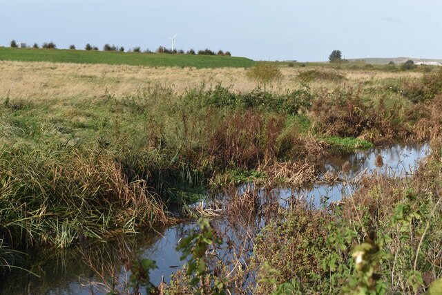
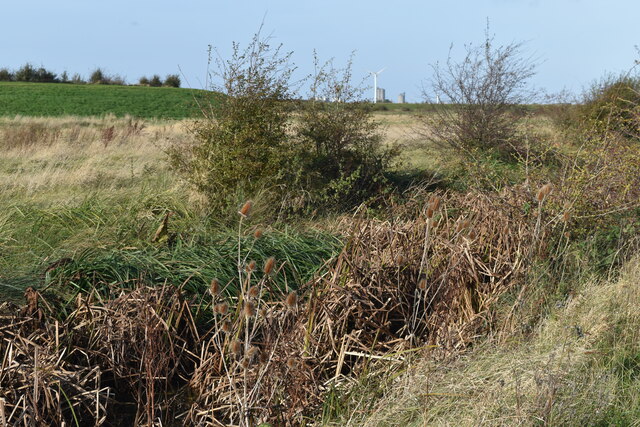
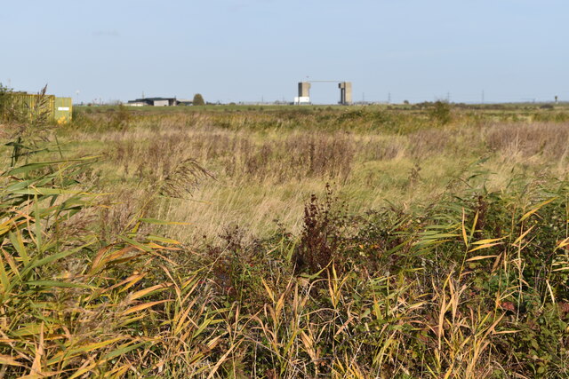
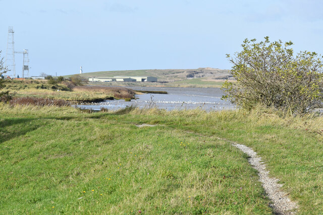
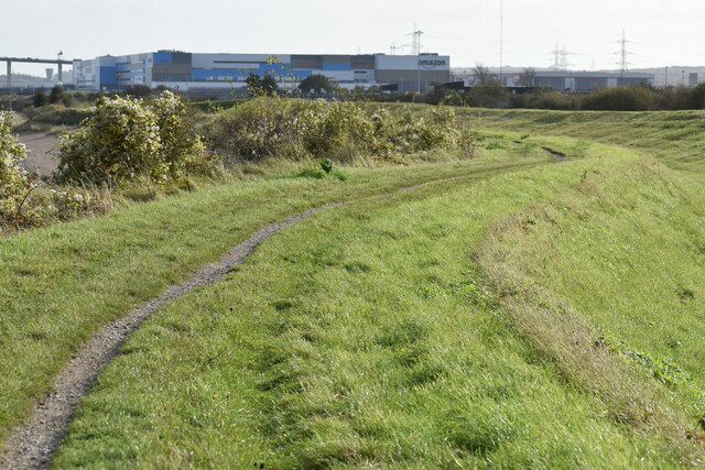
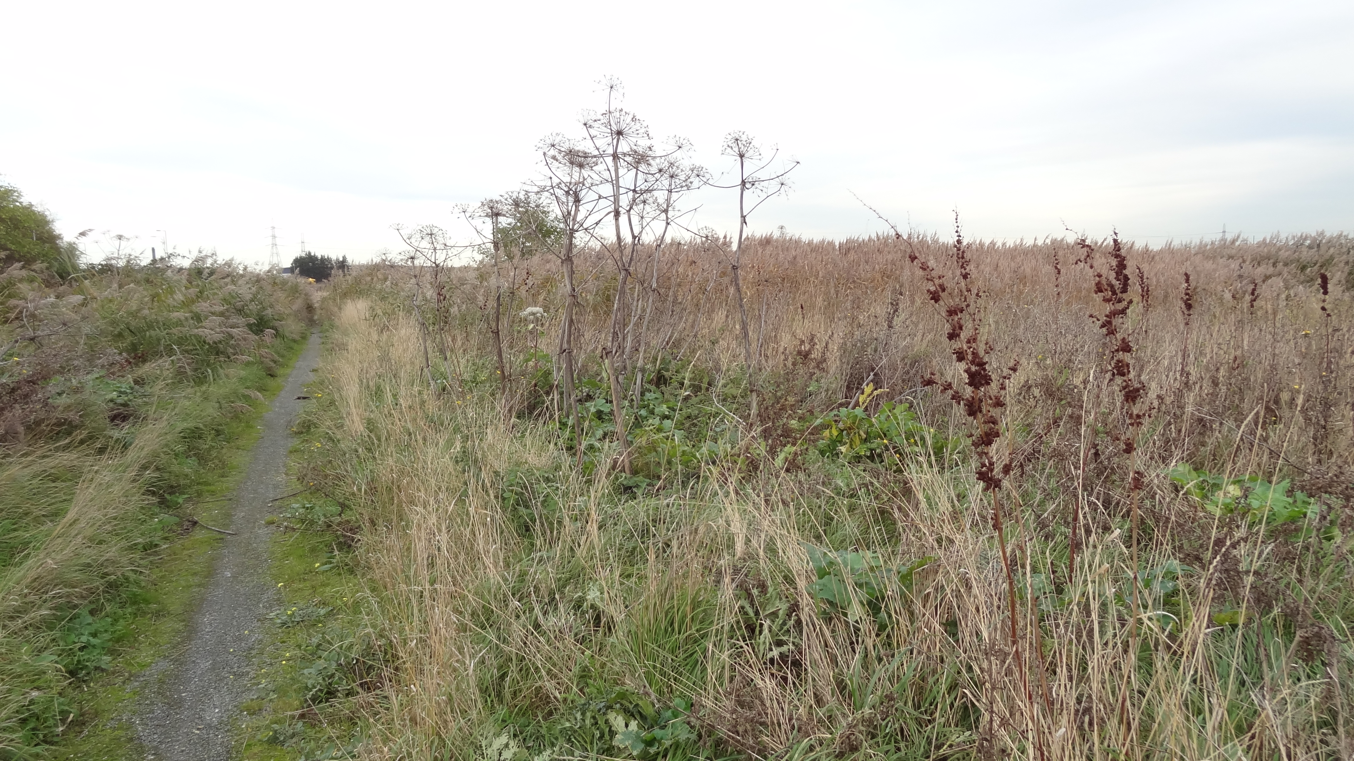
The creek is characterized by its diverse habitat, which includes mudflats, salt marshes, reed beds, and shallow water channels. It serves as an important feeding and breeding ground for a variety of bird species, including waders, wildfowl, and waterbirds. The area is designated as a Site of Special Scientific Interest (SSSI) due to its ecological significance.

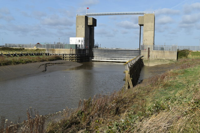
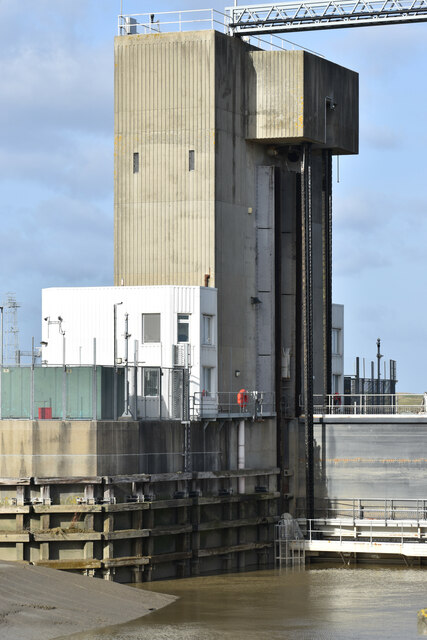
Dartford Creek is subject to significant tidal fluctuations, with water levels varying throughout the day. During high tide, the creek is filled with seawater, providing a suitable environment for marine life. As the tide recedes, it exposes the mudflats, attracting a range of invertebrates such as crabs, worms, and bivalves.

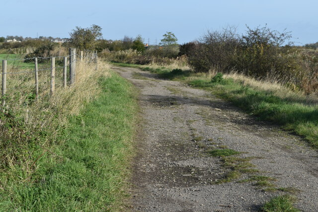
The creek is accessible to visitors via footpaths and a nature reserve, providing an opportunity to observe the unique flora and fauna of the area. It is also a popular spot for birdwatching and nature photography.

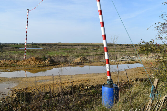
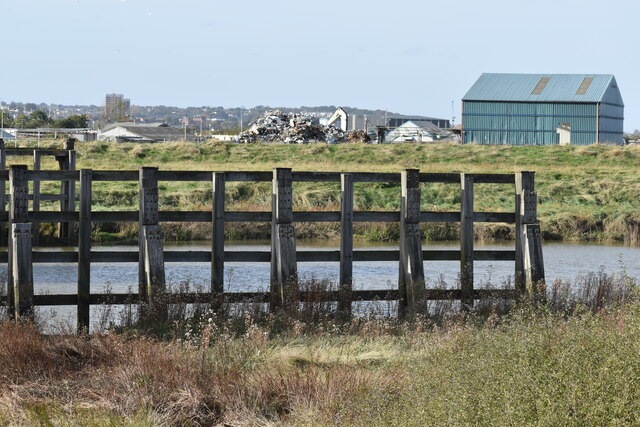
Due to its proximity to urban areas, Dartford Creek faces certain environmental challenges, including pollution and habitat degradation. However, efforts are being made to protect and restore the estuary, ensuring its long-term sustainability as a vital ecosystem.

If you have any feedback on the listing, please let us know in the comments section below.

Dartford Creek Images

Images are sourced within 2km of 51.47632/0.21484927 or Grid Reference TQ5377. Thanks to Geograph Open Source API. All images are credited.

Apartment block beside Fastrack dedicated bus route For details see <span class="nowrap"><a title="https://www.go-fastrack.co.uk/" rel="nofollow ugc noopener" href="https://www.go-fastrack.co.uk/">Link</a><img style="margin-left:2px;" alt="External link" title="External link - shift click to open in new window" src="https://s1.geograph.org.uk/img/external.png" width="10" height="10"/></span>
Apartment block beside Fastrack dedicated bus route
For details see LinkExternal link
Modern housing in Brunel Way
Houses in Brunel Way, seen from footpath
Drainage ditch beside Joyce Green Lane
Sand and gravel quarrying beside Joyce Green Lane
Ditch and marshland beside Joyce Green Lane The grassy bank on the left is the flood bank beside Dartford Creek, which is not accessible from Joyce Green Lane.
Ditch and marshland beside Joyce Green Lane
The grassy bank on the left is the flood bank beside Dartford Creek, which is not accessible from Joyce Green Lane.
Dartford Marshes View across the marshes to the Dartford Creek Barrier, seen from a bend in Joyce Green Lane.
Dartford Marshes
View across the marshes to the Dartford Creek Barrier, seen from a bend in Joyce Green Lane.
Dartford Creek Flood Barrier The barrier was closed due to an approaching high tide, with the river level in the Thames already a couple of metres above that in the Darent.
Dartford Creek Flood Barrier
The barrier was closed due to an approaching high tide, with the river level in the Thames already a couple of metres above that in the Darent.
West tower of Dartford Creek Flood Barrier A guillotine-style barrier with two moving sections lowered on chains into the river, protecting Dartford Creek and surrounding areas from high water levels in the Thames beyond.
West tower of Dartford Creek Flood Barrier
A guillotine-style barrier with two moving sections lowered on chains into the river, protecting Dartford Creek and surrounding areas from high water levels in the Thames beyond.
Footpath at mouth of the River Darent, with distant view of the Thames
Dartford Creek, just below the flood barrier
Beacon at the mouth of Dartford Creek The riverside apartments are at Purfleet on the opposite bank of the Thames.
Beacon at the mouth of Dartford Creek
The riverside apartments are at Purfleet on the opposite bank of the Thames.
On the Thames flood bank at Dartford Marshes The grass bank is part of the Thames flood protection system. The Queen Elizabeth II Bridge is in the distance.
On the Thames flood bank at Dartford Marshes
The grass bank is part of the Thames flood protection system. The Queen Elizabeth II Bridge is in the distance.
Track on Dartford Marshes
Shooting range on Dartford Marshes
Path beside the Thames, looking to Queen Elizabeth II Bridge
View across Thames to jetty and Harris Academy Riverside
Path on Thames flood bank The large building in the distance is the recently-built Amazon warehouse on part of the Littlebrook Power Station site.
Path on Thames flood bank
The large building in the distance is the recently-built Amazon warehouse on part of the Littlebrook Power Station site.
Show me another place!

Dartford Creek is located at Grid Ref: TQ5377 (Lat: 51.47632, Lng: 0.21484927)

Administrative County: Kent

District: Dartford

Police Authority: Kent

What 3 Words

///layers.spill.report. Near Purfleet, Essex

Nearby Locations

Dartford Creek

Related Wikis

River Darent

The Darent is a Kentish tributary of the River Thames and takes the waters of the River Cray as a tributary in the tidal portion of the Darent near Crayford...

Mardyke (river)

The Mardyke (sometimes, but less frequently, Mar Dyke, occasionally Mardike) is a small river, mainly in Thurrock, that flows into the River Thames at...

Purfleet railway station

Purfleet railway station is on the London, Tilbury and Southend line serving the town of Purfleet, Essex. It is 16 miles 2 chains (25.8 km) down the line...

Slade Green F.C.

Slade Green F.C. was a football club based in Slade Green in the London Borough of Bexley, England. They were established in 1946 and played in the Kent...

River Cray

The River Cray is the largest tributary of the River Darent. It is the prime river of outer, south-east Greater London, rising in Priory Gardens, Orpington...

Joyce Green Hospital

Joyce Green Hospital was a hospital near Dartford, Kent, England. It opened in 1903 as an isolation hospital. In later years it was a training hospital...

Joyce Green, Kent

Joyce Green is an area of Dartford in Kent, England. The former Joyce Green Hospital and Royal Flying Corps Station Joyce Green used to be in the area...

Rainham Marshes Nature Reserve

Rainham Marshes is an RSPB nature reserve in the east of London, adjacent to the Thames Estuary in Purfleet, Thurrock and the London Borough of Havering...

Nearby Amenities

Located within 500m of 51.47632,0.21484927
Created By: YahooApplet 1.0
Lat/Long: 51.4729031/0.211786
Note: There is a gate here, but seems to be normally left open. It has a step built on to it so can be climbed over even if closed
Lat/Long: 51.4779839/0.2210679
The Dartford Creek Barrier
Board Type: sight
Check Date: 2023-06-01
Information: board
Operator: Environment Agency
Tourism: information
Wheelchair: no
Lat/Long: 51.4789059/0.2173776
The Dartford Creek Barrier
Board Type: sight
Information: board
Tourism: information
Wheelchair: limited
Lat/Long: 51.4782753/0.2155135
Flo-Well Drainage and Plumbing
Addr City: Erith
Addr Housename: William Harbrow Estate
Addr Housenumber: Unit 8
Addr Postcode: DA8 2LD
Addr State: Bexley
Addr Street: Ness Road
Addr Unit: 8
Contact Facebook: https://www.facebook.com/flowelldrainageandplumbing/
Contact Instagram: https://www.instagram.com/flowelldrainage/
Craft: plumber
Opening Hours: Mo-Fr 00:00-24:00
Payment Cash: yes
Payment Cheque: yes
Payment Credit Cards: yes
Phone: +44 20 3795 2298
Services: bus
Website: https://www.flo-well.co.uk/
Lat/Long: 51.4769038/0.2120572
Man Made: beacon
Note: Light which flashes when the Dartford Creek Barrier is closed to indicate that vessels will be unable to pass through
Operator: Environment Agency
Lat/Long: 51.4793166/0.2200189
Coal tax obelisk
Historic: boundary_stone
Inscription: 14 & 15 VICT C 146
Material: granite
Note: Coal tax boundary marker 217
Lat/Long: 51.4804599/0.2165167
Traffic Calming: choker
Lat/Long: 51.4779027/0.210415
Traffic Calming: choker
Lat/Long: 51.4769956/0.2091305
Traffic Calming: choker
Lat/Long: 51.4755645/0.2078849
Ref GB Tflcid: RWG182097
Traffic Calming: hump
Lat/Long: 51.4783784/0.2111321
Seamark Light Colour: green
Seamark Type: light_minor
Lat/Long: 51.4781102/0.2164845
Seamark Light Colour: green
Seamark Type: light_minor
Lat/Long: 51.4783965/0.2164041
Seamark Light Colour: red
Seamark Type: light_minor
Lat/Long: 51.4784681/0.2168638
Seamark Light Colour: red
Seamark Type: light_minor
Lat/Long: 51.4781173/0.2169328
Seamark Light Colour: red
Seamark Type: light_minor
Lat/Long: 51.4793486/0.2200133
The data included in this document is from www.openstreetmap.org. The data is made available under ODbL.

Have you been to Dartford Creek?

Leave your review of Dartford Creek below (or comments, questions and feedback).