Brough Roads
Sea, Estuary, Creek in Yorkshire
England
Brough Roads

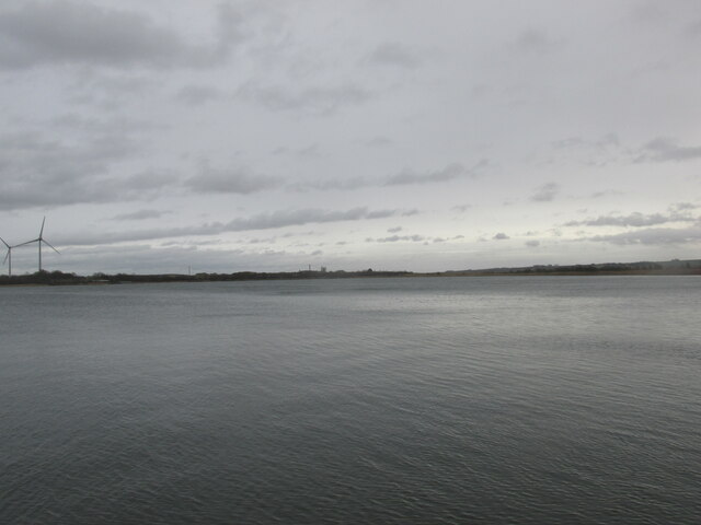
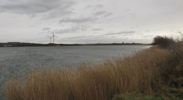
Brough Roads is a geographic feature located on the East coast of Yorkshire, England. It refers to the area where the River Humber meets the North Sea, forming an estuary that extends into the region. This estuary is characterized by a complex network of channels, sandbanks, and mudflats, creating a diverse and dynamic ecosystem that supports a variety of flora and fauna.
The Brough Creek, also known as Brough Haven, is a smaller watercourse that flows into the Humber Estuary. It is situated near the town of Brough, which gives the area its name. Brough Creek is relatively narrow and meandering, providing a habitat for numerous bird species, including wading birds and waterfowl.
The Brough Roads itself is a term often used to describe the navigational routes through the estuary. Due to the shifting sandbanks and changing tides, these routes require careful navigation and local knowledge. The area is significant for maritime transportation, serving as a major shipping channel for vessels entering and leaving the ports of Hull and Grimsby.
The tides in Brough Roads can be particularly treacherous, with the Humber experiencing one of the highest tidal ranges in the United Kingdom. The changing water levels can expose vast mudflats during low tide, attracting a range of wildlife, including seals and various bird species. However, the strong currents and shifting sands make this area hazardous for navigation, requiring skill and caution from mariners.
Overall, Brough Roads, Yorkshire, is a diverse and challenging environment, combining the forces of the North Sea, the River Humber, and Brough Creek. It offers a unique habitat for wildlife and plays a crucial role in maritime trade and transportation in the region.
If you have any feedback on the listing, please let us know in the comments section below.
Brough Roads Images
Images are sourced within 2km of 53.713201/-0.5737482 or Grid Reference SE9425. Thanks to Geograph Open Source API. All images are credited.


Brough Roads is located at Grid Ref: SE9425 (Lat: 53.713201, Lng: -0.5737482)
Division: East Riding
Unitary Authority: East Riding of Yorkshire
Police Authority: Humberside
What 3 Words
///computers.bucks.worksheet. Near Brough, East Yorkshire
Nearby Locations
Related Wikis

Brough Aerodrome
Brough Aerodrome (ICAO: EGNB) was a private use aerodrome located at Brough, East Riding of Yorkshire, England. It is now disused with the last known...

Brough railway station
Brough railway station serves the town of Brough in the East Riding of Yorkshire, England. It is managed by TransPennine Express, and also served by Northern...

Petuaria
Petuaria (or Petuaria Parisorum) was originally a Roman fort situated where the town of Brough in the East Riding of Yorkshire now stands. Petuaria means...

Brough, East Riding of Yorkshire
Brough ( BRUF, locally ) is a town in the East Riding of Yorkshire, England. It is part of the civil parish of Elloughton-cum-Brough with the neighbouring...
Have you been to Brough Roads?
Leave your review of Brough Roads below (or comments, questions and feedback).